1950s Maps of Merced County, California
Explore 22 historic maps of Merced County from the 1950s. These maps offer a rare glimpse into what life looked like during the 1950s — showing old roads, neighborhoods, homes, and landmarks that have changed or disappeared over time.
Whether you're researching your family's past, planning a metal detecting trip, or studying how Merced County's landscape evolved across the 1950s, these high-resolution maps are a powerful tool for exploring the history of this region.
- Focus on a specific era: All maps on this page are from the 1950s, giving you a focused view of this time period.
- See what’s changed: Compare century-old streets, trails, and buildings to today's modern landscape using overlays and satellite layers.
- Research with precision: Use these maps for genealogy, historical research, land use analysis, or educational projects.
- View, download, or print: Maps are fully viewable online in high resolution, and can be downloaded or printed for your own records.
Start exploring Merced County's history through authentic maps from the 1950s. This is your window into the past.
Merced County, CA maps
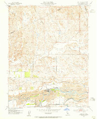
(22)- 1952 Map of Newman, 1954 Print
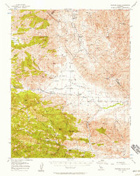
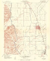 1952 Newman1954 Print · USGSThe San Joaquin Valley's agricultural landscape is captured here in the early 1950s, showing the critical rail and water systems that drove the region. Genealogists can trace family holdings along Stuhr Road or locate landmarks like the Canal Sch and West Side Hosp.4 unique versions available
 - 1953 Map of Howard Ranch, 1954 Print
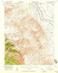
 1953 Howard Ranch1954 Print · USGSThe Central Valley meets the foothills in the 1950s as the Delta-Mendota Canal transforms the Merced and Stanislaus landscape. Researchers can trace rural life via Howard Ranch, Cottonwood School, and the family-named grid of Taglio Road.4 unique versions available
 - 1953 Map of San Luis Creek, 1954 Print
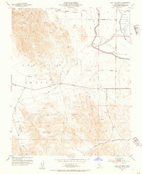 1953 San Luis Creek1954 Print · USGSThe foothills of Merced County are captured here in the early 1950s, showing the early infrastructure of the California water system. Researchers can trace the layout of family-run operations like Romero Ranch and San Luis Ranch alongside the massive Delta-Mendota Canal.2 unique versions available
 - 1953 Map of Montpelier, 1955 Print
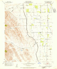
 1953 Montpelier1955 Print · USGSEastern Stanislaus County in the early fifties shows a landscape of growing irrigation networks and rural rail hubs. Genealogists can trace family holdings near Montpelier and Hickman or locate landmarks like the Grain Elevator and Southern Pacific railroad.
 - 1953 Map of Snelling, 1955 Print
 1953 Snelling1955 Print · USGSIn the early fifties, the area around the Merced River shows the lasting impact of industrial gold dredging. Researchers can trace the water infrastructure of the North Side Canal or locate local landmarks like Halterman and Snelling.
 - 1953 Map of Turlock Lake, 1955 Print
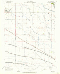
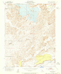 1953 Turlock Lake1955 Print · USGSThe Stanislaus and Merced county line is captured here in the mid-1950s, a time when irrigation projects were reshaping the Central Valley landscape. Researchers can trace the development of Turlock Lake and the vital Main Canal, or locate family sites along Davis Road and Olsen Road.2 unique versions available
 - 1954 Map of Indian Gulch, 1956 Print
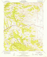
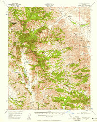
 1954 Indian Gulch1956 Print · USGSThe foothills of the Sierra Nevada come alive in this mid-century survey of the Mariposa gold country. Researchers can trace family ranching and mining history at Hornitos, the Cathay Cem, and numerous old workings like the Klondike Mine.2 unique versions available
 - 1954 Map of Merced Falls, 1956 Print
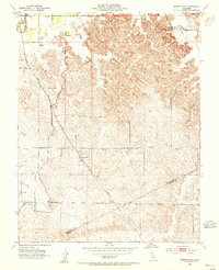
 1954 Merced Falls1956 Print · USGSThe Gold Country foothills meet the Central Valley floor in the mid-1950s, revealing a landscape shaped by river dredging and early reservoirs. Researchers can trace the massive Dredge Tailings near Snelling or locate rural landmarks like Whisky Flat and the Corner Sch.
 - 1955 Map of Santa Cruz
 1955 Santa Cruz1955 Print · USGSCoastal Monterey Bay and the fertile Salinas Valley are captured here during the post-war expansion of the mid-fifties. Researchers can trace the era's rail-and-road network via the Southern Pacific lines and find landmarks like Fort Ord or the Lonoak School.
 - 1955 Map of Crevison Peak, 1956 Print
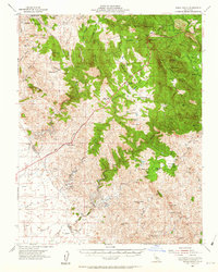
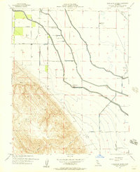
 1955 Crevison Peak1956 Print · USGSThe Diablo Range in the mid-1950s reveals a quiet landscape of high peaks and ranching outposts. Researchers can trace historic homesteads like Fifield Ranch, the operations at Bald Eagle Mine, and the water sources at China Cabin Flat.6 unique versions available
 - 1955 Map of Pacheco Pass, 1957 Print
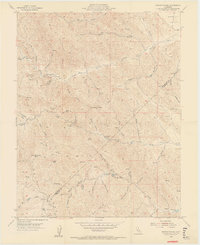
 1955 Pacheco Pass1957 Print · USGSThe Diablo Range crossing in the mid-1950s reveals a ranching landscape defined by vital water sources and early mountain roads. Genealogists and historians can trace the paths of old jeep trails and locate landmarks like Harris Ranch, O'Connells Spring, and the high point of Hagerman Peak.5 unique versions available
 - 1956 Map of San Jose
 1956 San Jose1956 Print · USGSCentral California in the mid-fifties reveals the transition from sprawling orchards to growing urban hubs like San Jose and Stockton. Genealogists and historians can trace the rail-era landscape of the Mother Lode through Chinese Camp and Tuttletown, or follow the water through the Joaquin River and Calaveras Reservoir.
 - 1956 Map of Laguna Seca Ranch, 1957 Print
 1956 Laguna Seca Ranch1957 Print · USGSThe eastern slopes of the Diablo Range meet the San Joaquin Valley in the mid-fifties, revealing a landscape of isolated ranching and water management. Trace family-named landmarks like Laguna Seca Ranch and Barneich Ranch among the folds of the Panoche Hills.4 unique versions available
 - 1956 Map of Oxalis, 1957 Print
 1956 Oxalis1957 Print · USGSThe border of Merced and Fresno counties in the mid-1950s reveals a productive landscape of ranches and rail lines. Trace family roots and local industry through Dos Palos, the Joint Union H S, and the Silaxo Oil Pumping Sta.4 unique versions available
 - 1956 Map of Charleston School, 1957 Print
 1956 Charleston School1957 Print · USGSMerced County agriculture and water infrastructure are captured here in the mid-1950s as the Central Valley's irrigation network expanded. Researchers can locate the Charleston Sch, trace the Delta-Mendota Canal, and find family-run operations like Woo Ranch.5 unique versions available
 - 1956 Map of Dos Palos, 1957 Print
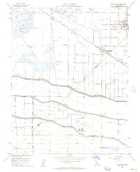 1956 Dos Palos1957 Print · USGSThe San Joaquin Valley comes into focus during the mid-fifties, showing an intricate web of irrigation and rail transit. Trace family roots at Dos Palos, find the Charleston School, or locate the Eagle Field Airport and various hunt clubs.4 unique versions available
 - 1956 Map of Panoche Valley, 1957 Print
 1956 Panoche Valley1957 Print · USGSMid-century San Benito and Fresno counties come alive in this map of ranchlands and remote mining outposts. Researchers can trace family-named sites and early industry at Mercey Hot Springs, the Panoche School, and the Juniper Mine.2 unique versions available
 - 1956 Map of Quien Sabe, 1958 Print
 1956 Quien Sabe1958 Print · USGSThe Diablo Range cattle country comes alive in the mid-1950s, showing a landscape of remote valleys and family-run grazing operations. Genealogists and historians can trace the foundations of the Quien Sabe Ranch and find landmarks like Schoolhouse Ridge and Haley Ranch.2 unique versions available
 - 1956 Map of Ortigalita Peak, 1958 Print
 1956 Ortigalita Peak1958 Print · USGSThe western San Joaquin Valley comes into focus in the mid-1950s as massive irrigation works reshaped the agricultural landscape. Genealogists and historians can trace family-run operations like Gaston Bide Ranch or find local landmarks like the Charleston School and Cotton Gin.2 unique versions available
 - 1956 Map of Ortigalita Peak NW, 1962 Print
 1956 Ortigalita Peak NW1962 Print · USGSThe foothills of the Diablo Range meet the valley edge in the mid-fifties, capturing a landscape of remote cattle ranches and early oil infrastructure. Genealogists and local historians can trace family-named sites like Gaston Bide Ranch, Arburua Ranch, and the isolated Carrisalito Springs.
 - 1957 Map of Santa Cruz
 1957 Santa Cruz1957 Print · USGSCentral California comes into sharp focus during the late fifties, from the fog-swept Monterey Bay to the sun-drenched San Joaquin Valley. Genealogists and historians can trace the mid-century footprints of Fort Ord Military Reservation, the Southern Pacific line, and the historic streets of San Juan Bautista.
 - 1958 Map of Santa Cruz
 1958 Santa Cruz1958 Print · USGSCoastal California and the central valleys are shown during the mid-fifties, capturing a landscape of massive military reserves and vital rail arteries. Genealogists and historians can trace the Southern Pacific line through Salinas or explore the early footprints of the Fort Ord Military Reservation and San Juan Bautista.2 unique versions available
End of results
Showing maps 1-22 of 22
Top cities of Merced County
- Merced historical maps
- Los Banos historical maps
- Atwater historical maps
- Livingston historical maps
- Delhi historical maps
- Winton historical maps
See more
Frequently asked questions
- What are the different types of historical maps available for Merced County?
- What is the oldest map of Merced County?
- Where can I purchase historical maps of Merced County for my home or office?
- Where can I download high-res historical maps of Merced County?
- Are there historical topographic maps available for Merced County?
- Is there historical aerial imagery available for Merced County?
- Where are historical maps of Merced County sourced from?