Old Maps of Merced County, California for Genealogy
Trace your family roots with 388 historic maps of Merced County. These high-res maps reveal old neighborhoods, homesites, landmarks, and streets — helping you uncover where your ancestors lived and how the area evolved over time.
- Explore historic neighborhoods: Identify where your relatives may have lived in the 1800s or 1900s.
- Compare maps over time: Trace the changes in streets, buildings, and landmarks for multi-generational research.
- Perfect for genealogy & ancestry research: Used by family historians and researchers to map out lineage and migration.
These maps are an incredible resource for exploring your personal connection to Merced County's past.
Merced County, CA maps
(388)- 1893 Map of Sonora
 1893 Sonora1893 Print · USGSThe Mother Lode region comes alive in the early 1890s, showing a landscape defined by mining camps and early river crossings before the big dams. Genealogists and historians can trace old settlements like Chinese Camp and Big Oak Flat, or locate industrial sites like the Olsen Mine and Hobron Mill.
 - 1896 Map of Sonora
 1896 Sonora1896 Print · USGSThe Mother Lode gold country is shown in the late nineteenth century as mining towns and river crossings defined the Sierra Nevada foothills. Genealogists and researchers can trace early routes through Chinese Camp and Coulterville, or locate industrial sites like the Red Cloud Mine and Benton Mill.
 - 1897 Map of Sonora
 1897 Sonora1897 Print · USGSThe Mother Lode region at the close of the nineteenth century is revealed here through its gold-country towns and rugged mining infrastructure. Trace the early footprints of Sonora, Coulterville, and Hornitos alongside sites like the Red Cloud Mine and Ward Ferry.8 unique versions available
 - 1898 Map of Sonora, 1932 Print
 1898 Sonora1932 Print · USGSThe Mother Lode region at the close of the nineteenth century reveals a complex world of river dams and mining camps. Genealogists can trace family names at Chinese Camp or Soulsbyville and locate early industry at the Red Cloud Mine and Bandarita Mine.
 - 1913 Map of Dickenson
 1913 Dickenson1913 Print · USGSStanislaus County ranching country comes into focus in this early twentieth-century survey of the foothills. Local historians and genealogists can pinpoint the locations of rural schoolhouses such as Tilden School and Lafayette School along the winding course of Dry Creek.
 - 1913 Map of Panoche
 1913 Panoche1913 Print · USGSThe San Joaquin Valley and its ranching foothills appear in the early twentieth century before modern expansion. Genealogists can find remote rural schools and outposts like Mercy School, Laguna Seca Ranch, and the Mercy Mine.4 unique versions available
 - 1914 Map of Merced
 1914 Merced1914 Print · USGSMerced and its surrounding farm colonies are captured in the early twentieth century as the railroad era transformed the valley. Genealogists and researchers can trace local landmarks like Farmdale School, the Merced County Hospital, and the small settlement at Tuttle.
 - 1915 Map of Owens Creek
 1915 Owens Creek1915 Print · USGSThe foothills of the central valley come alive in the mid-1910s as this survey traces the critical water and road networks of the era. Researchers can follow the historic path of the Old Miller and Stockton Road or trace the winding courses of Owens Creek and Mariposa Creek.2 unique versions available
 - 1915 Map of La Grange, 1957 Print
 1915 La Grange1957 Print · USGSThe foothills of the Sierra Nevada meet the valley floor in the early 1900s, centered on the vital waterworks of the Tuolumne River. Researchers can trace the early infrastructure of La Grange Dam and find family-history landmarks like the Live Oak School and Basso Bridge.
 - 1916 Map of Three Tree Flat
 1916 Three Tree Flat1916 Print · USGSThe foothills of the Central Valley meet early irrigation projects in the mid-1910s during a period of rapid agricultural growth. Genealogists can locate family-named landmarks like Tilden School, Dickenson School, and the early footprint of the Turlock Reservoir.2 unique versions available
 - 1916 Map of Hopeton
 1916 Hopeton1916 Print · USGSMerced County agriculture and infrastructure are in focus here during the mid-1910s. Researchers can locate the Rotterdam School, trace the path of the Crocker Hoffman Canal, and see the early layout of Hopeton near the Merced River.
 - 1916 Map of Mitchell School
 1916 Mitchell School1916 Print · USGSStanislaus and Merced counties appear here during the expansion of Central Valley irrigation and rail at the start of the Great War. Genealogists can locate several rural schoolhouses like Tegner School and Helmar School along the Electric R R.
 - 1916 Map of Cressey
 1916 Cressey1916 Print · USGSMerced County agriculture and transit were rapidly expanding when this survey was conducted. Researchers can trace early railroad siding towns like Ballico and Cressey or locate family roots near Madison School and the Merced River.
 - 1916 Map of Montpellier
 1916 Montpellier1916 Print · USGSThe Stanislaus County countryside comes into focus in the early twentieth century as irrigation and rail infrastructure begin to transform the Central Valley. Genealogists and local historians can trace the early layouts of Hickman and Montpellier along the Southern Pacific (Oakdale Branch).2 unique versions available
 - 1916 Map of Santa Rita Bridge, 1948 Print
 1916 Santa Rita Bridge1948 Print · USGSThe San Joaquin River valley was a landscape of ambitious ranching and irrigation in the mid-1940s. Genealogists and local historians can trace legacy holdings like Wolfsen Mill, Belmont Ranch, and Temple Ranch across this three-county border region.2 unique versions available
 - 1916 Map of Delta Ranch, 1948 Print
 1916 Delta Ranch1948 Print · USGSIn the Merced County interior during the mid-forties, this area shows the intensive development of Central Valley irrigation. Genealogists and historians can trace the boundaries of the Delta Ranch and Arroyo Farm or follow the Southern Pacific rail line to the siding at Agatha.
 - 1916 Map of Merced Falls, 1957 Print
 1916 Merced Falls1957 Print · USGSThe riverfront settlement of Merced Falls is captured here in the early twentieth century as a bustling industrial and transit hub. Researchers can trace the legacy of mining through the Tailings along the Merced River and follow historic routes like Old Mill Road.
 - 1917 Map of Turlock
 1917 Turlock1917 Print · USGSThe San Joaquin Valley was rapidly evolving just before the First World War as new irrigation canals and rail lines defined the landscape. You can trace early settlement patterns near Delhi and Irwin, and locate rural landmarks like Roselawn School or the Electric RR.
 - 1917 Map of Winton
 1917 Winton1917 Print · USGSMerced County agriculture was flourishing during the First World War as three major rail lines crossed the valley floor. Genealogists and local historians can trace early settlements at Winton and Amsterdam or locate rural landmarks like Hopeton School.2 unique versions available
 - 1917 Map of Newman
 1917 Newman1917 Print · USGSNewman and the surrounding San Joaquin Valley are captured here during a period of rapid agricultural expansion before the First World War. Researchers can trace the early irrigation grid and find local landmarks like Orestimba School, the Cem, and the rail lines serving Gustine.3 unique versions available
 - 1917 Map of Merced
 1917 Merced1917 Print · USGSMerced was a bustling rail and agricultural center during the First World War era. Genealogists and local historians can locate early landmarks like the Merced County Hospital, the Bellevue Ranch, and several rural schoolhouses such as Farmdale School.
 - 1918 Map of Snelling
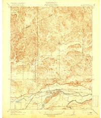 1918 Snelling1918 Print · USGSCentral California's river-driven economy is on display in this early twentieth-century survey of the Merced River valley. Researchers can trace historic irrigation routes like the Crocker Canal and locate the Anderson School or the town of Snelling.3 unique versions available
 - 1918 Map of Arena
 1918 Arena1918 Print · USGSMerced County agriculture and rural life are captured here during the First World War. Genealogists can locate family homesteads near country landmarks like Witmer School, Jordan School, and the village of Arena along the Southern Pacific tracks.2 unique versions available
 - 1918 Map of Bliss Ranch
 1918 Bliss Ranch1918 Print · USGSIn the San Joaquin Valley during the late teens, these ranchlands were being reshaped by early water management and survey grids. Genealogists can trace the footprint of the Chowchilla and Bliss Ranch along the Baxter Feeding Canal.2 unique versions available
 - 1918 Map of Owens Creek
 1918 Owens Creek1918 Print · USGSThe foothills of the Sierra Nevada transition into the valley floor during the early twentieth century along the Mariposa Co Merced Co boundary. Local historians can trace the path of the Old Ft. Miller and Stockton Road and the early reaches of Owens Creek.2 unique versions available
Showing maps 1-25 of 388
Top cities of Merced County
- Merced historical maps
- Los Banos historical maps
- Atwater historical maps
- Livingston historical maps
- Delhi historical maps
- Winton historical maps
See more
Frequently asked questions
- What are the different types of historical maps available for Merced County?
- What is the oldest map of Merced County?
- Where can I purchase historical maps of Merced County for my home or office?
- Where can I download high-res historical maps of Merced County?
- Are there historical topographic maps available for Merced County?
- Is there historical aerial imagery available for Merced County?
- Where are historical maps of Merced County sourced from?