1900s (20th Century) Maps of Mono County, California
Explore 213 historic maps of Mono County from the 1900s (20th Century). These maps offer a rare glimpse into what life looked like during the 1900s — showing old roads, neighborhoods, homes, and landmarks that have changed or disappeared over time.
Whether you're researching your family's past, planning a metal detecting trip, or studying how Mono County's landscape evolved across the 1900s, these high-resolution maps are a powerful tool for exploring the history of this region.
- Focus on a specific era: All maps on this page are from the 1900s, giving you a focused view of this time period.
- See what’s changed: Compare century-old streets, trails, and buildings to today's modern landscape using overlays and satellite layers.
- Research with precision: Use these maps for genealogy, historical research, land use analysis, or educational projects.
- View, download, or print: Maps are fully viewable online in high resolution, and can be downloaded or printed for your own records.
Start exploring Mono County's history through authentic maps from the 1900s. This is your window into the past.
Mono County, CA maps
(213)- 1900 Map of Silver Peak
 1900 Silver Peak1900 Print · USGSSilver Peak and the surrounding mining districts were centers of industry at the turn of the century. Genealogists and historians can trace old wagon routes through Emigrant Pass and locate remote desert sites like the Drinkwater Mine or Tarantula Spring.5 unique versions available
 - 1901 Map of Mt. Lyell
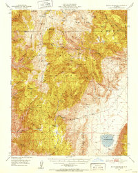
 1901 Mt. Lyell1901 Print · USGSThe High Sierra at the end of the century is captured here in immense detail, showing the early boundaries of Yosemite National Park. Researchers can trace old mountain routes past Soda Springs, Tuolumne Meadows, and Miller Bridge.12 unique versions available
 - 1908 Map of Lida
 1908 Lida1908 Print · USGSEsmeralda County enters its mining peak at the start of the twentieth century as rail lines and boomtowns transform the high desert. Researchers can trace the exact layout of the Tonopah and Goldfield RR, find remote camps like Diamondfield, and locate the Rattlesnake Mine.
 - 1909 Map of Hawthorne, 1955 Print
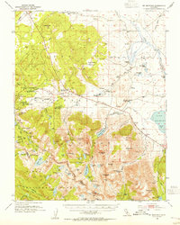
 1909 Hawthorne1955 Print · USGSWestern Nevada and the California borderlands are captured here during the height of the early mining era. Genealogists and historians can trace rail-depot life and remote outposts from Hawthorne to Belleville, including vanished sites like Oro City and Buckley Camp.
 - 1909 Map of Bridgeport, 1956 Print
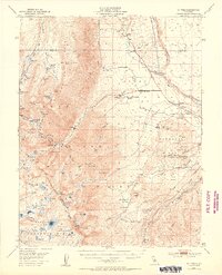
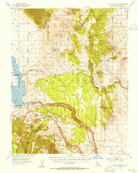
 1909 Bridgeport1956 Print · USGSThe High Sierra and Mono Basin are seen here in the decade following the peak of the local gold boom. Genealogists and historians can trace old stage routes and find significant mining sites like the Dunderberg Mine and the remote settlement of Belfort.
 - 1911 Map of Bridgeport
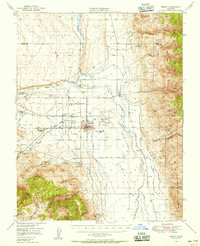
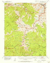
 1911 Bridgeport1911 Print · USGSMono County at the start of the twentieth century was a landscape of high-altitude mining camps and early park boundaries. Trace the footprints of the gold era at Bodie, locate family ranching history at Mormon Ranch, or study the remote Masonic Liberty Mine.7 unique versions available
 - 1911 Map of Hawthorne
 1911 Hawthorne1911 Print · USGSEarly Nevada mining and rail history come alive in this survey of the Walker Lake region during the era of steam and silver. Researchers can trace the routes of the Southern Pacific System and locate the sites of Lucky Boy, Marietta, and Belleville.4 unique versions available
 - 1912 Map of Mt. Goddard
 1912 Mt. Goddard1912 Print · USGSThe high Sierra crest at the opening of the twentieth century remains a land of seasonal camps and early hydroelectric power. Trace the old trails to Andrews Camp, the Old Brewery near Bishop, and early wilderness outposts at Hot Springs.10 unique versions available
 - 1913 Map of Bishop
 1913 Bishop1913 Print · USGSThe Owens Valley was a landscape of high-altitude industry and burgeoning towns in the years before massive water diversions. Trace the path of the Southern Pacific Railroad through Laws and Big Pine, or locate family sites like Roberts Ranch and the Riverside School.8 unique versions available
 - 1913 Map of Lida
 1913 Lida1913 Print · USGSThe Nevada and California borderlands appear here at the peak of the gold rush era, centered on the bustling streets of Goldfield. Genealogists and historians can trace the early rail networks of the Bullfrog Goldfield RR and locate camps like Gen Thomas Camp or the remote Palmetto Mine.5 unique versions available
 - 1914 Map of Mt. Morrison
 1914 Mt. Morrison1914 Print · USGSThe High Sierra and Mono Basin are seen here in the early twentieth century, showing a network of remote ranches and early timber camps. Researchers can trace historic sites like Mono Mills, the remote Dutch Petes Ranch, and the Casa Diablo Mine.8 unique versions available
 - 1915 Map of Hawthorne, 1951 Print
 1915 Hawthorne1951 Print · USGSWestern Nevada at the turn of the century shows a landscape dominated by mining outposts and the reaching arms of the Southern Pacific System. Genealogists can trace early residents to sites like Candelaria, Sodaville, and Mina or locate vanished camps such as Buckley Camp.
 - 1917 Map of White Mountain
 1917 White Mountain1917 Print · USGSThe high desert borderlands of California and Nevada come alive in this survey from the mid-1910s. Researchers can trace the Southern Pacific rail line past remote outposts like Benton Sta. or locate high-altitude workings at the Sacramento Mine and Gold Hit.7 unique versions available
 - 1920 Map of Bridgeport
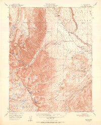
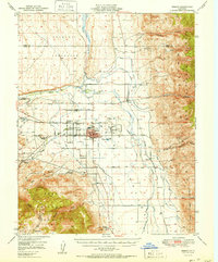
 1920 Bridgeport1920 Print · USGSThe High Sierra and Mono Basin are shown here in the early twentieth century, during a peak period of mining and ranching. Researchers can locate vanished camps like Star City, trace the California Masonic Road, and find family names at Conway Ranch.
 - 1947 Map of Mariposa, 1948 Print
 1947 Mariposa1948 Print · USGSThe High Sierra and Owens Valley transition is captured here in the late 1940s, just as the region’s hydroelectric and tourism infrastructure was maturing. Genealogists and historians can trace old ranger stations, the Casa Diablo Mine, and rail stops along the Southern Pacific like Benton Station and Zurich.2 unique versions available
 - 1948 Map of Walker Lake
 1948 Walker Lake1948 Print · USGSThe high desert of Nevada and the eastern Sierra Nevada are captured just after the war as mining and ranching shaped the local economy. Genealogists can trace family connections to centers like Hawthorne and Mina or locate the historic Rockland Mines and Aurora.2 unique versions available
 - 1948 Map of Mariposa, 1951 Print
 1948 Mariposa1951 Print · USGSThe High Sierra and Mariposa foothills are shown here in the late 1940s as the post-war tourism and water infrastructure expanded. Genealogists and historians can locate vanished waypoints like Mormon Bar, the Glacier Point Hotel, and the granite quarries of Knowles.
 - 1949 Map of Mt. Tom, 1955 Print
 1949 Mt. Tom1955 Print · USGSIn the Sierra Nevada during the late 1940s, the tungsten mining boom transformed the landscape around Round Valley. Researchers can trace industrial sites like the Adamson Mine, locate the Round Valley School, and explore the canyon routes leading to Scheelite.6 unique versions available
 - 1949 Map of Bishop, 1956 Print
 1949 Bishop1956 Print · USGSThe Owens Valley was a center of mining and water engineering at mid-century, dominated by the growth of Bishop. Researchers can trace the legacy of tribal lands at the Paiute Shoshone Indian Reservation or locate extraction sites like the Rossi Tungsten Mine and Southern Belle Mine.4 unique versions available
 - 1951 Map of Mt. Tom
 1951 Mt. Tom1951 Print · USGSInyo County mining reached its peak in the early fifties as tungsten and vanadium extraction transformed the eastern Sierra slopes. Researchers can trace the era's industrial footprint through the Pine Creek Mine, Tungsten Hills, and the company town at Rovana.2 unique versions available
 - 1951 Map of Bishop
 1951 Bishop1951 Print · USGSOwens Valley thrives as an agricultural and mining center in the early fifties, mapped just before local shifts in water and rail. Trace the Southern Pacific line past Laws or locate the Southern Belle Mine and Keough Hot Springs.
 - 1951 Map of Blanco Mountain, 1953 Print
 1951 Blanco Mountain1953 Print · USGSThe Inyo Mountains and Deep Spring Valley appear in the early fifties as a landscape of high-altitude research and mining. Trace old workings like Wilkerson Mine and remote outposts such as Roberts Ranch or the Naval Research Station.5 unique versions available
 - 1953 Map of Mt. Morrison, 1955 Print
 1953 Mt. Morrison1955 Print · USGSThe Eastern Sierra Nevada and Owens River valley appear here in the early fifties, a time of both ranching and high-altitude recreation. Genealogists and historians can trace Arcularius Ranch, the site at Old Mammoth, and the Scheelore Mine among the mountain peaks.7 unique versions available
 - 1953 Map of Casa Diablo Mtn, 1955 Print
 1953 Casa Diablo Mtn1955 Print · USGSThe High Sierra and Benton Range meet in the early 1950s, showing a landscape defined by Owens River water and hard-rock mining. Trace the historic mining district through the Casa Diablo Mine, Kings Mill, and the community at Toms Place.4 unique versions available
 - 1953 Map of Merced Peak, 1955 Print
 1953 Merced Peak1955 Print · USGSThe High Sierra wilderness of the early fifties is mapped here in detail, spanning the boundary of Yosemite and the national forests. Researchers can locate remote outposts and industry like the Strawberry Tungsten Mine, Knoblock Cabin, and the Merced Lake Ranger Sta.7 unique versions available
Showing maps 1-25 of 213
Top cities of Mono County
- Mammoth Lakes historical maps
- June Lake historical maps
- Crowley Lake historical maps
- Walker historical maps
- Chalfant Valley historical maps
- Coleville historical maps
See more
Frequently asked questions
- What are the different types of historical maps available for Mono County?
- What is the oldest map of Mono County?
- Where can I purchase historical maps of Mono County for my home or office?
- Where can I download high-res historical maps of Mono County?
- Are there historical topographic maps available for Mono County?
- Is there historical aerial imagery available for Mono County?
- Where are historical maps of Mono County sourced from?