1980s Maps of Mono County, California
Explore 74 historic maps of Mono County from the 1980s. These maps offer a rare glimpse into what life looked like during the 1980s — showing old roads, neighborhoods, homes, and landmarks that have changed or disappeared over time.
Whether you're researching your family's past, planning a metal detecting trip, or studying how Mono County's landscape evolved across the 1980s, these high-resolution maps are a powerful tool for exploring the history of this region.
- Focus on a specific era: All maps on this page are from the 1980s, giving you a focused view of this time period.
- See what’s changed: Compare century-old streets, trails, and buildings to today's modern landscape using overlays and satellite layers.
- Research with precision: Use these maps for genealogy, historical research, land use analysis, or educational projects.
- View, download, or print: Maps are fully viewable online in high resolution, and can be downloaded or printed for your own records.
Start exploring Mono County's history through authentic maps from the 1980s. This is your window into the past.
Mono County, CA maps
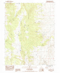
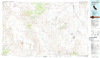
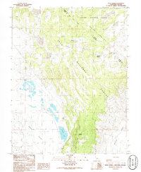
(74)- 1982 Map of Mt. Morgan
 1982 Mt. Morgan1982 Print · USGSThe high Sierra peaks around Inyo County were a hub of mining and mountain recreation in the early 1980s. Researchers can locate high-altitude operations like the Adamson Mine, the Scheelite (Site), and numerous Mines alongside lakeside camps.3 unique versions available
 - 1982 Map of Mt. Abbot
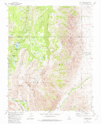
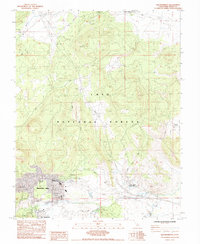
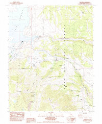
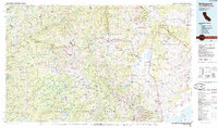
 1982 Mt. Abbot1982 Print · USGSThe High Sierra crest near the Fresno and Mono county lines is captured here in the early eighties, showcasing the intersection of the Inyo National Forest and Sierra National Forest. Hikers and historians can trace the high-altitude trails through Mono Pass and identify prominent summits like Mt Stanford and Mt Abbot.3 unique versions available
 - 1983 Map of Whitmore Hot Sprs
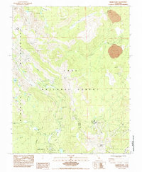
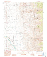
 1983 Whitmore Hot Sprs1983 Print · USGSMono County's high-desert basin is captured here in the early eighties as a landscape of thermal springs and cattle ranching. Researchers can locate the Cashbaugh Ranch, trace the waters of Hot Creek, and identify the Mono County Youth Camp near the alkali flats.
 - 1983 Map of Rovana
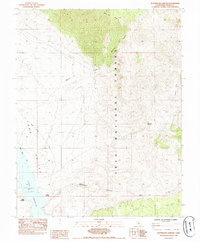
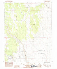
 1983 Rovana1983 Print · USGSRound Valley and the Owens River corridor are captured in the early 1980s as centers for mining and water management. Researchers can trace local landmarks like the Round Valley School and industrial sites including the Western Mine and the Powerhouse near Birchim Canyon.2 unique versions available
 - 1983 Map of Old Mammoth, 1984 Print
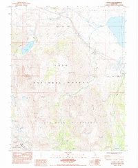
 1983 Old Mammoth1984 Print · USGSMammoth Lakes and the high country of the Eastern Sierra are captured here in the early eighties as the region evolved into a major recreation hub. Trace the development of the village and outlying sites like Casa Diablo Hot Sprs, Old Mammoth, and the Arcularius Ranch.3 unique versions available
 - 1983 Map of Mt. Ritter, 1984 Print
 1983 Mt. Ritter1984 Print · USGSThe high Sierra crest at the Madera and Mono county line is documented here during the early eighties. Hikers and historians can trace the classic routes of the John Muir Trail and Pacific Crest National Scenic Trail past Thousand Island Lake and the Minaret Mine.
 - 1983 Map of Convict Lake, 1984 Print
 1983 Convict Lake1984 Print · USGSThe Eastern Sierra Nevada in the early eighties reveals a world of remote alpine lakes and high-altitude mining prospects. Researchers and hikers can trace paths to the Scheelore Mine, the waters of Lake Crowley, or the secluded Bright Dot Lake.
 - 1983 Map of Bloody Mtn, 1984 Print
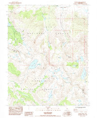 1983 Bloody Mtn1984 Print · USGSThe High Sierra during the early eighties shows a transition from mining history to wilderness preservation in Mono County. Researchers can trace the legacy of the Old Mammoth Mine, the ruins at Mill City, and high-altitude routes like the Pacific Crest National Scenic Trail.2 unique versions available
 - 1984 Map of Fish Slough
 1984 Fish Slough1984 Print · USGSThe Owens Valley area in the mid-1980s reveals a landscape shaped by both geology and irrigation. Researchers can trace the water network from Fish Slough to the Owens River, while locating sites like Brockmans Corner and the Bishop Paute Indian Res.2 unique versions available
 - 1984 Map of Banner Ridge
 1984 Banner Ridge1984 Print · USGSThe high desert of Mono County in the mid-1980s was a center of mineral exploration across the Benton Range. Geologists and local historians can trace numerous mining operations including the Black Rock Mine, West Tower Mine, and Beckman Mine.2 unique versions available
 - 1984 Map of Toms Place
 1984 Toms Place1984 Print · USGSEastern Sierra Nevada settlement and recreation are captured here in the mid-1980s as the high-country gateways developed. Researchers can trace land use through Toms Place, the Long Valley Dam, and backcountry sites like Swall Meadow.
 - 1984 Map of Mammoth Mtn
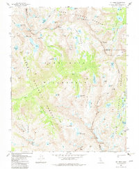
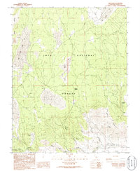
 1984 Mammoth Mtn1984 Print · USGSThe high Sierra peaks of Mono County are captured in the mid-1980s, showing the established trails and campgrounds of the Inyo National Forest. Researchers can trace the routes of the Pacific Crest National Scenic Trail and locate landmarks like the Devils Postpile and Mammoth Mtn Main Lodge.2 unique versions available
 - 1984 Map of Watterson Canyon
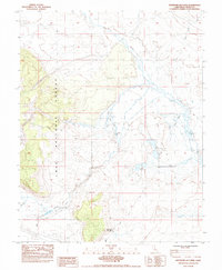
 1984 Watterson Canyon1984 Print · USGSMono County's high-elevation basin is captured in the mid-1980s as it transitions from the shores of Crowley Lake into the national forest. Researchers can trace the riparian landscape of Wilfred Creek, the access point at Benton Crossing, and the lakeside activity at North Landing.
 - 1984 Map of Laws
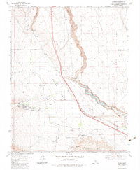
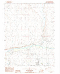
 1984 Laws1984 Print · USGSThe Owens River Valley in the mid-1980s reveals a unique intersection of high-desert irrigation and mountain mining history. Researchers can trace the legacy of regional transport and industry through the Railroad Museum at Laws and the Southern Belle Mine in the foothills.2 unique versions available
 - 1984 Map of Casa Diablo Mtn
 1984 Casa Diablo Mtn1984 Print · USGSMono County during the 1980s reveals a high-desert industrial landscape where the Sierra Nevada meets the volcanic plains. Researchers can trace the footprint of the Casa Diablo Mine, investigate the Powerhouse near Rock Creek, or locate the historic Sherwin Grade.3 unique versions available
 - 1984 Map of Crystal Crag
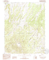
 1984 Crystal Crag1984 Print · USGSThe High Sierra backcountry and the iconic Devils Postpile are captured here in the mid-eighties. Trail researchers can trace the paths of the Pacific Crest and John Muir Trail past Rainbow Falls and the remote Iva Bell Hot Springs.
 - 1985 Map of Excelsior Mts
 1985 Excelsior Mts1985 Print · USGSThe Nevada-California borderlands were a center of high-desert mining and military activity in the 1980s. Local history buffs can trace the Southern Pacific rail line and locate heritage sites like the Borealis Mine and Sodaville.2 unique versions available
 - 1985 Map of Smith Valley
 1985 Smith Valley1985 Print · USGSThe Nevada-California borderlands are captured here in the mid-1980s, showcasing the high-desert valleys and Sierra peaks. Trace the mining history at Leviathan Mine or explore the early communities of Minden, Wellington, and the Washoe Indian Res.2 unique versions available
 - 1985 Map of Last Chance Range
 1985 Last Chance Range1985 Print · USGSThe high deserts of the California-Nevada border come alive in the mid-eighties, showing a landscape shaped by remote mining and volcanic geology. Researchers can trace historic extraction routes at the Sylvania Mine, locate the iconic Scotty's Castle, or follow the Old Railroad Grade past Bonnie Claire.2 unique versions available
 - 1985 Map of Bridgeport
 1985 Bridgeport1985 Print · USGSThe High Sierra and Nevada borderlands are captured in the mid-1980s, documenting a landscape of national forests and high-altitude mining districts. Researchers can trace historic operations like the Bodie Mine and May Lundy Mine or locate early settlements at Aurora and Baker Station.
 - 1985 Map of Goldfield
 1985 Goldfield1985 Print · USGSEsmeralda County and the surrounding high desert are captured in the mid-eighties as modern infrastructure intersected with a century of mining history. Researchers can locate remote extraction sites like the Mohawk Mine, early outposts at Klondike, and geothermal features like Alkali Hot Spring.
 - 1986 Map of Negit Island
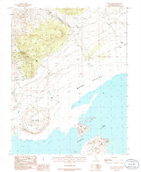 1986 Negit Island1986 Print · USGSThe Mono Lake shoreline and its volcanic islands are captured here in the mid-1980s, revealing a landscape of high-desert springs and mining prospects. Researchers can locate remote mineral works like the Prospect Mine Shaft and natural features such as Hot Spring and Black Point.
 - 1986 Map of River Spring
 1986 River Spring1986 Print · USGSThe high desert along the California-Nevada border is captured here in the mid-1980s, documenting a remote landscape of springs and forest boundaries. Genealogists and researchers can trace the old settlement at Pizona and locate vital water sources like River Spring Lakes and Antelope Spring.2 unique versions available
 - 1986 Map of Crestview
 1986 Crestview1986 Print · USGSThe volcanic Eastern Sierra highlands come into focus in this mid-eighties survey of Mono County. Researchers can trace the rugged transition from the Mono Craters to the Owens River headwaters, locating landmarks like Big Springs and the settlement at Crestview.
 - 1986 Map of Glass Mountain
 1986 Glass Mountain1986 Print · USGSInyo National Forest at the height of the 1980s reveals a wild Mono County landscape of volcanic peaks and hidden alpine meadows. Trace the high-country drainages of McGee Creek and Wet Creek as they flow near Glass Mountain.
Showing maps 1-25 of 74
Top cities of Mono County
- Mammoth Lakes historical maps
- June Lake historical maps
- Crowley Lake historical maps
- Walker historical maps
- Chalfant Valley historical maps
- Coleville historical maps
See more
Frequently asked questions
- What are the different types of historical maps available for Mono County?
- What is the oldest map of Mono County?
- Where can I purchase historical maps of Mono County for my home or office?
- Where can I download high-res historical maps of Mono County?
- Are there historical topographic maps available for Mono County?
- Is there historical aerial imagery available for Mono County?
- Where are historical maps of Mono County sourced from?