2020s Maps of Orange County, California
Explore 25 historic maps of Orange County from the 2020s. These maps offer a rare glimpse into what life looked like during the 2020s — showing old roads, neighborhoods, homes, and landmarks that have changed or disappeared over time.
Whether you're researching your family's past, planning a metal detecting trip, or studying how Orange County's landscape evolved across the 2020s, these high-resolution maps are a powerful tool for exploring the history of this region.
- Focus on a specific era: All maps on this page are from the 2020s, giving you a focused view of this time period.
- See what’s changed: Compare century-old streets, trails, and buildings to today's modern landscape using overlays and satellite layers.
- Research with precision: Use these maps for genealogy, historical research, land use analysis, or educational projects.
- View, download, or print: Maps are fully viewable online in high resolution, and can be downloaded or printed for your own records.
Start exploring Orange County's history through authentic maps from the 2020s. This is your window into the past.
Orange County, CA maps
(25)- 2021 Map of Alberhill, 2021 Print
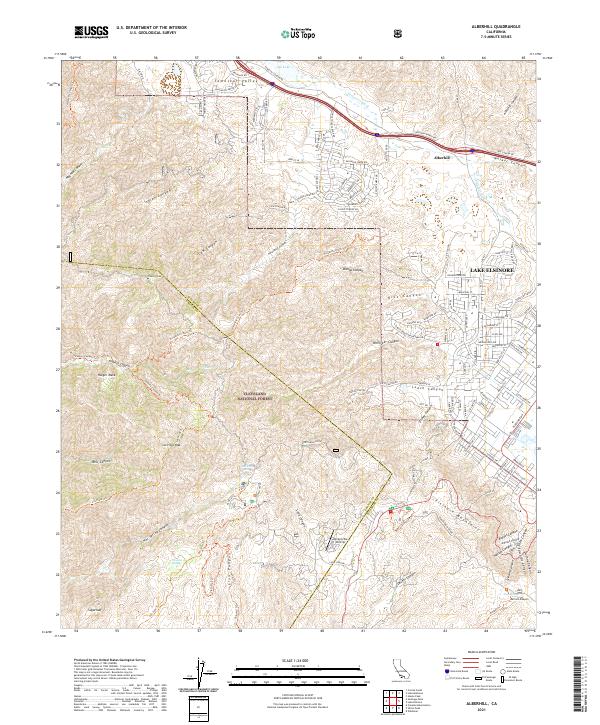 2021 Alberhill2021 Print · USGSThe Alberhill and Lake Elsinore area in the 2020s shows the meeting of modern development and protected wilderness. Local researchers can trace residential growth near Lee Lake or explore the rugged geography of the Cleveland National Forest and Trabuco Peak.
 - 2021 Map of Newport Beach OE S, 2021 Print
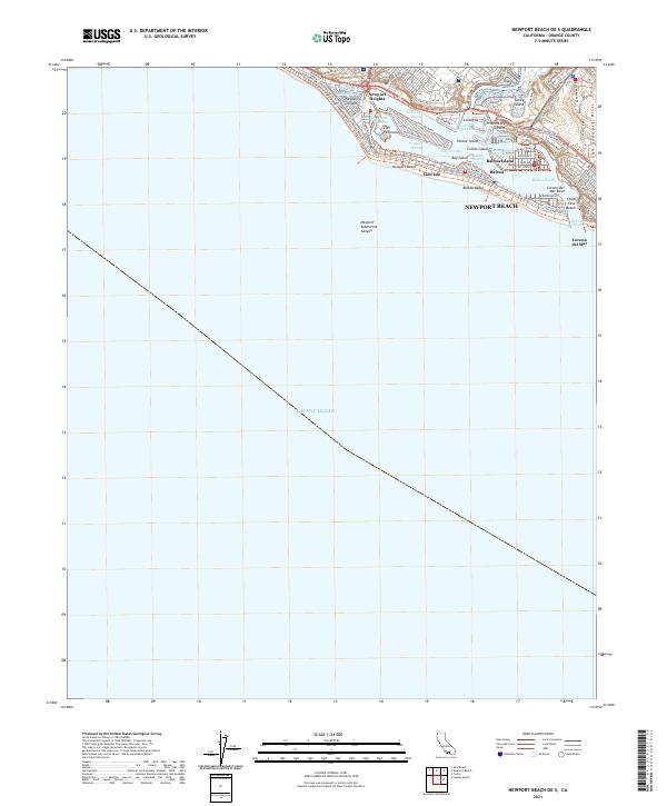 2021 Newport Beach OE S2021 Print · USGSThe Orange County coast is captured here in contemporary detail, showing the sophisticated harbor network of islands and channels. Researchers can trace the modern layout of Lido Isle, Balboa Island, and the secluded sands of China Cove Beach.
 - 2021 Map of Los Alamitos, 2021 Print
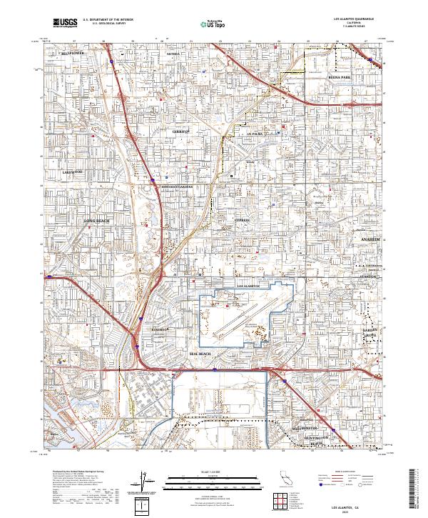
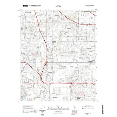 2021 Los Alamitos2021 Print · USGSCovers Orange County, including Long Beach, Anaheim, and other nearby areas
 - 2021 Map of Seal Beach, 2021 Print
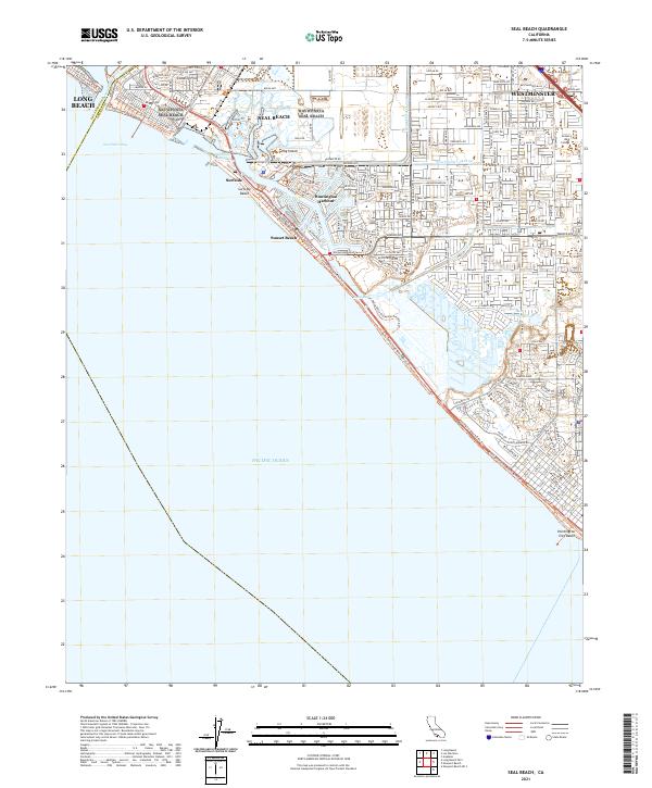 2021 Seal Beach2021 Print · USGSThe Orange County coast in the early twenty-first century reveals a highly engineered landscape of harbors and preserves. Trace the evolution of coastal communities from Landing Hill to Huntington Harbour and the Bolsa Chica Ecological Preserve.
 - 2021 Map of Whittier, 2021 Print
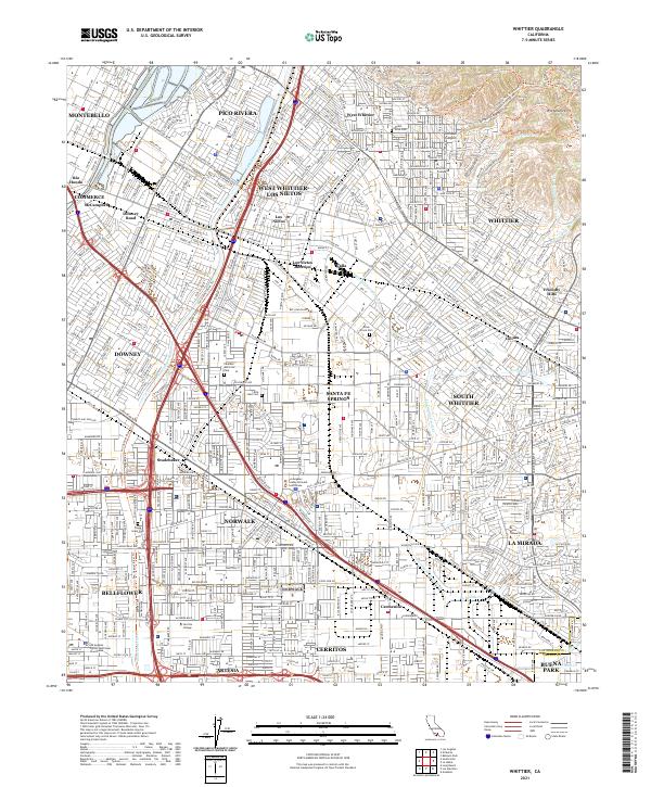 2021 Whittier2021 Print · USGSSoutheastern Los Angeles County is captured in this modern survey, showing the dense residential and academic fabric of the region. Researchers can trace institutional grounds like Whittier College and Biola University alongside landmarks such as Mount Olive Cem.
 - 2022 Map of La Habra, 2022 Print
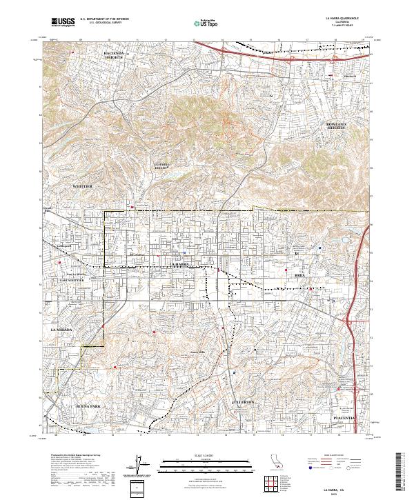 2022 La Habra2022 Print · USGSThe Orange and Los Angeles County line in the early 2020s shows a landscape of established suburban centers nestled against the Puente Hills. Researchers can locate institutional sites like Hope International University and trace recreational paths through Powder Canyon.
 - 2022 Map of San Onofre Bluff, 2022 Print
 2022 San Onofre Bluff2022 Print · USGSThe coastal corridor north of San Diego comes into focus in this recent survey of the bluffs and canyons. Trace the evolution of California travel along El Camino Real and Old Pacific Hwy near San Onofre Bluff and the steep terrain of Foley Canyon.
 - 2022 Map of Santiago Peak, 2022 Print
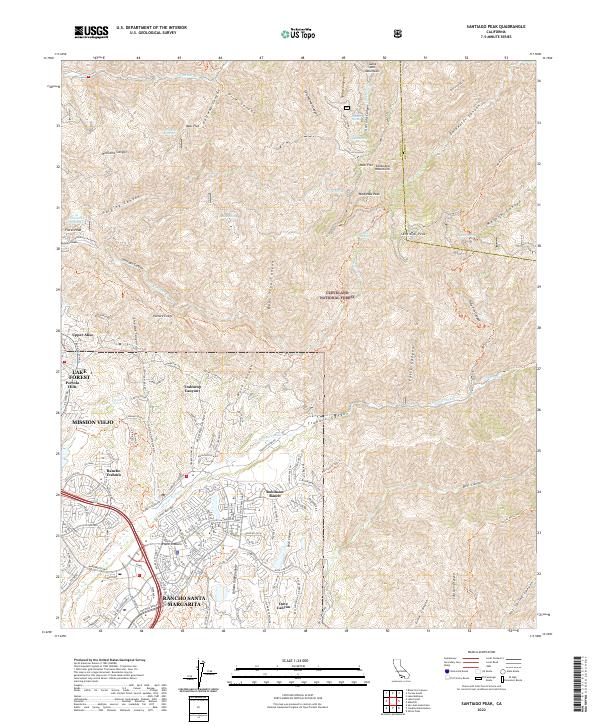 2022 Santiago Peak2022 Print · USGSThe eastern foothills of Orange County meet the high summits of the Santa Ana Mountains during this recent era of suburban expansion. Researchers can trace the interface between master-planned communities like Rancho Santa Margarita and the rugged reaches of Trabuco Canyon and Santiago Peak.
 - 2022 Map of Orange, 2022 Print
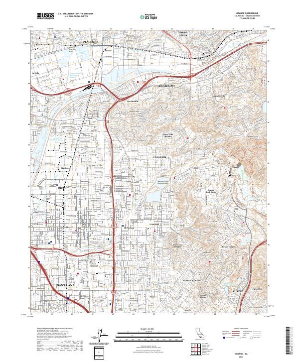 2022 Orange2022 Print · USGSCentral Orange County at the start of the 2020s shows a dense network of suburban cities and sophisticated water management systems. Researchers can trace local institutions and sites like Chapman University, Historic Yorba Cem, and Anaheim Lake.
 - 2022 Map of Lake Forest, 2022 Print
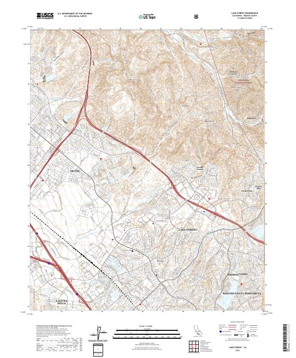 2022 Lake Forest2022 Print · USGSOrange County's modern suburban landscape meets the Santa Ana foothills in this detailed survey of the Lake Forest area. Researchers can trace the development of Foothill Ranch and El Toro alongside landmarks like Ascension Cem and The Sinks.
 - 2022 Map of San Clemente, 2022 Print
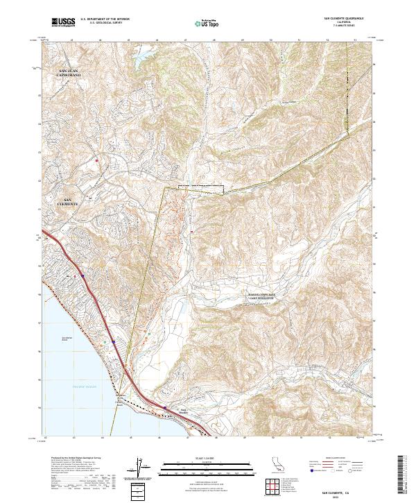 2022 San Clemente2022 Print · USGSThe Orange and San Diego County line comes into focus in this recent survey of the Southern California coast. Trace the suburban development of San Clemente out toward the natural drainages of San Mateo Canyon and the shores of Trestles Beach.
 - 2022 Map of Laguna Beach, 2022 Print
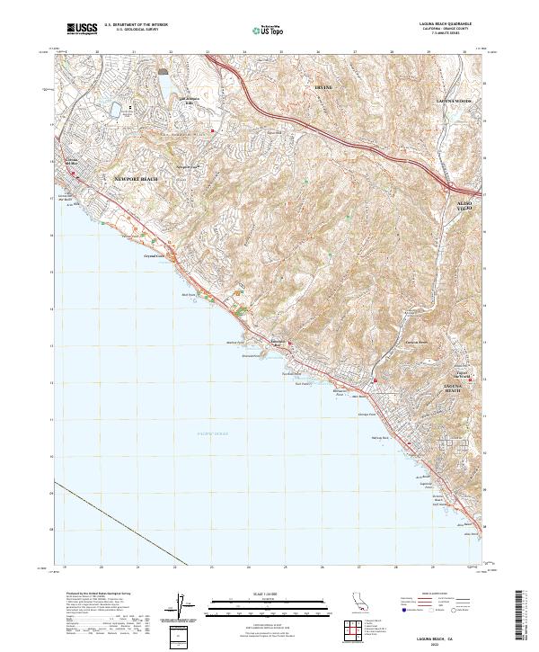 2022 Laguna Beach2022 Print · USGSThe Orange County coastline comes alive in this contemporary survey of the hills and coves from Newport to South Laguna. Trace the modern development of Newport Coast or locate coastal landmarks like Crystal Cove and the Laguna College of Art and Design.
 - 2022 Map of Sitton Peak, 2022 Print
 2022 Sitton Peak2022 Print · USGSThe high meadows and mountain peaks of the southern Cleveland National Forest are captured here in the early 2020s. Hikers and historians can trace the intricate network of fire roads and trails connecting Sitton Peak, Oak Flats, and Verdugo Potrero.
 - 2022 Map of Yorba Linda, 2022 Print
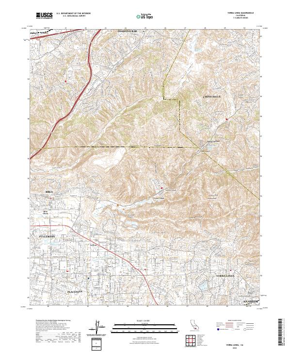 2022 Yorba Linda2022 Print · USGSYorba Linda and its neighbors in Orange and San Bernardino counties appear here in a period of extensive suburban development. Trace family roots and local growth across Yorba Linda, Placentia, and the canyons of the Chino Hills.
 - 2022 Map of Corona South, 2022 Print
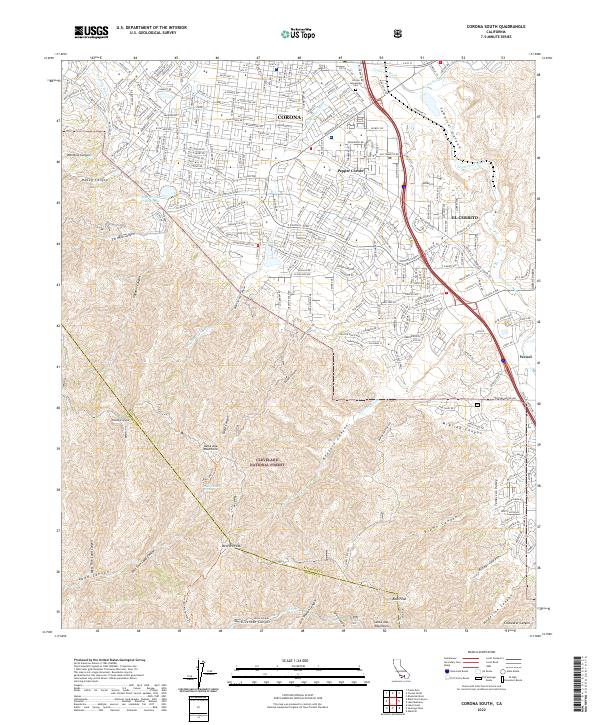 2022 Corona South2022 Print · USGSThe suburban edge of Riverside County meets the Santa Ana Mountains in the early 2020s. Researchers can trace the development of El Cerrito and Pepper Corner or follow historic routes like the Bedford Motor Way into the Cleveland National Forest.
 - 2022 Map of Black Star Canyon, 2022 Print
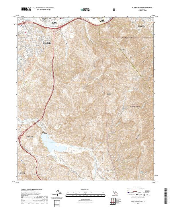 2022 Black Star Canyon2022 Print · USGSThe Orange County backcountry meets modern development in this recent survey of the Santa Ana Mountains. Researchers can trace the rugged topography of Black Star Canyon, locate Irvine Lake, and follow the Santa Ana River through the Chino Hills.
 - 2022 Map of Dana Point, 2022 Print
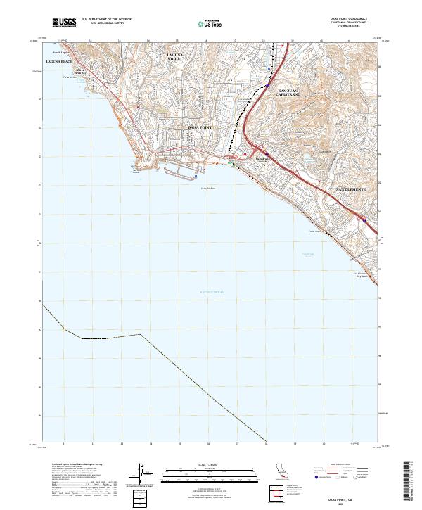 2022 Dana Point2022 Print · USGSCoastal Orange County is captured in this modern survey during a period of intense density and developed trail networks. Trace the shoreline from Three Arch Bay to San Clemente City Beach, locating landmarks like Dana Cove and the Folsom Ridge overlook.
 - 2022 Map of Canada Gobernadora, 2022 Print
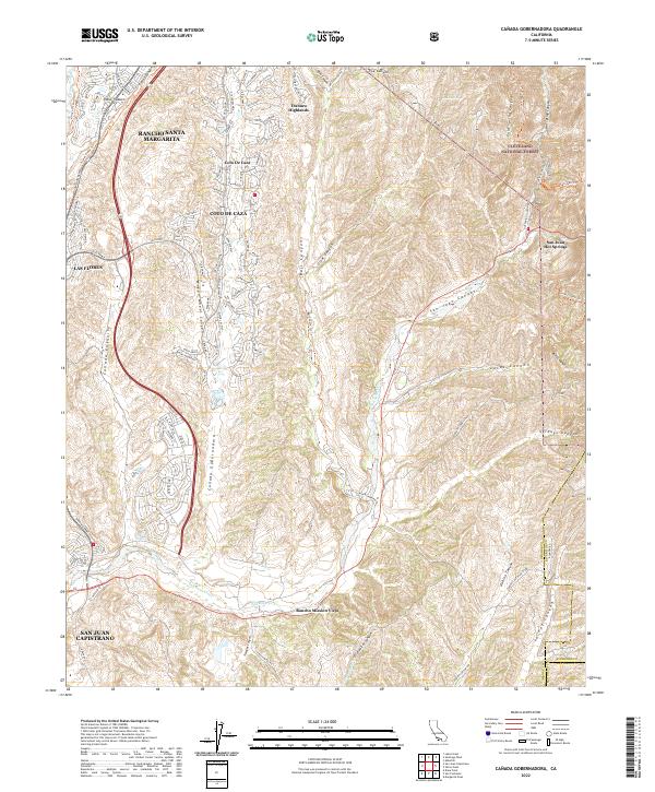 2022 Canada Gobernadora2022 Print · USGSOrange County's canyon country comes into focus in the early 2020s as suburban growth meets the protected wilderness of the Cleveland National Forest. Genealogists and local researchers can trace modern community boundaries from Coto De Caza to the historic Rancho Mission Viejo and the San Juan Hot Springs.
 - 2022 Map of Newport Beach, 2022 Print
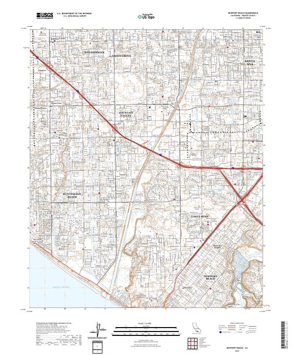 2022 Newport Beach2022 Print · USGSCoastal Orange County is shown here during a period of dense suburban maturity and complex water management. Researchers can trace the expansion of Huntington Beach, find established sites like Westminster Memorial Park, and explore the canyon terrain of the San Joaquin Hills.
 - 2022 Map of San Juan Capistrano, 2022 Print
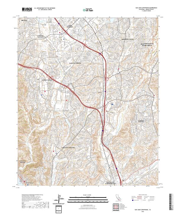 2022 San Juan Capistrano2022 Print · USGSSouthern Orange County in the early twenty-first century is a landscape of master-planned communities and rugged coastal canyons. Trace the development of Laguna Hills and Mission Viejo alongside landmarks like Saddleback College and the Mission Cem.
 - 2022 Map of Anaheim, 2022 Print
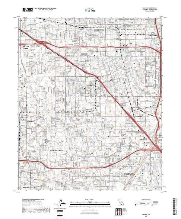 2022 Anaheim2022 Print · USGSThe heart of Orange County's urban landscape is captured here, showing the dense growth connecting Anaheim, Fullerton, and Santa Ana. Researchers can trace local landmarks like Anaheim Cem, Fullerton Municipal Airport, and several regional college campuses.
 - 2022 Map of Tustin, 2022 Print
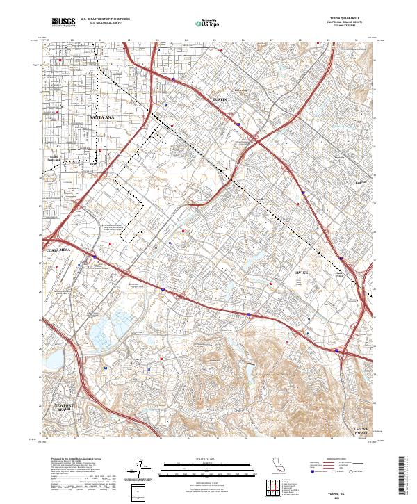 2022 Tustin2022 Print · USGSThe Orange County heartland is shown in high detail during this era of intensive suburban and academic growth. Researchers can trace the modern campus layout of the University of California Irvine and locate landmarks like French Hill and Red Hill.
 - 2022 Map of Prado Dam, 2022 Print
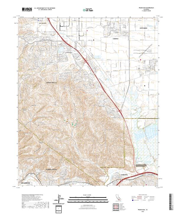 2022 Prado Dam2022 Print · USGSSouthern California's urban edge meets the wild canyonlands at the junction of three counties in the early 2020s. Researchers can map the residential growth of Los Serranos and Chino Hills or trace the geography of the Santa Ana River near the Prado Flood Control Basin.
 - 2022 Map of Long Beach OE S, 2022 Print
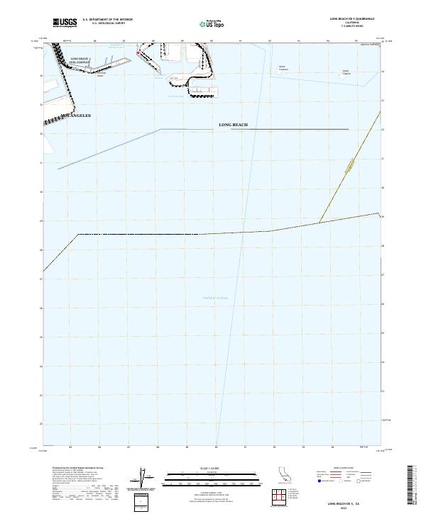 2022 Long Beach OE S2022 Print · USGSThe industrial coastline of Southern California is captured here in the early 2020s, focusing on the massive port infrastructure and artificial islands. Researchers can trace the modern layout of Terminal Island, shipping routes through the Outer Harbor, and landmarks like Island Freeman.
 - 2023 Map of Los Alamitos, 2023 Print
 2023 Los Alamitos2023 Print · USGSThe Orange and Los Angeles County borderlands are revealed in this modern survey of a bustling coastal plain. Researchers can trace institutional landmarks like Los Alamitos Army Airfield and the Artesia Cem alongside the channelized San Gabriel River.
End of results
Showing maps 1-25 of 25
Top cities of Orange County
- Anaheim historical maps
- Santa Ana historical maps
- Irvine historical maps
- Huntington Beach historical maps
- Garden Grove historical maps
- Fullerton historical maps
See more
Frequently asked questions
- What are the different types of historical maps available for Orange County?
- What is the oldest map of Orange County?
- Where can I purchase historical maps of Orange County for my home or office?
- Where can I download high-res historical maps of Orange County?
- Are there historical topographic maps available for Orange County?
- Is there historical aerial imagery available for Orange County?
- Where are historical maps of Orange County sourced from?