Old Maps of Twentynine Palms, California for Academic Research
Study the evolution of Twentynine Palms with 57 high-resolution historic maps. Whether you're teaching, researching, or modeling changes in land use, these maps provide essential visual documentation of urban, environmental, and geographic change.
- Analyze long-term change: Track patterns in development, transportation, and natural features.
- Ideal for environmental or urban studies: Support academic projects with primary historical map data.
- Use in the classroom or lab: Educators and researchers rely on these maps to bring historical context to life.
These maps are a powerful tool for teaching, research, and visualizing how Twentynine Palms has changed over the decades.
Twentynine Palms, CA maps
(57)- 1942 Map of Amboy
 1942 Amboy1942 Print · USGSSan Bernardino's high desert reveals its rail-and-road bones in the 1940s as transcontinental traffic pulses along the iconic route 66. Researchers can trace the water sources and small stations that made desert life possible, from Bonanza King Well and Wilhelm Camp to the rail stops at Amboy and Cadiz.
 - 1943 Map of Amboy
 1943 Amboy1943 Print · USGSThe Mojave Desert during the Second World War reveals a landscape of critical military training and vital rail infrastructure. Genealogists and historians can trace desert outposts like Bolo Station, the industrial Lime Mine Refinery, and the wartime 3rd Armd Div Camp.
 - 1953 Map of San Bernardino
 1953 San Bernardino1953 Print · USGSSouthern California underwent massive post-war growth as suburban sprawl reached the foothills of the San Bernardino Mountains. Genealogists and historians can trace the rail-and-road roots of the Inland Empire through the Union Pacific RR and Lake Arrowhead resorts.2 unique versions available
 - 1954 Map of Needles
 1954 Needles1954 Print · USGSThe Mojave Desert at the height of the mid-century era shows a landscape defined by the Atchison Topeka and Santa Fe railroad and the legendary U S Highway 66. Genealogists and historians can trace rail stops like Goffs, mining sites such as the Bonanza King Mine, and the early borders of the Chemehuevi Indian Reservation.
 - 1954 Map of Valley Mtn, 1955 Print
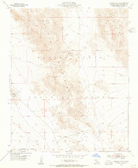
 1954 Valley Mtn1955 Print · USGSSan Bernardino's high desert in the mid-1950s reveals a landscape of isolated mines and military training grounds. Researchers can trace early mining at the Ben Butler Mine or locate early aviation markers like the Landing Field and Amboy Road.3 unique versions available
 - 1955 Map of Deadman Lake SE
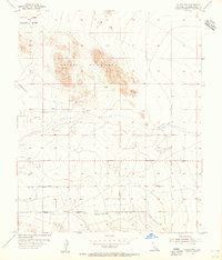
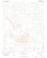
 1955 Deadman Lake SE1955 Print · USGSThe high desert near San Bernardino was a landscape of military activity and mineral exploration in the mid-1950s. Trace the boundaries of the Marine Corps Training Center and locate scattered Prospects throughout the Bullion Mountains.5 unique versions available
 - 1955 Map of Twentynine Palms, 1956 Print
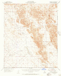
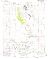
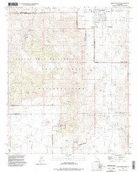
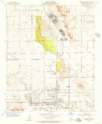 1955 Twentynine Palms1956 Print · USGSTwentynine Palms in the mid-fifties shows the desert community's expansion between the massive Marine Corps Training Center and the national monument. Researchers can trace early street layouts, find the Oasis of Mara, and locate the Chemehuevi Indian Res and Smith Ranch.2 unique versions available
 - 1955 Map of Twentynine Palms, 1956 Print
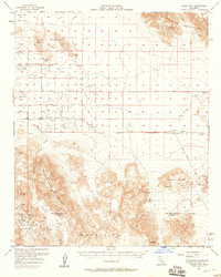
 1955 Twentynine Palms1956 Print · USGSTwentynine Palms and the northern Mojave desert are captured here in the mid-1950s just as military and recreational interest in the region expanded. Trace early desert life through landmarks like the Oasis of Mara, the Desert Queen Mine, and the original Smith Ranch.5 unique versions available
 - 1955 Map of Deadman Lake, 1956 Print
 1955 Deadman Lake1956 Print · USGSThe Mojave Desert in the mid-fifties is seen here as a landscape of military training and geological survey. You can trace early desert tracks and training grounds including the Training Center, Gypsum Ridge, and Surprise Spring.2 unique versions available
 - 1956 Map of San Bernardino
 1956 San Bernardino1956 Print · USGSSouthern California's Inland Empire and High Desert come into focus in the mid-fifties as agriculture gives way to suburban and military growth. Trace early rail lines like the Pacific Electric or find remote landmarks like Camp Rock Mine and George AFB.
 - 1956 Map of Needles
 1956 Needles1956 Print · USGSThe Mojave Desert and Colorado River come alive in the mid-fifties, showing the intersection of vital rail lines and massive water projects. Trace the Atchison Topeka and Santa Fe line through Amboy or locate remote sites like the Copper World Mine and Rio Vista Guest Ranch.7 unique versions available
 - 1956 Map of Valley Mountain, 1958 Print
 1956 Valley Mountain1958 Print · USGSThe high desert of San Bernardino and Riverside Counties was a hub of prospecting and early aviation during the 1950s. Miners and genealogists can trace numerous workings including the Virginia Dale Mine, Marbolite Mine, and the settlement at Old Dale.3 unique versions available
 - 1957 Map of San Bernardino
 1957 San Bernardino1957 Print · USGSSouthern California's Inland Empire and High Desert met during the postwar expansion of the late fifties. Genealogists and historians can trace the growth of San Bernardino and Redlands alongside remote landmarks like Edwards AFB and the Camp Rock Mine.
 - 1958 Map of San Bernardino, 1975 Print
 1958 San Bernardino1975 Print · USGSSouthern California’s Inland Empire and High Desert come into focus during the mid-century boom, showing the rise of suburbs and massive military installations. Researchers can trace the rail networks of the Union Pacific RR or locate landmarks like Norton AFB and Big Bear Lake.
 - 1959 Map of San Bernardino
 1959 San Bernardino1959 Print · USGSSouthern California underwent a massive transformation in the late fifties as suburban growth and military power reshaped the desert and valley. Researchers can trace the legacy of the Union Pacific Railroad and locate early footprints of Joshua Tree National Monument and Edwards Air Force Base.
 - 1966 Map of San Bernardino
 1966 San Bernardino1966 Print · USGSThe San Bernardino Valley and Mojave Desert met during a period of massive military and suburban growth in the mid-sixties. Genealogists and historians can trace the development of Edwards Air Force Base, old desert mines like the Bagdad Chase Mine, and mountain communities near Big Bear Lake.
 - 1972 Map of Indian Cove, 1975 Print
 1972 Indian Cove1975 Print · USGSThe Joshua Tree high desert during the early seventies preserves a landscape of ranching and mining history. Trace the legacy of early homesteaders and prospectors at sites like Keys Ranch, the Lang Mine, and the Wall Street Mill.2 unique versions available
 - 1972 Map of Queen Mountain, 1975 Print
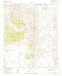 1972 Queen Mountain1975 Print · USGSTwentynine Palms and the northern reaches of Joshua Tree are captured here in the early 1970s. Trace the history of desert prospecting and early tourism through the Desert Queen Mine, the Pine City site, and the Fortynine Palms Oasis.2 unique versions available
 - 1972 Map of Sunfair, 1975 Print
 1972 Sunfair1975 Print · USGSThe High Desert of San Bernardino County comes alive in the early seventies as new communities begin to take root near Coyote Lake. Researchers can trace the development of Sunfair Heights, locate the Hi Desert Airport, and follow the Giant Rock Old Chisholm Trail.2 unique versions available
 - 1973 Map of Twentynine Palms, 1975 Print
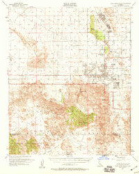
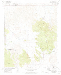
 1973 Twentynine Palms1975 Print · USGSTwentynine Palms and its desert neighborhoods are shown here in the 1970s as the community expanded around the Marine Corps base. Genealogists and local historians can trace family locations at Smith Ranch, Harmony Acres, or the Twentynine Palms Cem.2 unique versions available
 - 1981 Map of Needles, 1987 Print
 1981 Needles1987 Print · USGSThe High Desert and Colorado River valley are seen here in the early 1980s through the unique lens of satellite imagery. Trace the isolated outposts of the AT & SF railroad at Goffs and Essex, or explore the sprawling shores of Lake Havasu.
 - 1982 Map of Big Bear Lake, 1996 Print
 1982 Big Bear Lake1996 Print · USGSThe San Bernardino Mountains meet the high Mojave desert in the early eighties, showing a landscape defined by mountain resorts and desert basins. Trace the historic Belleville (Site), the rail lines of the Atchison Topeka and Santa Fe, and old mining works like the Gold Belt Mine.
 - 1985 Map of Twentynine Palms Mountain
 1985 Twentynine Palms Mountain1985 Print · USGSThe High Desert border of San Bernardino and Riverside Counties is captured here in the mid-1980s during a period of active resource extraction. Researchers can trace the layout of mining operations like the North Star Mine and Carlos Jr Mine near the desert outpost of Gold Park.2 unique versions available
 - 1985 Map of Sheep Hole Mountains
 1985 Sheep Hole Mountains1985 Print · USGSThe high desert of San Bernardino County is revealed in the mid-eighties as a landscape of remote mines and vast salt basins. Genealogists and historians can trace the mining history of Old Dale or locate rail stops like Chubbuck and Milligan near the Iron Mountains.
 - 1995 Map of Queen Mountain, 1998 Print
 1995 Queen Mountain1998 Print · USGSThe Mojave Desert highlands come to life in the mid-nineties, showing the intersection of mining history and park conservation. Trace old claims at the Desert Queen Mine or Anaconda Mine and locate vanished habitations at Pine City (Site).2 unique versions available
Showing maps 1-25 of 57
Top neighborhoods of Twentynine Palms
Frequently asked questions
- What are the different types of historical maps available for Twentynine Palms?
- What is the oldest map of Twentynine Palms?
- Where can I purchase historical maps of Twentynine Palms for my home or office?
- Where can I download high-res historical maps of Twentynine Palms?
- Are there historical topographic maps available for Twentynine Palms?
- Is there historical aerial imagery available for Twentynine Palms?
- Where are historical maps of Twentynine Palms sourced from?