
1955 Map of Deadman Lake SE
USGS Topo · Published 1955About this map
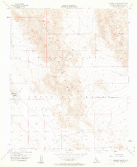
The Bullion Mountains dominate this high desert landscape, which in the mid-1950s was characterized by extensive military use and scattered mineral prospecting. The southern expanse is defined by the Marine Corps Training Center and a Naval Reservation Boundary, indicating the area's conversion into a specialized military range. Evidence of small-scale activity is found at a Rifle Range and a Gravel Pit near the southern flats. A network of Jeep Trails provides the only access into the elevated terrain where several unnamed Prospects and a single Prospect to the east point to a history of exploratory mining. The arid basin to the west is anchored by the dry bed of Deadman Lake, reflecting a landscape of intense isolation and tactical utility.
Find a feature on this map
9 named features on this map. Tap any name to fly to it.
Don’t see what you’re looking for? This feature index may not catch every label — zoom into the map to look around manually.
Map Details
Editions of this 1955 Deadman Lake SE Map
5 editions found
Other maps of this area

1942 · Amboy
USGS Topo · 1:250,000

1943 · Amboy
USGS Topo · 1:250,000

1953 · San Bernardino
USGS Topo · 1:250,000

1954 · Needles
USGS Topo · 1:250,000

1954 · Valley Mtn
USGS Topo · 1:24,000

1955 · Deadman Lake NW
USGS Topo · 1:24,000

1955 · Lead Mountain
USGS Topo · 1:24,000

1955 · Deadman Lake NE
USGS Topo · 1:24,000

1955 · Deadman Lake SW
USGS Topo · 1:24,000

1955 · Lead Mountain SW
USGS Topo · 1:24,000