Old Maps of Victorville, California for Metal Detecting
Plan your next treasure hunt with 47 historic maps of Victorville. Find old homesites, ghost towns, trails, and gathering spots that may be lost to time — perfect for identifying promising metal detecting locations.
- Locate forgotten sites: Uncover places like long-lost settlements, abandoned rail lines, or gathering spots.
- Plan better hunts: Use map overlays combined with LiDAR or satellite views to narrow in on historically rich areas.
- Made for detectorists: Thousands of hobbyists use these maps to discover relics, coins, and hidden history.
Use these historic maps to boost your research and find new opportunities beneath the surface of Victorville.
Victorville, CA maps
(47)- 1901 Map of Southern California Sheet No. 1
 1901 Southern California Sheet No. 11901 Print · USGSGreater Los Angeles at the dawn of the twentieth century is a landscape of growing citrus towns and a burgeoning rail network. Genealogists and historians can trace the early gridded streets of Hollywood and Pasadena or locate landmarks like Bear Lake and the Cahuilla Indian Reservation.6 unique versions available
 - 1902 Map of Hesperia
 1902 Hesperia1902 Print · USGSSan Bernardino County at the turn of the century shows the vital rail corridor climbing toward the high desert. Genealogists and historians can trace the early route of the Southern California railroad and locate historic outposts like Burcham Ranch and Hesperia.6 unique versions available
 - 1904 Map of Southern California Sheet No. 1, 1905 Print
 1904 Southern California Sheet No. 11905 Print · USGSSouthern California at the dawn of the twentieth century shows a landscape of citrus groves and coastal towns connected by rail. Genealogists and historians can trace early settlements like San Juan Capistrano, find remote sites like the Rose Mine, and study the original water systems of the Santa Ana River.2 unique versions available
 - 1932 Map of Barstow, 1956 Print
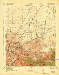
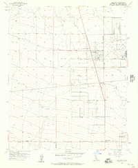
 1932 Barstow1956 Print · USGSIn the early 1930s, the High Desert economy centered on the Mojave River corridor and the steel rails of the Atchison Topeka and Santa Fe RR. Researchers can trace the early footprints of Barstow and Victorville or locate mining operations like the Apex Mine.
 - 1934 Map of Barstow
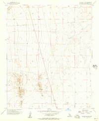
 1934 Barstow1934 Print · USGSThe Mojave Desert and its river-based corridor are captured here in the early thirties, during the heyday of Route 66. Researchers can trace the original Atchison Topeka and Santa Fe line and locate mining sites like the Western States Mine or the settlement at Helendale.3 unique versions available
 - 1942 Map of Hesperia
 1942 Hesperia1942 Print · USGSSan Bernardino County ranchlands and mountain passes are captured here during the early years of the war. Genealogists and historians can trace the Atchison Topeka and Santa Fe rail line as it climbs toward Cajon Pass and the Cajon Summit Lookout.
 - 1953 Map of San Bernardino
 1953 San Bernardino1953 Print · USGSSouthern California underwent massive post-war growth as suburban sprawl reached the foothills of the San Bernardino Mountains. Genealogists and historians can trace the rail-and-road roots of the Inland Empire through the Union Pacific RR and Lake Arrowhead resorts.2 unique versions available
 - 1956 Map of San Bernardino
 1956 San Bernardino1956 Print · USGSSouthern California's Inland Empire and High Desert come into focus in the mid-fifties as agriculture gives way to suburban and military growth. Trace early rail lines like the Pacific Electric or find remote landmarks like Camp Rock Mine and George AFB.
 - 1956 Map of Baldy Mesa, 1957 Print
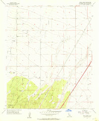 1956 Baldy Mesa1957 Print · USGSThe High Desert south of Victorville is captured in the mid-1950s when ranching and forest boundaries defined the landscape. Genealogists can trace family holdings like Yucca Forest Ranch, Patterson Ranch, and Warner Ranch along the early alignments of Phelan Road.8 unique versions available
 - 1956 Map of Hesperia, 1957 Print
 1956 Hesperia1957 Print · USGSHesperia was poised for growth in the mid-fifties as new rail lines and residential grids began to define the high desert landscape. Genealogists and researchers can trace early street layouts and find local landmarks such as the Cem, the Mojave State Fish Hatchery, and the Union Pacific rail corridor.6 unique versions available
 - 1956 Map of Victorville, 1957 Print
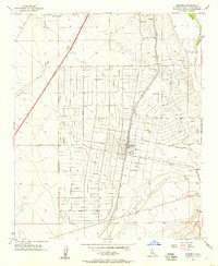
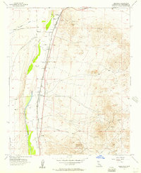
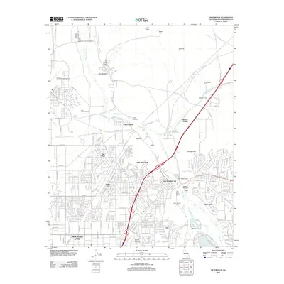
 1956 Victorville1957 Print · USGSVictorville and the High Desert are captured here in the mid-fifties during a period of industrial and military expansion. Genealogists and historians can trace the foundations of Apple Valley, the footprint of George Air Force Base, and local landmarks like Victor Valley Memorial Park.8 unique versions available
 - 1956 Map of Adelanto, 1957 Print
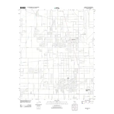
 1956 Adelanto1957 Print · USGSAdelanto and its desert surroundings are shown here in the mid-fifties, during the height of the Cold War. Researchers can trace the early footprint of George Air Force Base and locate smaller settlements at Adobe Corners and Mountain View.8 unique versions available
 - 1956 Map of Victorville NW, 1957 Print
 1956 Victorville NW1957 Print · USGSThe Mojave Desert north of Victorville comes into focus during the mid-1950s, showing a landscape defined by mining and arid-land navigation. Researchers can trace early mining sites like the Red Raven Mine and the winding path of Fremont Wash near Helendale Road.6 unique versions available
 - 1956 Map of Helendale, 1957 Print
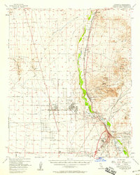
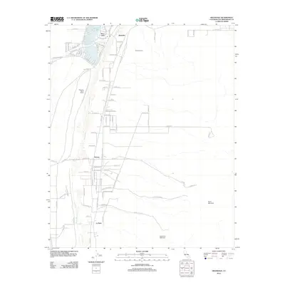
 1956 Helendale1957 Print · USGSThe High Desert landscape in the mid-fifties centers on the Mojave River corridor, where vital rail lines and desert mining operations intersect. Genealogists and historians can trace the rail settlements of Helendale and Bryman or locate the Oro Grande Mine and Branch Mine.5 unique versions available
 - 1956 Map of Victorville, 1958 Print
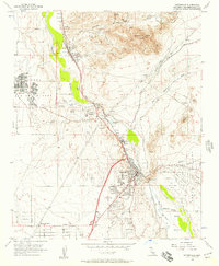
 1956 Victorville1958 Print · USGSSan Bernardino County's High Desert transition is visible here during the mid-fifties, as military expansion and mining shaped the corridor from Victorville to Helendale. Researchers can trace old desert claims like the Red Raven Mine and early community hubs such as Adobe Corners and Oro Grande.3 unique versions available
 - 1957 Map of San Bernardino
 1957 San Bernardino1957 Print · USGSSouthern California's Inland Empire and High Desert met during the postwar expansion of the late fifties. Genealogists and historians can trace the growth of San Bernardino and Redlands alongside remote landmarks like Edwards AFB and the Camp Rock Mine.
 - 1958 Map of San Bernardino, 1975 Print
 1958 San Bernardino1975 Print · USGSSouthern California’s Inland Empire and High Desert come into focus during the mid-century boom, showing the rise of suburbs and massive military installations. Researchers can trace the rail networks of the Union Pacific RR or locate landmarks like Norton AFB and Big Bear Lake.
 - 1959 Map of San Bernardino
 1959 San Bernardino1959 Print · USGSSouthern California underwent a massive transformation in the late fifties as suburban growth and military power reshaped the desert and valley. Researchers can trace the legacy of the Union Pacific Railroad and locate early footprints of Joshua Tree National Monument and Edwards Air Force Base.
 - 1966 Map of San Bernardino
 1966 San Bernardino1966 Print · USGSThe San Bernardino Valley and Mojave Desert met during a period of massive military and suburban growth in the mid-sixties. Genealogists and historians can trace the development of Edwards Air Force Base, old desert mines like the Bagdad Chase Mine, and mountain communities near Big Bear Lake.
 - 1982 Map of Victorville
 1982 Victorville1982 Print · USGSThe High Desert during the early eighties reveals a landscape of massive aerospace installations and growing desert communities. Researchers can trace the sprawling boundaries of Edwards Air Force Base alongside the vital California Aqueduct and the rail hub at Barstow.2 unique versions available
 - 1982 Map of San Bernardino, 1983 Print
 1982 San Bernardino1983 Print · USGSThe Inland Empire and San Gabriel Valley met at a peak of suburban and industrial expansion in the early eighties. Researchers can trace the massive rail infrastructure through Cajon Pass and locate landmarks like Norton Air Force Base or the Fontana International Raceway.
 - 1996 Map of Baldy Mesa, 1999 Print
 1996 Baldy Mesa1999 Print · USGSThe High Desert region south of Victorville is captured here in the mid-1990s as suburban growth began to meet traditional ranching lands. Genealogists and local historians can trace family-named sites like Fish Ranch and White Ranch near the San Bernardino National Forest boundary.
 - 2012 Map of Adelanto, 2012 Print
 2012 Adelanto2012 Print · USGSCovers Victorville, including Adelanto, Phelan, and other nearby areas
 - 2012 Map of Helendale, 2012 Print
 2012 Helendale2012 Print · USGSCovers Victorville, including Adelanto, Helendale, and other nearby areas
 - 2012 Map of Victorville, 2012 Print
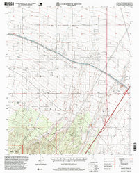
 2012 Victorville2012 Print · USGSCovers Victorville, including Apple Valley, Adelanto, and other nearby areas
Showing maps 1-25 of 47
Top cities near Victorville
- Hesperia historical maps
- Apple Valley historical maps
- Adelanto historical maps
- Oak Hills historical maps
- Piñon Hills historical maps
Top neighborhoods of Victorville
- Bellevue Heights historical maps
- The Village historical maps
- Eagle Ranch historical maps
- Duncan Corners historical maps
- Sunset Ridge historical maps
- Golden Mesa historical maps
See more
Frequently asked questions
- What are the different types of historical maps available for Victorville?
- What is the oldest map of Victorville?
- Where can I purchase historical maps of Victorville for my home or office?
- Where can I download high-res historical maps of Victorville?
- Are there historical topographic maps available for Victorville?
- Is there historical aerial imagery available for Victorville?
- Where are historical maps of Victorville sourced from?