1940s Maps of San Luis Obispo County, California
Explore 78 historic maps of San Luis Obispo County from the 1940s. These maps offer a rare glimpse into what life looked like during the 1940s — showing old roads, neighborhoods, homes, and landmarks that have changed or disappeared over time.
Whether you're researching your family's past, planning a metal detecting trip, or studying how San Luis Obispo County's landscape evolved across the 1940s, these high-resolution maps are a powerful tool for exploring the history of this region.
- Focus on a specific era: All maps on this page are from the 1940s, giving you a focused view of this time period.
- See what’s changed: Compare century-old streets, trails, and buildings to today's modern landscape using overlays and satellite layers.
- Research with precision: Use these maps for genealogy, historical research, land use analysis, or educational projects.
- View, download, or print: Maps are fully viewable online in high resolution, and can be downloaded or printed for your own records.
Start exploring San Luis Obispo County's history through authentic maps from the 1940s. This is your window into the past.
San Luis Obispo County, CA maps
(78)- 1941 Map of Bradley
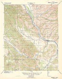 1941 Bradley1941 Print · USGSCoastal California ranching and rail life are recorded here during the early years of the war. Genealogists and local historians can locate early homesteads and schoolhouses like Hames School or trace the Southern Pacific Coast Line through Bradley.
 - 1941 Map of Cape San Martin
 1941 Cape San Martin1941 Print · USGSThe central California coast was a landscape of remote mining claims and family ranchlands during the early 1940s. Trace the history of the Los Burros Mine and the W R Hearst Foremans Headquarters as the Coast Highway winds past Gorda P O.
 - 1941 Map of Bryson
 1941 Bryson1941 Print · USGSThe Santa Lucia Range and the valley of the Nacimiento River come into focus in this early 1940s survey. Genealogists can locate family holdings like Graves Ranch or Davis Ranch and study local education at Hesperia School.
 - 1941 Map of Port San Luis
 1941 Port San Luis1941 Print · USGSCoastal San Luis Obispo County is captured here just before the Second World War, showing the steep interface of the Diablo Range and the sea. Researchers can trace the maritime landscape around Port San Luis and identify distinctive coastal landmarks like Pecho Rock and Saddle Pk.
 - 1941 Map of Caliente Mountain, 1956 Print
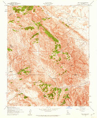
 1941 Caliente Mountain1956 Print · USGSThe Carrizo Plain and its surrounding mountain ranges are captured here in the early 1940s, documenting a landscape of remote cattle ranches and high desert basins. Researchers can trace the legacy of family holdings like Spanish Ranch and Washburn Ranch or locate natural features such as Soda Lake and Painted Rock.
 - 1941 Map of McPherson Peak, 1956 Print
 1941 McPherson Peak1956 Print · USGSThe northern Santa Barbara backcountry is seen here in the early 1940s, highlighting the transition from the Cuyama River valley into the high Sierra Madres. Researchers can locate remote ranch sites and forest landmarks such as Hinsdale Ranch, the Wasioja Sch, and the Hurricane Deck ridge.3 unique versions available
 - 1942 Map of Guadalupe
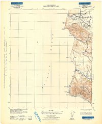 1942 Guadalupe1942 Print · USGSThe Central Coast during the early war years reveals a landscape of coastal rail stations and ranching canyons along the Santa Barbara shore. Researchers can trace the Southern Pacific line through Surf and Honda to find vanished spurs and schools like Lynden Sch.
 - 1942 Map of Adelaida
 1942 Adelaida1942 Print · USGSThe Santa Lucia Range was still a rugged frontier of ranching and quicksilver mining in the early 1940s. Genealogists can trace family holdings like Kentucky Ranch and old rural schoolhouses including Summit School and Asuncion School.
 - 1942 Map of San Luis Obispo
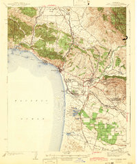
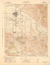
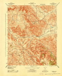
 1942 San Luis Obispo1942 Print · USGSSan Luis Obispo and the surrounding Santa Lucia Range are captured here just before the mid-century expansion, centered on the Southern Pacific rail line. Researchers can trace early campus boundaries at the California Polytechnic School and find rural landmarks like Stowe Sch and Eagle Ranch.2 unique versions available
 - 1942 Map of Lompoc
 1942 Lompoc1942 Print · USGSSanta Barbara County at the start of World War II reveals a landscape of missions, ranching, and coastal rail. Researchers can trace the Pacific Coast Railroad, locate historic schools like Sisquoc Sch, and find the remote Asphaltum Mine.
 - 1942 Map of Bryson
 1942 Bryson1942 Print · USGSCoastal range foothills and river valleys are shown here during the early years of the war, as military holdings expanded over historic ranch lands. Researchers can trace the boundaries of the Hunter Liggett Military Reservation and locate old landmarks like the Quicksilver Mine and Playa School.
 - 1942 Map of Arroyo Grande
 1942 Arroyo Grande1942 Print · USGSThe San Luis Obispo coastline and the fertile Cienega Valley are shown here in the early 1940s, as steam and narrow-gage rails still shaped the local economy. Genealogists can locate vanished schools like Belleview Sch and trace the paths of the Pacific Coast Railway and Southern Pacific Railroad through Oceano and Edna.3 unique versions available
 - 1942 Map of Cape San Martin
 1942 Cape San Martin1942 Print · USGSThe Monterey coast and Santa Lucia Range are captured here during the early 1940s, just as military use of the backcountry intensified. Genealogists and researchers can locate remote homesteads like the Krenkel Ranch and Dutra Place, alongside several workings like the Polar Star Mine.
 - 1942 Map of Santa Maria
 1942 Santa Maria1942 Print · USGSSanta Barbara County was a hub of petroleum production and river-valley agriculture in the early 1940s. Genealogists and local historians can trace the early footprints of Santa Maria, the Santa Maria Valley Oil Field, and rural stops like Bicknell and Orcutt.
 - 1942 Map of Branch Mountain
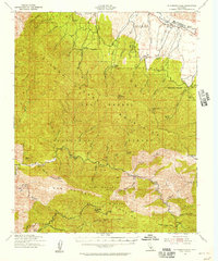
 1942 Branch Mountain1942 Print · USGSSan Luis Obispo and Santa Barbara counties meet along the high ridges and river canyons of the interior in the early 1940s. Genealogists and historians can trace pioneer outposts like Scott Ranch and Avenales Ranch or locate the remote Pine Canyon Guard Sta.3 unique versions available
 - 1942 Map of Point Sal
 1942 Point Sal1942 Print · USGSThe Santa Barbara coast during the early war years is shown here in high detail, from the river valley down to the Pacific cliffs. Genealogists and researchers can trace the rail settlements at Narlon, the rural community at Casmalia, and the local Bonita Sch.
 - 1942 Map of Caliente Mtn, 1952 Print
 1942 Caliente Mtn1952 Print · USGSCoastal California’s interior highlands were a domain of remote ranching and seasonal water sources during the early 1940s. Genealogists and historians can trace old homesteads like Goodwin Ranch and Spanish Ranch or locate the historic Painted Rock landmark.2 unique versions available
 - 1942 Map of Ballinger Canyon, 1958 Print
 1942 Ballinger Canyon1958 Print · USGSThe high desert canyons of the California interior come to life in the early 1940s at the convergence of four county lines. Researchers can trace historic ranch sites like Klipstein Ranch and remote outposts such as Camp Dix near the Cuyama Valley floor.
 - 1942 Map of East of Cuyama Ranch, 1959 Print
 1942 East of Cuyama Ranch1959 Print · USGSThe Cuyama Valley at the start of the 1940s reveals a landscape of isolated ranching and early petroleum discovery. Genealogists and historians can trace family holdings like Coulter Ranch and Whitner Ranch near the Cuyama School.
 - 1942 Map of Tent Hills, 1960 Print
 1942 Tent Hills1960 Print · USGSIn the early 1940s, this pocket of the California Coast Ranges was a rugged intersection of ranch land and high ridges. Genealogists and historians can trace old homestead boundaries and early routes through Cottonwood Pass, Iron Spring Ranch, and Fahey Ranch.2 unique versions available
 - 1943 Map of Packwood
 1943 Packwood1943 Print · USGSThe Temblor Range and the border of Kern and San Luis Obispo counties are captured here during the early 1940s. Genealogists and local historians can trace isolated ranch sites like W M Cook and Sumners or locate the remote Cemetery and Bitterwater Pump Station.
 - 1943 Map of Grant Lake
 1943 Grant Lake1943 Print · USGSRanching outposts and high-desert canyons define this region of the California coast ranges during the early war years. Family-named landmarks such as Iverson Ranch and McIsaac can be traced alongside Choice Valley School and Grant Lake.
 - 1943 Map of Shandon
 1943 Shandon1943 Print · USGSShandon and the surrounding San Luis Obispo ranchlands are shown here during the early 1940s as an active agricultural community. Researchers can trace historic family holdings like the Sacramento Ranch and Hillman Ranch or locate landmarks such as the Shandon School.
 - 1943 Map of Paso Robles
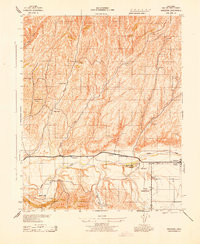
 1943 Paso Robles1943 Print · USGSMid-century San Luis Obispo County is defined here by the river-and-rail corridor connecting Paso Robles to its rural agricultural outposts during the war years. Genealogists and historians can trace local family landmarks and district hubs like San Miguel Mission, Creston, and the Oak Flat School.
 - 1943 Map of Commatti Canyon
 1943 Commatti Canyon1943 Print · USGSEastern San Luis Obispo County ranches and canyons are captured here during the early years of the Second World War. Genealogists and researchers can trace family-named sites like Alfalfa Ranch, Commatti Ranch, and the Alliance School.
Showing maps 1-25 of 78
Top cities of San Luis Obispo County
- San Luis Obispo historical maps
- Atascadero historical maps
- Paso Robles historical maps
- Arroyo Grande historical maps
- Grover Beach historical maps
- Morro Bay historical maps
See more
Frequently asked questions
- What are the different types of historical maps available for San Luis Obispo County?
- What is the oldest map of San Luis Obispo County?
- Where can I purchase historical maps of San Luis Obispo County for my home or office?
- Where can I download high-res historical maps of San Luis Obispo County?
- Are there historical topographic maps available for San Luis Obispo County?
- Is there historical aerial imagery available for San Luis Obispo County?
- Where are historical maps of San Luis Obispo County sourced from?