1990s Maps of San Luis Obispo County, California
Explore 30 historic maps of San Luis Obispo County from the 1990s. These maps offer a rare glimpse into what life looked like during the 1990s — showing old roads, neighborhoods, homes, and landmarks that have changed or disappeared over time.
Whether you're researching your family's past, planning a metal detecting trip, or studying how San Luis Obispo County's landscape evolved across the 1990s, these high-resolution maps are a powerful tool for exploring the history of this region.
- Focus on a specific era: All maps on this page are from the 1990s, giving you a focused view of this time period.
- See what’s changed: Compare century-old streets, trails, and buildings to today's modern landscape using overlays and satellite layers.
- Research with precision: Use these maps for genealogy, historical research, land use analysis, or educational projects.
- View, download, or print: Maps are fully viewable online in high resolution, and can be downloaded or printed for your own records.
Start exploring San Luis Obispo County's history through authentic maps from the 1990s. This is your window into the past.
San Luis Obispo County, CA maps
(30)- 1991 Map of Ballinger Canyon
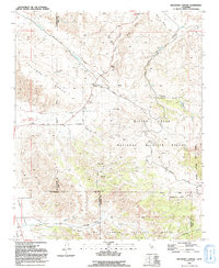 1991 Ballinger Canyon1991 Print · USGSThe high-desert terrain of Kern and San Luis Obispo counties is captured here in the early nineties, dominated by the San Andreas Rift Zone. Researchers can trace old land grants like the Cuyama Grant and find quiet locales like Adobe and Stubblefield.
 - 1994 Map of Tent Hills
 1994 Tent Hills1994 Print · USGSThe high borderlands of the California Coast Ranges come into focus in the early nineties, where Kings, Monterey, and Kern counties meet. Genealogists and historians can locate remote landmarks like Cottonwood Pass, the Johnson Peak summit, and a secluded Cem.2 unique versions available
 - 1995 Map of Caldwell Mesa, 1999 Print
 1995 Caldwell Mesa1999 Print · USGSSan Luis Obispo County’s interior ridges and canyonlands are mapped here in the mid-1990s, showing the intersection of the national forest and old ranch holdings. Researchers can trace historic homesteads like the Reeves Place and family-named landmarks including Porter Ranch and Hathaway Place.
 - 1995 Map of La Panza, 2000 Print
 1995 La Panza2000 Print · USGSThe high backcountry of San Luis Obispo County is captured here in the mid-1990s as it transitions from ranching lands to protected wilderness. Genealogists and hikers can trace old family sites like Martinez Place and remote landmarks including Coyote Hole and King David Spring.
 - 1995 Map of San Luis Obispo, 2000 Print
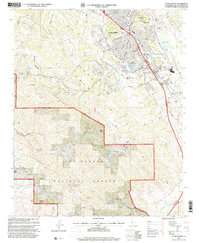
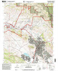 1995 San Luis Obispo2000 Print · USGSSan Luis Obispo and its surrounding volcanic peaks are captured in the mid-1990s as the city and university expand. Researchers can trace the legacy of the Southern Pacific RR through Cuesta Pass or locate ancestral sites like the Catholic Cem and Old Mission San Luis Obispo de Tolosa.
 - 1995 Map of Taylor Canyon, 2000 Print
 1995 Taylor Canyon2000 Print · USGSThe Cuyama Valley in the mid-1990s reveals a landscape of massive historical land grants and isolated ranching outposts. Researchers can trace the boundaries of the Cuyama Grant and locate remote sites like Spanish Ranch and the Landing Strip.
 - 1995 Map of Santa Margarita Lake, 2000 Print
 1995 Santa Margarita Lake2000 Print · USGSThe coastal hills of San Luis Obispo County are mapped here in the mid-1990s, during a period of transition between historic mining and wilderness preservation. Trace the area's mercury mining history at Rinconada Mine, locate the junction at Pippin Corner, and explore the canyon lands near Pozo.
 - 1995 Map of Peak Mountain, 2000 Print
 1995 Peak Mountain2000 Print · USGSThe high Sierra Madre range and Cuyama Valley meet in the 1990s, revealing a landscape of historical ranch grants and rugged wilderness. Genealogists and hikers can trace the Cuyama Grant boundaries or locate remote sites like Caliente Ranch and McPherson Peak.
 - 1995 Map of Burnett Peak, 2000 Print
 1995 Burnett Peak2000 Print · USGSThe Monterey and San Luis Obispo county line meets in the mid-1990s within this stretch of the Santa Lucia Range. Researchers can trace the complex borders of Fort Hunter Liggett and historic ranch grants near Burnett Peak and the Nacimiento River.
 - 1995 Map of Pozo Summit, 2000 Print
 1995 Pozo Summit2000 Print · USGSSan Luis Obispo County in the mid-1990s shows a rugged intersection of forest service lands and early settlements. Local historians can trace family-named sites like Sellars Potrero and Las Chiches alongside the historic Pozo School.
 - 1995 Map of Ballinger Canyon, 2000 Print
 1995 Ballinger Canyon2000 Print · USGSHigh-desert ranchlands and tectonic fault lines define the tri-county borderlands in the mid-nineties. Trace old land grant boundaries like the Cuyama Grant and remote outposts such as Adobe and Padrone.
 - 1995 Map of Los Machos Hills, 2000 Print
 1995 Los Machos Hills2000 Print · USGSThe La Panza Range and Los Machos Hills are captured in the mid-nineties as they appeared within the national forest. Researchers can locate remote ranching sites like Avenales Ranch, the Joughin Ranch, and old mining ventures near Stony Ridge.
 - 1995 Map of Camatta Ranch, 2000 Print
 1995 Camatta Ranch2000 Print · USGSIn the mid-1990s, this pocket of San Luis Obispo County remained a landscape of high-elevation ranching and forest management. Researchers can trace historical property lines like the Panza Grant and locate remote landmarks such as Camatta Ranch and Black Mountain.
 - 1995 Map of New Cuyama, 2000 Print
 1995 New Cuyama2000 Print · USGSThe Cuyama Valley in the mid-1990s shows a landscape of ranching, oil infrastructure, and the company-town roots of New Cuyama. Researchers can trace the Cuyama Grant, locate the Phosphate Mine, and follow the Rocky Ridge Trail into the national forest.
 - 1995 Map of Tar Spring Ridge, 2000 Print
 1995 Tar Spring Ridge2000 Print · USGSSan Luis Obispo County in the mid-nineties shows a landscape shaped by massive water projects and historic land grants. Genealogists and local historians can trace family-named sites like Ranchita Ranch and Park Ranch near the waters of Lopez Lake.
 - 1995 Map of Huasna Peak, 2000 Print
 1995 Huasna Peak2000 Print · USGSCoastal California ranching and rugged canyons are captured here in the mid-1990s as the wilderness met the rising waters of the reservoir. Researchers can locate family outposts like Porter Ranch and Oakley Ranch, or trace the remote Deer Trail Mine.
 - 1995 Map of Chimineas Ranch, 2000 Print
 1995 Chimineas Ranch2000 Print · USGSThe high-desert ranchlands of the eastern San Luis Obispo County interior are mapped here during the mid-nineties. Researchers can trace the legacy of remote outposts like Chimineas Ranch and Saucito Ranch alongside the shoreline of Soda Lake.
 - 1995 Map of Morro Bay North, 2000 Print
 1995 Morro Bay North2000 Print · USGSCentral Coast life in the mid-nineties shows the town of Morro Bay nestled between the coastal range and Estero Bay. Researchers can trace the development of local schools and parks like Lila Keiser Park alongside the rugged terrain of Rusty Peak.
 - 1995 Map of Miranda Pine Mountain, 2000 Print
 1995 Miranda Pine Mountain2000 Print · USGSThe high ridges of the Santa Barbara backcountry are shown here in the mid-nineties as the wilderness and forest lands border the Cuyama Valley. Researchers can locate remote historical sites like Davis Cabin and Gifford Ranch or trace the Sierra Madre Road past Porter Peak.
 - 1995 Map of Arroyo Grande NE, 2000 Print
 1995 Arroyo Grande NE2000 Print · USGSThe San Luis Obispo coastline and its inland canyons come into focus in the mid-1990s as suburban growth reaches the edge of historic land grants. Genealogists and local historians can trace school sites like Independence School and Brauch School, or the boundaries of the Santa Manuela Grant.
 - 1995 Map of Atascadero, 2000 Print
 1995 Atascadero2000 Print · USGSAtascadero and the Salinas River valley are captured in the mid-nineties as suburban growth pressed against the Santa Lucia Range. Researchers can locate established landmarks like the Atascadero State Hospital, the Charles Paddock Zoo, and Atascadero Lake.
 - 1995 Map of Lopez Mountain, 2000 Print
 1995 Lopez Mountain2000 Print · USGSThe Santa Lucia Range in the mid-nineties shows a landscape of protected wilderness and historic land grants. Genealogists and hikers can trace remote locations like Upper Lopez Campsite, the Salinas River, and peaks like Gay Mountain.
 - 1995 Map of Villa Creek, 2000 Print
 1995 Villa Creek2000 Print · USGSThe Monterey coastline near the mid-nineties is characterized by protected wilderness and the winding path of the Cabrillo Highway. Researchers can locate remote trail waypoints like the Buckeye Campsite and trace the bounds of the California Sea Otter State Game Refuge.
 - 1995 Map of Burro Mountain, 2000 Print
 1995 Burro Mountain2000 Print · USGSThe Big Sur coastline met the rugged Santa Lucia Range in the mid-nineties, showing a landscape of wilderness trails and remote ranches. Researchers can locate the Polar Star Mine, the Baldwin Ranch, and numerous backcountry sites like Estrella Campsite.
 - 1995 Map of La Panza Ranch, 2000 Print
 1995 La Panza Ranch2000 Print · USGSThe eastern San Luis Obispo County backcountry is shown here in the 1990s as a landscape of remote ranching and forest service outposts. Researchers can trace the rugged drainages of Navajo Creek to find sites like French Camp, La Panza Ranch, and Wreden.
Showing maps 1-25 of 30
Top cities of San Luis Obispo County
- San Luis Obispo historical maps
- Atascadero historical maps
- Paso Robles historical maps
- Arroyo Grande historical maps
- Grover Beach historical maps
- Morro Bay historical maps
See more
Frequently asked questions
- What are the different types of historical maps available for San Luis Obispo County?
- What is the oldest map of San Luis Obispo County?
- Where can I purchase historical maps of San Luis Obispo County for my home or office?
- Where can I download high-res historical maps of San Luis Obispo County?
- Are there historical topographic maps available for San Luis Obispo County?
- Is there historical aerial imagery available for San Luis Obispo County?
- Where are historical maps of San Luis Obispo County sourced from?