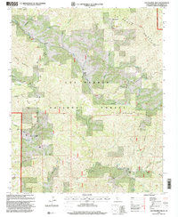
1995 Map of Los Machos Hills
USGS Topo · Published 2000About this map
La Panza Range and the Los Machos Hills anchor this high-elevation landscape within the Los Padres National Forest. The 1995 revision reveals a remote network of ranching outposts and rugged cattle-country infrastructure, including the Avenales Ranch and Joughin Ranch. The upper reaches of the Salinas River flow through the northwest corner, while the complex terrain is defined by landmarks like Machesna Mountain and Garcia Mountain.
Find a feature on this map
46 named features on this map. Tap any name to fly to it.
Don’t see what you’re looking for? This feature index may not catch every label — zoom into the map to look around manually.
Map Details
Editions of this 1995 Los Machos Hills Map
This is the sole edition of this map. No revisions or reprints were ever made.
Other maps of this area

1922 · Pozo
USGS Topo · 1:62,500

1922 · Nipomo
USGS Topo · 1:62,500

1932 · La Panza
USGS Topo · 1:48,000

1935 · La Panza
USGS Topo · 1:62,500

1936 · La Panza
USGS Topo · 1:62,500

1937 · Branch Mtn
USGS Topo · 1:48,000

1942 · Branch Mountain
USGS Topo · 1:62,500

1947 · San Luis Obispo
USGS Topo · 1:250,000

1948 · San Luis Obispo
USGS Topo · 1:250,000
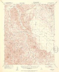
1952 · La Panza
USGS Topo · 1:62,500