1950s Maps of San Luis Obispo County, California
Explore 50 historic maps of San Luis Obispo County from the 1950s. These maps offer a rare glimpse into what life looked like during the 1950s — showing old roads, neighborhoods, homes, and landmarks that have changed or disappeared over time.
Whether you're researching your family's past, planning a metal detecting trip, or studying how San Luis Obispo County's landscape evolved across the 1950s, these high-resolution maps are a powerful tool for exploring the history of this region.
- Focus on a specific era: All maps on this page are from the 1950s, giving you a focused view of this time period.
- See what’s changed: Compare century-old streets, trails, and buildings to today's modern landscape using overlays and satellite layers.
- Research with precision: Use these maps for genealogy, historical research, land use analysis, or educational projects.
- View, download, or print: Maps are fully viewable online in high resolution, and can be downloaded or printed for your own records.
Start exploring San Luis Obispo County's history through authentic maps from the 1950s. This is your window into the past.
San Luis Obispo County, CA maps
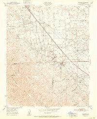
(50)- 1950 Map of Maricopa, 1965 Print
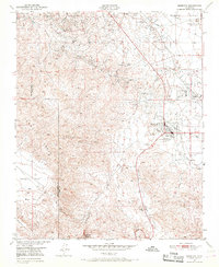 1950 Maricopa1965 Print · USGSMaricopa and the southern San Joaquin Valley are captured here during the 1950s oil boom. Researchers can trace the industrial footprint of Oil Wells and the Norwalk Oil Refinery alongside small settlements like Spellacy and Hazelton.2 unique versions available
 - 1950 Map of Fellows, 1968 Print
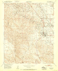
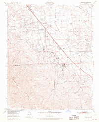 1950 Fellows1968 Print · USGSMid-century petroleum production in the San Joaquin Valley is centered here around Fellows and the sprawling Naval Petroleum Reserve No 2. Genealogists and industrial historians can locate the Midway Oil Camp, Associated Oil Camp, and the Midway School.4 unique versions available
 - 1950 Map of Reward, 1969 Print
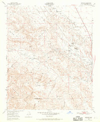 1950 Reward1969 Print · USGSKern County industrial and ranching life is captured at mid-century as the oil fields of the west side were in full operation. Genealogists and historians can trace the footprint of Reward, the Olig School, and the extensive Southern Pacific rail and oil infrastructure.4 unique versions available
 - 1951 Map of Reward
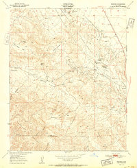 1951 Reward1951 Print · USGSKern County's oil boom era is on full display in this mid-century survey of the valley foothills. Researchers can trace the industrial footprint of Standard Oil Co and Union Oil near the vanished Olig School and the settlement of Reward.
 - 1951 Map of Fellows
 1951 Fellows1951 Print · USGSThe oil-rich landscape of Kern County is captured here in the early fifties during the peak of federal energy extraction. Genealogists and historians can trace the specific layouts of Fellows, Midway Oil Camp, and the historic Midway School.
 - 1951 Map of Maricopa
 1951 Maricopa1951 Print · USGSThe oil-rich landscape of southern Kern County is captured here in the early 1950s, showing the height of local petroleum production. Researchers can trace the industrial footprint of the Norwalk Oil Refinery and find old settlements like Spellacy and Hazelton.
 - 1951 Map of Port San Luis, 1953 Print
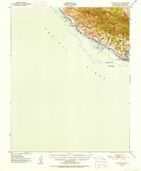 1951 Port San Luis1953 Print · USGSThe Central Coast of California appears here in the early fifties, before modern industrial development reshaped its canyons. Researchers can trace historical landmarks like the Point San Luis Lighthouse, the landing at Port San Luis, and the drainage of Diablo Canyon.3 unique versions available
 - 1951 Map of Cayucos, 1953 Print
 1951 Cayucos1953 Print · USGSThe Central Coast in the early fifties shows a landscape of fishing villages and emerging coastal suburbs. Trace family history at the Quintana Cem or locate former schoolhouses like Simeon Sch and Sunnyside Sch.5 unique versions available
 - 1952 Map of Caliente Mountain
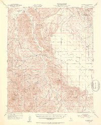
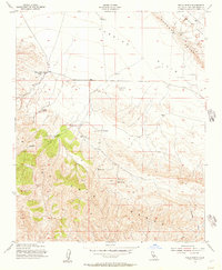
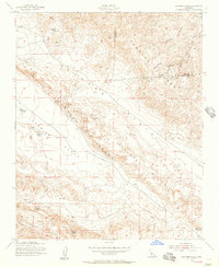
 1952 Caliente Mountain1952 Print · USGSThe high desert of the Carrizo Plain and the steep Caliente Range are captured here in the early fifties. Researchers can locate remote family operations like Goodwin Ranch, find the Painted Rock landmark, and trace the Cuyama River canyon.
 - 1952 Map of Arroyo Grande, 1953 Print
 1952 Arroyo Grande1953 Print · USGSThe Central Coast comes alive in the early fifties as coastal tourism and inland agriculture thrive side-by-side. Genealogists and historians can trace the Southern Pacific RR corridor through Grover City, locate family landmarks like Branch School, or study the Sand Dunes and lakes around Oceano.3 unique versions available
 - 1952 Map of La Panza, 1953 Print
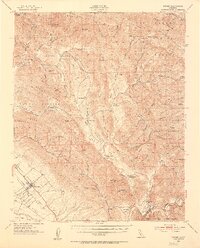
 1952 La Panza1953 Print · USGSThe high desert of eastern San Luis Obispo County is shown here in the early fifties during a period of ranching and early oil exploration. Genealogists and historians can locate remote outposts like La Panza Ranch, the Queen Bee Camp Ground, and topographic landmarks like Syncline Hill.3 unique versions available
 - 1952 Map of Branch Mountain, 1953 Print
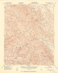 1952 Branch Mountain1953 Print · USGSThe rugged interior of the Central Coast is seen here during the early fifties, characterized by remote cattle operations and mountain trails. Genealogists and local historians can trace legacy holdings like Carrisa Ranch, Gifford Ranch, and the Gline Ranch Corral.3 unique versions available
 - 1952 Map of Nipomo, 1953 Print
 1952 Nipomo1953 Print · USGSCoastal ridges and interior ranchlands define this mid-century look at the southern San Luis Obispo back country. Local historians can trace old family holdings like Tar Springs Ranch and Porter Ranch or locate the Santa Manuela School.3 unique versions available
 - 1952 Map of Pozo, 1954 Print
 1952 Pozo1954 Print · USGSSan Luis Obispo County ranching and mountain country are frozen in time here during the early fifties. Local historians can trace the network of old roads and mines like the Red Eagle Mine or locate early centers of community like Pozo and the Pozo Sch.3 unique versions available
 - 1952 Map of San Luis Obispo, 1954 Print
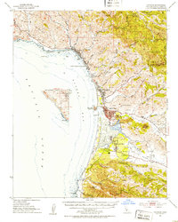
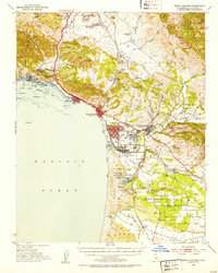
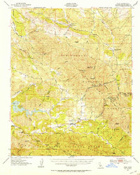
 1952 San Luis Obispo1954 Print · USGSSan Luis Obispo County in the early fifties shows a landscape of burgeoning colleges, military grounds, and historic mines. Trace the Southern Pacific rail line as it winds past Santa Margarita and the Pick and Shovel Mine.2 unique versions available
 - 1954 Map of Wells Ranch, 1957 Print
 1954 Wells Ranch1957 Print · USGSIn the mid-fifties, the high desert terrain of San Luis Obispo County was a world of remote cattle operations and stark geology. Researchers can trace historic ranch footprints like Seaback Ranch, locate The Old Adobe, and map water sources like Wells Spring.3 unique versions available
 - 1954 Map of Panorama Hills, 1957 Print
 1954 Panorama Hills1957 Print · USGSSan Luis Obispo and Kern counties meet along this dramatic fault-line landscape in the mid-1950s. Researchers can trace early geological and industrial activity near Crocker Flat, the prominent Elkhorn Scarp, and several Oil Wells (Aban'd).3 unique versions available
 - 1954 Map of Elkhorn Hills, 1957 Print
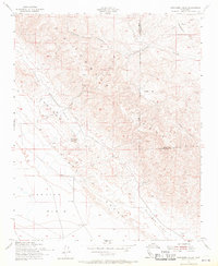
 1954 Elkhorn Hills1957 Print · USGSThe high desert border of San Luis Obispo and Kern Counties comes into focus during the mid-1950s, revealing a landscape of remote cattle ranches and early oil exploration. Genealogists and historians can trace family holdings like AF Traver Ranch and Hanline Ranch while following the dramatic line of the Elkhorn Scarp.6 unique versions available
 - 1955 Map of Los Angeles
 1955 Los Angeles1955 Print · USGSThe mid-century transformation of Southern California comes into focus as the urban sprawl of Los Angeles meets the wilderness of the Santa Monica Mountains. Researchers can trace the development of post-war suburbs alongside historic landmarks like the Santa Barbara Lighthouse and early industrial sites such as the Good Luck Mine.
 - 1955 Map of Bakersfield
 1955 Bakersfield1955 Print · USGSThe southern San Joaquin Valley in the mid-fifties shows an era of massive oil production and industrial irrigation. Trace family roots in Allensworth, the oil fields of Oildale, or the shorelines of Tulare Lake and Buena Vista Lake.
 - 1956 Map of Bakersfield
 1956 Bakersfield1956 Print · USGSThe southern San Joaquin Valley and High Sierra come alive in the mid-fifties, showing the region's complex agricultural and rail networks. Genealogists and historians can trace family roots in towns like Bakersfield, Taft, and Delano, or locate early infrastructure along the Sunset Railway.
 - 1956 Map of San Luis Obispo, 1963 Print
 1956 San Luis Obispo1963 Print · USGSCentral California coastal and valley life unfolds in the mid-fifties, from the shoreline of Pismo Beach to the arid Carrizo Plain. Trace early travel routes along the Southern Pacific RR or locate family sites near the Templeton Cemetery and Paso Robles County Cemetery.5 unique versions available
 - 1956 Map of Santa Maria, 1973 Print
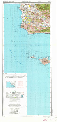 1956 Santa Maria1973 Print · USGSThe Central Coast landscape at the height of the Cold War reveals a mix of aerospace expansion and historic ranching towns. Trace the early footprint of Vandenberg AFB or locate coastal rail stops like Surf and the mission site at La Purisima Mission State Park.2 unique versions available
 - 1957 Map of San Luis Obispo
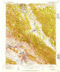
 1957 San Luis Obispo1957 Print · USGSCoastal California in the late fifties is defined by the steep Santa Lucia Range and the rail-connected hub of San Luis Obispo. Genealogists and researchers can trace rural life via Union School, the Southern Pacific line, and old sites like the Polar Star Mine.
 - 1957 Map of Santa Maria
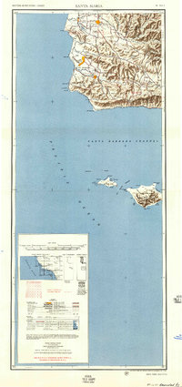 1957 Santa Maria1957 Print · USGSCoastal Santa Barbara County is captured here during the mid-fifties, showing a landscape defined by military installations and petroleum production. Researchers can trace the Southern Pacific rail line and locate rural landmarks like Honda School, Betteravia, and the John Manville Plant.
Showing maps 1-25 of 50
Top cities of San Luis Obispo County
- San Luis Obispo historical maps
- Atascadero historical maps
- Paso Robles historical maps
- Arroyo Grande historical maps
- Grover Beach historical maps
- Morro Bay historical maps
See more
Frequently asked questions
- What are the different types of historical maps available for San Luis Obispo County?
- What is the oldest map of San Luis Obispo County?
- Where can I purchase historical maps of San Luis Obispo County for my home or office?
- Where can I download high-res historical maps of San Luis Obispo County?
- Are there historical topographic maps available for San Luis Obispo County?
- Is there historical aerial imagery available for San Luis Obispo County?
- Where are historical maps of San Luis Obispo County sourced from?