1970s Maps of San Luis Obispo County, California
Explore 11 historic maps of San Luis Obispo County from the 1970s. These maps offer a rare glimpse into what life looked like during the 1970s — showing old roads, neighborhoods, homes, and landmarks that have changed or disappeared over time.
Whether you're researching your family's past, planning a metal detecting trip, or studying how San Luis Obispo County's landscape evolved across the 1970s, these high-resolution maps are a powerful tool for exploring the history of this region.
- Focus on a specific era: All maps on this page are from the 1970s, giving you a focused view of this time period.
- See what’s changed: Compare century-old streets, trails, and buildings to today's modern landscape using overlays and satellite layers.
- Research with precision: Use these maps for genealogy, historical research, land use analysis, or educational projects.
- View, download, or print: Maps are fully viewable online in high resolution, and can be downloaded or printed for your own records.
Start exploring San Luis Obispo County's history through authentic maps from the 1970s. This is your window into the past.
San Luis Obispo County, CA maps
(11)- 1975 Map of Los Angeles, 1977 Print
 1975 Los Angeles1977 Print · USGSSouthern California is captured in a period of significant growth during the mid-seventies, showing the urban sprawl from the coast to the high desert. Researchers can trace the development of the Pacific Coast Hwy and find aerospace landmarks like Edwards Air Force Base and the Flight Test Center (NASA).2 unique versions available
 - 1976 Map of Bradley
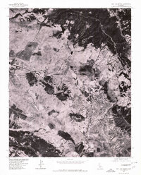
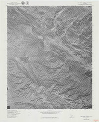
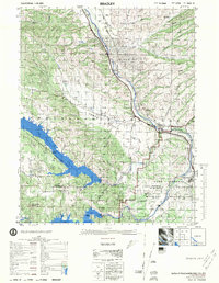 1976 Bradley1976 Print · USGSThe Salinas River valley in the mid-1970s shows a complex landscape of oil extraction, military training, and massive reservoirs. Researchers can trace the legacy of the Southern Pacific railroad, the rural Hames Valley Hall, and the vast Camp Roberts Military Reservation.
 - 1976 Map of Morro Bay South, 1979 Print
 1976 Morro Bay South1979 Print · USGSThe Central California coast is captured in detail during the mid-seventies, showing the expansion of seaside communities around the estuary. Trace the development of Morro Bay and Los Osos or the iconic silhouette of Morro Rock.
 - 1976 Map of San Luis Obispo, 1980 Print
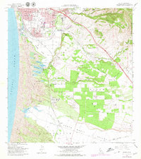
 1976 San Luis Obispo1980 Print · USGSThe city of San Luis Obispo and its surrounding hills appear in striking photographic detail in the mid-1970s. Researchers can trace the exact footprint of the city and the military facilities at Camp San Luis Obispo and Bishop.
 - 1976 Map of Maricopa, 1980 Print
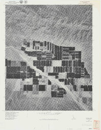
 1976 Maricopa1980 Print · USGSMaricopa and the foothills of the western San Joaquin Valley are captured in this mid-seventies orthophoto survey. Researchers can trace the exact footprint of the town and analyze its proximity to landforms like Signal Hill and the winding Devils Gulch.
 - 1976 Map of San Simeon, 1980 Print
 1976 San Simeon1980 Print · USGSThe San Luis Obispo coast is captured in detail during the mid-seventies in this unique aerial-imagery survey. Researchers can trace the drainage of Arroyo de la Cruz and locate the seaside buildings of San Simeon near the rocky shore.
 - 1977 Map of Chimney Canyon
 1977 Chimney Canyon1977 Print · USGSCovers San Luis Obispo County, including Santa Barbara County, United States, and other nearby areas
 - 1977 Map of Caliente Mtn
 1977 Caliente Mtn1977 Print · USGSCovers San Luis Obispo County, including Santa Barbara County, United States, and other nearby areas
 - 1977 Map of Ballinger Canyon
 1977 Ballinger Canyon1977 Print · USGSCovers San Luis Obispo County, including Kern County, Ventura County, and other nearby areas
 - 1977 Map of Cuyama
 1977 Cuyama1977 Print · USGSCovers San Luis Obispo County, including Cuyama, Santa Barbara County, and other nearby areas
 - 1979 Map of Oceano
 1979 Oceano1979 Print · USGSThe Central Coast landscape transitioned from quiet dunes to industrial and suburban growth in the late seventies. Researchers can trace the Southern Pacific rail infrastructure through Oceano and past the Oil Refinery and Coke Ovens at Callender.
End of results
Showing maps 1-11 of 11
Top cities of San Luis Obispo County
- San Luis Obispo historical maps
- Atascadero historical maps
- Paso Robles historical maps
- Arroyo Grande historical maps
- Grover Beach historical maps
- Morro Bay historical maps
See more
Frequently asked questions
- What are the different types of historical maps available for San Luis Obispo County?
- What is the oldest map of San Luis Obispo County?
- Where can I purchase historical maps of San Luis Obispo County for my home or office?
- Where can I download high-res historical maps of San Luis Obispo County?
- Are there historical topographic maps available for San Luis Obispo County?
- Is there historical aerial imagery available for San Luis Obispo County?
- Where are historical maps of San Luis Obispo County sourced from?