Old Maps of Santa Clara County, California
Explore 129 old maps of Santa Clara County, spanning from 1889 to today. These high-resolution historic maps reveal how streets, neighborhoods, landmarks, and natural features evolved over time — perfect for genealogy, metal detecting, research, and local history exploration.
What you can do with these maps:
- See how Santa Clara County changed over time: Compare historical maps to modern-day views to trace roads, homesites, rail lines & more.
- View detailed metadata: Each map includes creators, publishers, year, scale, and archive source.
- Overlay maps with satellite & LiDAR: Visualize the past alongside modern tools to explore terrain & human change.
- Trusted historical sources: Maps sourced from the USGS, Library of Congress, and other archives.
- Access maps your way: View online, download high-res files, or order prints for personal or research use.
Start exploring old maps of Santa Clara County to uncover forgotten places, hidden landmarks, and the deep history beneath your feet.
Santa Clara County, CA maps
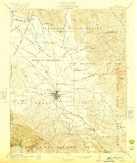
(129)- 1889 Map of San Jose, 1939 Print
 1889 San Jose1939 Print · USGSCovers Santa Clara County, including San Jose, Fremont, and other nearby areas2 unique versions available
 - 1897 Map of San Jose
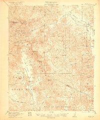
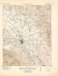
 1897 San Jose1897 Print · USGSCovers Santa Clara County, including San Jose, Fremont, and other nearby areas
 - 1897 Map of Mt. Hamilton
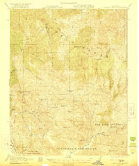
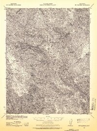
 1897 Mt. Hamilton1897 Print · USGSCovers Santa Clara County, including San Jose, The Arnold Ranch, and other nearby areas6 unique versions available
 - 1897 Map of Palo Alto
 1897 Palo Alto1897 Print · USGSCovers Santa Clara County, including San Jose, Fremont, and other nearby areas
 - 1899 Map of San Jose
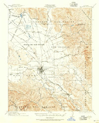
 1899 San Jose1899 Print · USGSCovers Santa Clara County, including San Jose, Fremont, and other nearby areas10 unique versions available
 - 1899 Map of Palo Alto
 1899 Palo Alto1899 Print · USGSCovers Santa Clara County, including San Jose, Fremont, and other nearby areas11 unique versions available
 - 1902 Map of Santa Cruz
 1902 Santa Cruz1902 Print · USGSCovers Santa Clara County, including San Jose, Fremont, and other nearby areas9 unique versions available
 - 1915 Map of San Juan Bautista
 1915 San Juan Bautista1915 Print · USGSCovers Santa Clara County, including Gilroy, Watsonville, and other nearby areas
 - 1916 Map of New Almaden
 1916 New Almaden1916 Print · USGSCovers Santa Clara County, including San Jose, Santa Cruz, and other nearby areas
 - 1917 Map of Morgan Hill
 1917 Morgan Hill1917 Print · USGSCovers Santa Clara County, including San Jose, Gilroy, and other nearby areas5 unique versions available
 - 1917 Map of San Juan Bautista
 1917 San Juan Bautista1917 Print · USGSCovers Santa Clara County, including Gilroy, Watsonville, and other nearby areas8 unique versions available
 - 1919 Map of Hollister
 1919 Hollister1919 Print · USGSCovers Santa Clara County, including Hollister, San Felipe, and other nearby areas
 - 1919 Map of New Almaden, 1928 Print
 1919 New Almaden1928 Print · USGSCovers Santa Clara County, including San Jose, Santa Cruz, and other nearby areas4 unique versions available
 - 1920 Map of Pacheco Pass
 1920 Pacheco Pass1920 Print · USGSCovers Santa Clara County, including Gustine, Santa Nella Village, and other nearby areas4 unique versions available
 - 1921 Map of Gilroy Hot Springs
 1921 Gilroy Hot Springs1921 Print · USGSCovers Santa Clara County, including Stanislaus County, United States, and other nearby areas5 unique versions available
 - 1921 Map of Hollister
 1921 Hollister1921 Print · USGSCovers Santa Clara County, including Hollister, San Felipe, and other nearby areas4 unique versions available
 - 1922 Map of Quien Sabe
 1922 Quien Sabe1922 Print · USGSCovers Santa Clara County, including Merced County, San Benito County, and other nearby areas4 unique versions available
 - 1923 Map of Hollister, 1955 Print
 1923 Hollister1955 Print · USGSCovers Santa Clara County, including Hollister, San Felipe, and other nearby areas
 - 1938 Map of Mt. Boardman, 1957 Print
 1938 Mt. Boardman1957 Print · USGSCovers Santa Clara County, including Ashrama, Alameda County, and other nearby areas3 unique versions available
 - 1939 Map of Morgan Hill, 1957 Print
 1939 Morgan Hill1957 Print · USGSCovers Santa Clara County, including San Jose, Gilroy, and other nearby areas2 unique versions available
 - 1939 Map of Gilroy Hot Springs, 1958 Print
 1939 Gilroy Hot Springs1958 Print · USGSCovers Santa Clara County, including Stanislaus County, United States, and other nearby areas
 - 1939 Map of San Juan Bautista, 1958 Print
 1939 San Juan Bautista1958 Print · USGSCovers Santa Clara County, including Gilroy, Watsonville, and other nearby areas2 unique versions available
 - 1940 Map of San Juan Bautista
 1940 San Juan Bautista1940 Print · USGSCovers Santa Clara County, including Gilroy, Watsonville, and other nearby areas
 - 1940 Map of Gilroy Hot Springs
 1940 Gilroy Hot Springs1940 Print · USGSCovers Santa Clara County, including Stanislaus County, United States, and other nearby areas
 - 1940 Map of Hollister
 1940 Hollister1940 Print · USGSCovers Santa Clara County, including Hollister, San Felipe, and other nearby areas2 unique versions available
Showing maps 1-25 of 129
Top cities of Santa Clara County
- San Jose historical maps
- Sunnyvale historical maps
- Santa Clara historical maps
- Milpitas historical maps
- Mountain View historical maps
- Palo Alto historical maps
See more
Frequently asked questions
- What are the different types of historical maps available for Santa Clara County?
- What is the oldest map of Santa Clara County?
- Where can I purchase historical maps of Santa Clara County for my home or office?
- Where can I download high-res historical maps of Santa Clara County?
- Are there historical topographic maps available for Santa Clara County?
- Is there historical aerial imagery available for Santa Clara County?
- Where are historical maps of Santa Clara County sourced from?