Old Maps of Cloverdale, California for Metal Detecting
Plan your next treasure hunt with 27 historic maps of Cloverdale. Find old homesites, ghost towns, trails, and gathering spots that may be lost to time — perfect for identifying promising metal detecting locations.
- Locate forgotten sites: Uncover places like long-lost settlements, abandoned rail lines, or gathering spots.
- Plan better hunts: Use map overlays combined with LiDAR or satellite views to narrow in on historically rich areas.
- Made for detectorists: Thousands of hobbyists use these maps to discover relics, coins, and hidden history.
Use these historic maps to boost your research and find new opportunities beneath the surface of Cloverdale.
Cloverdale, CA maps
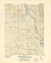
(27)- 1921 Map of Kelseyville
 1921 Kelseyville1921 Print · USGSNorthern California's thermal springs and mining districts are in full view in this early twentieth-century survey of Lake and Sonoma counties. Researchers can trace historic ranch boundaries like Moulton Ranch or locate vanished operations at the Cloverdale Quicksilver Mine and the Geyser Hotel.
 - 1938 Map of Hopland
 1938 Hopland1938 Print · USGSNorthern California’s Russian River valley is captured here in the 1920s, showing the early rail-and-road network between Hopland and Cloverdale. Trace old rail stops like Thorn Siding and historic locations such as Duncan Springs and Preston.
 - 1943 Map of Kelseyville, 1959 Print
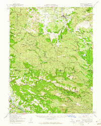
 1943 Kelseyville1959 Print · USGSIn the early 1940s, this region of Lake and Sonoma counties was a mosaic of active ranching and mountain retreats. Researchers can trace family-named lands like Fifield Ranch, locate the Socrates Mine, or find the historic Geyser Resort and Mountain School.
 - 1943 Map of Hopland, 1960 Print
 1943 Hopland1960 Print · USGSMendocino County ranching and the Russian River valley are captured here in the early 1940s as the rail and road networks matured. Researchers can trace family-named lands like McDowell Ranch, the Nacomis Indian Rancheria, and the operations at Thorn Siding.
 - 1944 Map of Hopland
 1944 Hopland1944 Print · USGSThe Russian River valley in the 1940s was a landscape of remote ranches and rail sidings on the Mendocino-Sonoma border. Researchers can trace the Northwestern Pacific Railroad through Pieta, find the old McDonald School, or locate the Nacomis Indian Rancheria.
 - 1947 Map of Santa Rosa
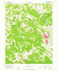
 1947 Santa Rosa1947 Print · USGSNorthern California in the late 1940s was a landscape of agricultural valleys and vital rail hubs. Trace the historic routes of the Northwestern Pacific through Healdsburg or explore the mid-century waterfronts of Vallejo and Benicia near Mare Island.
 - 1949 Map of Santa Rosa
 1949 Santa Rosa1949 Print · USGSThe North Bay and Wine Country appear here in the late 1940s, when the Northwestern Pacific RR still dominated regional transit. Genealogists and historians can trace old coastal outposts like Anchor Bay Settlement and the early layout of Santa Rosa.2 unique versions available
 - 1958 Map of Santa Rosa, 1968 Print
 1958 Santa Rosa1968 Print · USGSThe North Bay and Wine Country are captured in the mid-twentieth century as the region balanced its agricultural roots with a growing military and recreational footprint. Researchers can trace the Northwestern Pacific RR through the Russian River valley or locate landmarks like the Petaluma Adobe Historical Monument and The Geysers Resort.3 unique versions available
 - 1959 Map of Asti
 1959 Asti1959 Print · USGSThe Alexander Valley viticulture and Russian River transit corridor are captured here during the late fifties and seventies. Genealogists and historians can trace the local infrastructure of Asti, from the Washington Sch and winery to the Cloverdale Airfield.6 unique versions available
 - 1959 Map of Kelseyville, 1961 Print
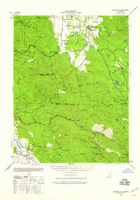
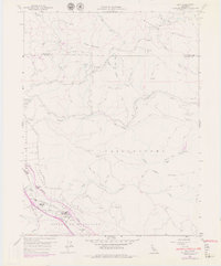
 1959 Kelseyville1961 Print · USGSThe volcanic heights of the Mayacmas Mountains meet the geothermal steam fields of Lake County during the late fifties. Genealogists and local historians can locate early mining operations like the Culver-Bear Mine and Caldwell Mines or the remote community at Mercuryville.2 unique versions available
 - 1960 Map of Cloverdale, 1962 Print
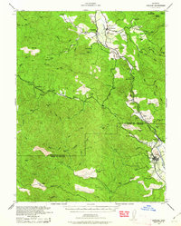
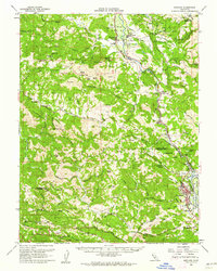
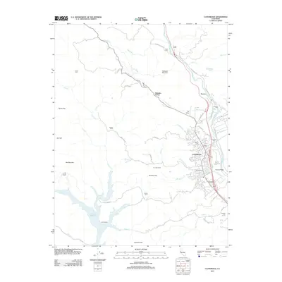
 1960 Cloverdale1962 Print · USGSCloverdale and the Russian River valley are captured in the early sixties as the regional rail and road networks shaped northern Sonoma County. Genealogists and local historians can trace family-named sites like Porterfield, the Cloverdale Rancheria, and the Cemetery at Preston.4 unique versions available
 - 1960 Map of Hopland, 1962 Print
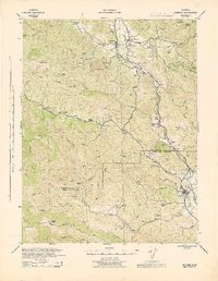
 1960 Hopland1962 Print · USGSMendocino and Sonoma counties meet in this early 1960s survey of the Russian River valley as it transitions into the coastal range. Researchers can trace the rail-and-road corridor through Old Hopland, locate the Cloverdale Rancheria, and find historical sites like the Squaw Rock Slide Historical Marker.2 unique versions available
 - 1962 Map of Santa Rosa
 1962 Santa Rosa1962 Print · USGSThe North Bay and Wine Country were entering a period of significant growth in the early sixties, anchored by established rail corridors and coastal maritime commerce. Genealogists and historians can trace the development of Santa Rosa, locate the Mare Island Naval Shipyard, and follow the Northwestern Pacific RR through the Cotati Valley.
 - 1964 Map of Santa Rosa
 1964 Santa Rosa1964 Print · USGSThe North Bay and Wine Country appear in the mid-fifties during a period of significant military and educational growth. Trace old rail lines like the Northwestern Pacific RR and explore historic sites from Petaluma to the Benicia Arsenal.
 - 1972 Map of Healdsburg, 1975 Print
 1972 Healdsburg1975 Print · USGSNorthern California wine country and the lower Lake County basins appear here during the early seventies. Trace the Northwestern Pacific rail line and discover foothill communities like Middletown and Loch Lomond.2 unique versions available
 - 1981 Map of Point Arena
 1981 Point Arena1981 Print · USGSThe Mendocino and Sonoma coastlines meet here in the early eighties, where the rift zone carves a path through the redwood country. Genealogists and researchers can trace the development of Point Arena and Guerneville or locate the newly formed Lake Sonoma behind the Warm Springs Dam.2 unique versions available
 - 1993 Map of Asti
 1993 Asti1993 Print · USGSThe Alexander Valley and Russian River wine country come into focus in the early nineties. Genealogists and historians can trace the Northwestern Pacific rail line through Asti or locate landmarks like Our Lady of Carmel Church.
 - 1998 Map of Asti, 2002 Print
 1998 Asti2002 Print · USGSThe Russian River valley and the Mayacmas Mountains meet in this Sonoma County survey from the late nineties. Genealogists and researchers can trace the vicinity of Asti, locate Our Lady of Carmel Church, or explore the steep drainages of Big Sulphur Creek.
 - 2012 Map of Asti, 2012 Print
 2012 Asti2012 Print · USGSCovers Cloverdale, including Asti, Sonoma County, and other nearby areas
 - 2012 Map of Cloverdale, 2012 Print
 2012 Cloverdale2012 Print · USGSCovers Cloverdale, including Alderglen Springs, Preston, and other nearby areas
 - 2015 Map of Cloverdale, 2015 Print
 2015 Cloverdale2015 Print · USGSCovers Cloverdale, including Alderglen Springs, Preston, and other nearby areas
 - 2015 Map of Asti, 2015 Print
 2015 Asti2015 Print · USGSCovers Cloverdale, including Asti, Sonoma County, and other nearby areas
 - 2018 Map of Asti, 2018 Print
 2018 Asti2018 Print · USGSCovers Cloverdale, including Asti, Sonoma County, and other nearby areas
 - 2018 Map of Cloverdale, 2018 Print
 2018 Cloverdale2018 Print · USGSCovers Cloverdale, including Alderglen Springs, Preston, and other nearby areas
 - 2021 Map of Cloverdale, 2021 Print
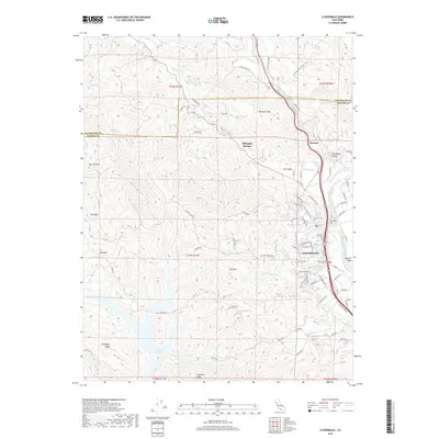
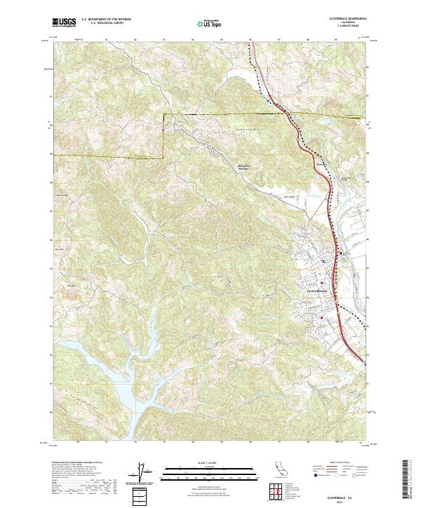 2021 Cloverdale2021 Print · USGSCloverdale and the surrounding Sonoma hills are shown in detail during this period of modern growth. Genealogists and historians can trace the developments along the Russian River, identify burials at Cloverdale Cem, and locate landmarks like Alderglen Springs or the heights of Red Mtn.
Showing maps 1-25 of 27
Top cities near Cloverdale
- Healdsburg historical maps
- Lakeport historical maps
- Kelseyville historical maps
- Geyserville historical maps
- Finley historical maps
- Finley historical maps
See more
Top neighborhoods of Cloverdale
- Solar Park historical maps
- Kings Valley historical maps
- Vista Oaks historical maps
- Cherry Creek historical maps
- Rancho De Amigos historical maps
- Clover Creek historical maps
See more
Frequently asked questions
- What are the different types of historical maps available for Cloverdale?
- What is the oldest map of Cloverdale?
- Where can I purchase historical maps of Cloverdale for my home or office?
- Where can I download high-res historical maps of Cloverdale?
- Are there historical topographic maps available for Cloverdale?
- Is there historical aerial imagery available for Cloverdale?
- Where are historical maps of Cloverdale sourced from?