1940s Maps of Tuolumne County, California
Explore 40 historic maps of Tuolumne County from the 1940s. These maps offer a rare glimpse into what life looked like during the 1940s — showing old roads, neighborhoods, homes, and landmarks that have changed or disappeared over time.
Whether you're researching your family's past, planning a metal detecting trip, or studying how Tuolumne County's landscape evolved across the 1940s, these high-resolution maps are a powerful tool for exploring the history of this region.
- Focus on a specific era: All maps on this page are from the 1940s, giving you a focused view of this time period.
- See what’s changed: Compare century-old streets, trails, and buildings to today's modern landscape using overlays and satellite layers.
- Research with precision: Use these maps for genealogy, historical research, land use analysis, or educational projects.
- View, download, or print: Maps are fully viewable online in high resolution, and can be downloaded or printed for your own records.
Start exploring Tuolumne County's history through authentic maps from the 1940s. This is your window into the past.
Tuolumne County, CA maps
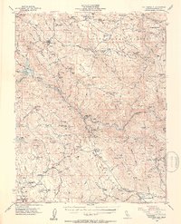
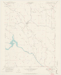
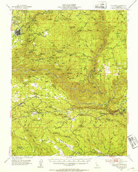
(40)- 1942 Map of Copperopolis
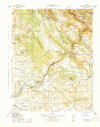 1942 Copperopolis1942 Print · USGSThe Mother Lode's mining and water heritage is preserved here in the early 1940s, centered on the copper-rich hills and the Stanislaus River. Genealogists and historians can trace family-named sites like Curtin Ranch, old schools such as O'Byrnes School, and active mines including the Wilbur Womble Mine.
 - 1944 Map of Merced Falls
 1944 Merced Falls1944 Print · USGSThe California foothills in the early forties reveal a landscape of active river dredging and massive reservoirs. Trace the historic Coulterville Road through the mines at Solambo Mine Ridge or locate the dredging Tailings near Snelling.2 unique versions available
 - 1945 Map of San Andreas, 1959 Print
 1945 San Andreas1959 Print · USGSThe Mother Lode region of the Sierra foothills is captured here at a mid-century peak of ranching and deep-shaft mining. Genealogists and historians can trace family landholdings from Bernasconi Ranch to Felix, alongside legendary mines like the Utica Mine and Gold Cliff Mine.
 - 1947 Map of San Andreas
 1947 San Andreas1947 Print · USGSCalaveras County gold country is recorded here in the mid-1940s, showing the height of local industrial mining and ranching. Genealogists and historians can trace the foundations of San Andreas, the mine-rich hills around Altaville, and the location of rural schoolhouses like Fricot Ranch Sch.2 unique versions available
 - 1947 Map of Sacramento, 1948 Print
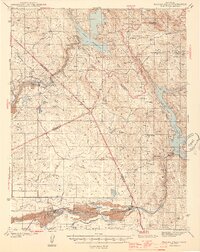
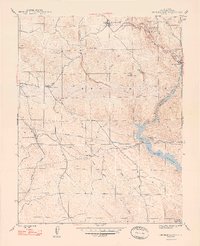
 1947 Sacramento1948 Print · USGSThe Sacramento Valley meets the high Sierra during a period of post-war expansion. Trace the historic river delta islands like Grand Island or locate early airfield footprints at McClellan Air Force Base and Mather Air Force Base.2 unique versions available
 - 1947 Map of San Jose, 1948 Print
 1947 San Jose1948 Print · USGSNorthern California's heartland is captured here just after the war, showing the rapid growth of the Santa Clara and Central Valleys. Researchers can trace the legacy of rail and water at Castle Air Force Base, Stockton, and the Hetch Hetchy Aqueduct.
 - 1947 Map of Mariposa, 1948 Print
 1947 Mariposa1948 Print · USGSThe High Sierra and Owens Valley transition is captured here in the late 1940s, just as the region’s hydroelectric and tourism infrastructure was maturing. Genealogists and historians can trace old ranger stations, the Casa Diablo Mine, and rail stops along the Southern Pacific like Benton Station and Zurich.2 unique versions available
 - 1947 Map of Coulterville, 1953 Print
 1947 Coulterville1953 Print · USGSIn the late 1940s, this portion of the Mother Lode still shows a landscape dense with gold mining and ranching activity. Researchers can trace the heritage of Coulterville and Hornitos or locate numerous historic workings like the Mary Harrison Mine and Red Cloud Mines.4 unique versions available
 - 1947 Map of Chinese Camp, 1959 Print
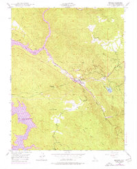
 1947 Chinese Camp1959 Print · USGSTuolumne County gold country and industrial water works are captured here in the late 1940s. Genealogists and historians can trace mining claims like the Eagle-Shawmut Mine and vanished rail stops at Hetch Hetchy Junc and Crimea House.4 unique versions available
 - 1947 Map of Jawbone Ridge, 1963 Print
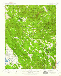
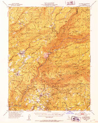
 1947 Jawbone Ridge1963 Print · USGSThe Stanislaus National Forest in the late 1940s reveals a rugged landscape of water tunnels and gold mines. Trace family history at Smith Station and Smith Cem, or locate historic sites like the Gold Queen Mine and Buck Meadows.3 unique versions available
 - 1947 Map of Groveland, 1964 Print
 1947 Groveland1964 Print · USGSThe foothills of the Sierra Nevada are surveyed here in the late 1940s, documenting the legacy of the Gold Rush in Tuolumne County. Genealogists and historians can locate the Bret Harte Cabin, the old settlement at Second Garrotte, and rural landmarks like the Red Jacket Mine.4 unique versions available
 - 1947 Map of Coulterville, 1964 Print
 1947 Coulterville1964 Print · USGSMariposa County gold country is preserved here in the late 1940s, showing the early expansion of the Merced River's reservoirs. Researchers can locate vanished infrastructure like the Split Rock Ferry and historic mining sites such as the Mary Harrison Mine and Virginia Mine.6 unique versions available
 - 1948 Map of Moccasin
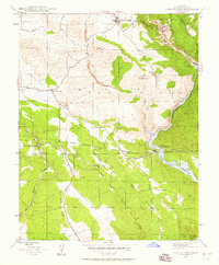
 1948 Moccasin1948 Print · USGSGold Country hills and water infrastructure define this Tuolumne County landscape as it appeared mid-century. Researchers can trace historic mining operations at the Clio Mine and follow the route of the Hetch Hetchy Aqueduct near Moccasin.5 unique versions available
 - 1948 Map of Walker Lake
 1948 Walker Lake1948 Print · USGSThe high desert of Nevada and the eastern Sierra Nevada are captured just after the war as mining and ranching shaped the local economy. Genealogists can trace family connections to centers like Hawthorne and Mina or locate the historic Rockland Mines and Aurora.2 unique versions available
 - 1948 Map of Chinese Camp
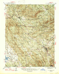
 1948 Chinese Camp1948 Print · USGSThe Mother Lode gold country of Tuolumne County is captured here in the late 1940s, highlighting a landscape defined by deep-rock mining and major water projects. Researchers can trace historic operations at the Eagle-Shawmut Mine or locate early settlements like Chinese Camp and Jacksonville.2 unique versions available
 - 1948 Map of Mariposa, 1951 Print
 1948 Mariposa1951 Print · USGSThe High Sierra and Mariposa foothills are shown here in the late 1940s as the post-war tourism and water infrastructure expanded. Genealogists and historians can locate vanished waypoints like Mormon Bar, the Glacier Point Hotel, and the granite quarries of Knowles.
 - 1948 Map of Sacramento, 1951 Print
 1948 Sacramento1951 Print · USGSPost-war Northern California comes alive in this regional survey, capturing the era of expansion between the Central Valley and the High Sierra. Researchers can trace the rail networks of the Central California Traction and Sacramento Northern RR or locate landmarks like the State Capitol and University of California Davis.
 - 1948 Map of Columbia, 1953 Print
 1948 Columbia1953 Print · USGSTuolumne and Calaveras counties in the late 1940s reveal a landscape shaped by the gold rush and emerging state preservation. Genealogists can trace family homesteads near Columbia and Murphys, or locate industrial sites like the Sheep Ranch Mine and Experimental Mine.6 unique versions available
 - 1948 Map of Tuolumne, 1953 Print
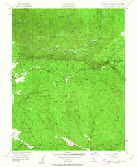
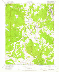
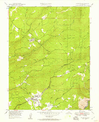
 1948 Tuolumne1953 Print · USGSTuolumne County in the late 1940s reveals a rugged landscape of mining camps and early water infrastructure. Genealogists can trace family holdings like Murphy Ranch and Ralph Ranch alongside the historic Sierra RR and the Bret Harte Cabin.4 unique versions available
 - 1948 Map of Sonora, 1953 Print
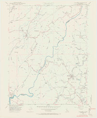
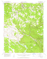
 1948 Sonora1953 Print · USGSTuolumne County’s historic mining district is documented here in the late 1940s, centered on the corridor between the county seat and the Sierra foothills. Genealogists and historians can trace family locations from the Mark Twain Cabin to the Harvard Mine and the rail stops of the Sierra RR.5 unique versions available
 - 1948 Map of Columbia SE, 1956 Print
 1948 Columbia SE1956 Print · USGSTuolumne County's mining history is preserved here in the years following the war, detailing a landscape shaped by gold extraction. Researchers can locate specific legacy sites like the Indian Girl Mine, the Belleview Sch, and the Phoenix Powerhouse.4 unique versions available
 - 1948 Map of Columbia, 1956 Print
 1948 Columbia1956 Print · USGSTuolumne County's gold rush heartland is documented here in the late 1940s, showing the preservation of Columbia before modern expansion. You can trace early mining claims and water routes like the Utica Ditch, Carson Hill Mine, and the now-familiar Moaning Caves.5 unique versions available
 - 1948 Map of Murphys, 1957 Print
 1948 Murphys1957 Print · USGSCalaveras County's mining and sanatorium history is documented here in the late 1940s. Genealogists and historians can trace the foundations of Sheep Ranch, locate the Bret Harte Sanatorium, and find old mines like the Red Top Mine.3 unique versions available
 - 1948 Map of Duckwall Mtn, 1959 Print
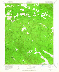
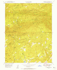
 1948 Duckwall Mtn1959 Print · USGSThe Stanislaus National Forest in the late 1940s reveals a high-country landscape of logging operations and remote outposts. Researchers can trace the narrow-gauge Lumber RR and locate historic points like the Quinn Ranch, Femmons, and Thompson Peak Lookout.5 unique versions available
 - 1948 Map of Sonora, 1962 Print
 1948 Sonora1962 Print · USGSTuolumne County's Mother Lode country comes alive in this post-war survey of the Sierra Foothills. Researchers can trace the path of the Sierra RR, locate the Harvard Mine, and explore historic communities from Chinese Camp to Soulsbyville.2 unique versions available
Showing maps 1-25 of 40
Top cities of Tuolumne County
- Sonora historical maps
- Jamestown historical maps
- Sonora Meadows historical maps
- Groveland historical maps
Frequently asked questions
- What are the different types of historical maps available for Tuolumne County?
- What is the oldest map of Tuolumne County?
- Where can I purchase historical maps of Tuolumne County for my home or office?
- Where can I download high-res historical maps of Tuolumne County?
- Are there historical topographic maps available for Tuolumne County?
- Is there historical aerial imagery available for Tuolumne County?
- Where are historical maps of Tuolumne County sourced from?