1950s Maps of Archuleta County, Colorado
Explore 14 historic maps of Archuleta County from the 1950s. These maps offer a rare glimpse into what life looked like during the 1950s — showing old roads, neighborhoods, homes, and landmarks that have changed or disappeared over time.
Whether you're researching your family's past, planning a metal detecting trip, or studying how Archuleta County's landscape evolved across the 1950s, these high-resolution maps are a powerful tool for exploring the history of this region.
- Focus on a specific era: All maps on this page are from the 1950s, giving you a focused view of this time period.
- See what’s changed: Compare century-old streets, trails, and buildings to today's modern landscape using overlays and satellite layers.
- Research with precision: Use these maps for genealogy, historical research, land use analysis, or educational projects.
- View, download, or print: Maps are fully viewable online in high resolution, and can be downloaded or printed for your own records.
Start exploring Archuleta County's history through authentic maps from the 1950s. This is your window into the past.
Archuleta County, CO maps
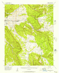
(14)- 1953 Map of Durango, 1963 Print
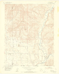
 1953 Durango1963 Print · USGSThe high peaks of the San Juan Mountains and the Colorado mining country are shown here as they appeared in the early fifties. Genealogists and local historians can trace the rail lines of the D & R G W RR and locate historic mining camps like Silverton, Ouray, and Old Ophir.
 - 1954 Map of Durango
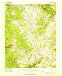
 1954 Durango1954 Print · USGSSouthern Colorado in the mid-1950s was defined by high-altitude mining towns and the expansion of water storage in the San Luis Valley. Trace the narrow-gauge Denver & Rio Grande Western RR as it connects Durango to mountain outposts like Silverton and Creede.2 unique versions available
 - 1954 Map of Allison, 1955 Print
 1954 Allison1955 Print · USGSSettlements along the New Mexico border were defined by the railroad and river in the mid-1950s. You can trace the historic Denver and Rio Grande Western line through Allison and Arboles or locate the Cem and irrigation works like the Pine River Canal.7 unique versions available
 - 1954 Map of Carracas, 1955 Print
 1954 Carracas1955 Print · USGSThe Colorado-New Mexico borderlands in the mid-1950s show a rugged river landscape dominated by tribal land and the Denver and Rio Grande Western railroad. Trace the tracks along the San Juan River through the Southern Ute Indian Reservation to the settlement at Carracas.7 unique versions available
 - 1954 Map of Rosa, 1956 Print
 1954 Rosa1956 Print · USGSThe San Juan River valley of the mid-1950s shows the community of Rosa and its outlying ranching infrastructure just before major landscape shifts. Researchers can locate the Santa Rosa Ch, the local Cem, and early energy developments like the Pipe Line.5 unique versions available
 - 1954 Map of Aztec, 1975 Print
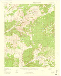
 1954 Aztec1975 Print · USGSNorthern New Mexico and southern Colorado come alive in the mid-1950s, showing the high-country settlements and tribal lands of the San Juan Basin. Genealogists and historians can trace the path of the Denver & Rio Grande Western RR and locate communities like Abiquiu, Park View, and Lumberton.4 unique versions available
 - 1955 Map of Chama, 1957 Print
 1955 Chama1957 Print · USGSUpper Rio Arriba County comes to life in the mid-1950s as a high-altitude rail and ranching corridor. You can trace the narrow gauge Denver and Rio Grande Western tracks past the Stockyard in Chama and through the vast Tierra Amarilla Grant.4 unique versions available
 - 1955 Map of Lumberton, 1957 Print
 1955 Lumberton1957 Print · USGSLumberton and the surrounding Rio Arriba high country were centers of mining and rail activity in the mid-fifties. Genealogists and historians can trace the Denver and Rio Grande Western line to old stops at Monero and Amargo.4 unique versions available
 - 1955 Map of Brazos Peak, 1957 Print
 1955 Brazos Peak1957 Print · USGSThe high New Mexico and Colorado borderlands are captured here during the mid-fifties, showing a remote landscape of rail and ranching. Genealogists and historians can trace the narrow-gauge Denver and Rio Grande Western railroad past Toltec Gorge and locate family-named sites like Nelagoney Ranch and Rivera Cow Camp.4 unique versions available
 - 1957 Map of Chromo, 1959 Print
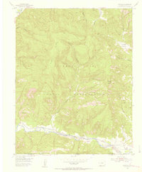
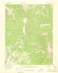
 1957 Chromo1959 Print · USGSThe Colorado-New Mexico borderlands come to life in the late fifties, showing the high-country landscape of the San Juan National Forest. Trace the paths of early travelers via the Pack Trail networks and identify historical landmarks like Chromo, Edith, and Squaretop Guard Station.5 unique versions available
 - 1957 Map of Wolf Creek Pass, 1959 Print
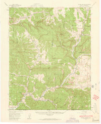
 1957 Wolf Creek Pass1959 Print · USGSThe high San Juan peaks and ranching valleys are captured here in the late fifties, just as mountain access and national forest management were expanding. Researchers can trace historic family-named sites like Hott Ranch or locate the Red Ryder Rodeo Grounds and Treasure Guard Station.6 unique versions available
 - 1957 Map of Pagosa Junction, 1959 Print
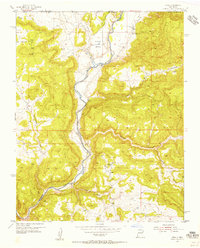
 1957 Pagosa Junction1959 Print · USGSThe Colorado and New Mexico borderlands come to life in the late fifties, where the D & R G W RR tracks the San Juan River. Researchers can trace the layout of small settlements like Pagosa Junction and Trujillo or locate family landmarks near Villareal.4 unique versions available
 - 1957 Map of Chama Peak, 1959 Print
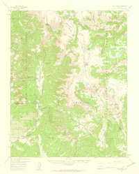 1957 Chama Peak1959 Print · USGSArchuleta and Conejos counties are shown here in the late fifties, where the Continental Divide splits the high wilderness. Genealogists and researchers can trace the historic Tierra Amarilla Grant Boundary and remote sites like Gramps Oil Field and Banded Peak Ranch.4 unique versions available
 - 1958 Map of Aztec
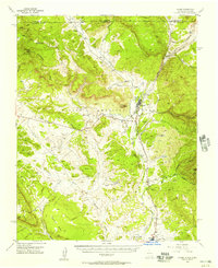
 1958 Aztec1958 Print · USGSNorthern New Mexico and the southern Colorado border are captured here during the mid-fifties, showing the rugged intersection of national forests and tribal lands. Researchers can trace the Denver and Rio Grande Western rail line and locate remote outposts like Blanco Trading Post or Sargent Ranch.
End of results
Showing maps 1-14 of 14
Top cities of Archuleta County
Frequently asked questions
- What are the different types of historical maps available for Archuleta County?
- What is the oldest map of Archuleta County?
- Where can I purchase historical maps of Archuleta County for my home or office?
- Where can I download high-res historical maps of Archuleta County?
- Are there historical topographic maps available for Archuleta County?
- Is there historical aerial imagery available for Archuleta County?
- Where are historical maps of Archuleta County sourced from?