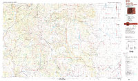
1980s Maps of Archuleta County, Colorado
Explore 25 historic maps of Archuleta County from the 1980s. These maps offer a rare glimpse into what life looked like during the 1980s — showing old roads, neighborhoods, homes, and landmarks that have changed or disappeared over time.
Whether you're researching your family's past, planning a metal detecting trip, or studying how Archuleta County's landscape evolved across the 1980s, these high-resolution maps are a powerful tool for exploring the history of this region.
- Focus on a specific era: All maps on this page are from the 1980s, giving you a focused view of this time period.
- See what’s changed: Compare century-old streets, trails, and buildings to today's modern landscape using overlays and satellite layers.
- Research with precision: Use these maps for genealogy, historical research, land use analysis, or educational projects.
- View, download, or print: Maps are fully viewable online in high resolution, and can be downloaded or printed for your own records.
Start exploring Archuleta County's history through authentic maps from the 1980s. This is your window into the past.
Archuleta County, CO maps
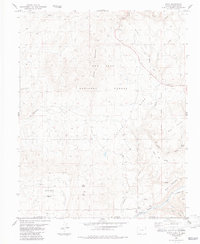
(25)- 1980 Map of Navajo Reservoir, 1981 Print
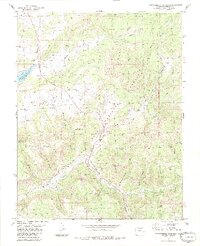
 1980 Navajo Reservoir1981 Print · USGSThe high desert and river valleys of Rio Arriba and San Juan counties are captured here in the early eighties. Genealogists and local historians can trace the development of Aztec and Bloomfield or locate family sites along Gubernador Canyon and the Animas River.
 - 1981 Map of Chama, 1982 Print
 1981 Chama1982 Print · USGSNorthern New Mexico's high-country rail corridors and historic land grants are mapped here as they appeared in the early eighties. Genealogists and historians can trace traditional settlements like Los Ojos and Tierra Amarilla or follow the narrow-gauge Cumbres and Toltec Scenic Railroad.
 - 1983 Map of Dulce
 1983 Dulce1983 Print · USGSDulce and the Jicarilla Apache lands are documented here during the early eighties, showcasing a landscape shaped by tribal history and mountain terrain. Researchers can locate the Old RR Grade, the settlement of Lumberton, and landmarks like Dulce Airport.2 unique versions available
 - 1983 Map of Monero
 1983 Monero1983 Print · USGSThe high mesa country along the New Mexico-Colorado border is captured here in the early 1980s, shortly after the field checks of the late seventies. Researchers can trace the boundaries of the Tierra Amarilla Grant and locate landmarks like Crowley Reservoir, Mesa Diamante, and Monero Mountain.
 - 1983 Map of West Fork Rio Brazos
 1983 West Fork Rio Brazos1983 Print · USGSThe high country of the New Mexico-Colorado border comes into focus in this early 1980s study of the Tierra Amarilla region. Trace the winding path of the Cumbres & Toltec Scenic RR past Osier Mesa and the headwaters of the West Fork Rio Brazos.2 unique versions available
 - 1983 Map of Durango
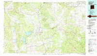
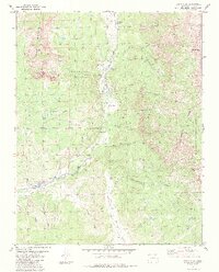
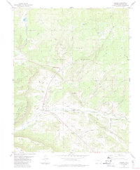
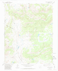
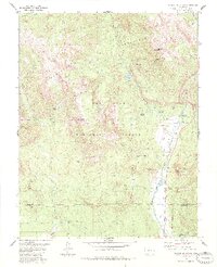
 1983 Durango1983 Print · USGSSouthwestern Colorado at the start of the 1980s shows a landscape where high-mountain wilderness meets the agricultural plateaus of the Southern Ute. Genealogists and historians can trace the Durango & Silverton Narrow Gauge Railroad or locate sites like Southern Ute Agency and Pagosa Junction.
 - 1983 Map of Chama
 1983 Chama1983 Print · USGSIn the early 1980s, the high mountain valley surrounding Chama remained a landscape of deep river canyons and historic land grants. Researchers can trace the rugged terrain of the Tierra Amarilla Grant and locate features like Lobato and Rabbit Peak.2 unique versions available
 - 1983 Map of Chromo Mountain
 1983 Chromo Mountain1983 Print · USGSHigh-altitude borderlands in the early 1980s show a landscape shaped by historical transit and modern water management. Trace the path of the Old RR Grade and the Azotea Tunnel near the Tierra Amarilla Grant.2 unique versions available
 - 1984 Map of Chama Peak
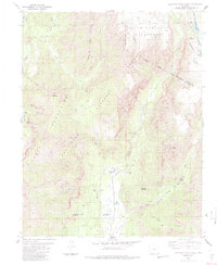
 1984 Chama Peak1984 Print · USGSThe high peaks of the San Juan Mountains dominate this 1980s survey of the Continental Divide along the Colorado-Archuleta border. Researchers can trace the industrial footprint of the Oil Field at Gramps or the water diversion paths near the Oso Diversion Dam.2 unique versions available
 - 1984 Map of Blackhead Peak
 1984 Blackhead Peak1984 Print · USGSThe Colorado high country in the early eighties is captured here through its network of remote trails and peaks. Hikers and researchers can trace old routes like the Pack Trail past Quartz Lake or identify landmarks such as The Needles and Blanco Basin.2 unique versions available
 - 1984 Map of Chromo
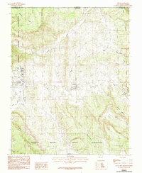
 1984 Chromo1984 Print · USGSThe Navajo River valley in the early eighties shows a high-altitude ranching landscape defined by complex irrigation and early energy exploration. Genealogists and historians can trace family-named water rights like Elmer Ditch or Shahan Ditch and locate landmarks near Chromo.2 unique versions available
 - 1984 Map of Harris Lake
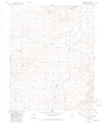 1984 Harris Lake1984 Print · USGSArchuleta County in the 1980s was a landscape of high-country water engineering and pristine wilderness. Trace the remote network of Pack Trails leading to Harris Lake or locate infrastructure like the Blanco Tunnel.
 - 1984 Map of Pagosa Junction
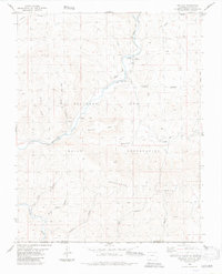
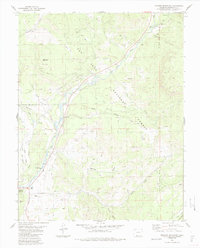
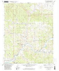 1984 Pagosa Junction1984 Print · USGSThe Colorado-New Mexico borderlands in the mid-1980s reveal a landscape of reservation boundaries and river-cut canyons. Genealogists and historians can trace the Old Grade along the San Juan River and find markers for Pagosa Junction and Monte Camado.2 unique versions available
 - 1984 Map of Wolf Creek Pass
 1984 Wolf Creek Pass1984 Print · USGSThe Continental Divide dominated this high-country landscape in the 1980s, where ski runs and wilderness areas converge. You can trace the Continental Divide Pack Trail past landmarks like Treasure Falls and the Lobo Overlook.3 unique versions available
 - 1984 Map of Edith
 1984 Edith1984 Print · USGSThe Colorado-New Mexico borderlands come into focus in the mid-1980s, centered on the Navajo River and the high country of the San Juan National Forest. Genealogists and historians can trace an Old Railroad Grade near Edith and locate early water works like the Shahan Ditch.2 unique versions available
 - 1984 Map of Victoria Lake
 1984 Victoria Lake1984 Print · USGSHigh alpine basins along the Continental Divide define this wilderness area in the mid-1980s. Hikers and historians can trace pack trails past remote landmarks like Victoria Lake, Grams Peak, and the Tierra Amarilla Grant Boundary.2 unique versions available
 - 1984 Map of Trujillo
 1984 Trujillo1984 Print · USGSThe Colorado-New Mexico borderlands come into focus in the mid-1980s as the river valleys of the Southern Ute Indian Reservation are mapped in detail. Genealogists and local historians can trace the settlement at Trujillo, find family burial sites at the local Cem, and locate early infrastructure like the Virginia Ditch and Trujillo Road.
 - 1984 Map of Archuleta Creek
 1984 Archuleta Creek1984 Print · USGSThe high mountain wilderness of Archuleta County is captured here in the mid-1980s, showcasing the high-elevation divide where two counties meet. Backpackers and historians can trace the paths of several Pack Trails to remote basins like Chama Lake, Mystery Lake, and Crater Lake.3 unique versions available
 - 1984 Map of Oak Brush Hill
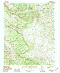
 1984 Oak Brush Hill1984 Print · USGSThe Southern Ute Reservation and San Juan National Forest meet in this 1980s study of the high mesas and river canyons. Researchers can trace the Old Indian Treaty Boundary and locate landmarks like Echo Canyon Reservoir and Oak Brush Hill.
 - 1984 Map of Serviceberry Mountain
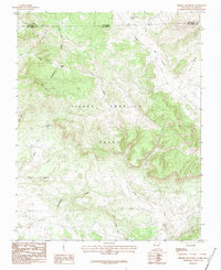
 1984 Serviceberry Mountain1984 Print · USGSArchuleta County land is characterized by high peaks and strategic water management in the mid-1980s. Trace the path of the Old Railroad Grade and explore local landmarks like Turkey Mountain, the Lookout Tower, and Spiler Lake.3 unique versions available
 - 1984 Map of Elephant Head Rock
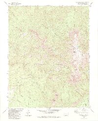
 1984 Elephant Head Rock1984 Print · USGSArchuleta County's high wilderness is captured here in the mid-1980s, showcasing the remote terrain of the Chalk Mountains and the Continental Divide. Researchers can trace old routes like the Pack Trail to remote landmarks such as Elephant Head Rock, Bond House, and Opal Lake.4 unique versions available
 - 1984 Map of Saddle Mountain
 1984 Saddle Mountain1984 Print · USGSHigh in the San Juan Mountains during the 1980s, this area shows a landscape defined by wilderness protection and high-country recreation. Trace family history at Mc Coy Cem or explore the drainage of the West Fork San Juan River near Blacks Mine.2 unique versions available
 - 1984 Map of Lonetree Canyon
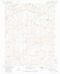
 1984 Lonetree Canyon1984 Print · USGSArchuleta County's high-country canyons and reservation lands are captured here in the late seventies. Researchers can trace the Piedra Stock Trail and locate the settlement of Altura near the Southern Ute Indian Reservation boundary.
 - 1984 Map of Jackson Mountain
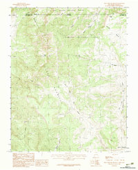
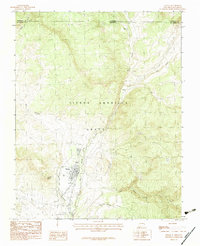
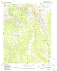
 1984 Jackson Mountain1984 Print · USGSThe mountain landscape surrounding Pagosa Springs comes into focus during the mid-eighties as a hub of forest management and river valley life. Genealogists and historians can trace local landmarks like the Rodeo Ground, the Guard Sta, and family-named features such as Jackson Mountain.4 unique versions available
 - 1985 Map of Antonito
 1985 Antonito1985 Print · USGSThe Colorado and New Mexico borderlands come into focus during the mid-eighties as the high peaks of the San Juans meet the San Luis Valley. Trace the winding Cumbres and Toltec Scenic Railroad or locate historical mining sites like the Black Diamond Mine and Summitville.2 unique versions available
End of results
Showing maps 1-25 of 25
Top cities of Archuleta County
Frequently asked questions
- What are the different types of historical maps available for Archuleta County?
- What is the oldest map of Archuleta County?
- Where can I purchase historical maps of Archuleta County for my home or office?
- Where can I download high-res historical maps of Archuleta County?
- Are there historical topographic maps available for Archuleta County?
- Is there historical aerial imagery available for Archuleta County?
- Where are historical maps of Archuleta County sourced from?