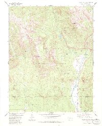
1984 Map of Saddle Mountain
USGS Topo · Published 1984About this map
The West Fork San Juan River and its numerous tributaries carve through this high-elevation landscape of the San Juan National Forest. During the mid-1980s, the area reflects a balance between conservation and historic extraction, with the Weminuche Wilderness protected alongside legacy sites like Blacks Mine. A network of pack trails facilitates access to remote spots such as Poison Park and Allen Park, while water management is evident at the T Lazy T Reservoir and the private Rod and Gun Club Lake. The presence of the Mc Coy Cem near the river valley provides a poignant connection to the early residents of this mountainous region. The convergence of the West Fork San Juan River and the East Fork San Juan River in the south highlights the importance of these waterways to the regional geography.
Find a feature on this map
41 named features on this map. Tap any name to fly to it.
Don’t see what you’re looking for? This feature index may not catch every label — zoom into the map to look around manually.
Map Details
Editions of this 1984 Saddle Mountain Map
2 editions found
Other maps of this area

1905 · San Cristobal
USGS Topo · 1:125,000

1907 · San Cristobal
USGS Topo · 1:125,000

1913 · Summitville
USGS Topo · 1:125,000

1914 · Creede
USGS Topo · 1:125,000

1915 · Summitville
USGS Topo · 1:125,000

1916 · Creede
USGS Topo · 1:125,000

1924 · Pagosa Springs
USGS Topo · 1:125,000

1927 · Pagosa Springs
USGS Topo · 1:125,000

1945 · Durango
USGS Topo · 1:250,000

1953 · Durango
USGS Topo · 1:250,000