1960s Maps of Eagle County, Colorado
Explore 18 historic maps of Eagle County from the 1960s. These maps offer a rare glimpse into what life looked like during the 1960s — showing old roads, neighborhoods, homes, and landmarks that have changed or disappeared over time.
Whether you're researching your family's past, planning a metal detecting trip, or studying how Eagle County's landscape evolved across the 1960s, these high-resolution maps are a powerful tool for exploring the history of this region.
- Focus on a specific era: All maps on this page are from the 1960s, giving you a focused view of this time period.
- See what’s changed: Compare century-old streets, trails, and buildings to today's modern landscape using overlays and satellite layers.
- Research with precision: Use these maps for genealogy, historical research, land use analysis, or educational projects.
- View, download, or print: Maps are fully viewable online in high resolution, and can be downloaded or printed for your own records.
Start exploring Eagle County's history through authentic maps from the 1960s. This is your window into the past.
Eagle County, CO maps
(18)- 1960 Map of Leadville
 1960 Leadville1960 Print · USGSThe Colorado high country in the mid-fifties comes alive through its mining camps, river valleys, and rail lines. Trace the industrial legacy of the Climax Molybdenum Mine and explore the alpine reaches of the Camp Hale Military Reservation.2 unique versions available
 - 1961 Map of Leon, 1963 Print
 1961 Leon1963 Print · USGSThe Roaring Fork Valley in the early 1960s shows a landscape of mountain ranching and early development. Follow the tracks of the Denver and Rio Grande Western near El Jebel or trace the irrigation lines of the Home Supply Ditch.4 unique versions available
 - 1961 Map of Basalt, 1963 Print
 1961 Basalt1963 Print · USGSThe Roaring Fork Valley in the early sixties was a landscape of rail transit and mountain agriculture. Trace the course of the Denver and Rio Grande Western Railroad past Emma and Wingo or locate the St Benedict Monastery near Capitol Creek.6 unique versions available
 - 1961 Map of Cottonwood Pass, 1963 Print
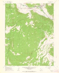
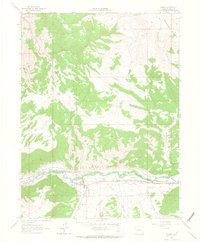
 1961 Cottonwood Pass1963 Print · USGSThis Colorado high-country landscape in the early sixties centers on the Cottonwood Divide and the northern reaches of the White River National Forest. Researchers can trace the winding Cottonwood Trail and identify local landmarks like The Eagle Nest and Von Springs Reservoir.7 unique versions available
 - 1961 Map of Woody Creek, 1963 Print
 1961 Woody Creek1963 Print · USGSPitkin County in the early sixties reveals a landscape of high-altitude ranching and railroading along the Roaring Fork River. Local historians can trace the Denver and Rio Grande Western tracks, find the Wheatley Cem, and locate early water works like the Walker Wonder Ditch.5 unique versions available
 - 1961 Map of Ruedi, 1963 Print
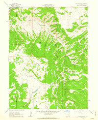
 1961 Ruedi1963 Print · USGSPitkin County high country in the early sixties shows the Fryingpan Valley before the landscape was transformed. Researchers can trace historic access routes like the Pack Trail to Cow Camp and find early recreational markers like Rocky Fork Campground.5 unique versions available
 - 1961 Map of Toner Reservoir, 1963 Print
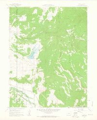
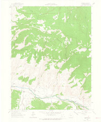
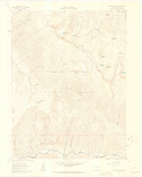 1961 Toner Reservoir1963 Print · USGSThe Fryingpan River valley meets the high backcountry of Eagle County in the early sixties. Researchers can trace land use through Castle View Ranch, Seven Castles, and remote outposts like Duffs Cabin and the State Fish and Game Station.5 unique versions available
 - 1961 Map of Red Creek, 1963 Print
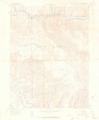
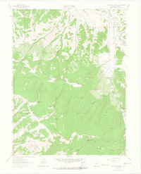
 1961 Red Creek1963 Print · USGSThe high country of Eagle County is captured here in the early sixties, showing the vast drainages of the White River National Forest. Outdoor enthusiasts and historians can trace old routes like the Pack Trail or locate the Red Creek Campground and L. E. D. E. Reservoir.5 unique versions available
 - 1962 Map of Leadville
 1962 Leadville1962 Print · USGSThe Colorado high country in the early sixties was a rugged landscape of mining camps, military training grounds, and emerging ski towns. Researchers can trace the legacy of Camp Hale, locate the Molybdenum mine near Leadville, and follow the Denver and Rio Grande Western RR through the canyons.
 - 1962 Map of Grouse Mountain, 1964 Print
 1962 Grouse Mountain1964 Print · USGSEagle County’s high peaks and alpine basins are captured here during the early sixties, showing a wilderness managed for both water and mineral access. Trace old routes like the W Grouse Trail to discover remote landmarks such as Nye Cabin, Discovery Tunnel, and Upper Turquoise Lake.5 unique versions available
 - 1962 Map of Gypsum, 1964 Print
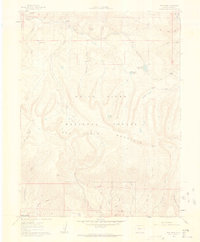
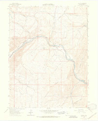
 1962 Gypsum1964 Print · USGSThe Eagle River valley in the early sixties was a hub of irrigation and rail transport centered on the town of Gypsum. Researchers can trace historic water rights via the Schumm DITCH and find local landmarks like the County Airport and Gaging Sta.5 unique versions available
 - 1962 Map of Suicide Mountain, 1964 Print
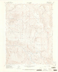
 1962 Suicide Mountain1964 Print · USGSHigh in Eagle County during the early sixties, this area shows a landscape defined by water rights and rugged summits. Researchers can trace historic irrigation through the McBrayer and Fenner Ditch or find remote landmarks like Quaking Corral and Fish Pond Lake.3 unique versions available
 - 1962 Map of Fulford, 1964 Print
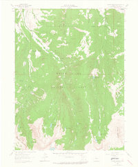
 1962 Fulford1964 Print · USGSThe high-elevation mining district of Fulford is captured in the early 1960s, showing a landscape defined by steep peaks and remote claims. Researchers can trace historic access via jeep trails to reach the Lady Belle Mine, the Cem at Graveyard Flats, and high mountain meadows like Triangle Park.4 unique versions available
 - 1962 Map of Wolcott, 1964 Print
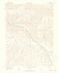
 1962 Wolcott1964 Print · USGSThe Eagle River valley in the early 1960s was a critical mountain corridor defined by the Denver and Rio Grande Western Railroad. Trace the old routes through Wolcott, explore the high elevations of Bellyache Ridge, and find local landmarks like Horn Ranch.6 unique versions available
 - 1962 Map of Eagle, 1964 Print
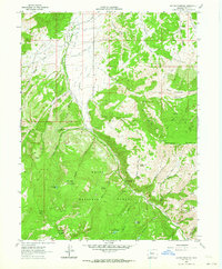
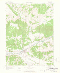 1962 Eagle1964 Print · USGSIn the early sixties, the mountain town of Eagle thrived as a hub for the Eagle River valley's ranching and rail operations. Genealogists and historians can trace the intricate network of water rights and early infrastructure through labels like the Red Eagle Ditch, Noecker Reservoir, and the Denver and Rio Grande Western Railroad.4 unique versions available
 - 1962 Map of Edwards, 1964 Print
 1962 Edwards1964 Print · USGSThe Eagle River valley in the early sixties is shown here as a quiet corridor of ranching and rail transport. You can trace the path of the Denver and Rio Grande Western through Edwards and Avon or locate the old Lake Creek Sch.8 unique versions available
 - 1962 Map of The Seven Hermits, 1964 Print
 1962 The Seven Hermits1964 Print · USGSThe Eagle high country is captured here in the early 1960s, showing a landscape defined by the White River National Forest and its complex ridges. Trace historical access routes like the Abrams Trail and locate remote water sources such as Mc Hatten Reservoir and Miller Spring.4 unique versions available
 - 1964 Map of Leadville
 1964 Leadville1964 Print · USGSColorado's high country is captured here during the mid-1960s, showing the intersection of mining history and mountain transport. Trace the legacy of high-altitude industry at the Climax Molybdenum Mine or follow the rails of the Colorado and Southern Ry past Leadville.
End of results
Showing maps 1-18 of 18
Top cities of Eagle County
- Edwards historical maps
- Gypsum historical maps
- Eagle historical maps
- Avon historical maps
- Vail historical maps
- El Jebel historical maps
See more
Frequently asked questions
- What are the different types of historical maps available for Eagle County?
- What is the oldest map of Eagle County?
- Where can I purchase historical maps of Eagle County for my home or office?
- Where can I download high-res historical maps of Eagle County?
- Are there historical topographic maps available for Eagle County?
- Is there historical aerial imagery available for Eagle County?
- Where are historical maps of Eagle County sourced from?