1970s Maps of Eagle County, Colorado
Explore 26 historic maps of Eagle County from the 1970s. These maps offer a rare glimpse into what life looked like during the 1970s — showing old roads, neighborhoods, homes, and landmarks that have changed or disappeared over time.
Whether you're researching your family's past, planning a metal detecting trip, or studying how Eagle County's landscape evolved across the 1970s, these high-resolution maps are a powerful tool for exploring the history of this region.
- Focus on a specific era: All maps on this page are from the 1970s, giving you a focused view of this time period.
- See what’s changed: Compare century-old streets, trails, and buildings to today's modern landscape using overlays and satellite layers.
- Research with precision: Use these maps for genealogy, historical research, land use analysis, or educational projects.
- View, download, or print: Maps are fully viewable online in high resolution, and can be downloaded or printed for your own records.
Start exploring Eagle County's history through authentic maps from the 1970s. This is your window into the past.
Eagle County, CO maps
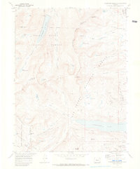
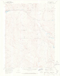
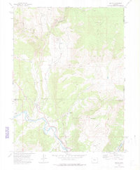
(26)- 1970 Map of Vail Pass
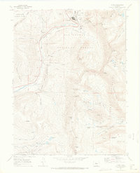
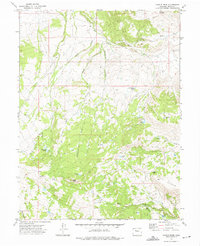
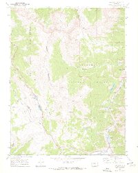 1970 Vail Pass1970 Print · USGSThe High Rockies at the dawn of the 1970s are defined here by the crossing of the Gore Range and Arapaho National Forest. Trace alpine travel routes like Vail Pass alongside old Mine sites and the settlement at Wheeler Junction.6 unique versions available
 - 1970 Map of Nast, 1973 Print
 1970 Nast1973 Print · USGSThe high Rockies of Pitkin and Eagle counties are shown here in the 1970s, as massive water diversion projects reshaped the local hydrology. Researchers can trace the path of the Charles H. Boustead Tunnel, locate the settlement of Nast, or find the high-altitude Kiln near Sellar Park.3 unique versions available
 - 1970 Map of Vail East, 1973 Print
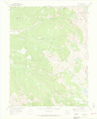
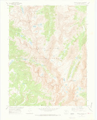
 1970 Vail East1973 Print · USGSThe Eagle County high country was rapidly evolving in the early seventies as recreation took root near the Eagle-Summit county line. Trace the early development of Vail and the Ski Area alongside mountain landmarks like Bald Mountain.5 unique versions available
 - 1970 Map of Willow Lakes, 1973 Print
 1970 Willow Lakes1973 Print · USGSThe high Gore Range wilderness is documented here in the early 1970s, showing the intersection of two national forests and the Continental Divide. Hikers and historians can trace routes like the Wheeler-Dillon Trail and locate remote sites such as the Boss Mine or Salmon Lake.4 unique versions available
 - 1970 Map of Homestake Reservoir, 1973 Print
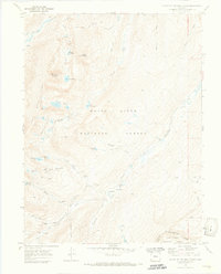
 1970 Homestake Reservoir1973 Print · USGSThe high alpine country of the Sawatch Range is documented here during a period of significant water engineering and mining legacy. You can trace the historic Old RR Grade toward Hagerman Pass or locate old mine workings like the St Kevin Shaft and Homestake Mine.2 unique versions available
 - 1970 Map of Mount Jackson, 1973 Print
 1970 Mount Jackson1973 Print · USGSThe high Sawatch Range of Eagle County comes into focus in this early 1970s survey of the alpine wilderness. Map collectors and researchers can trace remote mining prospects and high-altitude water bodies like Treasure Vault Lake, Gold Dust Peak, and Tellurium Lake.3 unique versions available
 - 1970 Map of Leadville North, 1973 Print
 1970 Leadville North1973 Print · USGSIn the early 1970s, the mountain slopes north of Leadville remained a complex landscape of active mining and growing alpine recreation. Researchers can trace historic claims like the Matchless Mine, locate the Evergreen Cem, and explore the rail lines leading toward Tennessee Pass.4 unique versions available
 - 1970 Map of Vail West, 1973 Print
 1970 Vail West1973 Print · USGSThe Eagle County high country is shown here just as Vail was establishing its modern footprint. You can trace early backcountry access via the Nottingham Ridge Trail and locate recreation sites like Piney Lake and Piney Campground.3 unique versions available
 - 1970 Map of Climax, 1973 Print
 1970 Climax1973 Print · USGSHigh in the Rocky Mountains during the early seventies, this map captures the industrial intensity of Climax and the surrounding peaks. Trace old mining operations like the North London Mine, American Mill, and the steep route over Mosquito Pass.6 unique versions available
 - 1970 Map of Red Cliff, 1973 Print
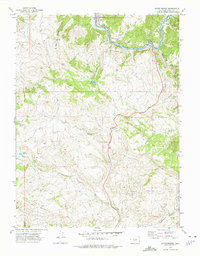
 1970 Red Cliff1973 Print · USGSRed Cliff at the start of the 1970s shows a high-mountain community where mining heritage meets the burgeoning ski industry. Genealogists and historians can locate the local Cemetery, the D & RG W RR line, and historic mining sites like the Hornsilver Mine.5 unique versions available
 - 1970 Map of Mount Of The Holy Cross, 1973 Print
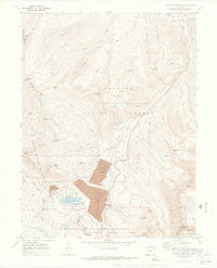
 1970 Mount Of The Holy Cross1973 Print · USGSThe high peaks of Eagle County are captured here in the early seventies, just as massive water diversion projects reached completion. Researchers can find old mining sites near Holy Cross City and trace the complex Missouri Homestake Aqueduct and Gold Park Cem.5 unique versions available
 - 1970 Map of Minturn, 1973 Print
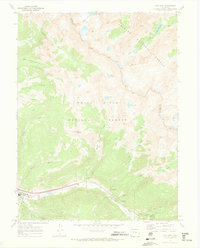
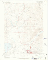
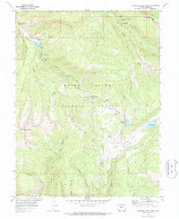
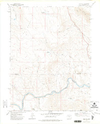
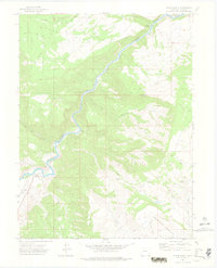
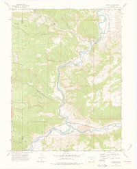
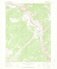 1970 Minturn1973 Print · USGSMinturn and the Eagle River valley are shown here in the early 1970s, balancing a mountain railroad economy with industrial mining. Researchers can trace the Denver and Rio Grande Western Railroad to the Eagle Mine and locate the River View Cemetery.5 unique versions available
 - 1970 Map of Meredith, 1973 Print
 1970 Meredith1973 Print · USGSThe Fryingpan River valley in the early seventies shows a landscape of mountain settlements and significant water engineering. Researchers can trace the river's path from Meredith to Norrie, locating the CH9 Chapman Tunnel and the Diamond J Ranch.4 unique versions available
 - 1970 Map of Copper Mountain, 1973 Print
 1970 Copper Mountain1973 Print · USGSIn the early 1970s, this high-country landscape between Summit and Lake counties shows the dramatic scale of industrial mining. Genealogists and historians can trace the foundations of Kokomo and locate legacy shafts like the Queen of the West Mine.4 unique versions available
 - 1970 Map of Crooked Creek Pass, 1973 Print
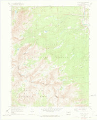
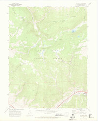
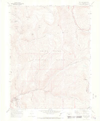
 1970 Crooked Creek Pass1973 Print · USGSThe high country of Eagle County is captured here in the early 1970s, showcasing a landscape of alpine lakes and national forest trails. Researchers can trace historic access routes to Fulford Cave, the Prospect mine, and the waters of Sylvan Lake.6 unique versions available
 - 1970 Map of Pando, 1973 Print
 1970 Pando1973 Print · USGSHigh in the Rockies during the early seventies, this survey shows the remnants of military and mining activity. Trace the legacy of Camp Hale along the Eagle River or locate the El Capitan Mine and Denver and Rio Grande Western Railroad.6 unique versions available
 - 1972 Map of Mc Coy, 1975 Print
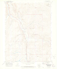
 1972 Mc Coy1975 Print · USGSThe Colorado high country in the early seventies centers on the rail-and-river corridor connecting the small settlements of McCoy and Bond. Genealogists and historians can trace the McCoy Cem, mining Prospects on Yarmony Mountain, and the Denver and Rio Grande Western rail line.3 unique versions available
 - 1972 Map of Blue Hill, 1975 Print
 1972 Blue Hill1975 Print · USGSRoutt and Eagle Counties meet along the rugged canyon of the Colorado River in the early seventies. Genealogists and historians can trace the Denver and Rio Grande Western rail line past Dell and the Balanced Rock Spring.2 unique versions available
 - 1972 Map of Burns South, 1975 Print
 1972 Burns South1975 Print · USGSThe Colorado River corridor near the Eagle County line is captured here in the 1970s, showcasing a rugged canyon economy shaped by rail and water. Local historians can trace the Denver and Rio Grande Western route past Derby Junction and the remote high ground of Greenhorn Mountain.4 unique versions available
 - 1972 Map of State Bridge, 1975 Print
 1972 State Bridge1975 Print · USGSThe Colorado River valley in the early 1970s shows a landscape of mountain railroading and high-altitude settlements. Researchers can trace the Denver and Rio Grande Western tracks through Bond and Orestod or find the lone Grave near the river.4 unique versions available
 - 1972 Map of Burns North, 1975 Print
 1972 Burns North1975 Print · USGSThe Colorado high country in the early seventies reveals a landscape of remote mountain ranching and forest management. Researchers can trace historic routes like the Ute Trail or locate the Cem near Burns and the riverside D & R G W railroad line.
 - 1972 Map of Castle Peak, 1975 Print
 1972 Castle Peak1975 Print · USGSThe Eagle County backcountry in the early seventies was a high-elevation landscape of ridges and remote basins. Researchers can trace historic access routes like the Dutch Horn Trail or locate named landmarks such as Schlegel Lake and Castle Peak.4 unique versions available
 - 1972 Map of Radium, 1976 Print
 1972 Radium1976 Print · USGSThe Colorado River corridor near the Grand and Eagle County line comes into focus in the early 1970s. Researchers can trace the path of the Denver and Rio Grande Western Railroad through Azure and Radium, or locate landmarks like Rancho del Rio and Red Gorge.
 - 1974 Map of Dotsero, 1977 Print
 1974 Dotsero1977 Print · USGSThe confluence of the Colorado and Eagle Rivers is captured in the mid-seventies, showing the vital rail corridor through the canyons. Researchers can trace the path of the Denver and Rio Grande Western and locate landmarks like the Dotsero Crater and Hells Gate.3 unique versions available
 - 1977 Map of Dome Peak, 1978 Print
 1977 Dome Peak1978 Print · USGSThe high alpine plateaus of Northwest Colorado are captured here in the late seventies, detailing the remote terrain where Garfield and Eagle counties meet. Researchers can trace the high-country water systems of Lion Basin Ditch and historical paths like the Ute Trail across the Derby Mesa.
Showing maps 1-25 of 26
Top cities of Eagle County
- Edwards historical maps
- Gypsum historical maps
- Eagle historical maps
- Avon historical maps
- Vail historical maps
- El Jebel historical maps
See more
Frequently asked questions
- What are the different types of historical maps available for Eagle County?
- What is the oldest map of Eagle County?
- Where can I purchase historical maps of Eagle County for my home or office?
- Where can I download high-res historical maps of Eagle County?
- Are there historical topographic maps available for Eagle County?
- Is there historical aerial imagery available for Eagle County?
- Where are historical maps of Eagle County sourced from?