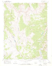
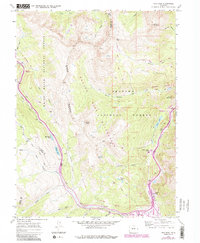
1970 Map of Vail Pass
USGS Topo · Published 1970About this map
The Gore Range dominates the western half of this 1970 landscape, marking the boundary between the White River National Forest and the Arapaho National Forest. This high-altitude terrain is characterized by a network of seasonal trails and specialized infrastructure, including the Tenmile Pipeline and several water-management features like Curtain Ponds and Uneva Lake. Near the southeastern corner, Wheeler Junction serves as a small node of activity where Tenmile Creek and West Tenmile Creek converge.
Find a feature on this map
46 named features on this map. Tap any name to fly to it.
Don’t see what you’re looking for? This feature index may not catch every label — zoom into the map to look around manually.
Map Details
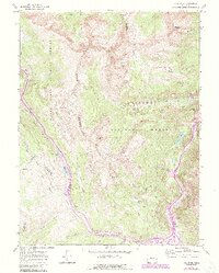
Editions of this 1970 Vail Pass Map
6 editions found
Other maps of this area

1889 · Leadville
USGS Topo · 1:125,000

1891 · Leadville
USGS Topo · 1:125,000

1929 · Dillon
USGS Topo · 1:62,500

1934 · Climax
USGS Topo · 1:48,000

1934 · Minturn
USGS Topo · 1:62,500

1934 · Dillon
USGS Topo · 1:62,500

1938 · Mt. Lincoln
USGS Topo · 1:48,000

1942 · Leadville
USGS Topo · 1:125,000

1945 · Mount Lincoln
USGS Topo · 1:62,500

1949 · Holy Cross
USGS Topo · 1:62,500