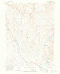
1970 Map of Vail Pass
USGS Topo · Published 1973About this map
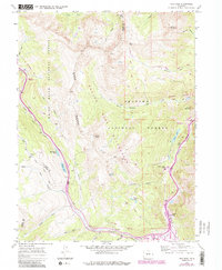
The high alpine terrain of the Gore Range dominates this 1970s survey, where the border of the White River National Forest and Arapaho National Forest follows the jagged ridgeline. This era marks a significant point in the region's transition from early mining and ranching toward its modern role as a recreation and transportation corridor. The settlement at Wheeler Junction sits near the confluence of Tenmile Creek and West Tenmile Creek, adjacent to the sweeping area of Wheeler Flats. Evidence of earlier industrial utility is visible through the Tenmile Pipeline and scattered Mines near Uneva Lake. Historic routes such as the Wheeler Trail and Shrine Pass provide a record of how this high-altitude landscape was navigated before the intensification of modern highway infrastructure through Vail Pass.
Find a feature on this map
46 named features on this map. Tap any name to fly to it.
Don’t see what you’re looking for? This feature index may not catch every label — zoom into the map to look around manually.
Map Details
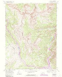
Editions of this 1970 Vail Pass Map
6 editions found
Other maps of this area

1889 · Leadville
USGS Topo · 1:125,000

1891 · Leadville
USGS Topo · 1:125,000

1929 · Dillon
USGS Topo · 1:62,500

1934 · Climax
USGS Topo · 1:48,000

1934 · Minturn
USGS Topo · 1:62,500

1934 · Dillon
USGS Topo · 1:62,500

1938 · Mt. Lincoln
USGS Topo · 1:48,000

1942 · Leadville
USGS Topo · 1:125,000

1945 · Mount Lincoln
USGS Topo · 1:62,500

1949 · Holy Cross
USGS Topo · 1:62,500