Old Maps of Montrose, Colorado for Genealogy
Trace your family roots with 32 historic maps of Montrose. These high-res maps reveal old neighborhoods, homesites, landmarks, and streets — helping you uncover where your ancestors lived and how the area evolved over time.
- Explore historic neighborhoods: Identify where your relatives may have lived in the 1800s or 1900s.
- Compare maps over time: Trace the changes in streets, buildings, and landmarks for multi-generational research.
- Perfect for genealogy & ancestry research: Used by family historians and researchers to map out lineage and migration.
These maps are an incredible resource for exploring your personal connection to Montrose's past.
Montrose, CO maps
(32)- 1909 Map of Montrose, 1960 Print
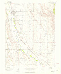
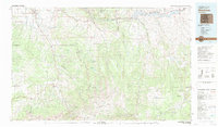
 1909 Montrose1960 Print · USGSThe Uncompahgre Valley and surrounding peaks come into focus during the first decade of the twentieth century. Researchers can trace the Denver and Rio Grande Western RR through Ridgway to Bachelor Switch and the Blaine Mine.
 - 1911 Map of Montrose
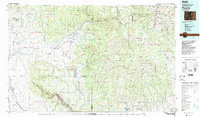
 1911 Montrose1911 Print · USGSThe Uncompahgre River valley and the Denver and Rio Grande RR define the landscape of this region before the First World War. Researchers can trace the early layout of Montrose, the mining influence at Blaine Mine, and the route through Ridgway.3 unique versions available
 - 1955 Map of Olathe, 1956 Print
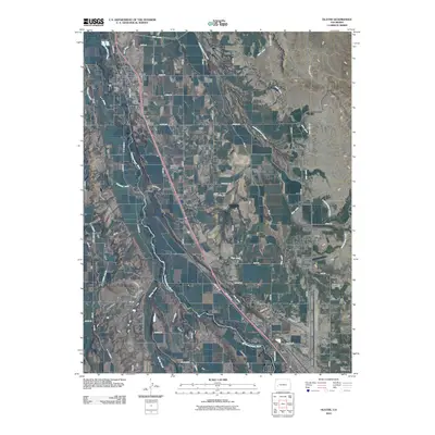
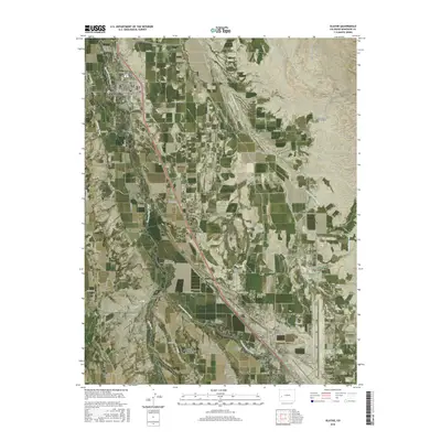
 1955 Olathe1956 Print · USGSThe Uncompahgre Valley in the mid-1950s is shown here as an intricate patchwork of irrigated farmland and essential rail transport. Genealogists can locate old family-named landmarks and institutions like the Menoken Sch, Coal Creek Sch, and Olathe Cem.7 unique versions available
 - 1955 Map of Red Rock Canyon, 1957 Print
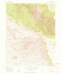 1955 Red Rock Canyon1957 Print · USGSMontrose County at the middle of the twentieth century reveals the dramatic contours of the Gunnison River and its surrounding canyons. Trace early land use through the State Tunnel Dam, a Mine (abandoned), and the established boundaries of Bostwick Park.5 unique versions available
 - 1956 Map of Montrose, 1963 Print
 1956 Montrose1963 Print · USGSThe Colorado western slope in the late fifties and early sixties shows a landscape defined by the Denver & Rio Grande Western RR and the Gunnison River. Trace the development of Blue Mesa Reservoir or locate high-country sites like the Bachelor Mine.3 unique versions available
 - 1959 Map of Montrose
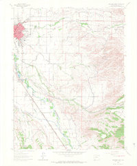
 1959 Montrose1959 Print · USGSWestern Colorado in the late fifties is defined by the high peaks and river valleys of the Southern Rockies. Genealogists and historians can trace the paths of the Denver & Rio Grande Western RR or locate mountain settlements like Crawford, Lazear, and Doyleville.
 - 1960 Map of Montrose
 1960 Montrose1960 Print · USGSThe Colorado high country in the mid-fifties is captured here during a period of steady ranching and persistent mining. Researchers can trace the path of the Denver & Rio Grande Western RR or locate small settlements like Somerset, Maher, and Sargent.2 unique versions available
 - 1962 Map of Montrose East, 1966 Print
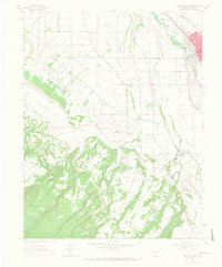
 1962 Montrose East1966 Print · USGSIn the early 1960s, Montrose served as a bustling hub for the Uncompahgre Valley, where rail lines and irrigation canals met. Trace local roots at Cedar Cemetery or follow the Denver and Rio Grande Western RR past Riverside Sch and Vernal.4 unique versions available
 - 1962 Map of Montrose West, 1966 Print
 1962 Montrose West1966 Print · USGSMontrose was thriving as a regional hub in the early sixties, where the valley's irrigation network met the mountain foothills. Researchers can locate vanished landmarks like the Maple Grove School or trace the route of the Denver and Rio Grande Western RR.4 unique versions available
 - 1968 Map of Montrose
 1968 Montrose1968 Print · USGSThe Western Slope and Continental Divide meet in the late sixties, showing the vital river valleys and high-mountain mining districts. Trace the historic route of the Denver and Rio Grande Western RR or locate small settlements like Sargents and Powderhorn.
 - 1983 Map of Montrose
 1983 Montrose1983 Print · USGSThe Uncompahgre Valley and high San Juan peaks come together in the early eighties, showing a landscape defined by deep canyons and mountain mining towns. Genealogists and hikers can trace old routes near Ouray, Lake City, and the Pelican Mine.2 unique versions available
 - 1983 Map of Paonia
 1983 Paonia1983 Print · USGSWestern Colorado's North Fork Valley and West Elk high country are shown here in the early eighties as a hub of coal mining and orchard farming. Researchers can trace historic extraction sites like the Colby Mine, rural settlements such as Maher, and landmarks like the Hotchkiss Nat Fish Hatchery.2 unique versions available
 - 2010 Map of Olathe, 2010 Print
 2010 Olathe2010 Print · USGSCovers Montrose, including Olathe, Frost, and other nearby areas
 - 2010 Map of Montrose East, 2010 Print
 2010 Montrose East2010 Print · USGSCovers Montrose, including Fairview, Uncompahgre, and other nearby areas
 - 2010 Map of Montrose West, 2010 Print
 2010 Montrose West2010 Print · USGSCovers Montrose, including Oak Grove, Montrose County, and other nearby areas
 - 2011 Map of Red Rock Canyon, 2011 Print
 2011 Red Rock Canyon2011 Print · USGSCovers Montrose, including Montrose County, United States, and other nearby areas
 - 2013 Map of Montrose West, 2013 Print
 2013 Montrose West2013 Print · USGSCovers Montrose, including Oak Grove, Montrose County, and other nearby areas
 - 2013 Map of Montrose East, 2013 Print
 2013 Montrose East2013 Print · USGSCovers Montrose, including Fairview, Uncompahgre, and other nearby areas
 - 2013 Map of Olathe, 2013 Print
 2013 Olathe2013 Print · USGSCovers Montrose, including Olathe, Frost, and other nearby areas
 - 2013 Map of Red Rock Canyon, 2013 Print
 2013 Red Rock Canyon2013 Print · USGSCovers Montrose, including Montrose County, United States, and other nearby areas
 - 2016 Map of Montrose West, 2016 Print
 2016 Montrose West2016 Print · USGSCovers Montrose, including Oak Grove, Montrose County, and other nearby areas
 - 2016 Map of Montrose East, 2016 Print
 2016 Montrose East2016 Print · USGSCovers Montrose, including Fairview, Uncompahgre, and other nearby areas
 - 2016 Map of Olathe, 2016 Print
 2016 Olathe2016 Print · USGSCovers Montrose, including Olathe, Frost, and other nearby areas
 - 2016 Map of Red Rock Canyon, 2016 Print
 2016 Red Rock Canyon2016 Print · USGSCovers Montrose, including Montrose County, United States, and other nearby areas
 - 2019 Map of Olathe, 2019 Print
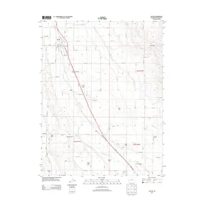
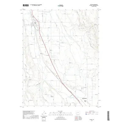 2019 Olathe2019 Print · USGSCovers Montrose, including Olathe, Frost, and other nearby areas
Showing maps 1-25 of 32
Top cities near Montrose
Top neighborhoods of Montrose
Frequently asked questions
- What are the different types of historical maps available for Montrose?
- What is the oldest map of Montrose?
- Where can I purchase historical maps of Montrose for my home or office?
- Where can I download high-res historical maps of Montrose?
- Are there historical topographic maps available for Montrose?
- Is there historical aerial imagery available for Montrose?
- Where are historical maps of Montrose sourced from?