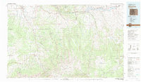
1983 Map of Montrose
USGS Topo · Published 1983About this map
The Uncompahgre River valley serves as the primary corridor for settlement in this region, anchoring towns from Montrose south through Colona and Ridgway to the steep mining terrain of Ouray. This 1983 revision captures the landscape after the development of the Wayne N. Aspinall Storage Unit, showing the significant water bodies of Morrow Point Reservoir and Blue Mesa Reservoir within the Curecanti National Recreation Area.
Find a feature on this map
50 named features on this map. Tap any name to fly to it.
Don’t see what you’re looking for? This feature index may not catch every label — zoom into the map to look around manually.
Map Details
Editions of this 1983 Montrose Map
2 editions found
Other maps of this area

1897 · Telluride
USGS Topo · 1:62,500

1897 · Silverton
USGS Topo · 1:62,500

1901 · Silverton
USGS Topo · 1:62,500

1902 · Silverton
USGS Topo · 1:62,500

1902 · Ouray
USGS Topo · 1:62,500

1903 · Lake City
USGS Topo · 1:62,500

1904 · Ouray
USGS Topo · 1:62,500

1904 · Telluride
USGS Topo · 1:62,500

1905 · Lake City
USGS Topo · 1:62,500

1905 · San Cristobal
USGS Topo · 1:125,000