1950s Maps of San Miguel County, Colorado
Explore 29 historic maps of San Miguel County from the 1950s. These maps offer a rare glimpse into what life looked like during the 1950s — showing old roads, neighborhoods, homes, and landmarks that have changed or disappeared over time.
Whether you're researching your family's past, planning a metal detecting trip, or studying how San Miguel County's landscape evolved across the 1950s, these high-resolution maps are a powerful tool for exploring the history of this region.
- Focus on a specific era: All maps on this page are from the 1950s, giving you a focused view of this time period.
- See what’s changed: Compare century-old streets, trails, and buildings to today's modern landscape using overlays and satellite layers.
- Research with precision: Use these maps for genealogy, historical research, land use analysis, or educational projects.
- View, download, or print: Maps are fully viewable online in high resolution, and can be downloaded or printed for your own records.
Start exploring San Miguel County's history through authentic maps from the 1950s. This is your window into the past.
San Miguel County, CO maps
(29)- 1950 Map of Horse Range Mesa
 1950 Horse Range Mesa1950 Print · USGSSan Miguel County mining operations are captured here at the dawn of the nuclear age. Researchers can trace numerous uranium and radium claims like Veta Mad Mine and the Charles T Mines near the settlement of Slick Rock.2 unique versions available
 - 1950 Map of Hamm Canyon
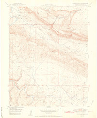 1950 Hamm Canyon1950 Print · USGSSan Miguel County saw a surge in uranium prospecting at mid-century, as shown in this detailed 1950 survey. Researchers can trace early mining access near Mexico Mines and Lookout Mine or follow the winding course of the Dolores River through Hamm Canyon.
 - 1950 Map of Joe Davis Hill
 1950 Joe Davis Hill1950 Print · USGSThe Colorado mining frontier of the late 1940s comes alive in this survey of the high plateaus along the Dolores River. Local historians and researchers can trace uranium-era claims like the Sarah Ellen Mine and remote outposts such as Spud Patch Camp.2 unique versions available
 - 1950 Map of Egnar
 1950 Egnar1950 Print · USGSSouthwest Colorado mining and ranching take center stage at the turn of the fifties on the San Miguel County line. Genealogists and industrial historians can locate specific operations like the Golden Rod Mines, Effie B Mine, and the Egnar School.2 unique versions available
 - 1950 Map of Anderson Mesa
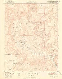 1950 Anderson Mesa1950 Print · USGSMontrose and San Miguel Counties are shown at the height of post-war mineral exploration in the late 1940s. Researchers can trace early mining operations like Morning Star Mine and The Raven Mine near the loops of Dolores River.2 unique versions available
 - 1953 Map of Mount Wilson, 1954 Print
 1953 Mount Wilson1954 Print · USGSThe San Miguel Mountains in the early fifties were a hive of industrial mining activity centered around Lizard Head. Researchers can trace the Old Railroad Grade past the Butterfly Mine (Active), Matterhorn Drifts, and the settlement of Ames.8 unique versions available
 - 1953 Map of Dolores Peak, 1954 Print
 1953 Dolores Peak1954 Print · USGSThe high San Miguel and Dolores county line was a center for mining and ranching at the dawn of the atomic age. Genealogists and historians can trace the West Dolores River to find Dunton, the Emma Mine, and the Rio Grande Southern Railroad.7 unique versions available
 - 1953 Map of Placerville, 1954 Print
 1953 Placerville1954 Print · USGSThe San Miguel River valley comes alive in the early fifties, showing a landscape defined by ranching and uranium-era mining. Trace the remains of Leonard (Aband) or locate the Omega Mine and the Iron Springs Mesa School (Aband).6 unique versions available
 - 1953 Map of Gray Head, 1954 Print
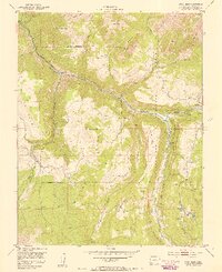 1953 Gray Head1954 Print · USGSThe San Miguel River valley in the early fifties shows a landscape of inactive mines and remote mountain settlements. Trace the Old Railroad Grade and find historic sites like Vanadium, the Belle Champion Mine, and Skyline Ranch.6 unique versions available
 - 1953 Map of Little Cone, 1955 Print
 1953 Little Cone1955 Print · USGSSan Miguel County in the early 1950s reveals a high-altitude landscape of mesas and mining infrastructure. Researchers can trace the Aerial Tramway near Saw Pit or explore the rugged trails leading to Woods Lake and Silver Pick Basin.6 unique versions available
 - 1953 Map of Durango, 1963 Print
 1953 Durango1963 Print · USGSThe high peaks of the San Juan Mountains and the Colorado mining country are shown here as they appeared in the early fifties. Genealogists and local historians can trace the rail lines of the D & R G W RR and locate historic mining camps like Silverton, Ouray, and Old Ophir.
 - 1954 Map of Durango
 1954 Durango1954 Print · USGSSouthern Colorado in the mid-1950s was defined by high-altitude mining towns and the expansion of water storage in the San Luis Valley. Trace the narrow-gauge Denver & Rio Grande Western RR as it connects Durango to mountain outposts like Silverton and Creede.2 unique versions available
 - 1954 Map of Mt Peale 4 NE, 1955 Print
 1954 Mt Peale 4 NE1955 Print · USGSThe high borderlands of San Juan County and western Colorado are captured in the mid-1950s before extensive modern development. Researchers can trace the rugged transition from Moosey Point down through Greasewood Canyon and into the Lower Lisbon Valley.
 - 1954 Map of Mt Peale 4 SE, 1955 Print
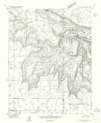 1954 Mt Peale 4 SE1955 Print · USGSThe Utah and Colorado borderlands are captured here in the mid-1950s, revealing a landscape of high mesas and deep canyons. Researchers can locate remote landmarks like the West Summit Sch, Summit Point, and the Lower Lisbon Valley.
 - 1954 Map of Lisbon Valley, 1957 Print
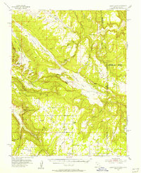 1954 Lisbon Valley1957 Print · USGSLisbon Valley's ranching and mining landscape is captured here in the mid-fifties, just as early aerial photography was refining regional maps. Genealogists and historians can trace local landmarks like Woods Ranch, Patterson Ranch, and the West Summit School.5 unique versions available
 - 1955 Map of Ironton, 1957 Print
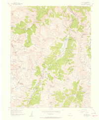 1955 Ironton1957 Print · USGSThe San Juan mining districts are captured here in the mid-fifties, showing the deep industrial roots of the Ouray and San Juan county lines. Genealogists and historians can trace the sites of Ironton, Guston, and the Revenue Mine, or locate the abandoned aerial tramway near Ingram Lake.5 unique versions available
 - 1955 Map of Telluride, 1957 Print
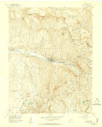 1955 Telluride1957 Print · USGSTelluride and its high-altitude mining basins are captured here during the mid-fifties, showing the town before its modern transformation. Researchers can trace historic operations like the Smuggler Mine, find the Tomboy (Ruins) townsite, and locate Lone Tree Cem.8 unique versions available
 - 1955 Map of Ophir, 1957 Print
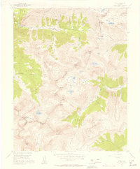 1955 Ophir1957 Print · USGSThe high-altitude mining community of Ophir is captured here in the mid-1950s, surrounded by a complex network of industrial history and alpine basins. Researchers can trace the Old RR Grade and locate historic workings such as the Gold King Mine and the Ophir Loop Sch.7 unique versions available
 - 1955 Map of Telluride, 1959 Print
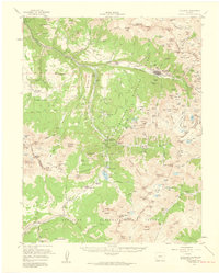 1955 Telluride1959 Print · USGSHigh in the San Miguel Mountains during the 1950s, this area shows the peak of Colorado's mining infrastructure. Genealogists and historians can trace the Rio Grande Southern Railroad past Tomboy and the Ophir Loop Sch.5 unique versions available
 - 1955 Map of Silverton, 1960 Print
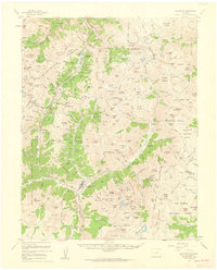 1955 Silverton1960 Print · USGSSilverton and the high San Juans are shown at a peak of mid-century mining activity, linked by rail and the mountain-hugging Million Dollar Highway. Researchers can trace historic claims and infrastructure from the Mayflower Mill to the remote Eureka and Howardsville town sites.3 unique versions available
 - 1956 Map of Montrose, 1963 Print
 1956 Montrose1963 Print · USGSThe Colorado western slope in the late fifties and early sixties shows a landscape defined by the Denver & Rio Grande Western RR and the Gunnison River. Trace the development of Blue Mesa Reservoir or locate high-country sites like the Bachelor Mine.3 unique versions available
 - 1956 Map of Cortez, 1972 Print
 1956 Cortez1972 Print · USGSThe Four Corners region comes alive in this mid-century study of the high plateaus and deep canyons surrounding Cortez. Trace the development of desert outposts like Towaoc or follow the historic Laramie Trail across a landscape dotted with ancient sites at Mesa Verde National Park.2 unique versions available
 - 1956 Map of Moab, 1972 Print
 1956 Moab1972 Print · USGSThe Colorado Plateau and La Sal Mountains appear here in the mid-fifties, just as the uranium boom and energy exploration were reshaping the Four Corners. Researchers can trace the Denver and Rio Grande Western through Cisco or locate the remote outpost of Uravan and Looking Glass Rock.3 unique versions available
 - 1957 Map of Eastland, 1960 Print
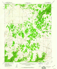 1957 Eastland1960 Print · USGSThe high plateau of San Juan County comes into focus during the late fifties, showing a remote landscape of canyons and early energy infrastructure. Genealogists and historians can trace local ties at Valley View Cemetery and rural sites like Burn School and Lockerby.4 unique versions available
 - 1958 Map of Cortez
 1958 Cortez1958 Print · USGSThe Four Corners region comes alive in the late fifties, showing the interplay between expanding mountain settlements and ancient archeological sites. Trace the layout of Cortez, Monticello, and Blanding alongside landmarks like Mesa Verde National Park and Fort Lewis A&M College.
Showing maps 1-25 of 29
Top cities of San Miguel County
- Telluride historical maps
- Mountain Village historical maps
- Norwood historical maps
- Ophir historical maps
- Sawpit historical maps
Frequently asked questions
- What are the different types of historical maps available for San Miguel County?
- What is the oldest map of San Miguel County?
- Where can I purchase historical maps of San Miguel County for my home or office?
- Where can I download high-res historical maps of San Miguel County?
- Are there historical topographic maps available for San Miguel County?
- Is there historical aerial imagery available for San Miguel County?
- Where are historical maps of San Miguel County sourced from?