1900s (20th Century) Maps of San Miguel County, Colorado
Explore 106 historic maps of San Miguel County from the 1900s (20th Century). These maps offer a rare glimpse into what life looked like during the 1900s — showing old roads, neighborhoods, homes, and landmarks that have changed or disappeared over time.
Whether you're researching your family's past, planning a metal detecting trip, or studying how San Miguel County's landscape evolved across the 1900s, these high-resolution maps are a powerful tool for exploring the history of this region.
- Focus on a specific era: All maps on this page are from the 1900s, giving you a focused view of this time period.
- See what’s changed: Compare century-old streets, trails, and buildings to today's modern landscape using overlays and satellite layers.
- Research with precision: Use these maps for genealogy, historical research, land use analysis, or educational projects.
- View, download, or print: Maps are fully viewable online in high resolution, and can be downloaded or printed for your own records.
Start exploring San Miguel County's history through authentic maps from the 1900s. This is your window into the past.
San Miguel County, CO maps
(106)- 1901 Map of Silverton, 1957 Print
 1901 Silverton1957 Print · USGSSilverton was the bustling center of the San Juan silver boom when these mountain railroads were at their peak. Genealogists and historians can trace the high-altitude rail lines to remote camps like Animas Forks, Guston, and Red Mountain.
 - 1902 Map of Silverton
 1902 Silverton1902 Print · USGSSilverton and its surrounding high-country mining camps are captured here during the peak of the San Juan mountain silver boom. Genealogists and industrial historians can trace the paths of the Silverton Northern R.R. to remote outposts like Animas Forks, Eureka, and the Sunnyside Mill.4 unique versions available
 - 1904 Map of Telluride
 1904 Telluride1904 Print · USGSThe San Juan Mountains were at the height of their mining boom when this survey was conducted at the turn of the century. Genealogists and historians can trace the intricate rail network of the Rio Grande Southern R.R. and locate storied operations like the Smuggler Mine and the community at Ophir.2 unique versions available
 - 1909 Map of Montrose, 1960 Print
 1909 Montrose1960 Print · USGSThe Uncompahgre Valley and surrounding peaks come into focus during the first decade of the twentieth century. Researchers can trace the Denver and Rio Grande Western RR through Ridgway to Bachelor Switch and the Blaine Mine.
 - 1911 Map of Montrose
 1911 Montrose1911 Print · USGSThe Uncompahgre River valley and the Denver and Rio Grande RR define the landscape of this region before the First World War. Researchers can trace the early layout of Montrose, the mining influence at Blaine Mine, and the route through Ridgway.3 unique versions available
 - 1916 Map of Paradox Valley, 1955 Print
 1916 Paradox Valley1955 Print · USGSWestern Colorado during the height of early mineral exploration is documented here across the high plateaus and deep river canyons. Genealogists and historians can locate remote outpost camps like Shamrock Camp or Sunny Jim Camp and industrial landmarks such as the Coke Ovens.
 - 1922 Map of Paradox Valley
 1922 Paradox Valley1922 Print · USGSMontrose and San Miguel Counties are shown here during the early twentieth-century mining era, featuring a network of ore-processing camps and early river settlements. Researchers can trace historic industrial sites like the Cashin Mine and Coke Ovens or locate early rural institutions such as the Radium School.2 unique versions available
 - 1945 Map of Durango
 1945 Durango1945 Print · USGSSouthwest Colorado and Northern New Mexico at mid-century are defined by the high peaks of the San Juan Range and the tribal lands of the Southern Ute. Genealogists and historians can trace the paths of the D & R G W RR and locate local landmarks like Animas City and the Blanco Basin School.3 unique versions available
 - 1948 Map of Bull Canyon, 1955 Print
 1948 Bull Canyon1955 Print · USGSWestern Colorado's high desert mining country is captured here just as the atomic age spurred new interest in the Plateau's mineral wealth. Researchers can locate remote extraction sites like Wild Steer Mines and Jo Dandy Mine or trace the early Monogram Trail.
 - 1948 Map of Horse Range Mesa, 1955 Print
 1948 Horse Range Mesa1955 Print · USGSSan Miguel County became a focal point of the Cold War uranium boom during the late 1940s as industry moved into this canyon landscape. Researchers can locate specific mining operations like the Veta Mad Mine, Radium No 5 Mine, and the Slick Rock Water Tower near the river.
 - 1948 Map of Hamm Canyon, 1955 Print
 1948 Hamm Canyon1955 Print · USGSSan Miguel County, Colorado, is captured here in the late 1940s during a period of renewed geological interest in the plateau's mineral resources. Researchers can trace the rugged drainage of the Dolores River and locate historic mining sites like Mexico Mines or the Lookout Mine.
 - 1948 Map of Naturita NW, 1957 Print
 1948 Naturita NW1957 Print · USGSWestern Colorado mining and ranching lands are captured here just after the war, showing the stark divide between the Paradox Valley floor and the surrounding heights. Researchers can trace mid-century industrial sites like the Thunderbolt Mine or locate water sources such as Spectacle Reservoir.4 unique versions available
 - 1948 Map of Gypsum Gap, 1957 Print
 1948 Gypsum Gap1957 Print · USGSWestern San Miguel County is shown during a period of intense mineral exploration in the late 1940s. Researchers can trace the early footprints of the local uranium boom through landmarks like the Long Ridge Mines, Bald Eagle Mines, and Larson Spring.4 unique versions available
 - 1949 Map of Bull Canyon
 1949 Bull Canyon1949 Print · USGSThe Colorado uranium belt comes into focus during the late 1940s as industry and exploration transform this high-mesa landscape. Researchers can trace early mining operations like the Wild Steer Mines and Rim Rock Mine alongside remote sites like Indian Henrys Cabin.2 unique versions available
 - 1949 Map of Gypsum Gap
 1949 Gypsum Gap1949 Print · USGSSan Miguel County in the late 1940s reflects the height of post-war mineral exploration under the Atomic Energy Commission. Researchers can trace early uranium-era activity at the Long Ridge Mines, Bald Eagle Mines, and the passage through Gypsum Gap.2 unique versions available
 - 1949 Map of Naturita NW
 1949 Naturita NW1949 Print · USGSThe Paradox Valley and Monogram Mesa are captured here in the late 1940s as regional mining intensified. Researchers can locate the Thunderbolt Mine and trace the complex drainages of Dry Creek and West Fork Basin Creek.2 unique versions available
 - 1949 Map of Egnar
 1949 Egnar1949 Print · USGSThe mining landscape near the Colorado-Utah border is detailed in this late 1940s survey. Researchers can trace numerous early claims like the Effie B Mine and Golden Rod Mines alongside local landmarks like the Egnar School.4 unique versions available
 - 1949 Map of Anderson Mesa, 1955 Print
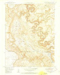 1949 Anderson Mesa1955 Print · USGSThe high mesas of western Colorado are documented here in the late 1940s as mineral exploration began to peak. Researchers can trace early uranium mining efforts at Morning Star Mine and The Raven Mine or follow the loops of the Dolores River past Muleshoe Bend.2 unique versions available
 - 1949 Map of Joe Davis Hill, 1957 Print
 1949 Joe Davis Hill1957 Print · USGSSan Miguel and Dolores counties at the height of the mid-century uranium boom. Mineral hunters can trace the locations of the Norma Jean Mine and Mucho Grande Mine, or locate the site of Spud Patch Camp along the Dolores River.5 unique versions available
 - 1950 Map of Horse Range Mesa
 1950 Horse Range Mesa1950 Print · USGSSan Miguel County mining operations are captured here at the dawn of the nuclear age. Researchers can trace numerous uranium and radium claims like Veta Mad Mine and the Charles T Mines near the settlement of Slick Rock.2 unique versions available
 - 1950 Map of Hamm Canyon
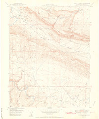 1950 Hamm Canyon1950 Print · USGSSan Miguel County saw a surge in uranium prospecting at mid-century, as shown in this detailed 1950 survey. Researchers can trace early mining access near Mexico Mines and Lookout Mine or follow the winding course of the Dolores River through Hamm Canyon.
 - 1950 Map of Joe Davis Hill
 1950 Joe Davis Hill1950 Print · USGSThe Colorado mining frontier of the late 1940s comes alive in this survey of the high plateaus along the Dolores River. Local historians and researchers can trace uranium-era claims like the Sarah Ellen Mine and remote outposts such as Spud Patch Camp.2 unique versions available
 - 1950 Map of Egnar
 1950 Egnar1950 Print · USGSSouthwest Colorado mining and ranching take center stage at the turn of the fifties on the San Miguel County line. Genealogists and industrial historians can locate specific operations like the Golden Rod Mines, Effie B Mine, and the Egnar School.2 unique versions available
 - 1950 Map of Anderson Mesa
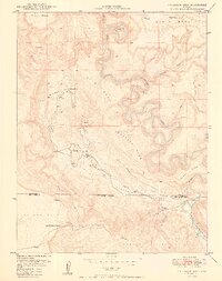 1950 Anderson Mesa1950 Print · USGSMontrose and San Miguel Counties are shown at the height of post-war mineral exploration in the late 1940s. Researchers can trace early mining operations like Morning Star Mine and The Raven Mine near the loops of Dolores River.2 unique versions available
 - 1953 Map of Mount Wilson, 1954 Print
 1953 Mount Wilson1954 Print · USGSThe San Miguel Mountains in the early fifties were a hive of industrial mining activity centered around Lizard Head. Researchers can trace the Old Railroad Grade past the Butterfly Mine (Active), Matterhorn Drifts, and the settlement of Ames.8 unique versions available
Showing maps 1-25 of 106
Top cities of San Miguel County
- Telluride historical maps
- Mountain Village historical maps
- Norwood historical maps
- Ophir historical maps
- Sawpit historical maps
Frequently asked questions
- What are the different types of historical maps available for San Miguel County?
- What is the oldest map of San Miguel County?
- Where can I purchase historical maps of San Miguel County for my home or office?
- Where can I download high-res historical maps of San Miguel County?
- Are there historical topographic maps available for San Miguel County?
- Is there historical aerial imagery available for San Miguel County?
- Where are historical maps of San Miguel County sourced from?