1910s Maps of Delaware
Explore 11 historic maps of Delaware from the 1910s. These maps offer a rare glimpse into what life looked like during the 1910s — showing old roads, neighborhoods, homes, and landmarks that have changed or disappeared over time.
Whether you're researching your family's past, planning a metal detecting trip, or studying how Delaware's landscape evolved across the 1910s, these high-resolution maps are a powerful tool for exploring the history of this region.
- Focus on a specific era: All maps on this page are from the 1910s, giving you a focused view of this time period.
- See what’s changed: Compare century-old streets, trails, and buildings to today's modern landscape using overlays and satellite layers.
- Research with precision: Use these maps for genealogy, historical research, land use analysis, or educational projects.
- View, download, or print: Maps are fully viewable online in high resolution, and can be downloaded or printed for your own records.
Start exploring Delaware's history through authentic maps from the 1910s. This is your window into the past.
Delaware maps
(11)- 1915 Map of Seaford
 1915 Seaford1915 Print · USGSCoastal Sussex County and the Maryland borderlands are seen here at a time when river traffic and rail lines were the lifeblood of the region. Researchers can trace the Steamboat Route up to Seaford or locate ancestral sites like Cannons Ferry and Cokesbury School.4 unique versions available
 - 1917 Map of Elkton
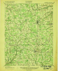
 1917 Elkton1917 Print · USGSNorthern Cecil County and the Delaware borderlands appear here in the era of rail and canal dominance. Genealogists can trace family names across Back Creek Neck or locate early settlements like Lewisville and Mechanic Valley.
 - 1917 Map of Millsboro
 1917 Millsboro1917 Print · USGSCoastal Sussex County is captured here during the First World War, showing a landscape of rural schoolhouses and railroad sidings centered on Georgetown. Genealogists can trace family connections through numerous landmarks like Mc Colleys, Shortly, and the Westwood Church.2 unique versions available
 - 1918 Map of Cedar Creek
 1918 Cedar Creek1918 Print · USGSDelaware's bay coast during the Great War era reveals a landscape of tidal marshes and remote beach landings. Researchers can trace rural Sussex County life through sites like Old Baptist Ch, Mispillion River LH, and the P. B. and W. RR.2 unique versions available
 - 1918 Map of Harrington
 1918 Harrington1918 Print · USGSThe Kent and Sussex County borderlands at the end of the Great War reveal a landscape of busy rail corridors and small schoolhouses. Researchers can trace the legacy of rural education at Union Chapel School or locate family roots near Harrington and Hickman.4 unique versions available
 - 1918 Map of Rehoboth
 1918 Rehoboth1918 Print · USGSCoastal Sussex County is seen here at the close of the Great War, when small farming villages still outnumbered beach resorts. Genealogists can trace family roots through numerous rural landmarks like Trinity Church, Eldorado School, and the Grange Hall.8 unique versions available
 - 1918 Map of Cape Henlopen
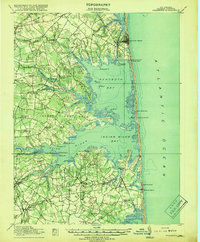
 1918 Cape Henlopen1918 Print · USGSCoastal Sussex County is seen here at a pivotal maritime moment, as the bustling port at Lewes manages the traffic of the Delaware Bay. Researchers can trace early twentieth-century rail lines, the historic Cape Henlopen Light, and local landmarks like West Hill School.2 unique versions available
 - 1918 Map of Coatesville, 1921 Print
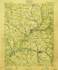
 1918 Coatesville1921 Print · USGSChester County and the Lancaster border are captured in the late First World War era as industrial and academic centers thrived. Trace the early layout of Lincoln University, the busy Pennsylvania R.R. corridor, and old post offices like Springdell Derbydown PO.
 - 1919 Map of Cedar Creek
 1919 Cedar Creek1919 Print · USGSSussex County's coastal necks and rail towns are captured here at the end of the Great War. Genealogists can trace family schoolhouses like Cave Neck School and Slaughter Neck School or locate old water-powered sites such as Marshall Mill Pond.
 - 1919 Map of Wilmington
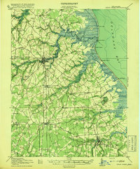
 1919 Wilmington1919 Print · USGSNorthern Delaware and the river corridor are mapped at the close of the Great War, highlighting strategic coastal defenses and rail hubs. Genealogists can trace early landmarks like Coochs Bridge, Corner Ketch, and the defensive works at Fort Delaware.2 unique versions available
 - 1919 Map of Vineland, 1921 Print
 1919 Vineland1921 Print · USGSCumberland County’s coastal oyster ports and inland industrial centers are captured here during a period of peak maritime activity. Genealogists and historians can trace rail lines like the Central R. R. of New Jersey or locate vanished sites like Whitehall Ldg. and Sheppards Mill.
End of results
Showing maps 1-11 of 11
Top cities of Delaware
- Wilmington historical maps
- Dover historical maps
- Newark historical maps
- Hockessin historical maps
- Smyrna historical maps
- Middletown historical maps
See more
Top counties of Delaware
Frequently asked questions
- What are the different types of historical maps available for Delaware?
- What is the oldest map of Delaware?
- Where can I purchase historical maps of Delaware for my home or office?
- Where can I download high-res historical maps of Delaware?
- Are there historical topographic maps available for Delaware?
- Is there historical aerial imagery available for Delaware?
- Where are historical maps of Delaware sourced from?