1990s Maps of Delaware
Explore 60 historic maps of Delaware from the 1990s. These maps offer a rare glimpse into what life looked like during the 1990s — showing old roads, neighborhoods, homes, and landmarks that have changed or disappeared over time.
Whether you're researching your family's past, planning a metal detecting trip, or studying how Delaware's landscape evolved across the 1990s, these high-resolution maps are a powerful tool for exploring the history of this region.
- Focus on a specific era: All maps on this page are from the 1990s, giving you a focused view of this time period.
- See what’s changed: Compare century-old streets, trails, and buildings to today's modern landscape using overlays and satellite layers.
- Research with precision: Use these maps for genealogy, historical research, land use analysis, or educational projects.
- View, download, or print: Maps are fully viewable online in high resolution, and can be downloaded or printed for your own records.
Start exploring Delaware's history through authentic maps from the 1990s. This is your window into the past.
Delaware maps
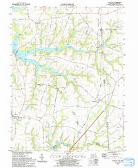
(60)- 1992 Map of Harbeson
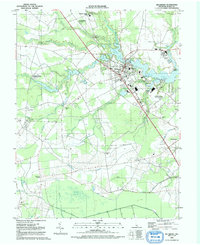
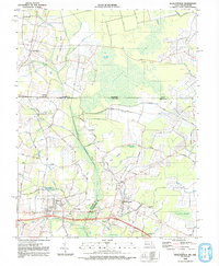
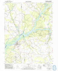
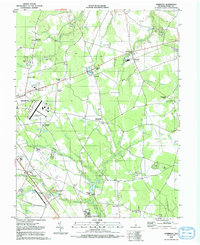 1992 Harbeson1992 Print · USGSThe rural landscapes of Sussex County are captured here in the early nineties, showing a network of small rail settlements and agricultural crossroads. Genealogists can trace family landmarks like Beaverdam Cem and the country churches at Springfield Crossroads or Stockley.
 - 1992 Map of Hebron
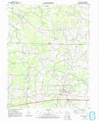
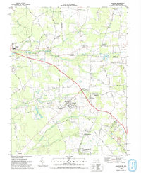 1992 Hebron1992 Print · USGSThe Maryland-Delaware border region comes alive in this early 1990s survey of Wicomico County. Genealogists and historians can trace the foundations of Hebron, locate family sites near St Pauls Church, and follow the path of the Old Railroad.
 - 1992 Map of Seaford East
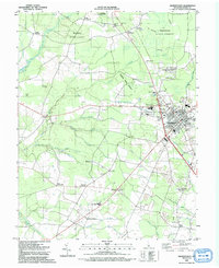
 1992 Seaford East1992 Print · USGSSussex County thrives along the Nanticoke River in the early nineties, showing a landscape of established towns and newer waterfront landings. Trace local history at Ross Mansion, the rail lines through Bridgeville, and old community hubs like Hearns Mill.
 - 1992 Map of Seaford West
 1992 Seaford West1992 Print · USGSThe Delaware-Maryland borderlands come into focus in the early nineties, showing the rural reaches of Sussex County as it meets Federalsburg. Researchers can locate rural landmarks like New Liberty Ch, the crossroads at Atlanta, and old milling sites near Craigs Mill.
 - 1992 Map of Trap Pond
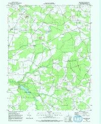 1992 Trap Pond1992 Print · USGSSussex County's agricultural heartland is documented here in the early nineties, centered on the wooded waters of Trap Pond State Park. Researchers can locate several historic community hubs at Whaleys Crossroads, Hardscrabble, and local landmarks like Bethesda Ch.
 - 1992 Map of Ellendale
 1992 Ellendale1992 Print · USGSSussex County's timberlands and agricultural hamlets are captured here in the early nineties. Genealogists and local historians can trace family locations near Ellendale Cem, Christian Tabernacle Sch, and the quiet crossroads of Robbins.
 - 1992 Map of Laurel
 1992 Laurel1992 Print · USGSLaurel and its surrounding Sussex County wetlands are captured here in the early nineties, centered on the Broad Creek waterway. Genealogists and local historians can locate Laurel Hill Cem, trace the Delaware RR corridor, and explore the outskirts near Hearns Crossroads.
 - 1992 Map of Milton
 1992 Milton1992 Print · USGSCoastal Sussex County in the early nineties shows a landscape of tidal wetlands and small crossroads towns near the Delaware Bay. Researchers can locate family landmarks like Reynolds Mill, Wesley Chapel, and the historic cemeteries of Argo Corners.
 - 1992 Map of Millsboro
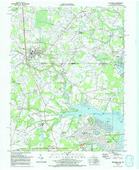
 1992 Millsboro1992 Print · USGSSussex County in the early nineties reveals a landscape of riverfront commerce and agricultural drainage. Researchers can find many rural landmarks, from the Stockley Center Hosp and Old Field Cem to the waterfront at Old Landing.
 - 1992 Map of Pittsville
 1992 Pittsville1992 Print · USGSMaryland's borderlands with Delaware come into focus in the early 1990s, centered on the growing rail and road hubs of Wicomico County. Genealogists and historians can trace community roots through rural sites like Melson Ch, Aydelotte, and the remote Race Bridge Cem.
 - 1992 Map of Georgetown
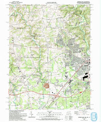
 1992 Georgetown1992 Print · USGSGeorgetown and its surrounding forests are captured here in the early 1990s as the regional hub for education and industry. Genealogists can trace family names at Kings Crossroads or locate rural landmarks like Hebron Ch and Asbury Ch.
 - 1992 Map of Assawoman Bay
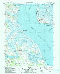
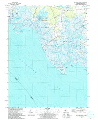
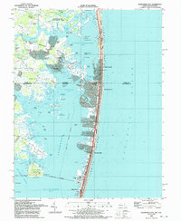 1992 Assawoman Bay1992 Print · USGSCoastal Delaware and Maryland meet in the early nineties along a landscape of shifting barrier islands and growing waterfront communities. Trace the shoreline development of Fenwick Island and Maryland Beach, or locate historic landmarks like the Fenwick Island Lighthouse and Peppers Landing.
 - 1992 Map of Whaleysville
 1992 Whaleysville1992 Print · USGSThe Maryland-Delaware borderlands appear in the early nineties as a landscape of swamp-fringed settlements and agricultural ridges. Genealogists can trace family names and local landmarks through Pulletts Chapel, the Willards Sch, and the Bethel Cem near Gumboro.
 - 1992 Map of Selbyville
 1992 Selbyville1992 Print · USGSThe Delaware-Maryland border region near Selbyville is captured in the early nineties as modern residential growth meets rural crossroads. Trace family history at Old St Martins Ch or explore the tidal reaches of the St Martin River and Shingle Landing Prong.
 - 1992 Map of Greenwood
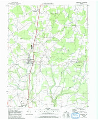 1992 Greenwood1992 Print · USGSThe Delmarva landscape comes alive in the 1990s as it transitions from the rail town of Greenwood to the thick timber of Ellendale State Forest. Researchers can trace the heritage of local settlements like Staytonville and Farmington alongside landmarks like St Johnstown Ch.
 - 1992 Map of Delmar
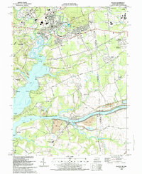
 1992 Delmar1992 Print · USGSSpanning the border between Delaware and Maryland in the 1990s, this area shows the rail-centered growth of Delmar and the expanding suburbs of Salisbury. Genealogists can trace family names through Oliphant Cem and Nichols Cem or locate historic sites like Leonards Mill.
 - 1992 Map of Sharptown
 1992 Sharptown1992 Print · USGSThe Nanticoke River valley on the Maryland-Delaware border is captured here in the 1990s as a landscape of river landings and rural crossroads. Researchers can trace family history through sites like Santa Domingo, Zion Ch, and the Redman Cem.
 - 1992 Map of Newark West, 1993 Print
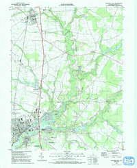
 1992 Newark West1993 Print · USGSThe borderlands of Maryland, Delaware, and Pennsylvania are shown in the early nineties, centered on the equestrian landscapes of Fair Hill. Trace family roots at the Welsh Tract Ch or locate the Fair Hill Training Center and Elk Mills.3 unique versions available
 - 1992 Map of Elkton, 1993 Print
 1992 Elkton1993 Print · USGSMaryland and Delaware meet along this corridor in the early nineties as suburban expansion reaches the historic Cecil County seat. Genealogists can trace family names and sites from Gilpin Cem and Crouch Chapel to the industrial legacy of the Chesapeake and Delaware Canal.
 - 1993 Map of Canton
 1993 Canton1993 Print · USGSCoastal Salem County comes into focus in the early nineties, showing a landscape defined by the vast marshlands of the Delaware Bay. Researchers can trace historic crossroads and tide-water landmarks from Harmersville down to Stow Creek Landing and the old milling site at Maskells Mill.
 - 1993 Map of Cecilton
 1993 Cecilton1993 Print · USGSThe Maryland-Delaware borderlands near the Sassafras River come into focus in the early nineties, showing a landscape defined by tidal creeks and historic necks. Genealogists and local researchers can trace sites like St Francis Xavier Ch, Bohemia Mills, and the small settlement at Cayots.
 - 1993 Map of Taylors Bridge
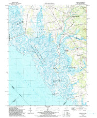
 1993 Taylors Bridge1993 Print · USGSThe Delaware shoreline and tidal marshes are captured in the early 1990s as the Salem Nuclear Powerplant stands opposite historic rural landings. Researchers can trace local genealogy and land use through Taylors Bridge, old schools along Walker School Road, and the family-named Thomas Landing.
 - 1993 Map of Ben Davis Point
 1993 Ben Davis Point1993 Print · USGSThe coastal reaches of Cumberland County are captured in the early nineties, where the marshy expanse of Back Neck meets the bay. Trace the isolated outposts at Husted Landing and Sea Breeze, or locate the Ben Davis Pt Light marking the shoreline.
 - 1993 Map of Harrington
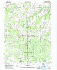
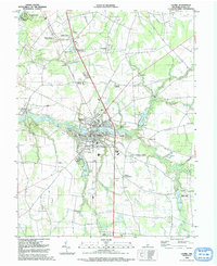
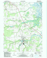
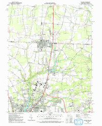
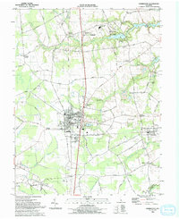 1993 Harrington1993 Print · USGSHarrington and the surrounding Kent County farm country are shown in the early nineties, centered on the bustling city and its expansive fairgrounds. Genealogists and historians can locate family-named junctions like Melvins Crossroads, rural schools such as Lake Forest Sch, and the quiet village of Houston.
 - 1993 Map of Newark East
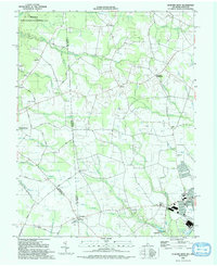
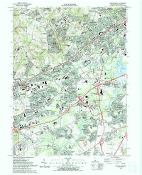 1993 Newark East1993 Print · USGSNewark and the surrounding Delaware suburbs are captured here in the early nineties as modern residential life integrates with historic transport corridors. Researchers can locate community anchors like Delaware Park, All Saints Cemetery, and Goldey Beacom College.2 unique versions available
Showing maps 1-25 of 60
Top cities of Delaware
- Wilmington historical maps
- Dover historical maps
- Newark historical maps
- Hockessin historical maps
- Smyrna historical maps
- Middletown historical maps
See more
Top counties of Delaware
Frequently asked questions
- What are the different types of historical maps available for Delaware?
- What is the oldest map of Delaware?
- Where can I purchase historical maps of Delaware for my home or office?
- Where can I download high-res historical maps of Delaware?
- Are there historical topographic maps available for Delaware?
- Is there historical aerial imagery available for Delaware?
- Where are historical maps of Delaware sourced from?