2020s Maps of Sussex County, Delaware
Explore 27 historic maps of Sussex County from the 2020s. These maps offer a rare glimpse into what life looked like during the 2020s — showing old roads, neighborhoods, homes, and landmarks that have changed or disappeared over time.
Whether you're researching your family's past, planning a metal detecting trip, or studying how Sussex County's landscape evolved across the 2020s, these high-resolution maps are a powerful tool for exploring the history of this region.
- Focus on a specific era: All maps on this page are from the 2020s, giving you a focused view of this time period.
- See what’s changed: Compare century-old streets, trails, and buildings to today's modern landscape using overlays and satellite layers.
- Research with precision: Use these maps for genealogy, historical research, land use analysis, or educational projects.
- View, download, or print: Maps are fully viewable online in high resolution, and can be downloaded or printed for your own records.
Start exploring Sussex County's history through authentic maps from the 2020s. This is your window into the past.
Sussex County, DE maps
(27)- 2023 Map of Seaford West, 2023 Print
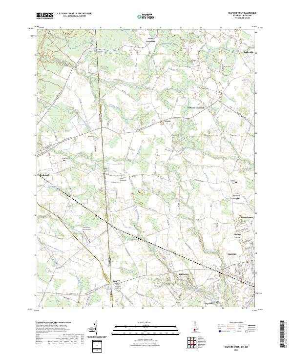 2023 Seaford West2023 Print · USGSThe Delaware Maryland borderlands come into focus in this recent study of the rural region west of Seaford. Researchers can trace generational family footprints through the Cannon Family Cem, Bethel Church Cem, and crossroads like Atlanta.
 - 2023 Map of Frankford, 2023 Print
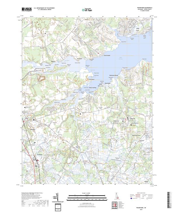 2023 Frankford2023 Print · USGSCoastal Sussex County is seen here in recent detail, where the waters of the Indian River Bay meet the inland towns. Genealogists can locate long-standing community centers like the Antioch African Methodist Episcopal Church and the Saint Georges Cem.
 - 2023 Map of Ellendale, 2023 Print
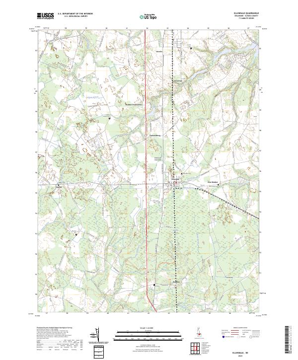 2023 Ellendale2023 Print · USGSCoastal plain settlements and wooded wetlands define this corner of Sussex County in the 2020s. Researchers can locate numerous family burial grounds including Oakley Cemetery and Union Church Cemetery, or trace local waterways like Johnson Branch and Maple Branch.
 - 2023 Map of Georgetown, 2023 Print
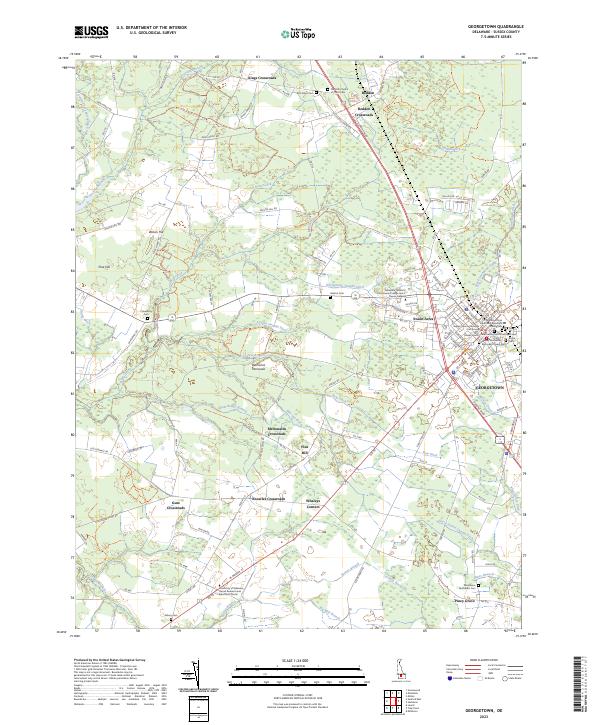 2023 Georgetown2023 Print · USGSGeorgetown and its rural crossroads in Sussex County are documented here in the early twenty-first century. Family historians can trace numerous burial sites including Wesley Methodist Episcopal Chapel Cem and Providence Methodist Cem.
 - 2023 Map of Trap Pond, 2023 Print
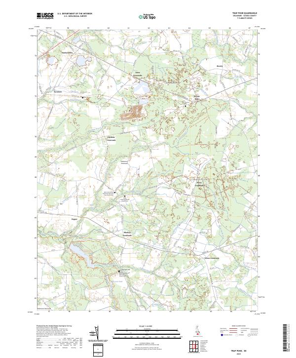 2023 Trap Pond2023 Print · USGSSouthern Delaware's rural landscape comes alive in this survey of Sussex County, where traditional crossroads communities define the interior. Researchers can trace family sites at Saint Thomas Cem or follow old routes through Hardscrabble and Shortly.
 - 2023 Map of Greenwood, 2023 Print
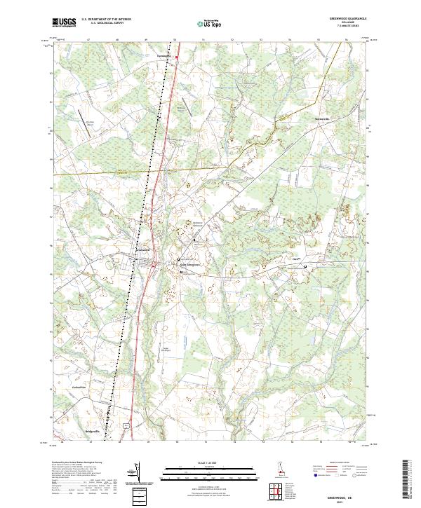 2023 Greenwood2023 Print · USGSSussex County agricultural life is centered on Greenwood and the headwaters of the Nanticoke River in the early twenty-first century. Family historians can trace local sites like Saint Johnstown, the Tressler Mennonite Cem, and the uniquely named Cocked Hat.
 - 2023 Map of Milford, 2023 Print
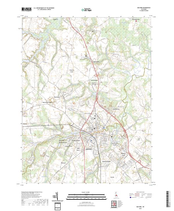 2023 Milford2023 Print · USGSThe Kent and Sussex county line meets at the Mispillion River in this 2023 survey of the Milford area. Genealogists can trace family heritage through the Old Community Cem, John Wesley Church, and Lynch Heights.
 - 2023 Map of Harbeson, 2023 Print
 2023 Harbeson2023 Print · USGSThe rural landscape of Sussex County, Delaware, comes into focus in this recent survey of the agricultural heartland near Georgetown. Genealogists and local historians can trace family burial sites at Beaverdam Cem and explore old mill sites like Hunters Millpond and Morris Mill.
 - 2023 Map of Millsboro, 2023 Print
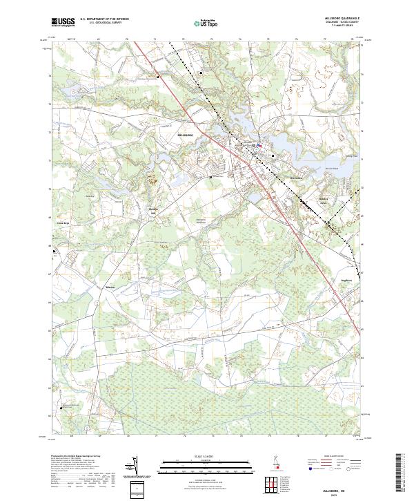 2023 Millsboro2023 Print · USGSSussex County's river-fed landscapes and growing towns are shown here in recent years as the area continues to evolve. Genealogists and historians can trace family locations at Saint Marks Episcopal Church Cem or find smaller sites like Askecksy and Mission.
 - 2023 Map of Assawoman Bay, 2023 Print
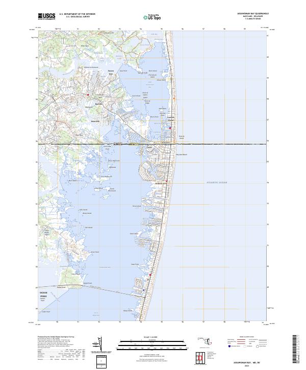 2023 Assawoman Bay2023 Print · USGSThe coastal border between Maryland and Delaware comes into focus during this period of maritime development. Genealogists and historians can trace the street grids of Ocean City and Maryland Beach or explore inland reaches like Swann Keys and Mattapany.
 - 2023 Map of Laurel, 2023 Print
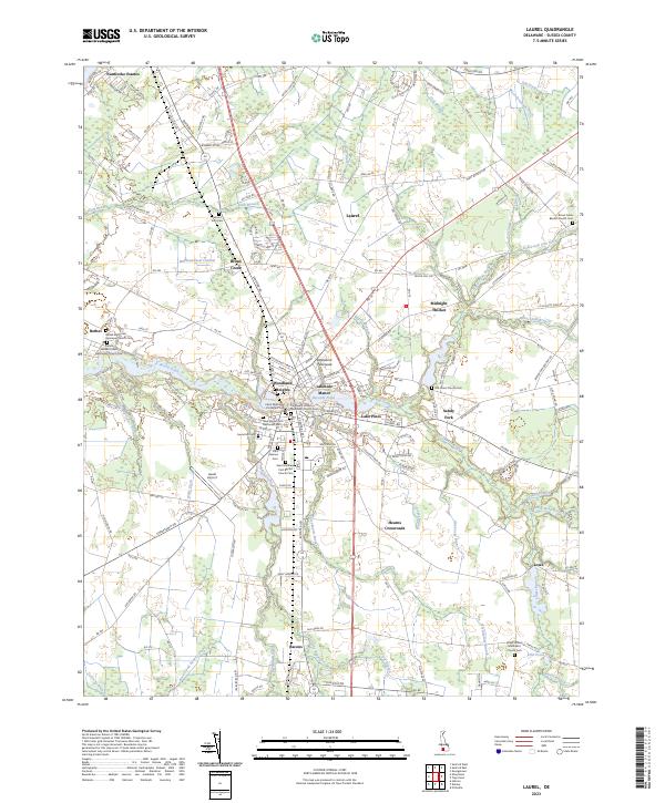 2023 Laurel2023 Print · USGSSussex County's river-fed landscapes and crossroads communities are shown in fine detail here during the early twenty-first century. Genealogists and local historians can trace family plots at Old Christ Church Cem or explore the waterways near Woodland Heights and Records Pond.
 - 2023 Map of Selbyville, 2023 Print
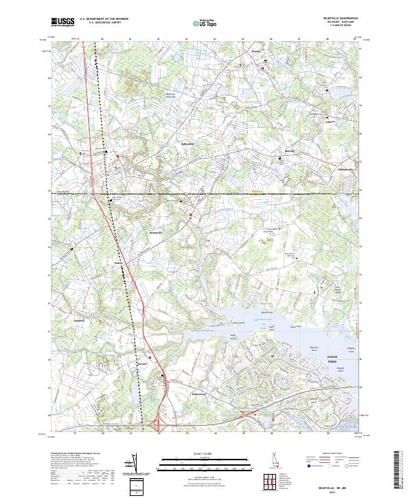 2023 Selbyville2023 Print · USGSThe Delaware-Maryland border country comes into focus in this recent survey of Sussex and Worcester counties. Researchers can trace family history through a dense network of local landmarks, including the Old Sound Methodist Church, Showell School, and Red Men Cem.
 - 2023 Map of Rehoboth Beach, 2023 Print
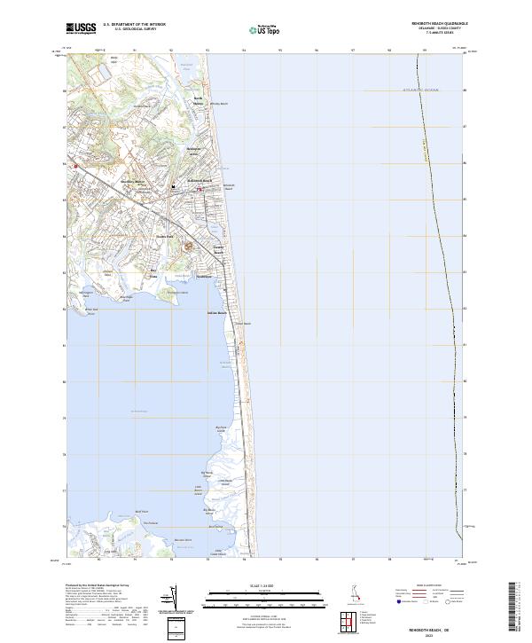 2023 Rehoboth Beach2023 Print · USGSThe Delaware shoreline at the start of the 2020s shows the dense coastal developments of Rehoboth Beach and Dewey Beach. Local historians can trace the inland waterways from Holland Glade to the marshes surrounding Big Bacon Island and Big Reedy Island.
 - 2023 Map of Seaford East, 2023 Print
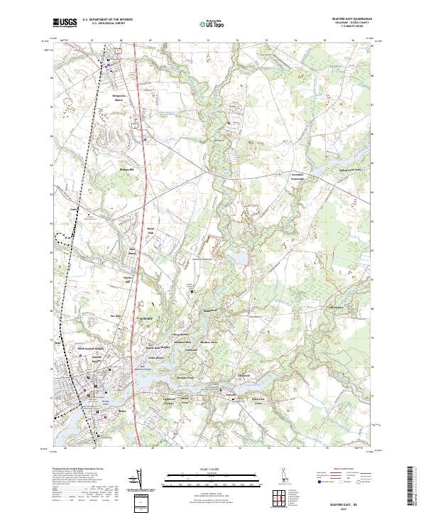 2023 Seaford East2023 Print · USGSSussex County life centers on the river and its historic industries in the twenty-first century. Family historians can trace local roots through Bridgeville Cem, Jackson Perkins Cem, and old industrial sites like Hearns Mill.
 - 2023 Map of Harrington, 2023 Print
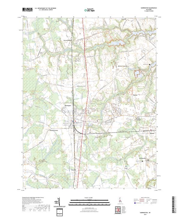 2023 Harrington2023 Print · USGSThe central Delmarva Peninsula comes into focus in this recent survey of the Kent and Sussex county lines. Genealogists and local researchers can trace family landmarks and rural intersections like Marvels Crossroads, Fleming Corners, and Griffiths Chapel Cem.
 - 2023 Map of Bethany Beach, 2023 Print
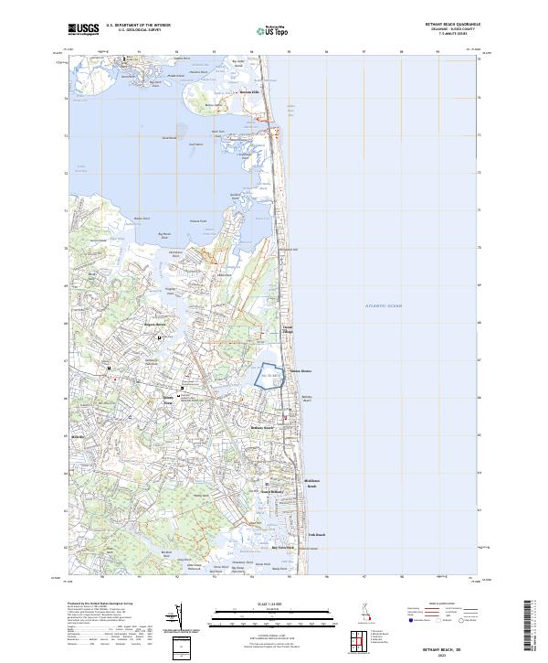 2023 Bethany Beach2023 Print · USGSCoastal Sussex County in the early twenty-first century reveals a landscape of growing beach communities and protected marshlands. Genealogists and researchers can trace local roots through the Mariners Bethel Church and several family burial grounds like the Burton Family Cemetery.
 - 2023 Map of Hickman, 2023 Print
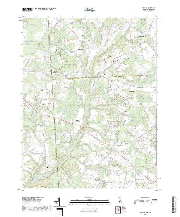 2023 Hickman2023 Print · USGSThe Delaware-Maryland borderlands come into focus in this contemporary survey of Kent and Sussex Counties. Genealogists and local historians can trace family roots through sites like Bethel Cem, the settlement at Andrewsville, and the uniquely named Hog Range.
 - 2023 Map of Fairmount, 2023 Print
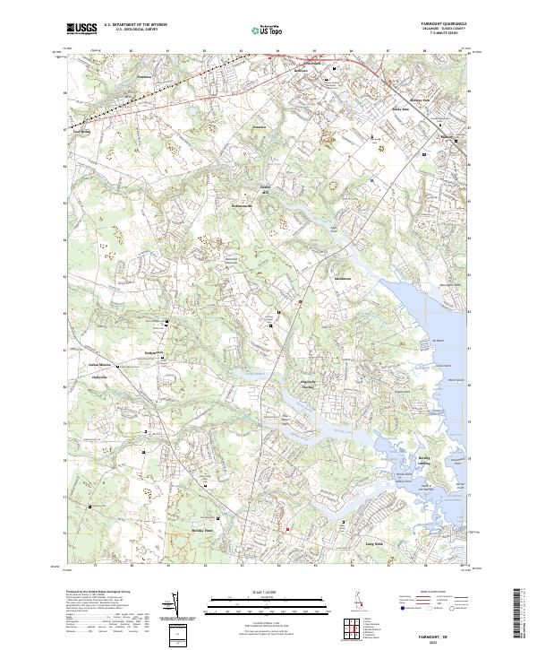 2023 Fairmount2023 Print · USGSCoastal Sussex County is shown here in the early 2020s, where traditional inland settlements meet the tidal marshes of Rehoboth Bay. Genealogists can locate family landmarks like Conley's Chapel Cem and the Henry Lingo Farm Cem amidst the reaches of Herring Creek.
 - 2023 Map of Mispillion River, 2023 Print
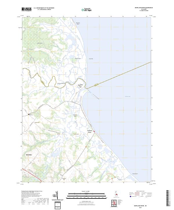 2023 Mispillion River2023 Print · USGSThe Delaware coastline at the Mispillion River comes to life in this detailed survey of its marshes and beaches. Researchers can trace land use through the Mispillion Light, Cedar Neck Cem, and small bayfront settlements like Slaughter Beach.
 - 2023 Map of Lewes, 2023 Print
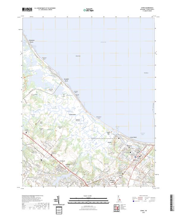 2023 Lewes2023 Print · USGSThe Delaware coast near the Delaware Bay is shown here as a complex puzzle of tidal marshes and historic maritime settlements. Researchers can trace family sites at Saint Peters Cem or explore the early waterfront footprints of Pilottown and Nassau.
 - 2023 Map of Cape Henlopen, 2023 Print
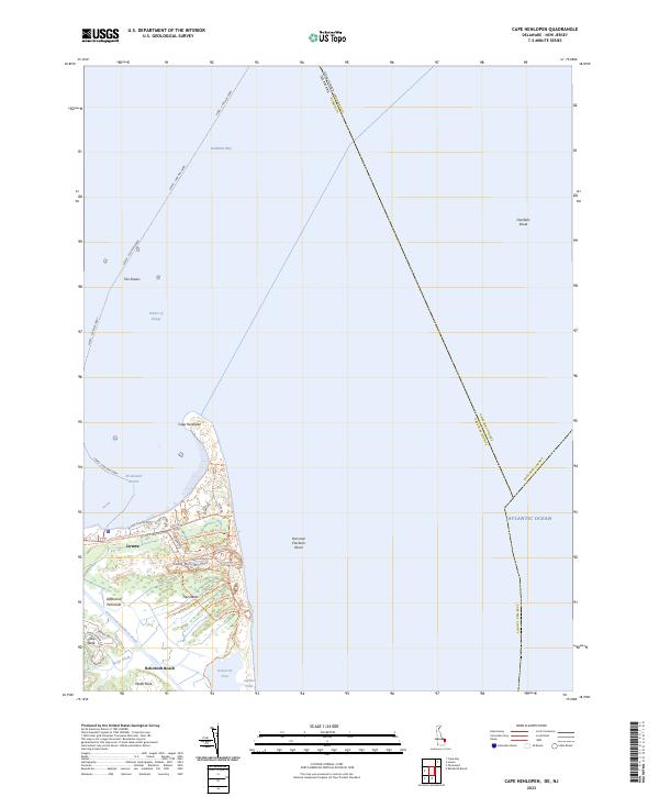 2023 Cape Henlopen2023 Print · USGSCoastal Sussex County is detailed in this recent survey of the Delaware shoreline where the bay meets the ocean. Researchers can trace modern conservation boundaries and maritime landmarks like Cape Henlopen State Park, The Shears, and the Lewes - Cape May Ferry.
 - 2023 Map of Sharptown, 2023 Print
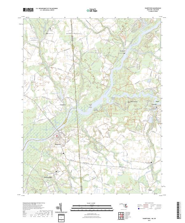 2023 Sharptown2023 Print · USGSThe Nanticoke River and its surrounding wetlands define this border region between Maryland and Delaware in the early twenty-first century. Researchers can trace the heritage of local communities at Santo Domingo, find family burial sites like Zion Methodist Cem, or locate historic water features such as Galestown Millpond.
 - 2023 Map of Delmar, 2023 Print
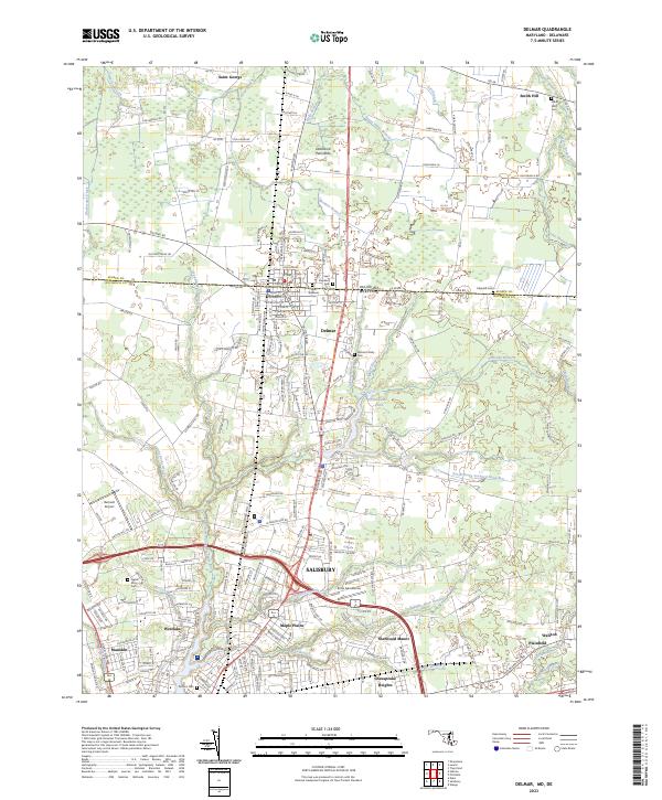 2023 Delmar2023 Print · USGSSituated on the border of Delaware and Maryland in recent years, this map details the unique shared geography of the Delmarva Peninsula. Local historians can trace family roots through Smith Mills Cem and Parsons Cem or explore the development around Salisbury and Delmar.
 - 2023 Map of Whaleyville, 2023 Print
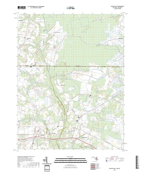 2023 Whaleyville2023 Print · USGSThe Maryland-Delaware borderlands near Whaleyville are shown here in modern detail, highlighting a landscape defined by the Cypress Swamp. Genealogists can locate family burial sites like the Twilley Family Cem and Littleton Family Cem or the historic Bethel Church.
 - 2023 Map of Pittsville, 2023 Print
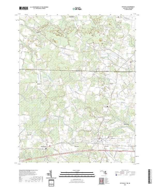 2023 Pittsville2023 Print · USGSCrossing the Maryland-Delaware state line in the early twenty-first century, this survey shows the rural landscape of Wicomico and Sussex counties. Researchers can locate many family burial grounds like Jones Cem and Melson Cem, or trace the winding course of Nassawango Creek.
Showing maps 1-25 of 27
Top cities of Sussex County
- Seaford historical maps
- Georgetown historical maps
- Laurel historical maps
- Lewes historical maps
- Millsboro historical maps
- Selbyville historical maps
See more
Frequently asked questions
- What are the different types of historical maps available for Sussex County?
- What is the oldest map of Sussex County?
- Where can I purchase historical maps of Sussex County for my home or office?
- Where can I download high-res historical maps of Sussex County?
- Are there historical topographic maps available for Sussex County?
- Is there historical aerial imagery available for Sussex County?
- Where are historical maps of Sussex County sourced from?