Old Maps of Dixie County, Florida for Hiking & Exploration
Hike through history with 141 historic maps of Dixie County. Explore old trails, ghost towns, and forgotten backroads — perfect for outdoor adventurers and local explorers.
- Rediscover forgotten places: Map out old mining camps, roads, and footpaths that no longer exist on modern maps.
- Layer with modern tools: Combine with LiDAR or satellite views to plan hikes through historical terrain.
- Made for exploration: Popular among hikers, overlanders, and local history lovers.
Use these maps to find adventure and explore the hidden past of Dixie County.
Dixie County, FL maps
(141)- 1954 Map of Steinhatchee SW, 1955 Print
 1954 Steinhatchee SW1955 Print · USGSThe Dixie County coastline in the mid-fifties remains a wilderness of tidal marshes and salt creeks along the Gulf of Mexico. Local historians and researchers can trace the natural shoreline from Hardy Point down to the Pepperfish Keys.5 unique versions available
 - 1954 Map of Cross City West, 1955 Print
 1954 Cross City West1955 Print · USGSDixie County at the start of the 1950s reveals a landscape defined by the timber industry and its expansive wetlands. Genealogists and local historians can trace the development of CROSS CITY, the community of Shamrock, and the rail infrastructure of the Atlantic Coast Line.3 unique versions available
 - 1954 Map of Eugene, 1955 Print
 1954 Eugene1955 Print · USGSCoastal Dixie County in the mid-fifties is defined by the deep reaches of California Swamp and the vital Atlantic Coast Line railroad. Genealogists and local historians can trace the rural landscape through Eugene, Long Pond Cem, and Prospect Ch.3 unique versions available
 - 1954 Map of Clara, 1955 Print
 1954 Clara1955 Print · USGSThe Florida Big Bend country in the mid-1950s is defined by its wild river systems and the reach of the Atlantic Coast Line railroad. Local historians can trace the small settlements of Clara and Tennille alongside landmarks like Steinhatchee Spring and Iron Spring.3 unique versions available
 - 1954 Map of Cross City East, 1955 Print
 1954 Cross City East1955 Print · USGSThe area around Cross City comes to life in the mid-1950s, showing a landscape defined by its wetlands and the Atlantic Coast Line railroad. You can trace the rural infrastructure from the Cross City Airport to local landmarks like Holly Hill Lookout Tower and Ocean Pond.3 unique versions available
 - 1954 Map of Mallory Swamp SW, 1955 Print
 1954 Mallory Swamp SW1955 Print · USGSThe Florida Big Bend interior remains a wild expanse in the mid-1950s, split by the boundary of Lafayette and Dixie Counties. Researchers can trace the primitive tracks and water systems through Mallory Swamp, Rawhide Bog, and Knife Hammock.3 unique versions available
 - 1954 Map of Jena, 1955 Print
 1954 Jena1955 Print · USGSThe coastal forest and wetlands of Dixie County are documented here in the mid-1950s as modern roads began to replace old timber routes. You can trace the Steinhatchee River boundary or locate family sites like Jena School, Mingos Cemetery, and the settlement of Jonesboro.3 unique versions available
 - 1954 Map of Steinhatchee, 1955 Print
 1954 Steinhatchee1955 Print · USGSThe Florida Gulf Coast near the Taylor and Dixie county line is shown here in the mid-1950s, centered on the riverfront at Steinhatchee. Local historians can trace old coastal access points like Dallus Creek Landing and the winding reaches of Pine Log Swamp.4 unique versions available
 - 1954 Map of Steinhatchee SE, 1955 Print
 1954 Steinhatchee SE1955 Print · USGSThe Dixie County coastline in the mid-1950s was a labyrinth of interconnected wetlands and bays just inland from the gulf. Researchers can trace the isolated Butler Cem and find the exact boundaries of Blue Lake Swamp and Tiger Bay.4 unique versions available
 - 1954 Map of Mallory Swamp SE, 1955 Print
 1954 Mallory Swamp SE1955 Print · USGSThe Florida Big Bend interior in the mid-fifties is a landscape of expansive wetlands and isolated outposts. Genealogists and researchers can locate remote sites like McElvain Camp, Cow Camp, and the Pleasant Grove Cem near Cemetery Lake.3 unique versions available
 - 1954 Map of Cross City SW, 1955 Print
 1954 Cross City SW1955 Print · USGSCoastal Dixie County in the mid-1950s was a landscape of dense wetlands and forest management infrastructure. You can trace the remnants of the Old Railroad Grade or locate local landmarks like Sandhill Cem and the Horseshoe Lookout Tower.4 unique versions available
 - 1954 Map of Horseshoe Beach, 1956 Print
 1954 Horseshoe Beach1956 Print · USGSThe Dixie County shoreline in the mid-1950s is centered around the growing coastal settlement of Horseshoe Beach. Researchers can trace the path of the Old Railroad Grade and locate coastal landmarks like Butler Island and the Pepperfish Keys.3 unique versions available
 - 1954 Map of Suwannee, 1956 Print
 1954 Suwannee1956 Print · USGSThe Suwannee River delta meets the Gulf of Mexico in the mid-1950s, revealing a landscape of tidal passes and timber history. Genealogists and historians can trace the Old Railroad Grade through the California Swamp and locate a Sunken Wreck near the settlement of Suwannee.4 unique versions available
 - 1954 Map of Manatee Springs, 1956 Print
 1954 Manatee Springs1956 Print · USGSThe Suwannee River forms the heart of this mid-1950s Florida survey, where the river-fed Manatee Springs meets the dense wetlands of Levy County. Local historians can trace riverside life at Lower Clay Landing and find family roots at Antioch Cem and Long Pond Ch.3 unique versions available
 - 1954 Map of Vista, 1956 Print
 1954 Vista1956 Print · USGSThe Suwannee River forms the heart of this Dixie County landscape in the mid-1950s. Trace the riverfront history of Fowler Bluff, locate the Keen Cem near the wetlands, or explore the expansive California Swamp and Otter Sink Camp.4 unique versions available
 - 1954 Map of East Pass, 1956 Print
 1954 East Pass1956 Print · USGSThe Suwannee River delta meets the Gulf of Mexico in the mid-1950s, revealing a pristine coastal wilderness of tidal creeks and marsh islands. Trace the intricate waterways of East Pass, the remote outpost at Fletcher Landing, and landmarks like Tiger Island and Lone Cabbage Reef.4 unique versions available
 - 1954 Map of Gainesville, 1965 Print
 1954 Gainesville1965 Print · USGSMid-century North Central Florida comes into focus as a landscape of timber, rails, and river towns along the Gulf. Trace family roots in established centers like Gainesville or follow the path of the Suwannee River to the coastal docks of Cedar Key.3 unique versions available
 - 1955 Map of Shired Island, 1956 Print
 1955 Shired Island1956 Print · USGSThe Dixie County coast in the mid-1950s was a remote expanse of tidal marsh and deep swamp. Researchers can trace the remnants of local industry along the Old Railroad Grade or explore the intricate waterways of California Swamp and Shired Creek.3 unique versions available
 - 1956 Map of Mallory Swamp SE
 1956 Mallory Swamp SE1956 Print · USGSThe Florida interior on the border of Dixie and Lafayette Counties was a landscape of dense wetlands and isolated outposts in the mid-1950s. Researchers can trace rural landmarks like McElvain Camp, Pleasant Grove Cem, and Deserters Hammock.
 - 1958 Map of Gainesville
 1958 Gainesville1958 Print · USGSNorth Central Florida’s rail and river networks are frozen in time just before the interstate era. Genealogists and historians can trace the paths of the Atlantic Coast Line through Gainesville or locate coastal settlements like Steinhatchee and Cedar Key.
 - 1959 Map of Gainesville
 1959 Gainesville1959 Print · USGSNorth Florida in the mid-fifties is seen here from the Gulf coast to the inland lakes, showing the rail-and-river network before modern highways dominated. Researchers can trace the paths of the Seaboard Air Line through towns like Chiefland and Micanopy, or explore the coastal inlets of Waccasassa Bay.
 - 1968 Map of Hatchbend, 1971 Print
 1968 Hatchbend1971 Print · USGSThe Suwannee River creates a winding tri-county border in this late 1960s snapshot of Florida's river country. Genealogists and local historians can locate several rural landmarks including Old Hatchbend Cem, McCalla Chapel, and Rock Bluff Landing.3 unique versions available
 - 1968 Map of Suwannee River, 1971 Print
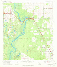 1968 Suwannee River1971 Print · USGSThe Florida river country comes alive in this survey of the tri-county borderlands during the late sixties. Genealogists and local historians can trace the foundations of Old Town and Fanning Springs, or locate rural landmarks like St Christophers Ch and the Old Town Cem.3 unique versions available
 - 1968 Map of Wannee, 1971 Print
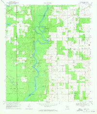 1968 Wannee1971 Print · USGSThe Suwannee River borderlands in the late sixties remain a landscape of river landings, quiet springs, and rural parishes. Researchers can locate family landmarks like McCrabb Church, trace old routes along the Jeep Trail, or find the sites of Wannee and Priscilla.4 unique versions available
 - 1978 Map of Ocala, 1980 Print
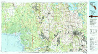 1978 Ocala1980 Print · USGSFlorida's interior heartland and Gulf coast are seen here in the late seventies, showing the transition from freshwater springs to coastal hammocks. Genealogists and historians can trace the Seaboard Coast Line Railroad through Chiefland, Bronson, and Dunnellon.2 unique versions available
Showing maps 1-25 of 141
Top cities of Dixie County
Frequently asked questions
- What are the different types of historical maps available for Dixie County?
- What is the oldest map of Dixie County?
- Where can I purchase historical maps of Dixie County for my home or office?
- Where can I download high-res historical maps of Dixie County?
- Are there historical topographic maps available for Dixie County?
- Is there historical aerial imagery available for Dixie County?
- Where are historical maps of Dixie County sourced from?