
1954 Map of Steinhatchee SE
USGS Topo · Published 1955About this map
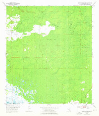
Butler Cem stands as a solitary cultural marker in the southeast corner of this coastal Florida landscape, which was meticulously surveyed in the mid-1950s. The terrain is defined by an extensive network of wetlands and seasonal drainages leading toward the Gulf of Mexico. Large, named swamp systems dominate the interior, including Rocky Creek Swamp, Blue Lake Swamp, and Bear Bay Swamp. These features illustrate the low-lying, hydrologically complex nature of Dixie County's coastline before significant modern development. The map details how the water-saturated land is segmented into various basins like Tiger Bay and Cedar Swamp, while Little Rock Swamp occupies the eastern boundary. This survey offers a clear view of the natural drainage patterns and the sparse human footprint in this wilderness area during the early post-war era.
Find a feature on this map
8 named features on this map. Tap any name to fly to it.
Don’t see what you’re looking for? This feature index may not catch every label — zoom into the map to look around manually.
Map Details
Editions of this 1954 Steinhatchee SE Map
4 editions found
Other maps of this area

1954 · Steinhatchee SW
USGS Topo · 1:24,000

1954 · Cross City West
USGS Topo · 1:24,000

1954 · Jena
USGS Topo · 1:24,000

1954 · Steinhatchee
USGS Topo · 1:24,000

1954 · Cross City SW
USGS Topo · 1:24,000

1954 · Horseshoe Beach
USGS Topo · 1:24,000

1954 · Gainesville
USGS Topo · 1:250,000

1955 · Shired Island
USGS Topo · 1:24,000

1958 · Gainesville
USGS Topo · 1:250,000

1959 · Gainesville
USGS Topo · 1:250,000