2020s Maps of Tampa, Florida
Explore 18 historic maps of Tampa from the 2020s. These maps offer a rare glimpse into what life looked like during the 2020s — showing old roads, neighborhoods, homes, and landmarks that have changed or disappeared over time.
Whether you're researching your family's past, planning a metal detecting trip, or studying how Tampa's landscape evolved across the 2020s, these high-resolution maps are a powerful tool for exploring the history of this region.
- Focus on a specific era: All maps on this page are from the 2020s, giving you a focused view of this time period.
- See what’s changed: Compare century-old streets, trails, and buildings to today's modern landscape using overlays and satellite layers.
- Research with precision: Use these maps for genealogy, historical research, land use analysis, or educational projects.
- View, download, or print: Maps are fully viewable online in high resolution, and can be downloaded or printed for your own records.
Start exploring Tampa's history through authentic maps from the 2020s. This is your window into the past.
Tampa, FL maps
(18)- 2021 Map of Brandon, 2021 Print
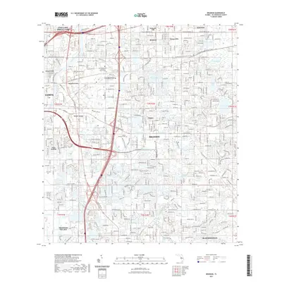 2021 Brandon2021 Print · USGSCovers Tampa, including Brandon, Mango, and other nearby areas
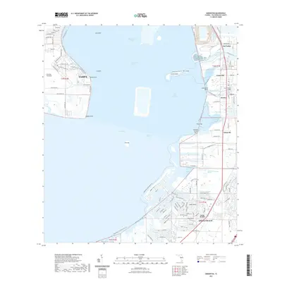
 - 2021 Map of Port Tampa, 2021 Print
 2021 Port Tampa2021 Print · USGSCovers Tampa, including Saint Petersburg, Crescent Park, and other nearby areas
 - 2021 Map of Gibsonton, 2021 Print
 2021 Gibsonton2021 Print · USGSCovers Tampa, including Apollo Key Village, Andalucia, and other nearby areas
 - 2021 Map of Lutz, 2021 Print
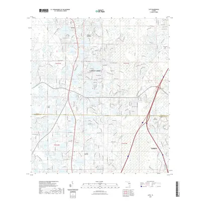 2021 Lutz2021 Print · USGSCovers Tampa, including Lutz, Dupree Gardens, and other nearby areas
 - 2021 Map of Gandy Bridge, 2021 Print
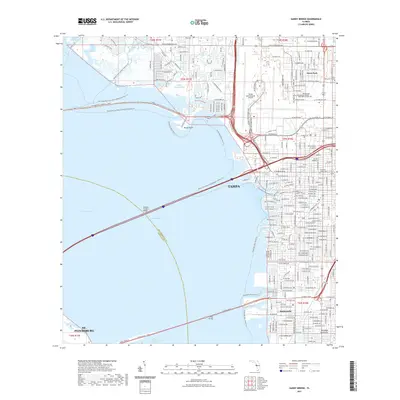 2021 Gandy Bridge2021 Print · USGSCovers Tampa, including Saint Petersburg, Feather Sound, and other nearby areas
 - 2021 Map of Tampa, 2021 Print
 2021 Tampa2021 Print · USGSCovers Tampa, including Boran, East Bay Farms, and other nearby areas
 - 2021 Map of Sulphur Springs, 2021 Print
 2021 Sulphur Springs2021 Print · USGSCovers Tampa, including Temple Terrace, Lutz, and other nearby areas
 - 2021 Map of Wesley Chapel, 2021 Print
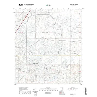 2021 Wesley Chapel2021 Print · USGSCovers Tampa, including Pebble Creek, Club Manor East of Grand Hampton, and other nearby areas
 - 2021 Map of Thonotosassa, 2021 Print
 2021 Thonotosassa2021 Print · USGSCovers Tampa, including Breckenridge Park, Andrews, and other nearby areas
 - 2024 Map of Brandon, 2024 Print
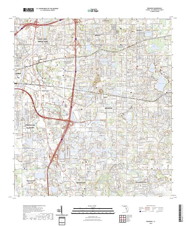 2024 Brandon2024 Print · USGSHillsborough County's suburban expansion is on full display in this modern survey of the corridor between Tampa and the Alafia River. Researchers can locate important local burial sites like Limona Cem and Hackney Cem or trace waterways including Sixmile Creek and Buckhorn Spring.
 - 2024 Map of Gandy Bridge, 2024 Print
 2024 Gandy Bridge2024 Print · USGSTampa and its western bayfront are captured in this contemporary look at the city’s industrial and residential expansion toward the bay. Researchers can trace local history through markers like Hopewell Church Cemetery and the settlement of Rattlesnake.
 - 2024 Map of Port Tampa, 2024 Print
 2024 Port Tampa2024 Print · USGSThe northern reaches of the bay area come alive in this survey of the Interbay Peninsula and St. Petersburg waterfront. Researchers can trace modern coastal development from MacDill Air Force Base to the residential canals of Venetian Isles.
 - 2024 Map of Gibsonton, 2024 Print
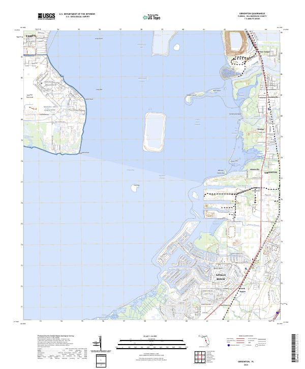 2024 Gibsonton2024 Print · USGSCoastal Hillsborough County and the eastern edge of the Interbay Peninsula appear here in the early twenty-first century. Researchers can trace the layout of MacDill Air Force Base and locate smaller settlements like Remlap, Adamsville, and Gardenville.
 - 2024 Map of Tampa, 2024 Print
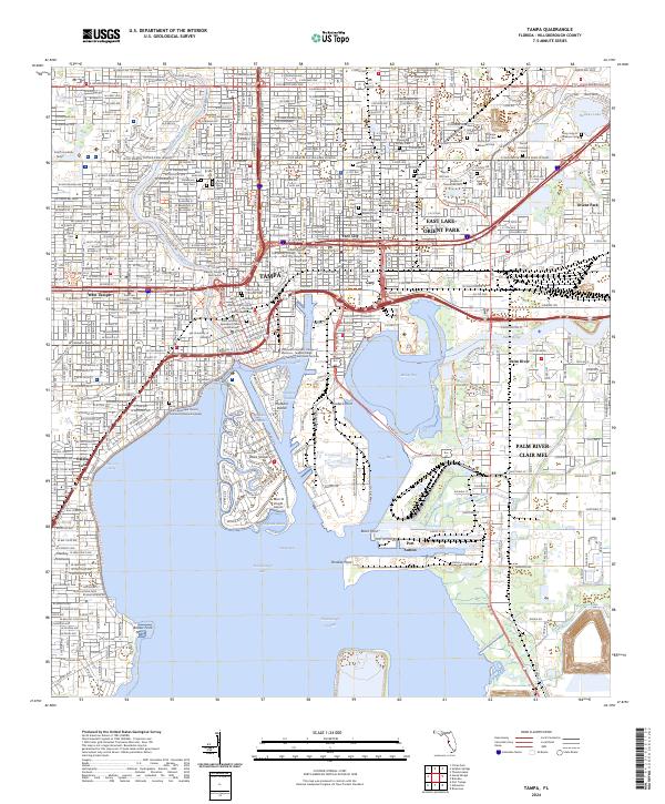 2024 Tampa2024 Print · USGSTampa and its surrounding bay communities are shown in fine detail during this contemporary era of urban density and maritime commerce. Genealogists can locate historic burial sites like Oaklawn Cem and Myrtle Hill Memorial Park, while researchers can trace the industrial shorelines of Hookers Point.
 - 2024 Map of Lutz, 2024 Print
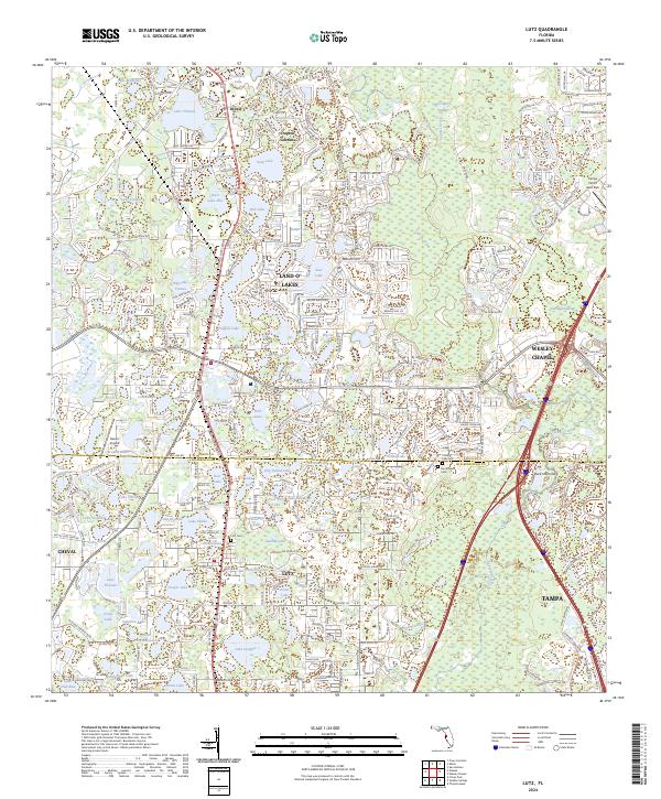 2024 Lutz2024 Print · USGSFlorida's lake country at the Pasco and Hillsborough border shows a landscape where water and modern growth meet. Trace the development of Lutz and Wesley Chapel alongside local landmarks like Dupree Gardens and the Lutz Cem.
 - 2024 Map of Thonotosassa, 2024 Print
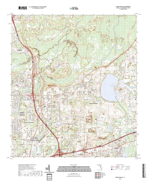 2024 Thonotosassa2024 Print · USGSHillsborough County's suburban and natural edges meet in the early twenty-first century as development surrounds the waters of Lake Thonotosassa. Trace local history through sites like Antioch Cem, the Old Fort King Trl, and the rural community of Clarkwild.
 - 2024 Map of Wesley Chapel, 2024 Print
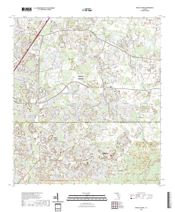 2024 Wesley Chapel2024 Print · USGSThe northern edge of the Tampa metropolitan area is captured here during its modern phase of development and suburban growth. Researchers can trace the waterways of the Hillsborough River and New River alongside major thoroughfares like Bruce B Downs Blvd and the community of Wesley Chapel.
 - 2024 Map of Sulphur Springs, 2024 Print
 2024 Sulphur Springs2024 Print · USGSThe North Tampa corridor is captured here in the mid-2020s, showing a densely populated landscape intertwined with numerous lakes and the Hillsborough River. Genealogists and local historians can locate several memorial sites including Robles Cem and Forest Hills Presbyterian Memorial Gardens.
End of results
Showing maps 1-18 of 18
Top cities near Tampa
- Saint Petersburg historical maps
- Brandon historical maps
- Riverview historical maps
- Temple Terrace historical maps
- Lutz historical maps
- Feather Sound historical maps
Top neighborhoods of Tampa
- Arlington Heights historical maps
- Alameda historical maps
- Arlington Heights West historical maps
- Alice Heights historical maps
- Allerton Park historical maps
- Armenia Gardens historical maps
See more
Frequently asked questions
- What are the different types of historical maps available for Tampa?
- What is the oldest map of Tampa?
- Where can I purchase historical maps of Tampa for my home or office?
- Where can I download high-res historical maps of Tampa?
- Are there historical topographic maps available for Tampa?
- Is there historical aerial imagery available for Tampa?
- Where are historical maps of Tampa sourced from?