Old Maps of Bradenton, Florida for Metal Detecting
Plan your next treasure hunt with 53 historic maps of Bradenton. Find old homesites, ghost towns, trails, and gathering spots that may be lost to time — perfect for identifying promising metal detecting locations.
- Locate forgotten sites: Uncover places like long-lost settlements, abandoned rail lines, or gathering spots.
- Plan better hunts: Use map overlays combined with LiDAR or satellite views to narrow in on historically rich areas.
- Made for detectorists: Thousands of hobbyists use these maps to discover relics, coins, and hidden history.
Use these historic maps to boost your research and find new opportunities beneath the surface of Bradenton.
Bradenton, FL maps
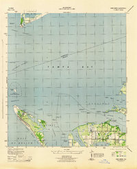
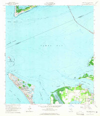
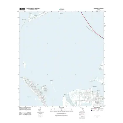
(53)- 1921 Map of Fort De Soto
 1921 Fort De Soto1921 Print · USGSThe Florida coast at the start of the twenties reveals a landscape of isolated military outposts and emerging rail towns along the Gulf. Genealogists and historians can trace early families in Bradentown, locate the U.S. Quarantine Station, and follow the Seaboard Air Line tracks.2 unique versions available
 - 1944 Map of Anna Maria
 1944 Anna Maria1944 Print · USGSCoastal Manatee County is captured during the mid-forties, showing the early layout of Anna Maria and the mainland groves of Palma Sola. Trace the old shoreline landmarks from the Municipal Pier to the ancient Portavant Mound and the isolated Passage Key.2 unique versions available
 - 1944 Map of Lorraine
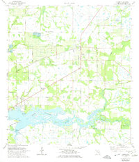
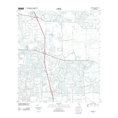
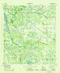 1944 Lorraine1944 Print · USGSManatee County was a patchwork of wetlands and early settlements during the mid-forties, revealing the landscape before modern suburban expansion. You can trace the historic Old RR Grade, locate the Braden River Cem, and follow the original paths of Rye Grade and Arcadia Road.2 unique versions available
 - 1944 Map of Ellenton
 1944 Ellenton1944 Print · USGSThe Manatee River coastline and Tampa Bay wetlands appear here during the mid-1940s, showing the early footprints of coastal Florida towns. Trace historical rail lines and settlements like Ellenton and Rubonia, or find the clay deposits at Fullers Earth.2 unique versions available
 - 1944 Map of Parish
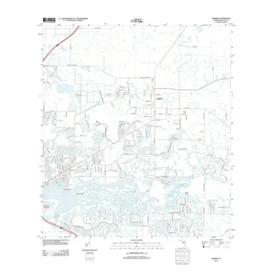
 1944 Parish1944 Print · USGSManatee County was a landscape of railroads and river bends during the mid-1940s, centered on the growing community of Parish. Researchers can trace old precincts, rural churches like New Bethel Church, and historic river landmarks including Fort Hamer.2 unique versions available
 - 1944 Map of Bradenton Beach
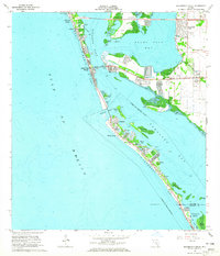
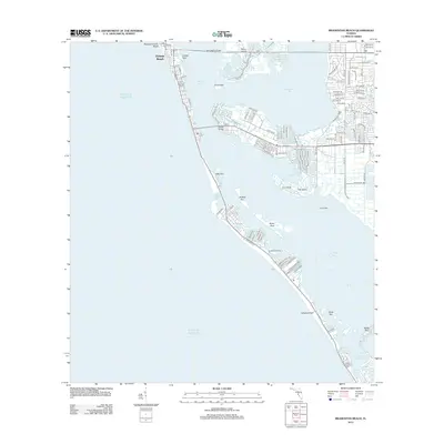
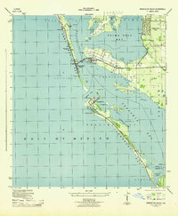 1944 Bradenton Beach1944 Print · USGSThe Florida Gulf Coast appears here during the mid-forties, showing the early settlement of the barrier islands and wartime infrastructure. Genealogists and coastal historians can trace the footprints of Bradenton Beach, Longbeach, and the Army Firing Range.2 unique versions available
 - 1947 Map of Bradenton
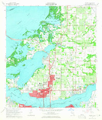
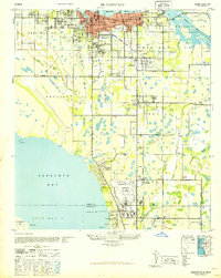 1947 Bradenton1947 Print · USGSCoastal Florida is shown in transition during the late 1940s, from the city streets of Bradenton to the large military installation at the Sarasota US Army Air Base. Researchers can trace the early layout of Whitfield Estates, locate the Manasota Cem, or find the original Prospect School site.
 - 1956 Map of Tampa, 1964 Print
 1956 Tampa1964 Print · USGSThe Florida Gulf Coast thrived in the mid-fifties, from the bustling docks of Tampa to the quiet shores of Sanibel. Genealogists and historians can trace old rail lines like the Atlantic Coast Line or find early layouts of Port Charlotte and Bokeelia.2 unique versions available
 - 1959 Map of Tampa
 1959 Tampa1959 Print · USGSThe Florida Gulf Coast appears in this late fifties survey during a period of steady coastal growth and established rail commerce. Researchers can trace historic neighborhoods and transit lines from Tampa to St Petersburg, or locate landmarks like Mac Dill AFB and Boca Grande.
 - 1960 Map of Tampa
 1960 Tampa1960 Print · USGSThe Florida Gulf Coast was undergoing a major transformation at the start of the sixties, with new bridges linking burgeoning cities across the bays. Researchers can trace the mid-century footprints of St Petersburg and Tampa, or locate coastal landmarks like Mac Dill AFB and the Sunshine Skyway.2 unique versions available
 - 1964 Map of Palmetto, 1965 Print
 1964 Palmetto1965 Print · USGSPalmetto and the shores of Tampa Bay are captured here in the mid-sixties as post-war growth transformed the Manatee County coast. Genealogists and researchers can trace local landmarks like Lincoln Memorial Sch, the Madira Bickel Mound, and the old Atlantic Coast Line Railroad corridors.5 unique versions available
 - 1964 Map of Bradenton Beach, 1965 Print
 1964 Bradenton Beach1965 Print · USGSThe Florida Gulf Coast appears in the mid-sixties as a landscape of evolving barrier island communities and intricate waterways. Trace the development of Bradenton Beach and Longbeach, or locate landmarks like St Bernards Ch and the Cortez Bridge.5 unique versions available
 - 1964 Map of Anna Maria, 1965 Print
 1964 Anna Maria1965 Print · USGSAnna Maria and the Manatee River shoreline are caught here in the mid-1960s, showing a mix of growing coastal settlements and preserved archaeological sites. Genealogists and historians can locate the Palma Sola Cem, Portavant Indian Mound, and the old Palma Sola Airport.3 unique versions available
 - 1964 Map of Bradenton, 1966 Print
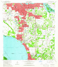 1964 Bradenton1966 Print · USGSBradenton and the Sarasota Bay shoreline are shown here during a mid-century period of rapid coastal growth. Genealogists and local historians can locate early landmarks like Braden Castle, Manatee Jr College, and Oneco.4 unique versions available
 - 1972 Map of Tampa, 1974 Print
 1972 Tampa1974 Print · USGSThe Florida Gulf Coast appears in a period of significant growth during the early seventies, from the urban centers of the bay to the quiet southern keys. Researchers can trace the expansion of St Petersburg or locate family sites near Safety Harbor, Valrico, and Boca Ciega.
 - 1973 Map of Parrish, 1974 Print
 1973 Parrish1974 Print · USGSManatee County in the early seventies shows a landscape of riverfront camps and railroad junctions. Genealogists and local historians can trace the foundations of Parrish near St Marys Ch, the Fortner Cem, and the historic Fort Hamer Boat Ramp.3 unique versions available
 - 1973 Map of Lorraine, 1975 Print
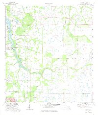 1973 Lorraine1975 Print · USGSThe Braden River watershed in the early 1970s reveals a Florida landscape of cypress strands and winding sloughs before major suburban expansion. Genealogists and local historians can locate the Braden River Cemetery, the settlement of Lorraine, and the Old Railroad Grade.3 unique versions available
 - 1979 Map of Sarasota, 1980 Print
 1979 Sarasota1980 Print · USGSCoastal Florida in the late seventies reveals the rapid growth of the Gulf shoreline from Bradenton down to Port Charlotte. Trace the expansion of coastal communities like Bayshore Gardens, find long-standing landmarks like Trailer Estates, or explore the vast preserve of Myakka River State Park.
 - 1981 Map of St Petersburg, 1983 Print
 1981 St Petersburg1983 Print · USGSThe Tampa Bay region is shown here in the early eighties as the urban centers of St Petersburg and Tampa expanded along the coastline. Genealogists and historians can trace rail lines like the Seaboard Coast Line and landmarks from Mac Dill Air Force Base to the Sunshine Skyway.
 - 1988 Map of St Petersburg
 1988 St Petersburg1988 Print · USGSThe Florida Gulf Coast reached a peak of late-twentieth-century development as seen in this late-1980s look at the growing corridor from St Petersburg to Port Charlotte. Researchers can trace the expansion of coastal infrastructure, including MacDill Air Force Base, the Seaboard System RR, and regional parks like Fort De Soto Park.
 - 1994 Map of Bradenton, 2000 Print
 1994 Bradenton2000 Print · USGSCoastal Manatee County at the end of the twentieth century shows a landscape of rapid suburban growth between the rivers and the bay. Researchers can find long-standing community landmarks like Braden Castle, Trailer Estates, and the Ringling Museum of Art.
 - 2012 Map of Anna Maria, 2012 Print
 2012 Anna Maria2012 Print · USGSCovers Bradenton, including Holmes Beach, Anna Maria island, and other nearby areas
 - 2012 Map of Lorraine, 2012 Print
 2012 Lorraine2012 Print · USGSCovers Bradenton, including Lorraine, Arbor Grande, and other nearby areas
 - 2012 Map of Bradenton Beach, 2012 Print
 2012 Bradenton Beach2012 Print · USGSCovers Bradenton, including Longboat Key, Holmes Beach, and other nearby areas
 - 2012 Map of Parrish, 2012 Print
 2012 Parrish2012 Print · USGSCovers Bradenton, including Fort Hamer, Erie, and other nearby areas
Showing maps 1-25 of 53
Top cities near Bradenton
- Saint Petersburg historical maps
- Sarasota historical maps
- Palmetto historical maps
- Saint Pete Beach historical maps
- Longboat Key historical maps
- Siesta Key historical maps
See more
Top neighborhoods of Bradenton
Frequently asked questions
- What are the different types of historical maps available for Bradenton?
- What is the oldest map of Bradenton?
- Where can I purchase historical maps of Bradenton for my home or office?
- Where can I download high-res historical maps of Bradenton?
- Are there historical topographic maps available for Bradenton?
- Is there historical aerial imagery available for Bradenton?
- Where are historical maps of Bradenton sourced from?