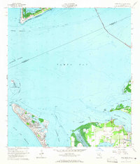
1964 Map of Anna Maria
USGS Topo · Published 1965About this map
Anna Maria and Holmes Beach anchor the barrier island landscape of the mid-1960s, a period of transition for this coastal stretch of the Gulf. Extensive hydrographic data highlights the intricate channels and shoals surrounding Mullet Key and Passage Key, where the Passage Key National Wildlife Refuge preserves the natural island state. The map details the early footprints of development near Palma Sola, including the Palma Sola Airport and a small landing strip, alongside long-standing local landmarks like the Palma Sola Cem.
Find a feature on this map
45 named features on this map. Tap any name to fly to it.
Don’t see what you’re looking for? This feature index may not catch every label — zoom into the map to look around manually.
Map Details
Editions of this 1964 Anna Maria Map
3 editions found
Other maps of this area

1921 · Fort De Soto
USGS Topo · 1:62,500

1942 · Cockroach Bay
USGS Topo · 1:31,680

1943 · Pass-A-Grille
USGS Topo · 1:31,680

1944 · Egmont Key
USGS Topo · 1:31,680

1944 · Anna Maria
USGS Topo · 1:31,680

1944 · Ellenton
USGS Topo · 1:31,680

1944 · Bradenton Beach
USGS Topo · 1:31,680

1945 · Cockroach Bay
USGS Topo · 1:31,680
1947 · Cockroach Bay
USGS Topo · 1:25,000

1947 · Bradenton
USGS Topo · 1:24,000