2020s Maps of Davenport, Florida
Explore 4 historic maps of Davenport from the 2020s. These maps offer a rare glimpse into what life looked like during the 2020s — showing old roads, neighborhoods, homes, and landmarks that have changed or disappeared over time.
Whether you're researching your family's past, planning a metal detecting trip, or studying how Davenport's landscape evolved across the 2020s, these high-resolution maps are a powerful tool for exploring the history of this region.
- Focus on a specific era: All maps on this page are from the 2020s, giving you a focused view of this time period.
- See what’s changed: Compare century-old streets, trails, and buildings to today's modern landscape using overlays and satellite layers.
- Research with precision: Use these maps for genealogy, historical research, land use analysis, or educational projects.
- View, download, or print: Maps are fully viewable online in high resolution, and can be downloaded or printed for your own records.
Start exploring Davenport's history through authentic maps from the 2020s. This is your window into the past.
Davenport, FL maps
(4)- 2021 Map of Davenport, 2021 Print
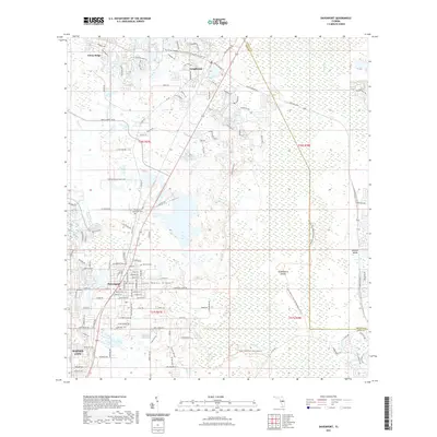 2021 Davenport2021 Print · USGSCovers Davenport, including Loughman, Polk County, and other nearby areas
 - 2021 Map of Gum Lake, 2021 Print
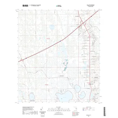 2021 Gum Lake2021 Print · USGSCovers Davenport, including Lake Alfred, Holiday Manor, and other nearby areas
 - 2024 Map of Davenport, 2024 Print
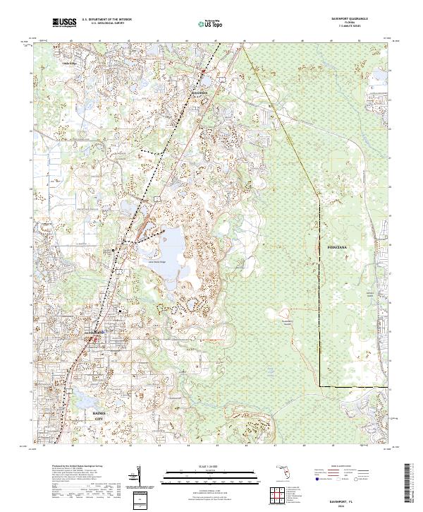 2024 Davenport2024 Print · USGSDavenport and the surrounding Central Florida ridge country are shown at a peak of modern residential expansion. Researchers can trace the development of suburban neighborhoods and find local burial sites like Davenport Evergreen Cem and Ret Row Cem.
 - 2024 Map of Gum Lake, 2024 Print
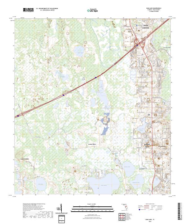 2024 Gum Lake2024 Print · USGSPolk County at the start of the 2020s shows a landscape defined by the expansive Green Swamp and growing urban centers. Researchers can trace the development of residential corridors near Haines City and the numerous shorelines of Lake Lowery and Gum Lake.
End of results
Showing maps 1-4 of 4
Top cities near Davenport
- Orlando historical maps
- Poinciana historical maps
- Kissimmee historical maps
- Kissimmee historical maps
- Kissimmee historical maps
- Kissimmee historical maps
See more
Frequently asked questions
- What are the different types of historical maps available for Davenport?
- What is the oldest map of Davenport?
- Where can I purchase historical maps of Davenport for my home or office?
- Where can I download high-res historical maps of Davenport?
- Are there historical topographic maps available for Davenport?
- Is there historical aerial imagery available for Davenport?
- Where are historical maps of Davenport sourced from?