2024 Map of Davenport
USGS Topo · Published 2024About this map
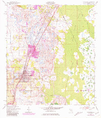
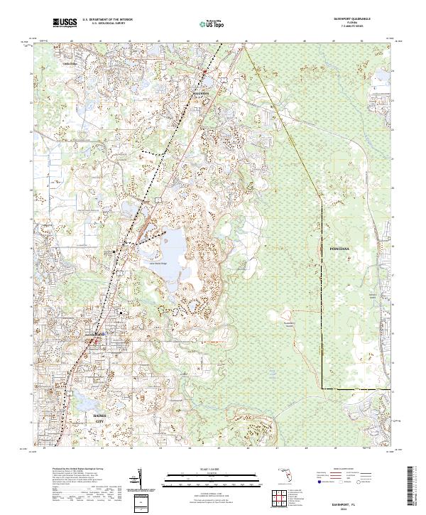
Davenport and the surrounding Citrus Ridge landscape exhibit a dense network of suburban development intertwined with critical Florida conservation areas. This modern survey shows the expansion of residential communities like Poinciana and Loughman alongside the protected corridor of the Lake Wales Ridge National Wildlife Refuge. The map provides a clear look at local landmarks for genealogists and researchers, including the Davenport Evergreen Cem and the Ret Row Cem near the heart of town.
Find a feature on this map
91 named features on this map. Tap any name to fly to it.
Don’t see what you’re looking for? This feature index may not catch every label — zoom into the map to look around manually.
Map Details
Editions of this 2024 Davenport Map
This is the sole edition of this map. No revisions or reprints were ever made.