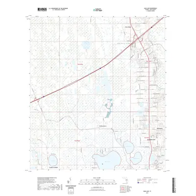
2021 Map of Gum Lake
USGS Topo · Published 2021About this map
Lake Wales Ridge dominates the eastern elevation of this landscape, rising above the lowlands of the Green Swamp to the west. This 2021 survey reveals a complex mosaic of aquatic features, from the large expanse of Lake Lowery and Gum Lake to smaller basins like Lost Lake and Duck Pond. The settlement pattern follows the higher ground along the ridge, where Haines City and Davenport exhibit dense residential and commercial expansion. In contrast, the western half of the map remains defined by hydrologic features such as Lake Mattie Marsh and Tangerine Lake. Transportation infrastructure is heavily influenced by the terrain, with names like Holly Hill Fruit Rd and Holly Hill Grove 1 Rd reflecting the area's agricultural legacy. Aviation history is noted at Gore Airport, while newer communities like Citrus Ridge and Holiday Manor mark the continuing residential growth of central Florida.
Find a feature on this map
102 named features on this map. Tap any name to fly to it.
Don’t see what you’re looking for? This feature index may not catch every label — zoom into the map to look around manually.
Map Details
Editions of this 2021 Gum Lake Map
This is the sole edition of this map. No revisions or reprints were ever made.
Other maps of this area

1944 · Polk City
USGS Topo · 1:31,680

1944 · Auburndale
USGS Topo · 1:31,680

1953 · Dundee
USGS Topo · 1:24,000

1953 · Intercession City
USGS Topo · 1:24,000

1953 · Davenport
USGS Topo · 1:24,000

1955 · Orlando
USGS Topo · 1:250,000

1957 · Orlando
USGS Topo · 1:250,000

1958 · Orlando
USGS Topo · 1:250,000

1959 · Gum Lake
USGS Topo · 1:24,000

1959 · Lake Louisa SW
USGS Topo · 1:24,000