Old Maps of Conyers, Georgia for Metal Detecting
Plan your next treasure hunt with 36 historic maps of Conyers. Find old homesites, ghost towns, trails, and gathering spots that may be lost to time — perfect for identifying promising metal detecting locations.
- Locate forgotten sites: Uncover places like long-lost settlements, abandoned rail lines, or gathering spots.
- Plan better hunts: Use map overlays combined with LiDAR or satellite views to narrow in on historically rich areas.
- Made for detectorists: Thousands of hobbyists use these maps to discover relics, coins, and hidden history.
Use these historic maps to boost your research and find new opportunities beneath the surface of Conyers.
Conyers, GA maps
(36)- 1888 Map of Atlanta, 1955 Print
 1888 Atlanta1955 Print · USGSAtlanta and its surrounding counties emerge as a booming rail hub in the years following the Civil War. Trace early settlements and infrastructure like Jett Ferry, Oakley Mill, and the massive granite profile of Stone Mountain before the era of modern sprawl.
 - 1890 Map of Atlanta
 1890 Atlanta1890 Print · USGSGeorgia's rail and river networks converge in the late nineteenth century as the capital city expands. Genealogists can trace family homesteads near Jetts Store, Howells Mills, and the various river crossings like Paces Ferry.
 - 1892 Map of Atlanta
 1892 Atlanta1892 Print · USGSAtlanta and its surrounding counties appear at a pivotal moment of post-war growth as the region's rail network reached maturity. Genealogists and historians can trace the foundations of modern DeKalb and Fulton counties through landmarks like Stone Mountain, Roswell Junction, and Paces Ferry.
 - 1895 Map of Atlanta
 1895 Atlanta1895 Print · USGSThe growing railroad hub of Atlanta is shown here in the late nineteenth century alongside its surrounding river ferries and emerging suburbs. Trace old family names and sites like Howell Mills, Vining Station, and Ft. McPherson.7 unique versions available
 - 1896 Map of Monroe
 1896 Monroe1896 Print · USGSNorth-central Georgia thrives during the late nineteenth century as a hub of river-powered industry and rail expansion. Genealogists and historians can trace family locations near Salem Camp Ground, the local commerce at Carithers Store, and several early crossings like Bells Bridge.5 unique versions available
 - 1953 Map of Atlanta, 1965 Print
 1953 Atlanta1965 Print · USGSThe growing Atlanta metro and the industrial corridors of Eastern Alabama are captured here during the mid-century transition. Researchers can trace the rail-to-road shift through hubs like Anniston and La Grange or locate sites within Fort McClellan.2 unique versions available
 - 1953 Map of Athens, 1966 Print
 1953 Athens1966 Print · USGSGeorgia's Piedmont and Savannah River borderlands come alive in this mid-century survey of the region surrounding Athens and Augusta. Trace the rail-and-river economy through the Georgia RR and landmarks like the Fort Gordon Military Reservation.3 unique versions available
 - 1956 Map of Conyers, 1957 Print
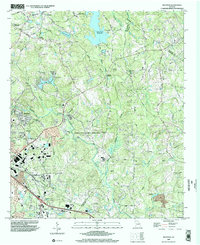
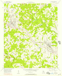 1956 Conyers1957 Print · USGSThe rail-and-quarry landscape of DeKalb and Rockdale counties comes alive in the mid-fifties, before the heavy suburban expansion of later decades. Genealogists and local historians can trace family locations through numerous landmarks like Bruce Sch, Eastview Cem, and Whites Chapel.5 unique versions available
 - 1957 Map of Atlanta
 1957 Atlanta1957 Print · USGSAtlanta and the Alabama borderlands appear here in the mid-fifties, capturing the region's post-war suburban and industrial transition. Trace the development of early transport hubs and military sites like Fort McPherson, Anniston, and the Kennesaw Mountain National Battlefield Park.
 - 1958 Map of Athens
 1958 Athens1958 Print · USGSNorth-central Georgia and the Savannah River valley are captured in the late fifties, showing the region as the new reservoirs were filling. Researchers can trace historic rail lines like the Georgia RR and locate rural landmarks such as Social Circle, Graves Mountain, and the Fort Gordon Military Reservation.
 - 1958 Map of Atlanta
 1958 Atlanta1958 Print · USGSMid-century Georgia and Alabama are shown in this regional study of the corridor between the Chattahoochee River and the Appalachian foothills. Local historians can trace the development of suburban Atlanta alongside vital landmarks like Stone Mountain, Dobbins AFB, and the Seaboard Air Line rail routes.
 - 1959 Map of Athens
 1959 Athens1959 Print · USGSNortheast Georgia and the South Carolina borderlands appear here in the mid-fifties, during a decade of infrastructure growth. Genealogists and historians can trace the rail-and-river geography of towns like Social Circle, the sprawl of Fort Gordon Military Reservation, and the newly formed Clark Hill Reservoir.
 - 1963 Map of Athens
 1963 Athens1963 Print · USGSGeorgia's Piedmont and the Savannah River valley are captured in the early sixties as major reservoirs and military installations reshaped the landscape. Researchers can trace the development of Clark Hill Reservoir, locate the Fort Gordon Military Reservation, and find historic towns like Social Circle and Eatonton.
 - 1964 Map of Kelleytown, 1966 Print
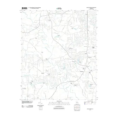
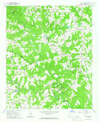 1964 Kelleytown1966 Print · USGSRockdale and Henry counties appear in the mid-1960s as a landscape of rural family farms and quiet crossroads. Researchers can locate legacy family sites and landmarks including Kelleytown, the Monastery of the Holy Ghost, and the Whitaker Cem.3 unique versions available
 - 1964 Map of Milstead, 1966 Print
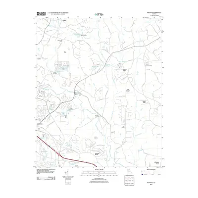
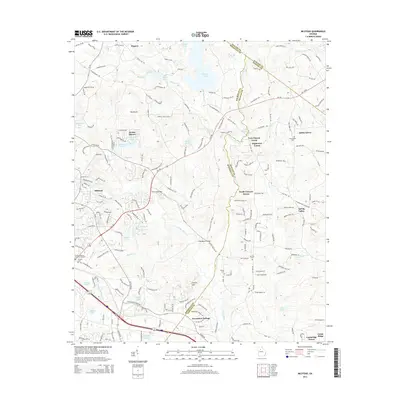
 1964 Milstead1966 Print · USGSThe Yellow River valley of northern Georgia is shown in the mid-1960s, a period when rural church communities and historic mill sites still defined the landscape. Genealogists and historians can trace family locations near Milstead, Philadelphia Ch, and Costley Millpond.4 unique versions available
 - 1980 Map of Athens, 1981 Print
 1980 Athens1981 Print · USGSNorth Georgia in the early eighties exhibits a landscape of growing university towns and deep-rooted rail hubs. Genealogists can trace family lands near Social Circle or Watkinsville while following the routes of the Central of Georgia and the Appalachee River.2 unique versions available
 - 1981 Map of Atlanta, 1982 Print
 1981 Atlanta1982 Print · USGSThe Atlanta metro area is shown during its late-century boom, following the completion of the beltway and the rise of its major international airport. Trace the growth of suburbs from Mableton to Tucker and the footprints of Fort McPherson and Stone Mtn.
 - 1988 Map of Athens
 1988 Athens1988 Print · USGSThe Georgia Piedmont and South Carolina borderlands appear in the late eighties as a landscape of vast reservoirs and growing towns. Researchers can trace the legacy of the Georgia RR connecting Athens and Augusta, or locate landmarks within Oconee National Forest.
 - 1993 Map of Milstead, 2000 Print
 1993 Milstead2000 Print · USGSRockdale and Newton counties are captured here in the early nineties, showing a landscape of river valleys and rural crossroads. Genealogists and historians can trace old community sites like Zingara and Almon, or locate family landmarks such as Philadelphia Ch and Deals Millpond.
 - 1999 Map of Milstead, 2002 Print
 1999 Milstead2002 Print · USGSThe Yellow River valley transitions from its industrial roots to modern development in the late nineties. Researchers can trace historic church sites like Philadelphia Church and early family markers at Almand Cemetery near Conyers.
 - 1999 Map of Conyers, 2003 Print
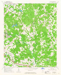
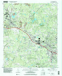 1999 Conyers2003 Print · USGSRockdale and DeKalb counties show significant suburban growth by the late nineties while preserving deep-rooted community landmarks. Genealogists can trace family footprints through numerous rural churches like New Hope Ch and landmarks such as the Bruce St Sch.
 - 2011 Map of Milstead, 2011 Print
 2011 Milstead2011 Print · USGSCovers Conyers, including Oxford, Spring Valley, and other nearby areas
 - 2011 Map of Conyers, 2011 Print
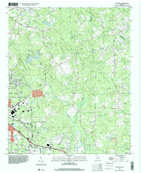
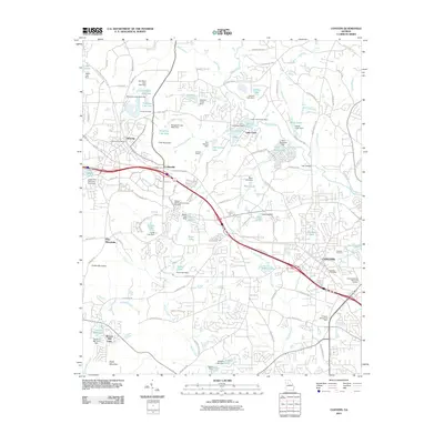 2011 Conyers2011 Print · USGSCovers Conyers, including Stonecrest, Lakeview Estates, and other nearby areas
 - 2011 Map of Kelleytown, 2011 Print
 2011 Kelleytown2011 Print · USGSCovers Conyers, including Stonecrest, Magnet, and other nearby areas
 - 2014 Map of Milstead, 2014 Print
 2014 Milstead2014 Print · USGSCovers Conyers, including Oxford, Spring Valley, and other nearby areas
Showing maps 1-25 of 36
Top cities near Conyers
- Stonecrest historical maps
- Tucker historical maps
- Redan historical maps
- Stockbridge historical maps
- McDonough historical maps
- Snellville historical maps
See more
Frequently asked questions
- What are the different types of historical maps available for Conyers?
- What is the oldest map of Conyers?
- Where can I purchase historical maps of Conyers for my home or office?
- Where can I download high-res historical maps of Conyers?
- Are there historical topographic maps available for Conyers?
- Is there historical aerial imagery available for Conyers?
- Where are historical maps of Conyers sourced from?