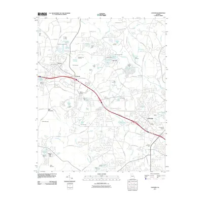
2011 Map of Conyers
USGS Topo · Published 2011About this map
The Yellow River cuts a prominent path through this landscape, which is defined by the intersection of industrial activity and residential expansion. The massive Lithonia Quarry stands as a central feature, highlighting the region's long-standing connection to stone extraction. Adjacent to the quarry, the settlements of Lithonia and Collinsville are woven together by a dense network of roads like the Old Covington Hwy, while the city of Conyers anchors the southeastern portion of the map with its own Conyers Post Office and residential developments.
Find a feature on this map
116 named features on this map. Tap any name to fly to it.
Don’t see what you’re looking for? This feature index may not catch every label — zoom into the map to look around manually.
Map Details
Editions of this 2011 Conyers Map
This is the sole edition of this map. No revisions or reprints were ever made.
Other maps of this area

1888 · Atlanta
USGS Topo · 1:125,000

1890 · Atlanta
USGS Topo · 1:125,000

1892 · Atlanta
USGS Topo · 1:125,000

1895 · Atlanta
USGS Topo · 1:125,000

1896 · Monroe
USGS Topo · 1:125,000

1953 · Atlanta
USGS Topo · 1:250,000

1953 · Athens
USGS Topo · 1:250,000

1956 · Stone Mountain
USGS Topo · 1:24,000

1956 · Snellville
USGS Topo · 1:24,000

1956 · Conyers
USGS Topo · 1:24,000