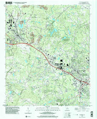
1999 Map of Conyers
USGS Topo · Published 2003About this map
The Yellow River winds through this landscape on the border of DeKalb and Rockdale counties, framing a region defined by granite outcroppings and the expansion of the Atlanta metropolitan area. Lithonia and Conyers anchor the map, showing a dense network of suburban development intertwined with older rural landmarks. Education and faith are central to the local geography, evidenced by the Bruce St Sch and numerous country churches such as Union Ch, Rockdale Ch, and Whites Chapel.
Find a feature on this map
59 named features on this map. Tap any name to fly to it.
Don’t see what you’re looking for? This feature index may not catch every label — zoom into the map to look around manually.
Map Details
Editions of this 1999 Conyers Map
This is the sole edition of this map. No revisions or reprints were ever made.
Other maps of this area

1888 · Atlanta
USGS Topo · 1:125,000

1890 · Atlanta
USGS Topo · 1:125,000

1892 · Atlanta
USGS Topo · 1:125,000

1895 · Atlanta
USGS Topo · 1:125,000

1896 · Monroe
USGS Topo · 1:125,000

1953 · Atlanta
USGS Topo · 1:250,000

1953 · Athens
USGS Topo · 1:250,000

1956 · Stone Mountain
USGS Topo · 1:24,000

1956 · Snellville
USGS Topo · 1:24,000

1956 · Conyers
USGS Topo · 1:24,000