Old Maps of Seminole County, Georgia for Metal Detecting
Plan your next treasure hunt with 90 historic maps of Seminole County. Find old homesites, ghost towns, trails, and gathering spots that may be lost to time — perfect for identifying promising metal detecting locations.
- Locate forgotten sites: Uncover places like long-lost settlements, abandoned rail lines, or gathering spots.
- Plan better hunts: Use map overlays combined with LiDAR or satellite views to narrow in on historically rich areas.
- Made for detectorists: Thousands of hobbyists use these maps to discover relics, coins, and hidden history.
Use these historic maps to boost your research and find new opportunities beneath the surface of Seminole County.
Seminole County, GA maps
(90)- 1952 Map of Bascom, 1953 Print
 1952 Bascom1953 Print · USGSUpper Jackson County at the Georgia line appears here in the early fifties, where river life met a dense network of rural communities. Trace the vanished airfield at Auxiliary Field No 3 or locate family roots near Bazzell Cem and Cedar Pond Sch.
 - 1953 Map of Dothan, 1966 Print
 1953 Dothan1966 Print · USGSSoutheast Alabama and Southwest Georgia are captured during a period of massive hydraulic and military expansion in the mid-fifties. Genealogists and historians can trace rural landmarks like Antioch Church and School, the Andrew Jackson Monument, and the early footprint of Fort Rucker Military Reservation.3 unique versions available
 - 1954 Map of Dothan
 1954 Dothan1954 Print · USGSSoutheast Alabama and Southwest Georgia are seen here in the mid-fifties, during a decade of military expansion and rural transition. Genealogists can trace the location of country schools like Little Zion School or the grounds of Kolomoki Mounds State Park.
 - 1954 Map of Steam Mill, 1955 Print
 1954 Steam Mill1955 Print · USGSThe borderlands of Georgia and Florida are captured here during the mid-century development of the Jim Woodruff Reservoir. Genealogists and local historians can trace rural life through sites like Lela Courthouse, Griselda Sch, and the Williams Cem.2 unique versions available
 - 1954 Map of Sneads, 1955 Print
 1954 Sneads1955 Print · USGSSneads and the surrounding Jackson County bottomlands are captured here in the mid-1950s as the riverfront landscape was being reshaped by the Jim Woodruff Reservoir. Researchers can trace family-named sites and rural institutions like Inwood Ch, Pope Cem, and the Grand Ridge Lookout Tower.2 unique versions available
 - 1954 Map of Desser, 1955 Print
 1954 Desser1955 Print · USGSSeminole County was a landscape of cypress ponds and rail-linked settlements in the mid-fifties. Researchers can trace family history at Rock Pond Courthouse or find rural landmarks like Olive Grove Ch and Trawick Cem.3 unique versions available
 - 1954 Map of Tallahassee, 1967 Print
 1954 Tallahassee1967 Print · USGSThe Florida Panhandle and South Georgia are captured here during a period of mid-century growth and military expansion. Researchers can trace the development of Panama City, the footprint of Tyndall Air Force Base, and the rail lines of the Atlantic Coast Line.4 unique versions available
 - 1955 Map of Dothan
 1955 Dothan1955 Print · USGSSoutheast Alabama and Southwest Georgia are captured here in the mid-fifties, showing a landscape of river-port history and growing military bases. Researchers can trace rural life via the Andrew Jackson Monument, Bauxite mines, and the Central of Georgia RR.
 - 1955 Map of Fairchild, 1956 Print
 1955 Fairchild1956 Print · USGSThe Florida-Georgia borderland is captured here in the mid-fifties just as the rising waters of the Jim Woodruff Reservoir reshaped the valley. Genealogists can locate family landmarks like Drakes Still and several rural burial sites, including Trawick Cem.2 unique versions available
 - 1955 Map of Reynoldsville, 1956 Print
 1955 Reynoldsville1956 Print · USGSThe Seminole County borderlands are seen here in the mid-fifties as massive water projects reshape the landscape near Reynoldsville. Researchers can trace old family sites at Sealy Plantation, Spring Creek Courthouse, and the FDR Sch.4 unique versions available
 - 1955 Map of Chattahoochee, 1956 Print
 1955 Chattahoochee1956 Print · USGSThe tri-river confluence at the Georgia-Florida border comes alive in the mid-fifties, showing the impact of the newly completed Jim Woodruff Dam. Genealogists and rail historians can trace the State Hospital grounds, local crossings at River Junction, and several rural burial sites like Freeman Cem.2 unique versions available
 - 1959 Map of Tallahassee
 1959 Tallahassee1959 Print · USGSFlorida's Panhandle and the Big Bend region appear here in the mid-fifties, showing a landscape defined by its great river systems and developing coast. Trace the early layout of Panama City, the expansive Apalachicola National Forest, and the coastal St Marks Lighthouse.
 - 1960 Map of Tallahassee
 1960 Tallahassee1960 Print · USGSThe Florida Panhandle and southern Georgia are captured here in the mid-twentieth century, showing a region defined by its rivers and military installations. Genealogists and historians can trace the growth of Tallahassee or locate coastal landmarks like the St Marks Lighthouse and Tyndall Air Force Base.
 - 1970 Map of Saffold, 1972 Print
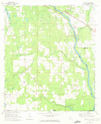 1970 Saffold1972 Print · USGSThe tri-state border of Alabama, Georgia, and Florida comes alive in the early seventies as a landscape of riverine swamps and rural hamlets. Genealogists can locate family landmarks like Pilgrims Rest Ch or trace the old rail stops at Alaga and Saffold.2 unique versions available
 - 1974 Map of Boykin, 1976 Print
 1974 Boykin1976 Print · USGSThe rural expanse of Miller and Decatur counties is captured here in the mid-seventies, showing the rail-side growth of communities like Boykin and Eldorendo. Genealogists can locate family landmarks including Lane Cem, Evergreen Ch, and Pilgrims Rest Ch.
 - 1974 Map of Donalsonville East, 1976 Print
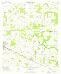 1974 Donalsonville East1976 Print · USGSSeminole County was a landscape of quiet agricultural hamlets and rail-side settlements in the mid-seventies. Genealogists can trace family landmarks like Friendship Cem and Miller Cems, or locate rural congregations at Corinth Ch and New Home Ch.
 - 1974 Map of Donalsonville West, 1976 Print
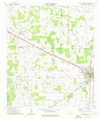 1974 Donalsonville West1976 Print · USGSDonalsonville and Jakin appear at a mid-seventies crossroads of rail and river commerce along the Seminole and Early county lines. Researchers can trace rural community life through numerous landmarks like Newberry Ch, the Seaboard Coast Line tracks, and Little Hope.
 - 1978 Map of Bainbridge, 1980 Print
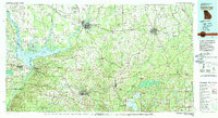 1978 Bainbridge1980 Print · USGSIn the late seventies, this Georgia-Florida borderland was defined by the confluence of the Flint and Chattahoochee rivers. Trace the region's infrastructure via the Seaboard Coast Line Railroad and find sites like Bainbridge State Hospital.
 - 1979 Map of Marianna, 1980 Print
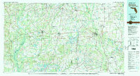 1979 Marianna1980 Print · USGSFlorida's northern panhandle and the neighboring Alabama-Georgia borderlands are captured here in the late seventies. Genealogists and local historians can trace family roots through settlements like Graceville and Cottondale or follow the historic Louisville and Nashville rail lines.2 unique versions available
 - 1981 Map of Dothan, 1982 Print
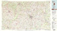 1981 Dothan1982 Print · USGSSoutheast Alabama and the tri-state border region are shown here in the early 1980s as the area thrived on military and rail connectivity. Researchers can trace historic transit lines like the Hartford and Slocomb railroad or locate family roots in Ozark, Headland, and Geneva.
 - 1981 Map of Camilla, 1982 Print
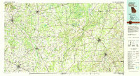 1981 Camilla1982 Print · USGSSouthwest Georgia in the early 1980s is defined by the winding Flint River and the ancient legacy of Kolomoki Mounds State Park. Researchers can trace the agricultural and rail economy through junctions like Blakely, Pelham, and the rail lines of the Central of Georgia.2 unique versions available
 - 1982 Map of Bascom
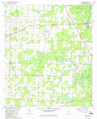 1982 Bascom1982 Print · USGSUpper Jackson County at the Georgia border shows a landscape of river landings and rural crossroads in the early eighties. Genealogists can locate family landmarks like Bazzell Cem, Shiloh Ch, and the site of Auxiliary Field No 3 (Abandoned).
 - 1982 Map of Sneads
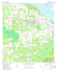 1982 Sneads1982 Print · USGSThe Florida-Georgia borderlands come to life in this early 1980s record of Jackson County, where the massive reservoir meets the winding river system. Genealogists and local historians can trace family sites at Yan Cem and Sinai Cem or locate the infrastructure of Sneads and Grand Ridge.
 - 1982 Map of Chattahoochee, 1983 Print
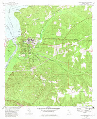 1982 Chattahoochee1983 Print · USGSFlorida's riverfront history is on display here in the early 1980s, where the Flint and Apalachicola Rivers converge at the state line. Trace the extensive STATE HOSPITAL grounds and the rail junction at River Junction, or locate family sites like Farrell Cem and Rosedale.
 - 1982 Map of Fairchild, 1983 Print
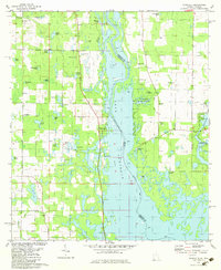 1982 Fairchild1983 Print · USGSThe Georgia-Florida borderlands come into focus in the early eighties as Lake Seminole reshapes the river valley. Genealogists and local historians can trace family-named sites like Wooten Cem, Butlers Ferry Landing, and the settlement at Haynes.
Showing maps 1-25 of 90
Top cities of Seminole County
Frequently asked questions
- What are the different types of historical maps available for Seminole County?
- What is the oldest map of Seminole County?
- Where can I purchase historical maps of Seminole County for my home or office?
- Where can I download high-res historical maps of Seminole County?
- Are there historical topographic maps available for Seminole County?
- Is there historical aerial imagery available for Seminole County?
- Where are historical maps of Seminole County sourced from?