1980s Maps of Adams County, Idaho
Explore 23 historic maps of Adams County from the 1980s. These maps offer a rare glimpse into what life looked like during the 1980s — showing old roads, neighborhoods, homes, and landmarks that have changed or disappeared over time.
Whether you're researching your family's past, planning a metal detecting trip, or studying how Adams County's landscape evolved across the 1980s, these high-resolution maps are a powerful tool for exploring the history of this region.
- Focus on a specific era: All maps on this page are from the 1980s, giving you a focused view of this time period.
- See what’s changed: Compare century-old streets, trails, and buildings to today's modern landscape using overlays and satellite layers.
- Research with precision: Use these maps for genealogy, historical research, land use analysis, or educational projects.
- View, download, or print: Maps are fully viewable online in high resolution, and can be downloaded or printed for your own records.
Start exploring Adams County's history through authentic maps from the 1980s. This is your window into the past.
Adams County, ID maps
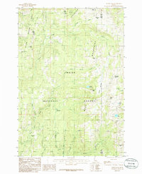
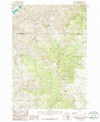
(23)- 1980 Map of McCall, 1993 Print
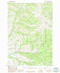
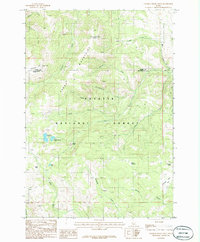
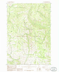
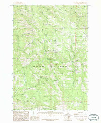
 1980 McCall1993 Print · USGSThe high timber country and glacial lakes of the West Mountains are documented here in the early eighties. Genealogists and local historians can trace the Union Pacific rail line and family-linked sites like Roseberry, Starkey, and the North Hornet Mine.2 unique versions available
 - 1980 Map of Weiser, 1993 Print
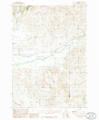
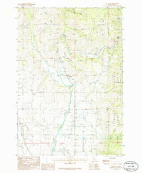
 1980 Weiser1993 Print · USGSThe Snake River valley and the foothills of the Boise Mountains are captured here in the 1980s, showing the vital rail and water infrastructure of the region. Researchers can trace the Union Pacific line through Payette or locate rural landmarks like Hog Cove Butte and Wilburn Butte.
 - 1985 Map of Tripod Peak, 1986 Print
 1985 Tripod Peak1986 Print · USGSThe high basins of the Boise and Payette National Forests are captured here in the mid-1980s, centered on the drainage of Squaw Creek. Researchers can locate specialized landmarks like the Snowbank Mountain radio tower, the seasonal Wilson Meadows, and the high waters of Blue Lake.
 - 1985 Map of Cold Spring Ridge, 1986 Print
 1985 Cold Spring Ridge1986 Print · USGSThe high ridges of Adams and Valley counties are captured here in the mid-1980s, documenting a rugged interface of national forest lands and major watersheds. Outdoorsmen and historians can trace the steep terrain from Lookout Peak and Mica Saddle down to the eastern shores of the Cascade Reservoir.
 - 1985 Map of Lone Tree, 1986 Print
 1985 Lone Tree1986 Print · USGSThe West Mountains of central Idaho are captured here in the mid-1980s, where the high-elevation divide separates the Payette and Weiser River watersheds. Outdoor researchers and local historians can trace the shoreline of the Cascade Reservoir and locate landmarks like Lone Tree and Poison Lake.
 - 1986 Map of Peck Mountain
 1986 Peck Mountain1986 Print · USGSThe high country of the Payette National Forest is captured here in the mid-1980s at the intersection of Washington and Adams counties. Historians and outdoor researchers can trace the drainages of Hornet Creek and locate landmarks like Peck Mountain and Stony Point.
 - 1986 Map of Council Mountain
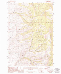
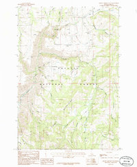
 1986 Council Mountain1986 Print · USGSThe Payette National Forest is captured here in the mid-1980s, documenting the high basins and river forks of Adams County. Genealogists and hikers can trace old routes near Dutch Oven Spring, Council Mountain, and the Middle Fork Weiser River headwaters.
 - 1986 Map of Indian Valley
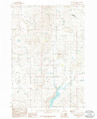
 1986 Indian Valley1986 Print · USGSIndian Valley in the mid-1980s reveals a high-country ranching landscape centered on the Little Weiser River. Genealogists and historians can locate the local Cemetery, the Ben Ross Reservoir, and named landmarks like Monday Gulch and Tiff Lindsey Draw.
 - 1986 Map of Council
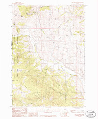
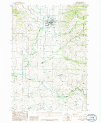 1986 Council1986 Print · USGSCouncil and the Weiser River valley are captured in the mid-1980s, showcasing a landscape of small settlements and river-fed agriculture. Genealogists and historians can trace the town's footprint from the Fairground to the outlying Mesa Siding and Mesa settlements.
 - 1986 Map of King Hill Creek
 1986 King Hill Creek1986 Print · USGSAdams County's high-country watersheds are captured here in the mid-1980s, centered on the headwaters of the Little Weiser River. Researchers can trace the drainages and landmarks within the Payette National Forest, locating specific points like Telephone Spring and Potato Knob.
 - 1986 Map of Crooked River Point
 1986 Crooked River Point1986 Print · USGSThe high peaks of the Cuddy Mountains straddle the border of Adams and Washington Counties in the mid-1980s. Researchers can locate remote high-altitude landmarks like Devils Slide, trace the waters of Hornet Reservoir, and explore the reaches of Payette National Forest.
 - 1986 Map of East of Cambridge
 1986 East of Cambridge1986 Print · USGSThe Salubria Valley of Washington County is captured here in the 1980s, showcasing the intersection of river life and high-desert ranching. Genealogists and local historians can locate the rural Cem and trace the winding paths of the Weiser River and Dixie Creek.
 - 1986 Map of Hog Creek Butte
 1986 Hog Creek Butte1986 Print · USGSThe high country of Washington and Adams counties is captured in the mid-1980s, showing a landscape shaped by water management and topography. Researchers can trace the shoreline of Crane Creek Reservoir or locate landmarks like Hog Creek Butte and Groner Reservoir.
 - 1986 Map of Rocky Comfort Flat
 1986 Rocky Comfort Flat1986 Print · USGSThe Cuddy Mountains and Payette National Forest define this Idaho landscape in the mid-1980s. Local researchers and outdoorsmen can trace the rugged drainages of the Wildhorse River and Crooked River or locate remote landmarks like Bear Creek Falls and the high Rocky Comfort Flat.
 - 1986 Map of Weasel Gulch
 1986 Weasel Gulch1986 Print · USGSThe mid-1980s high country of Adams County is mapped here during a time of forestry and watershed management. You can trace the complex drainage basins of the Weiser River or locate remote named sites like Harrington Spring and Weasel Gulch.
 - 1986 Map of Fruitvale
 1986 Fruitvale1986 Print · USGSThe Weiser River valley in the 1980s was a hub of small settlements and river-bottom agriculture. Genealogists and local historians can trace the foundations of Fruitvale, Starkey, and Glendale, or locate the Council Municipal Airport at the valley's southern end.
 - 1986 Map of Tamarack
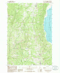
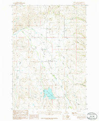
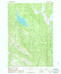 1986 Tamarack1986 Print · USGSThe timber and valley lands of the Idaho-Adams county line are captured here in the mid-eighties, centered on the Lost Valley Reservoir. Local historians can trace the development of Tamarack, the Evergreen Campground, and landmarks like Lost Creek Falls.
 - 1986 Map of New Meadows
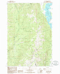
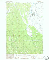 1986 New Meadows1986 Print · USGSMeadows Valley in the 1980s was a hub for timber and mountain transit within the Payette National Forest. Researchers can trace the legacy of local infrastructure through the Old RR Grade, the Railroad Trestle, and the small settlement of Rubicon.
 - 1986 Map of Cold Spring Summit
 1986 Cold Spring Summit1986 Print · USGSThe high Idaho backcountry of the mid-eighties comes into focus on this survey of the northern mountains. Outdoor historians and researchers can trace the old Peck Trail, locate the Cold Spring Summit, and follow the headwaters of the Weiser River.
 - 1987 Map of Riggins
 1987 Riggins1987 Print · USGSThe Salmon and Snake River canyons defined the Idaho-Oregon borderlands in the 1980s as wilderness recreation and historic mining sites overlapped. Researchers can trace the rugged access to Riggins, find high-altitude camps near Hazard Lake, and locate the Florence Mine or Black Bear Mine.
 - 1987 Map of Brownlee Dam
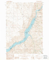 1987 Brownlee Dam1987 Print · USGSThe Oregon-Idaho border at the Snake River is defined by industrial scale and remote canyon terrain in the late 1980s. Researchers can trace the engineering of Brownlee Dam, explore the winding shoreline of Brownlee Reservoir, and locate small settlements like Wildhorse and Heath.
 - 1987 Map of Oxbow
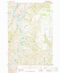 1987 Oxbow1987 Print · USGSThe Snake River borderlands of Oregon and Idaho appear here during the late twentieth century as a hub of hydroelectric power. Trace the engineering footprint of Oxbow Dam and the Oxbow Reservoir alongside high-country landmarks like Sheep Mountain.
 - 1987 Map of Cuddy Mountain
 1987 Cuddy Mountain1987 Print · USGSThe Cuddy Mountains and the Snake River corridor are captured here in the late eighties, showing a landscape defined by high-altitude forestry and mining. Genealogists and historians can trace numerous remote Prospects, the steep descent of the Grade, and Wildhorse Falls.
End of results
Showing maps 1-23 of 23
Top cities of Adams County
Frequently asked questions
- What are the different types of historical maps available for Adams County?
- What is the oldest map of Adams County?
- Where can I purchase historical maps of Adams County for my home or office?
- Where can I download high-res historical maps of Adams County?
- Are there historical topographic maps available for Adams County?
- Is there historical aerial imagery available for Adams County?
- Where are historical maps of Adams County sourced from?