Old Maps of Adams County, Idaho for Hiking & Exploration
Hike through history with 294 historic maps of Adams County. Explore old trails, ghost towns, and forgotten backroads — perfect for outdoor adventurers and local explorers.
- Rediscover forgotten places: Map out old mining camps, roads, and footpaths that no longer exist on modern maps.
- Layer with modern tools: Combine with LiDAR or satellite views to plan hikes through historical terrain.
- Made for exploration: Popular among hikers, overlanders, and local history lovers.
Use these maps to find adventure and explore the hidden past of Adams County.
Adams County, ID maps
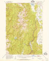
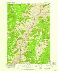
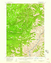
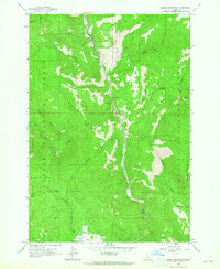
(294)- 1894 Map of Squaw Creek
 1894 Squaw Creek1894 Print · USGSCentral Idaho in the 1890s was a landscape of mountain valleys and river crossings where early pioneers established remote outposts. Trace the locations of historic river access at Smith Ferry and early industry at Walker Mill or the settlement of Ola.5 unique versions available
 - 1897 Map of Weiser
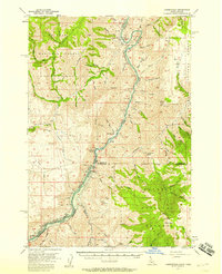
 1897 Weiser1897 Print · USGSThe Idaho-Oregon borderlands come alive in the 1890s as the Oregon Short Line connects river towns along the Snake River. Researchers can trace the early footprints of Weiser, Payette, and Middle Valley alongside now-obscure points like Mosquite and Washoe.5 unique versions available
 - 1911 Map of Meadows
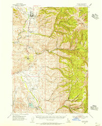
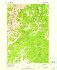
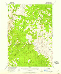
 1911 Meadows1911 Print · USGSThe high meadows and river valleys of central Idaho are seen here during the early years of the national forest system. Genealogists and historians can locate remote settlements like Lardo and Crawford, or trace rural schoolhouses including Hayes School and Rutledge School.2 unique versions available
 - 1920 Map of Seven Devils Mining District
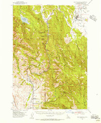
 1920 Seven Devils Mining District1920 Print · USGSThe Seven Devils Mining District was a bustling area of extraction and high-country ranching in the 1920s. Genealogists and historians can trace old homesteads and mining hubs like Cuprum, Landore, and Towsley Cabin, or locate the Landore School and Iron Springs Ranger Sta.
 - 1922 Map of He Devil
 1922 He Devil1922 Print · USGSThe Seven Devils Mountains of the early 1920s reveal a landscape of remote mining claims and high-elevation ranching camps. Researchers can locate historical sites like the Winchester Mine, Mc Gaffees Ranch, and Jacks Cabin.
 - 1938 Map of Riggins
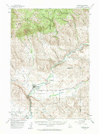
 1938 Riggins1938 Print · USGSRiggins and the canyon of the Salmon River appear here in the late 1930s, showing a landscape defined by mining, ranching, and forest management. Genealogists and historians can trace family-named sites like McMillians Mine, the Black Bear Inn, and the Middle District School.2 unique versions available
 - 1945 Map of Riggins
 1945 Riggins1945 Print · USGSRiggins and the deep river canyons of central Idaho are captured here just before the mid-century, showing the isolated ranching and forest-service life of the era. Researchers can locate remote homesteads and outposts like Hinkley Cabin, the Middle District Sch, and Old Pollock.
 - 1953 Map of Smiths Ferry, 1955 Print
 1953 Smiths Ferry1955 Print · USGSThe Payette River valley in the early fifties was a landscape of remote rail stops and mountain lookouts. Genealogists can trace rural school locations like Lower Alpha School (Aban'd) or follow the UNION PACIFIC line through Smiths Ferry.3 unique versions available
 - 1954 Map of Council, 1956 Print
 1954 Council1956 Print · USGSIn the mid-1950s, the Weiser River valley around Council balanced a rail-dependent economy with the expansive wilderness of the Payette National Forest. Genealogists can locate legacy sites like Indian Valley Cem and the Middle Fork School or trace the early industrial footprint of the Union Pacific line.2 unique versions available
 - 1954 Map of New Meadows, 1956 Print
 1954 New Meadows1956 Print · USGSNew Meadows and the surrounding timberlands of the Payette National Forest are captured here in the mid-1950s. Genealogists and researchers can trace the Pacific and Idaho Northern Railroad through mountain settlements like Fruitvale, Evergreen, and Starkey.2 unique versions available
 - 1954 Map of Cascade, 1956 Print
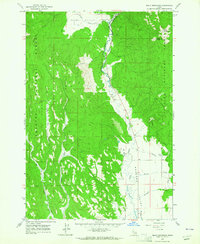
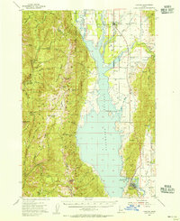 1954 Cascade1956 Print · USGSThe High Valley of the Payette River is captured here in the mid-fifties as the new reservoir redefines the landscape. Genealogists and historians can locate early settlements like Roseberry and Donnelly, the Hopps Cemetery, and high-country landmarks like Mica Mine.2 unique versions available
 - 1955 Map of Baker, 1964 Print
 1955 Baker1964 Print · USGSThe Oregon-Idaho borderlands are captured here in the mid-fifties as the Snake River underwent massive changes from dam construction. Trace the Oregon Trail Memorial Monument near Baker, find early mines like Virtue Mine, and follow the Union Pacific Railroad through Huntington.4 unique versions available
 - 1955 Map of Grangeville, 1964 Print
 1955 Grangeville1964 Print · USGSThe high country of the Idaho-Oregon border comes alive in the mid-1950s, showing the deep river canyons and mountain peaks. Trace the Union Pacific RR through the valleys or locate settlements like Grangeville, Joseph, and the shoreline of Wallowa Lake.4 unique versions available
 - 1957 Map of He Devil, 1958 Print
 1957 He Devil1958 Print · USGSThe high country of the Idaho-Oregon border is mapped here in the late fifties, centered on the dramatic Snake River Canyon. Trace the footprint of local history through outposts like Horse Creek Cabin and the site of the Rankin Mill (Aband).4 unique versions available
 - 1957 Map of Cambridge, 1958 Print
 1957 Cambridge1958 Print · USGSThe Weiser River valley in the late fifties shows a rural Idaho landscape defined by cattle country and rail lines. Genealogists and historians can trace the foundations of Middle Valley, Keithly, and the defunct Cove School (Aban'd).2 unique versions available
 - 1957 Map of Crane Creek Reservoir, 1958 Print
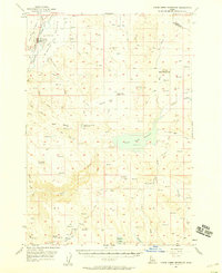 1957 Crane Creek Reservoir1958 Print · USGSThe Weiser River valley and its surrounding high-desert plateaus are captured here in the late fifties, showcasing a complex system of reservoirs and irrigation canals. Genealogists and historians can locate the Midvale townsite, the Midvale Cemetery, and rural landmarks like the Cozy Corners School (Aban'd).2 unique versions available
 - 1957 Map of Cuprum, 1958 Print
 1957 Cuprum1958 Print · USGSThe Seven Devils Mountains of Idaho are captured here during the 1950s, showing the intersection of forest management and declining copper mining. Genealogists and historians can locate old mining sites like Bluejacket Mine and the remnants of former settlements at Landore and Helena.3 unique versions available
 - 1957 Map of Homestead, 1958 Print
 1957 Homestead1958 Print · USGSThe Snake River canyon and the high Wallowa wilderness are captured in the late 1950s as a landscape of isolated outposts and steep timberlands. Local historians can trace the remote Homestead settlement, the winding Kleinschmidt Grade, and the Coverdale Guard Station.3 unique versions available
 - 1957 Map of Copperfield, 1958 Print
 1957 Copperfield1958 Print · USGSThe Snake River canyon was on the verge of total transformation in the late fifties as hydroelectric projects began to reshape the Idaho-Oregon border. Researchers can trace the original river course and landmarks like Brownlee Dam, Copperfield, and the Oxbow Sch before water levels rose.3 unique versions available
 - 1957 Map of Hornet, 1958 Print
 1957 Hornet1958 Print · USGSThe high country of the Adams and Washington county line is captured here in the late fifties during a period of forest management and industrial transition. Researchers can trace the legacy of remote mountain living at Upper Dale School and the North Hornet Mine.3 unique versions available
 - 1959 Map of Baker
 1959 Baker1959 Print · USGSThe Oregon and Idaho borderlands come alive in the late fifties, showing the rugged corridor along the Snake River and the high peaks of the Wallowa Mountains. Researchers can trace the legacy of the Union Pacific railroad or locate historic mining sites like the Flagstaff Mine and Virtue Mine.2 unique versions available
 - 1959 Map of Grangeville
 1959 Grangeville1959 Print · USGSThe high alpine peaks and deep river canyons of the Idaho-Oregon borderlands are captured in the late fifties. Researchers can trace the Union Pacific RR through the valleys to settlements like Enterprise, Union, and Grangeville.2 unique versions available
 - 1963 Map of Bally Mountain, 1964 Print
 1963 Bally Mountain1964 Print · USGSThe Little Salmon River corridor comes alive in the early sixties as it flows between the high timber of the Payette National Forest and the ranch lands of Meadows Valley. Local researchers can trace family landmarks like the Circle C Ranch and early recreational sites such as Hot Springs.2 unique versions available
 - 1963 Map of Indian Mountain, 1965 Print
 1963 Indian Mountain1965 Print · USGSIn the Idaho backcountry during the early sixties, the Little Salmon River provided the only major passage through the Payette National Forest. Researchers can trace remote Jeep Trails and locate high-altitude landmarks like Indian Mountain and Tepee Springs.2 unique versions available
 - 1963 Map of Railroad Saddle, 1965 Print
 1963 Railroad Saddle1965 Print · USGSAdams County’s high timberlands are mapped here in the early sixties, showing the vital water and forest management sites of the Payette National Forest. Trace the early Jeep Trail through Railroad Saddle and locate the Price Valley Guard Station along the Weiser River.2 unique versions available
Showing maps 1-25 of 294
Top cities of Adams County
Frequently asked questions
- What are the different types of historical maps available for Adams County?
- What is the oldest map of Adams County?
- Where can I purchase historical maps of Adams County for my home or office?
- Where can I download high-res historical maps of Adams County?
- Are there historical topographic maps available for Adams County?
- Is there historical aerial imagery available for Adams County?
- Where are historical maps of Adams County sourced from?