Old Maps of Bonner County, Idaho for Metal Detecting
Plan your next treasure hunt with 444 historic maps of Bonner County. Find old homesites, ghost towns, trails, and gathering spots that may be lost to time — perfect for identifying promising metal detecting locations.
- Locate forgotten sites: Uncover places like long-lost settlements, abandoned rail lines, or gathering spots.
- Plan better hunts: Use map overlays combined with LiDAR or satellite views to narrow in on historically rich areas.
- Made for detectorists: Thousands of hobbyists use these maps to discover relics, coins, and hidden history.
Use these historic maps to boost your research and find new opportunities beneath the surface of Bonner County.
Bonner County, ID maps
(444)- 1901 Map of Sandpoint
 1901 Sandpoint1901 Print · USGSNorthern Idaho in the late nineteenth century was a frontier of timber and rail defined by the massive waters of Pend Oreille Lake. Genealogists and historians can trace early settlements and river crossings like Seneaquoteen, Cocolalla, and the Hamill Ferry.3 unique versions available
 - 1901 Map of Spokane
 1901 Spokane1901 Print · USGSThe Inland Empire was entering a period of massive rail-driven growth at the turn of the century, with Spokane as its industrial heart. Genealogists and historians can trace the early foundations of Ft. Wright, the railroad works at Hillyard, and rural outposts like Chattaroy and Spokane Bridge.6 unique versions available
 - 1903 Map of Rathdrum
 1903 Rathdrum1903 Print · USGSNorthern Idaho's transition from frontier outposts to a rail-and-timber economy is visible here just after the turn of the century. Researchers can trace the early layout of Rathdrum, locate Fort Sherman, and follow the Leiberg Trail through the mountains.4 unique versions available
 - 1909 Map of Cataldo, 1954 Print
 1909 Cataldo1954 Print · USGSShoshone County was at its mining peak during the first decade of the 1900s, defined by the river-and-rail economy of the Idaho Panhandle. Genealogists can trace family roots through the silver and lead districts at Kellogg and Wardner, or find remote landmarks like Magee Ranch and the Old Mission.
 - 1911 Map of Cataldo
 1911 Cataldo1911 Print · USGSThe Idaho Panhandle's mining and timber country is documented here in the early twentieth century, showing the rail-linked settlements of the Coeur d'Alene River valley. Genealogists can trace family sites at Old Mission, Kellogg, and Magee Ranch.2 unique versions available
 - 1911 Map of Priest Lake, 1954 Print
 1911 Priest Lake1954 Print · USGSThe Idaho Panhandle during the early 1900s was a landscape of deep lakes and high-altitude mining operations connected by new rail lines. Genealogists and historians can trace pioneer settlements like Port Hill and Coolin, or locate remote industrial sites such as the Queen Mine and Mountain Chief Mine.
 - 1911 Map of Sandpoint, 1959 Print
 1911 Sandpoint1959 Print · USGSThe Idaho panhandle at the turn of the century shows a landscape of timber and transit centered on Sandpoint. You can trace early river crossings like Markham Ferry and the original rail routes of the Great Northern and Spokane International.2 unique versions available
 - 1913 Map of Priest Lake
 1913 Priest Lake1913 Print · USGSThe Idaho Panhandle was a rugged network of rail sidings and mining camps in the years before the Great War. Genealogists and historians can trace old homesteads and depots from Sandpoint up to the Continental Mine and the remote border crossing at Addie.3 unique versions available
 - 1934 Map of Metaline, 1959 Print
 1934 Metaline1959 Print · USGSThe Pend Oreille River valley was a hub of mining and rail activity in the 1930s as the railroad pushed north toward the Canadian border. Genealogists and historians can trace the foundations of Metaline Falls and Tiger or locate the Bunker Hill Mine and Lincoln Sch.
 - 1936 Map of Newport
 1936 Newport1936 Print · USGSThe Pend Oreille River valley in the 1930s reveals a landscape of railroad towns and timber outposts along the Idaho border. Genealogists can locate family-named school districts like Locke Sch and Otter Creek Sch, alongside settlements at Dalkena, Cusick, and Scotia.2 unique versions available
 - 1942 Map of Metaline
 1942 Metaline1942 Print · USGSThe Pend Oreille River valley and the surrounding Selkirk Mountains are shown here in the early 1940s, during a period of intense mining and timber activity. Genealogists and historians can trace rail-side settlements like Ione and Tiger or locate mining sites such as Josephine Mine and Bunker Hill Mines.3 unique versions available
 - 1942 Map of Newport
 1942 Newport1942 Print · USGSPend Oreille River country is captured here during the early 1940s, showing the vital rail and river links between Newport and the mountain frontier. Researchers can trace family homesteads near old schools like Fertile Valley Sch or locate the Indian Mission and Dalkena mill site.3 unique versions available
 - 1943 Map of Mt Spokane
 1943 Mt Spokane1943 Print · USGSThe Washington and Idaho borderlands are shown here during the early years of the state park's development. Genealogists and local historians can trace rural school districts like Blanchard Valley Sch and old supply points like the Peone Store.2 unique versions available
 - 1949 Map of Packsaddle Mtn, 1959 Print
 1949 Packsaddle Mtn1959 Print · USGSLake Pend Oreille and the surrounding national forests are captured here in the late 1940s as rail and mining operations shaped the rugged terrain. Genealogists and historians can locate old post offices like Broten PO and remote sites such as Whisky Rock or the Green Monarch Mine.3 unique versions available
 - 1950 Map of Mt Spokane, 1952 Print
 1950 Mt Spokane1952 Print · USGSThe Washington-Idaho borderlands in the early fifties reveal a landscape of high summits and quiet lake basins. Genealogists and local historians can trace rural school districts like Kit Carson School and small community hubs such as Inland Grange and Peone.3 unique versions available
 - 1951 Map of Packsaddle Mtn
 1951 Packsaddle Mtn1951 Print · USGSLake Pend Oreille was a hub of mining and rail transit in the early fifties, with many settlements and extraction sites lining its shores. Researchers can locate the Broten PO, trace the Northern Pacific tracks, and find operations like the Green Monarch Mine.2 unique versions available
 - 1951 Map of Clark Fork, 1952 Print
 1951 Clark Fork1952 Print · USGSThe Idaho-Montana borderlands are captured here in the early 1950s just as the river valley was preparing for major hydroelectric changes. Researchers can trace the legacy of local mining at Whitedelf Mine or locate early school sites like the River Echo Sch (Aband).4 unique versions available
 - 1951 Map of Mt Pend Oreille, 1952 Print
 1951 Mt Pend Oreille1952 Print · USGSThe Cabinet Mountains along the Idaho-Montana border are shown here in the early fifties, detailing a wilderness of forest lookouts and isolated mining claims. Researchers can find backcountry outposts like Smith Cabin and the Auxor Mine, along with numerous alpine waters such as Lake Estelle.4 unique versions available
 - 1951 Map of Elmira, 1953 Print
 1951 Elmira1953 Print · USGSNorthern Idaho's timber and rail country is captured here in the early fifties, just before the Albeni Falls Dam changed the shoreline of Pend Oreille Lake. Genealogists can trace several vanished rural schoolhouses, such as Pack River School and the Oden Sch (Aban'd).3 unique versions available
 - 1955 Map of Spokane, 1965 Print
 1955 Spokane1965 Print · USGSInland Empire life in the fifties and sixties centers on the growth of Spokane and the heavy mining industry of northern Idaho. Trace mid-century landmarks like Fairchild Air Force Base, the Bunker Hill Mine, and early campuses such as Gonzaga University.2 unique versions available
 - 1958 Map of Spokane
 1958 Spokane1958 Print · USGSThe Inland Empire is shown at a mid-century peak of industrial and military activity, from the rail hubs of Spokane to the deep silver mines of northern Idaho. Researchers can trace the sprawling rail lines of the Union Pacific RR or locate landmarks like Fairchild Air Force Base and the Bunker Hill Smelter & Mine.
 - 1958 Map of Sandpoint, 1966 Print
 1958 Sandpoint1966 Print · USGSThe Idaho Panhandle and Northeast Washington are shown here in the late fifties, when timber and hydroelectric power drove the local economy. Trace family roots in rail-side towns like Cusick or Metaline Falls, and locate landmarks like the Albeni Falls Dam or Falls Ranger Station.2 unique versions available
 - 1961 Map of Bayview, 1962 Print
 1961 Bayview1962 Print · USGSThe northern tip of Lake Pend Oreille meets the Idaho panhandle's deep forests in the early sixties. Researchers can trace the military history of the Naval Reservation near Bayview or locate remote landmarks like The Old Maids Clearing and Bunco Corners.
 - 1961 Map of Lakeview, 1962 Print
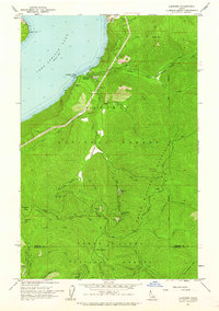 1961 Lakeview1962 Print · USGSThe eastern shores of Pend Oreille Lake are shown during a period of active mountain mining in the early sixties. Genealogists and historians can trace the remote operations of the Idaho Lakeview Mine, Weber Mine, and the lakeside settlement at Lakeview.2 unique versions available
 - 1961 Map of Spirit Lake East, 1962 Print
 1961 Spirit Lake East1962 Print · USGSThe timber and rail country of Kootenai County comes alive in the early sixties as the northern forests meet developing lakefronts. Genealogists and historians can trace the foundations of Spirit Lake, the Water Sch, and rail lines like the Northern Pacific.3 unique versions available
Showing maps 1-25 of 444
Top cities of Bonner County
- Sandpoint historical maps
- Priest River historical maps
- Ponderay historical maps
- Clark Fork historical maps
- Dover historical maps
- Kootenai historical maps
See more
Frequently asked questions
- What are the different types of historical maps available for Bonner County?
- What is the oldest map of Bonner County?
- Where can I purchase historical maps of Bonner County for my home or office?
- Where can I download high-res historical maps of Bonner County?
- Are there historical topographic maps available for Bonner County?
- Is there historical aerial imagery available for Bonner County?
- Where are historical maps of Bonner County sourced from?