1980s Maps of Caribou County, Idaho
Explore 33 historic maps of Caribou County from the 1980s. These maps offer a rare glimpse into what life looked like during the 1980s — showing old roads, neighborhoods, homes, and landmarks that have changed or disappeared over time.
Whether you're researching your family's past, planning a metal detecting trip, or studying how Caribou County's landscape evolved across the 1980s, these high-resolution maps are a powerful tool for exploring the history of this region.
- Focus on a specific era: All maps on this page are from the 1980s, giving you a focused view of this time period.
- See what’s changed: Compare century-old streets, trails, and buildings to today's modern landscape using overlays and satellite layers.
- Research with precision: Use these maps for genealogy, historical research, land use analysis, or educational projects.
- View, download, or print: Maps are fully viewable online in high resolution, and can be downloaded or printed for your own records.
Start exploring Caribou County's history through authentic maps from the 1980s. This is your window into the past.
Caribou County, ID maps
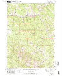
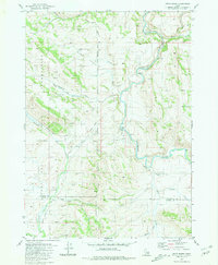
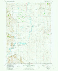
(33)- 1980 Map of Wayan West
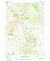
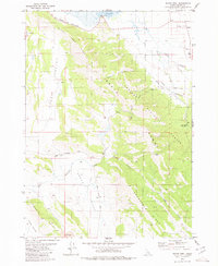 1980 Wayan West1980 Print · USGSCaribou County during the late twentieth century reveals a landscape shaped by both historic migration and active mining. Genealogists and historians can trace the Emigrant Trail (Lander Cutoff) or locate family sites near Wayan and the Henry Strip Mine.
 - 1980 Map of Thayne West
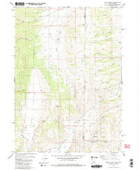
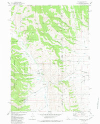
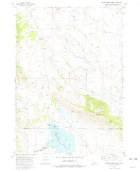
 1980 Thayne West1980 Print · USGSThe Star Valley region on the Idaho-Wyoming border thrived as a high-altitude agricultural hub in the early 1980s. Researchers can trace historical irrigation networks like Baker Ditch and locate local landmarks such as Haderlie Knoll and the Cem in Freedom.3 unique versions available
 - 1980 Map of Elk Valley
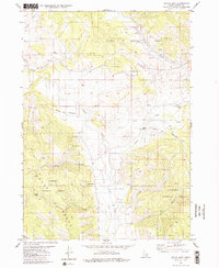
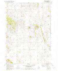
 1980 Elk Valley1980 Print · USGSThe high ridges of the Gannett Hills straddle the Idaho and Wyoming border during the early eighties, marking a remote wilderness between two national forests. Researchers can trace historic backcountry routes like the Pack Trail past landmarks such as The Pinnacle and Clover Knoll.2 unique versions available
 - 1980 Map of Sage Valley
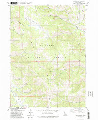
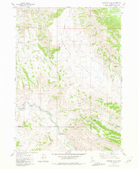
 1980 Sage Valley1980 Print · USGSSage Valley straddles the Idaho and Wyoming border in the late seventies, showing a high-country landscape of national forests and remote drainages. Researchers can trace historic access routes like the Tygee Trail and locate family-named landmarks such as Hardmans Hollow or Richardson Creek.2 unique versions available
 - 1980 Map of Stump Peak
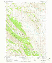
 1980 Stump Peak1980 Print · USGSCaribou County high country is shown in the late 1970s, where historic transit corridors and forest drainages converge. Trace the path of the Lander Cutoff past Stump Peak or follow the headwaters of Tincup Creek and Bechler Creek.3 unique versions available
 - 1980 Map of Auburn
 1980 Auburn1980 Print · USGSStar Valley and the Caribou National Forest meet at the Wyoming-Idaho border in this 1980 study. Local historians can trace the path of the historic Lander Cutoff and locate landmarks like the Stump Creek Guard Station and the Auburn Cem.
 - 1980 Map of Wayan East
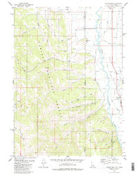
 1980 Wayan East1980 Print · USGSThe high Caribou Range in the 1980s reveals a landscape still marked by the path of westward migration. Genealogists and historians can trace the Emigrant Trail (Lander Cutoff) past Lanes Grave and through the remote dairying country of Upper Dairy.2 unique versions available
 - 1980 Map of Diamond Flat
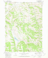
 1980 Diamond Flat1980 Print · USGSThe Caribou National Forest was a rugged crossroads for westward expansion in the late twentieth century. Genealogists and historians can trace the paths of early pioneers via the Emigrant Trail and Lander Cutoff near Diamond Peak.
 - 1981 Map of Dunn Basin
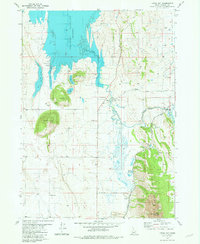
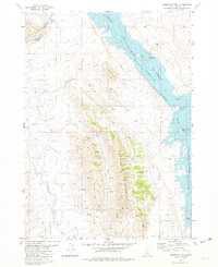
 1981 Dunn Basin1981 Print · USGSBingham and Caribou counties are captured here in the early eighties, showcasing a rugged landscape defined by the Fort Hall Indian Reservation boundary. Researchers can trace remote routes like the Portneuf Presto Trail and find landmarks such as Morgan Bridge over the Blackfoot River.
 - 1981 Map of Meadow Creek Mtn
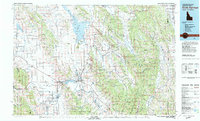
 1981 Meadow Creek Mtn1981 Print · USGSBingham and Caribou Counties are captured in the early eighties as the waters of the Blackfoot Reservoir meet high mountain ridges. Researchers can trace livestock history and backcountry landmarks at Association Corral, Meteor Hole, and Moses Pass.
 - 1981 Map of The Dip
 1981 The Dip1981 Print · USGSCaribou County, Idaho, in the early eighties shows a high-desert landscape shaped by volcanic geology and ranching history. Researchers can locate the Perkins Ranch (Site) and trace water sources like Indian Spring and Tenmile Lake.
 - 1981 Map of Paradise Valley
 1981 Paradise Valley1981 Print · USGSThe Blackfoot Mountains and Paradise Valley are shown in the early 1980s, revealing a landscape defined by its river and numerous springs. Researchers can trace land-use patterns through labeled fence lines and find historical recreation sites like Grave Creek Campground or Sagehen Campground.
 - 1981 Map of Lincoln Peak
 1981 Lincoln Peak1981 Print · USGSBingham County's mining and reservation lands are captured in the early eighties, showcasing the complex intersection of industry and tribal territory. Researchers can trace the massive Gay Mine complex, the Union Pacific rail spur, and remote water sources like Queedup Spring.
 - 1981 Map of Henry
 1981 Henry1981 Print · USGSCaribou County as it appeared in the early eighties shows the expansive waters of the Blackfoot Reservoir and the high ridges of the Idaho backcountry. Local researchers can locate the Henry Stampede Park (Site), trace family names like Gaston Beatty Spring, or explore the legendary Robbers Roost.
 - 1981 Map of Hatch
 1981 Hatch1981 Print · USGSThe high ridges of the Chesterfield Range meet the Idaho valleys in the early 1980s, documenting a landscape of ranching and grain storage. Genealogists and researchers can locate the settlement of Hatch and trace agricultural landmarks like the Grain Elevator and Tenmile Pass.
 - 1981 Map of Little Valley Hills
 1981 Little Valley Hills1981 Print · USGSSoutheast Idaho’s high country is captured in the early eighties as a complex network of county boundaries and mountain drainages. Genealogists and historians can trace the remote settlement of Homer or locate landmarks like the Cinder Pit and Little Valley Reservoir.
 - 1981 Map of China Hat
 1981 China Hat1981 Print · USGSCaribou County is shown during the early 1980s as phosphate mining and ranching shaped the high-desert landscape. Researchers can trace the industrial footprint of the Conda Mine and Union Pacific rail lines alongside local landmarks like Meadowville and China Hat.
 - 1981 Map of Chesterfield
 1981 Chesterfield1981 Print · USGSThe Portneuf Valley in the early eighties retains its historic settlement character, centered on the historic townsite of Chesterfield. Researchers can trace early infrastructure through the Meeting House, the Union Pacific rail line, and Chesterfield Cem.
 - 1981 Map of Reservoir Mtn, 1982 Print
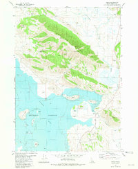
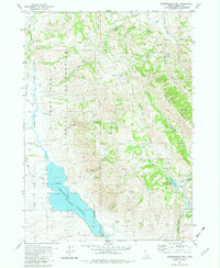
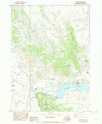
 1981 Reservoir Mtn1982 Print · USGSThe high country of Caribou County is shown here in the early 1980s, centered on the dramatic meeting of mountain peaks and water. Researchers can trace historical shoreline features like Hopkins Landing, the thermal waters of Hot Springs, and mining prospects near The Narrows.
 - 1981 Map of Grizzly Creek, 1982 Print
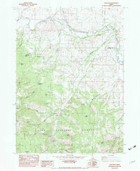
 1981 Grizzly Creek1982 Print · USGSCaribou County ranching and rugged high-country terrain are frozen in time here during the early eighties. Genealogists and historians can locate remote landmarks like the Chesterfield Cow Camp, Devils Gate, and the many named springs along the Blackfoot River.
 - 1981 Map of Chesterfield Res, 1982 Print
 1981 Chesterfield Res1982 Print · USGSThe high Idaho desert meets the Caribou County mountains in the early 1980s, revealing the intersection of water engineering and tribal lands. Genealogists and historians can trace the Old Indian Reservation Boundary and locate landmarks like Horse Camp, Hibner Springs, and the Portneuf Trail.
 - 1982 Map of Alexander
 1982 Alexander1982 Print · USGSCaribou County in the early eighties shows the intersection of pioneer trails and modern industry. Trace the historic Oregon Trail as it passes near Alexander, or locate water features like Alexander Reservoir and Soda Point.
 - 1982 Map of Soda Peak
 1982 Soda Peak1982 Print · USGSThe Bear River valley at the Idaho-Wyoming border appears here in the early eighties as a landscape of irrigation and mountain transit. Genealogists and historians can trace the Union Pacific corridor through Manson or locate backcountry sites like Camp Ho-Nok and the Eightmile FS Station.
 - 1982 Map of Soda Springs
 1982 Soda Springs1982 Print · USGSSoutheast Idaho and the Wyoming borderlands come alive in the early eighties as a landscape of mountain ranges and industrial valleys. Genealogists and historians can locate remote family plots like Lund Cem or trace the early paths through Fivemile Meadows and the Fort Hall Indian Reservation.2 unique versions available
 - 1982 Map of Soda Springs
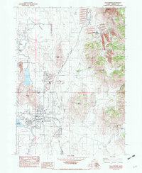 1982 Soda Springs1982 Print · USGSIn the early eighties, Soda Springs was a bustling center of phosphate processing and rail activity along the Union Pacific. Genealogists and historians can trace the mining footprint at Conda or locate the historic Idaho Sulphur Mine and the waters of Hooper Spring.
Showing maps 1-25 of 33
Top cities of Caribou County
Frequently asked questions
- What are the different types of historical maps available for Caribou County?
- What is the oldest map of Caribou County?
- Where can I purchase historical maps of Caribou County for my home or office?
- Where can I download high-res historical maps of Caribou County?
- Are there historical topographic maps available for Caribou County?
- Is there historical aerial imagery available for Caribou County?
- Where are historical maps of Caribou County sourced from?