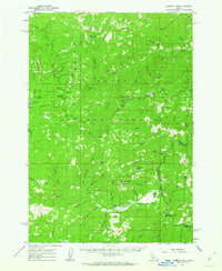
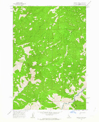
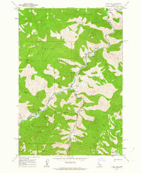
1960s Maps of Custer County, Idaho
Explore 80 historic maps of Custer County from the 1960s. These maps offer a rare glimpse into what life looked like during the 1960s — showing old roads, neighborhoods, homes, and landmarks that have changed or disappeared over time.
Whether you're researching your family's past, planning a metal detecting trip, or studying how Custer County's landscape evolved across the 1960s, these high-resolution maps are a powerful tool for exploring the history of this region.
- Focus on a specific era: All maps on this page are from the 1960s, giving you a focused view of this time period.
- See what’s changed: Compare century-old streets, trails, and buildings to today's modern landscape using overlays and satellite layers.
- Research with precision: Use these maps for genealogy, historical research, land use analysis, or educational projects.
- View, download, or print: Maps are fully viewable online in high resolution, and can be downloaded or printed for your own records.
Start exploring Custer County's history through authentic maps from the 1960s. This is your window into the past.
Custer County, ID maps
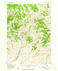
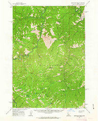
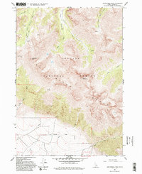
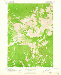
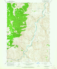
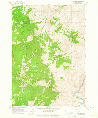
(80)- 1960 Map of Challis
 1960 Challis1960 Print · USGSCentral Idaho’s high backcountry is detailed here in the early sixties, showing the remote ranching and mining life across five national forests. Genealogists and researchers can trace family holdings at the Silva Ranch or Jones Ranch and find historic sites like Redfish Lake Lodge and Clayton.
 - 1960 Map of Muldoon Canyon, 1961 Print
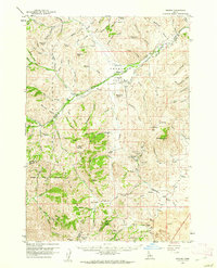
 1960 Muldoon Canyon1961 Print · USGSThe Pioneer Mountains during the early sixties were a landscape defined by high-altitude mining and national forest management. Trace the legacy of extraction at the Muldoon site, the Idaho Muldoon Mine, and the Eagle Bird Mine.3 unique versions available
 - 1960 Map of Grouse, 1961 Print
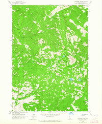
 1960 Grouse1961 Print · USGSAntelope Valley in the early 1960s was a landscape of remote mountain ranches and fading mining camps. Researchers can trace the heritage of vanished settlements at Martin (Site) or locate family landmarks like the Brockie Ranch and Antelope Cem.2 unique versions available
 - 1960 Map of Mackay, 1962 Print
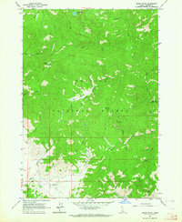
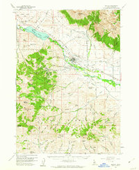 1960 Mackay1962 Print · USGSMackay and the Big Lost River Valley are shown at a peak of mining and rail activity in the early sixties. Researchers can trace the legacy of the Empire Mine and Darlington Shaft or locate historic burials at Battleground Cem and Nigger Hill Cem.2 unique versions available
 - 1960 Map of Copper Basin, 1962 Print
 1960 Copper Basin1962 Print · USGSCuster County ranching and mining high country is captured here during the early sixties. Genealogists and local historians can locate the Barton Cem, the Mackay Fish Hatchery, and remote outposts like the Corral Creek Cow Camp.2 unique versions available
 - 1961 Map of Greyhound Ridge, 1963 Print
 1961 Greyhound Ridge1963 Print · USGSThe Salmon River backcountry comes alive in the early sixties as a hub of remote mining and federal forest management. Genealogists and historians can locate remote outposts like Pistol Creek Ranch Airstrip, the Greyhound Mine, and the Middle Fork Guard Sta.2 unique versions available
 - 1961 Map of Chinook Mtn, 1963 Print
 1961 Chinook Mtn1963 Print · USGSThe remote Idaho backcountry comes into focus during the early sixties, showing the intersection of three national forests. Researchers can trace high-altitude mining operations like the Franklin D Mine and locate backcountry access points such as Morgan Airstrip and Sulphur Creek Ranch.2 unique versions available
 - 1962 Map of Hailey
 1962 Hailey1962 Print · USGSCentral Idaho in the early sixties showcases a landscape of high-altitude ranching and mining at the foot of the Sawtooth Mountains. Genealogists and historians can trace the rail-and-river economy through the Union Pacific Railroad corridor and explore old mining sites like the Triumph Mine or Silver Star Queens Mine.
 - 1962 Map of Norton Ridge, 1964 Print
 1962 Norton Ridge1964 Print · USGSCentral Idaho in the early sixties was a land of high ridges and forest service outposts. You can trace the primitive Trail systems connecting isolated sites like Mitchell Ranch, Norton Ridge Lookout, and the Middle Fork Salmon River.3 unique versions available
 - 1962 Map of Ramey Hill, 1964 Print
 1962 Ramey Hill1964 Print · USGSThe Idaho wilderness in the early 1960s is centered here on the confluence of the Middle Fork Salmon River and Loon Creek. Researchers can trace remote backcountry landmarks like the Tappen Ranch, Simplot Airstrip, and the Loon Creek Lookout.3 unique versions available
 - 1962 Map of Leatherman Peak, 1993 Print
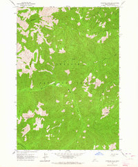
 1962 Leatherman Peak1993 Print · USGSThe high peaks of Custer County are captured here in the late sixties, showing a wilderness of the Lost River Range. You can trace high-altitude routes through Leatherman Pass and locate remote mining evidence like the Prospect near Sawmill Gulch.
 - 1963 Map of Challis
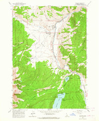
 1963 Challis1963 Print · USGSCentral Idaho's mountain corridors and mining districts appear in detail during the early sixties, highlighting the remote settlements of Challis and Stanley. Researchers can trace the legacy of the gold and silver rushes through labels for Bonanza, the Bayhorse Mine, and the Falconberry ranch.
 - 1963 Map of Challis Creek Lakes, 1964 Print
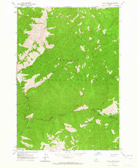
 1963 Challis Creek Lakes1964 Print · USGSCuster County, Idaho, in the early 1960s presents a landscape of high-altitude mining and pristine alpine drainages. You can trace the industrial footprint of the Parker Mine and Parker Mill or follow the headwaters of the Yankee Fork and Challis Creek Lakes.2 unique versions available
 - 1963 Map of Pinyon Peak, 1964 Print
 1963 Pinyon Peak1964 Print · USGSIn the early 1960s, this pocket of Custer County remained a remote frontier of mining and forest management. Researchers can trace the high-altitude trails leading to the Lost Packer Mine, the Lookout Pinyon Peak, and secluded waters like Blue Lake.3 unique versions available
 - 1963 Map of Custer, 1964 Print
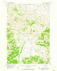
 1963 Custer1964 Print · USGSCuster and the surrounding Challis National Forest are captured here in the early sixties, a landscape defined by high-mountain mining and timber. Genealogists and historians can trace the paths of old Jeep Trails to the Sunbeam Mine, locate a riverside Grave, or find the Custer No 1 Campground.2 unique versions available
 - 1963 Map of Casto, 1964 Print
 1963 Casto1964 Print · USGSCuster County's rugged backcountry in the early sixties reveals a landscape of isolated ranches and Forest Service outposts. Researchers can locate the Boyle Ranch and its Boyle Landing Strip, trace the Loon Creek Guard Sta Trail, or find the secluded Prospect near Mayfield Creek.3 unique versions available
 - 1963 Map of Mt Cramer, 1964 Print
 1963 Mt Cramer1964 Print · USGSThe Sawtooth wilderness in the early sixties remained a world of granite spires and remote alpine basins before widespread modern development. Hikers and historians can trace old routes like the Bull Moose Trail and locate early camps such as the Redfish Inlet Transfer Camp.5 unique versions available
 - 1963 Map of Stanley, 1964 Print
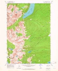
 1963 Stanley1964 Print · USGSStanley and the rugged Sawtooth Valley appear here in the early 1960s as a growing hub for Idaho recreation and forest management. Researchers can locate the Stanley Cem, trace old trails toward Marshall Lake, and find early campsites around Redfish Lake.3 unique versions available
 - 1963 Map of Rock Creek, 1964 Print
 1963 Rock Creek1964 Print · USGSThe Idaho backcountry at the boundary of Lemhi and Custer Counties is shown here in the early 1960s, a time of remote ranching and forest management. Researchers can locate isolated sites like Owen Cabin or the Foster Ranch Landing Strip among the geothermal waters of Hot Springs.2 unique versions available
 - 1963 Map of Bald Mountain, 1964 Print
 1963 Bald Mountain1964 Print · USGSCuster County in the early 1960s was a landscape of high peaks and river corridors where the Salmon River meets the East Fork. Local historians and collectors can trace the mining footprint at the Silver Bell Mine and Turtle Mine or locate early access via the Footbridge.3 unique versions available
 - 1963 Map of Bayhorse Lake, 1964 Print
 1963 Bayhorse Lake1964 Print · USGSCuster County's high country is preserved here in the early sixties, showing the remote peaks and drainages of the Challis National Forest. Researchers can locate historic sites like Tollgate Ruins and Bruno Cabin Ruins or trace high-altitude routes along Buffalo Ridge.4 unique versions available
 - 1963 Map of Elevenmile Creek, 1964 Print
 1963 Elevenmile Creek1964 Print · USGSCentral Idaho’s mountain wilderness is captured in the early sixties as the forest service managed the remote Salmon River high country. Researchers can trace historic access routes like the Jeep Trail and identify local landmarks including Cinnabar Mtn and Milk Lake.2 unique versions available
 - 1963 Map of Basin Butte, 1964 Print
 1963 Basin Butte1964 Print · USGSThe high basins and timberlands of Custer County are captured here in the early 1960s, showing a landscape shaped by mining and forestry. Researchers can trace the rugged trails leading to Basin Butte Lookout, the Prospect Mine, and the remote Cow Camp.3 unique versions available
 - 1963 Map of Bayhorse, 1964 Print
 1963 Bayhorse1964 Print · USGSMining activity in the Salmon River canyon was still clearly etched into the Idaho landscape in the early sixties. Researchers can trace the proximity of the Coke Ovens to historic workings like the Ramshorn Mine and Pacific Mine.2 unique versions available
 - 1963 Map of Sherman Peak, 1964 Print
 1963 Sherman Peak1964 Print · USGSThe Salmon River mountain wilderness of Custer County is captured here in the early sixties. Researchers can trace the high-altitude drainage systems and natural landmarks like Sherman Peak, Mayfield Peak, and the waters of East Fork Mayfield Creek.3 unique versions available
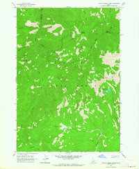
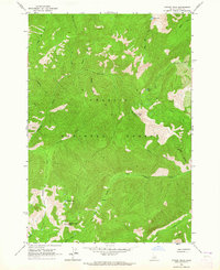
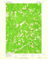
Showing maps 1-25 of 80
Top cities of Custer County
- Challis historical maps
- Mackay historical maps
- Stanley historical maps
- Clayton historical maps
- Tunnel Rock historical maps
Frequently asked questions
- What are the different types of historical maps available for Custer County?
- What is the oldest map of Custer County?
- Where can I purchase historical maps of Custer County for my home or office?
- Where can I download high-res historical maps of Custer County?
- Are there historical topographic maps available for Custer County?
- Is there historical aerial imagery available for Custer County?
- Where are historical maps of Custer County sourced from?