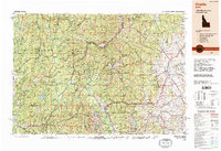
1980s Maps of Custer County, Idaho
Explore 33 historic maps of Custer County from the 1980s. These maps offer a rare glimpse into what life looked like during the 1980s — showing old roads, neighborhoods, homes, and landmarks that have changed or disappeared over time.
Whether you're researching your family's past, planning a metal detecting trip, or studying how Custer County's landscape evolved across the 1980s, these high-resolution maps are a powerful tool for exploring the history of this region.
- Focus on a specific era: All maps on this page are from the 1980s, giving you a focused view of this time period.
- See what’s changed: Compare century-old streets, trails, and buildings to today's modern landscape using overlays and satellite layers.
- Research with precision: Use these maps for genealogy, historical research, land use analysis, or educational projects.
- View, download, or print: Maps are fully viewable online in high resolution, and can be downloaded or printed for your own records.
Start exploring Custer County's history through authentic maps from the 1980s. This is your window into the past.
Custer County, ID maps
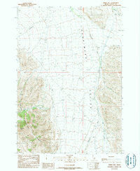
(33)- 1980 Map of Leadore, 1996 Print
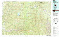
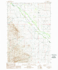
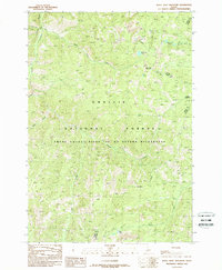
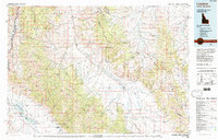 1980 Leadore1996 Print · USGSThe high mountain corridors of the Lemhi and Beaverhead ranges are captured here in the early 1980s. Local history researchers can trace the Old Railroad Grade past settlements like Leadore and Tendoy, or locate remote sites like the Copper Queen Mine and Chinatown.
 - 1982 Map of Challis
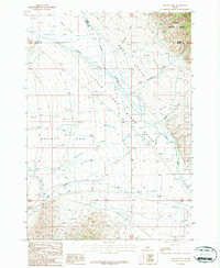
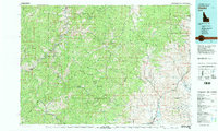 1982 Challis1982 Print · USGSIn the early 1980s, the rugged central Idaho backcountry around Challis remained a stronghold of mining and wilderness. Researchers can trace the legacy of remote industry at the Yellowjacket Mine and locate backcountry outposts like Casto and the Boyle Landing Strip.
 - 1982 Map of Pistol Creek
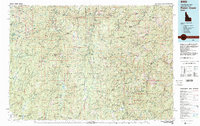 1982 Pistol Creek1982 Print · USGSThe central Idaho wilderness in the early eighties was a landscape of remote mining camps and backcountry airfields. Researchers can trace the history of mineral extraction at the Thunder Mountain Mine or locate early aviation sites like the Stibnite Landing Strip and Landmark Landing Strip.
 - 1982 Map of White Cloud Peaks
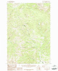
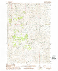
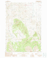
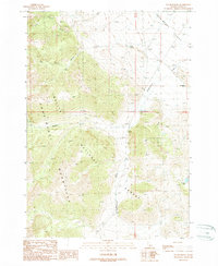
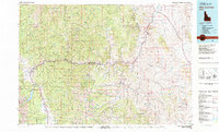 1982 White Cloud Peaks1982 Print · USGSCuster County in the early eighties is a landscape where high-mountain recreation meets a legacy of hard-rock mining. Genealogists and researchers can trace the roads to Custer, locate isolated sites like the Livingston Mine, or find the waters of Redfish Lake.2 unique versions available
 - 1982 Map of Deadwood River
 1982 Deadwood River1982 Print · USGSCentral Idaho in the early eighties was a vast expanse of protected wilderness and remote river canyons. Local historians and hunters can locate early landmarks like the Mary Jane Mine, the settlement of Lowman, and isolated facilities such as the Bruce Meadows Landing Strip.
 - 1987 Map of Mulkey Bar
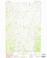
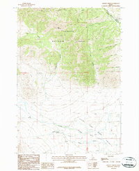
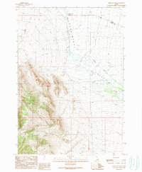
 1987 Mulkey Bar1987 Print · USGSButte County ranching and water management are frozen in time during the late eighties at the intersection of three counties. Trace the irrigation history of Mulkey Bar and Deer Flats through features like Black Ditch and the Dry Creek Canal.
 - 1987 Map of Warren Mountain
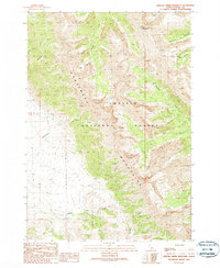
 1987 Warren Mountain1987 Print · USGSThe high peaks and deep canyons of Custer County are captured here in the late 1980s. Researchers and outdoor enthusiasts can trace routes over Pass Creek Summit and locate historic water sources like Squaw Springs or the remote Wagon Box Cr.
 - 1987 Map of Red Hills
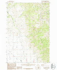
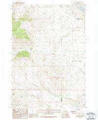 1987 Red Hills1987 Print · USGSThe high basins of Custer and Butte counties are captured in the late twentieth century, showing the drainage into the Little Lost River Valley. Researchers can trace old mountain routes and water sources like Buck Springs, Taylor Mountain, and Mulkey Bar.
 - 1987 Map of Iron Creek Point
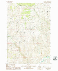
 1987 Iron Creek Point1987 Print · USGSThe high Lemhi Range and Salmon River Mountains meet in the late eighties along the Lemhi and Custer county line. Geologists and hikers can trace mining history through the Prospect Adit or navigate the drainages of Big Timber Creek and Sawmill Creek.
 - 1987 Map of Moffett Springs
 1987 Moffett Springs1987 Print · USGSHigh-country forests meet the pastoral valley of the Little Lost River in the late 1980s. Trace the remote landscape from Bear Mountain down to Barney Hot Springs and the irrigation network of Mud Flats Valley.
 - 1987 Map of Big Windy Peak
 1987 Big Windy Peak1987 Print · USGSThe Lemhi Range high country near the Custer and Lemhi county line is shown here in the late eighties, dominated by peak summits and mining claims. Researchers can trace historic prospecting sites near Big Windy Peak or locate remote landmarks like the Fairview Guard Station and Horse Lake.
 - 1988 Map of Arco, 1989 Print
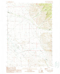
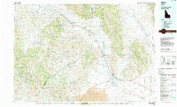 1988 Arco1989 Print · USGSThe Big Lost River Valley thrived as a high-altitude ranching and agricultural hub in the late eighties. Researchers can trace the Union Pacific line to Arco or locate smaller rural communities like Houston, Moore, and Butte City.
 - 1989 Map of May
 1989 May1989 Print · USGSThe Pahsimeroi River valley in the late eighties remains a rugged ranching landscape defined by its high-altitude water systems and remote mountain peaks. Genealogists and local historians can trace the small community of May, the local Cem, and infrastructure like the Airport and the Aqueduct.
 - 1989 Map of Grouse Peak
 1989 Grouse Peak1989 Print · USGSHigh in Custer County during the late eighties, this provisional survey captures the remote reaches of the Pahsimeroi Mountains. Researchers can trace old trails and drainages from Dodge Basin to family-named landmarks like Leaton Gulch and Gerry Gulch.
 - 1989 Map of Grouse Creek Mountain
 1989 Grouse Creek Mountain1989 Print · USGSThe Pahsimeroi Mountains of central Idaho are shown during the late 1980s, a period when this high country remained vital for forest management and grazing. Researchers can trace drainage patterns from Grouse Creek Mountain down to Sheep Pen Basin and Christian Gulch.
 - 1989 Map of Gooseberry Creek
 1989 Gooseberry Creek1989 Print · USGSCentral Idaho’s high-country drainages are captured in the late eighties as they converge toward the river. You can trace the rugged transition from Table Mountain down through named landmarks like First Crossing Gulch and Boneyard Gulch to the Salmon River.
 - 1989 Map of Challis
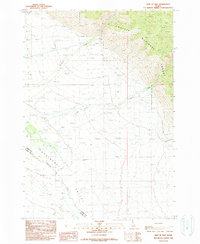
 1989 Challis1989 Print · USGSCentral Idaho in the late eighties remains a vast expanse of protected wilderness and high-mountain drainages. Researchers can trace remote settlements and backcountry outposts like Custer, Stibnite, and Sunbeam along the Salmon River and its many forks.2 unique versions available
 - 1989 Map of Meadow Peak
 1989 Meadow Peak1989 Print · USGSThe high wilderness of Custer County is captured here in the late eighties, showing a landscape of steep canyons and alpine basins. Researchers can trace land use at the Prospect site or locate remote water sources like Rattlesnake Spring and Grouse Creek Lake.
 - 1989 Map of Mahogany Hill
 1989 Mahogany Hill1989 Print · USGSThe high country of Custer and Lemhi counties is captured here in the late eighties, showing the transition from forest to valley floor. Researchers can trace the Pahsimeroi River through the Pahsimeroi Valley and locate landmarks like Mahogany Hill.
 - 1989 Map of Donkey Hills NW
 1989 Donkey Hills NW1989 Print · USGSThe Pahsimeroi Valley in the late eighties shows a remote ranching landscape at the Lemhi and Custer county line. Researchers can trace the original Goldburg (Site) and current Goldburg settlement near the Pahsimeroi River and local Cem.
 - 1989 Map of Spring Hill
 1989 Spring Hill1989 Print · USGSThe Pahsimeroi Valley and the slopes of the Lemhi Range are documented here during the late eighties. Researchers can trace the drainage of the Pahsimeroi River, locate the wooded boundaries of the Challis National Forest, and find local landmarks like Spring Hill.
 - 1989 Map of Doublespring
 1989 Doublespring1989 Print · USGSCuster County's high mountain terrain is documented in the late 1980s as the Pahsimeroi Mountains meet the valley floor. Researchers can trace remote water sources and landmarks like Doublespring Ranch, Carlson Lake, and Rock Spring.
 - 1989 Map of East of May
 1989 East of May1989 Print · USGSThe high mountain front meets the Pahsimeroi Valley in the late eighties as it straddles the Lemhi and Custer county line. Researchers can trace the drainages of Patterson Creek and Morse Creek as they flow toward the Pahsimeroi River.
 - 1989 Map of Pats Creek
 1989 Pats Creek1989 Print · USGSCuster County's high-country drainages are meticulously detailed in this late-1980s survey of the Challis National Forest. Researchers can trace the network of mountain waterways including Pats Creek and find early industrial markers like the prospects near Cartwright Gulch.
 - 1989 Map of White Goat Mountain
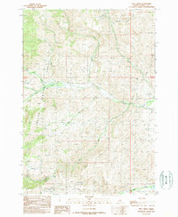
 1989 White Goat Mountain1989 Print · USGSCentral Idaho's high backcountry is captured in the late eighties, just as it remained protected within the Challis National Forest. Researchers can trace the drainages of Camas Creek and locate remote landmarks like White Goat Mountain and Camas Meadows.
Showing maps 1-25 of 33
Top cities of Custer County
- Challis historical maps
- Mackay historical maps
- Stanley historical maps
- Clayton historical maps
- Tunnel Rock historical maps
Frequently asked questions
- What are the different types of historical maps available for Custer County?
- What is the oldest map of Custer County?
- Where can I purchase historical maps of Custer County for my home or office?
- Where can I download high-res historical maps of Custer County?
- Are there historical topographic maps available for Custer County?
- Is there historical aerial imagery available for Custer County?
- Where are historical maps of Custer County sourced from?