1990s Maps of Custer County, Idaho
Explore 19 historic maps of Custer County from the 1990s. These maps offer a rare glimpse into what life looked like during the 1990s — showing old roads, neighborhoods, homes, and landmarks that have changed or disappeared over time.
Whether you're researching your family's past, planning a metal detecting trip, or studying how Custer County's landscape evolved across the 1990s, these high-resolution maps are a powerful tool for exploring the history of this region.
- Focus on a specific era: All maps on this page are from the 1990s, giving you a focused view of this time period.
- See what’s changed: Compare century-old streets, trails, and buildings to today's modern landscape using overlays and satellite layers.
- Research with precision: Use these maps for genealogy, historical research, land use analysis, or educational projects.
- View, download, or print: Maps are fully viewable online in high resolution, and can be downloaded or printed for your own records.
Start exploring Custer County's history through authentic maps from the 1990s. This is your window into the past.
Custer County, ID maps
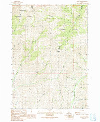
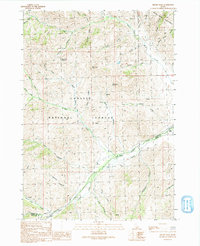
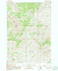
(19)- 1990 Map of Greyhound Mountain, 1991 Print
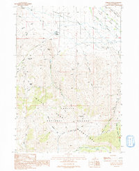
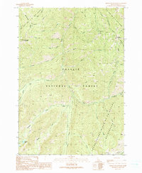 1990 Greyhound Mountain1991 Print · USGSCuster County's interior backcountry is captured here during the 1990s, showcasing a landscape of high ridges and mining history. Trace early routes like the Pack Trail to the Mountain King Mine or locate the Seafoam FS Station near Seafoam Lake.
 - 1990 Map of Big Soldier Mountain, 1991 Print
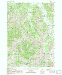
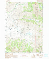
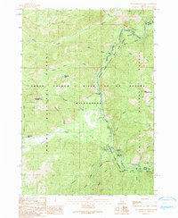 1990 Big Soldier Mountain1991 Print · USGSThe Middle Fork Salmon River flows through the heart of the Idaho wilderness in the early nineties, showing a landscape defined by water and high peaks. Traces of backcountry life appear at Sulphur Creek Ranch and the Lookout Morehead Mountain.
 - 1990 Map of Soldier Creek, 1991 Print
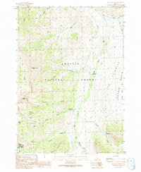
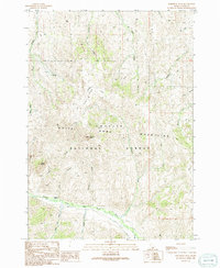
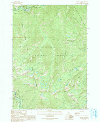 1990 Soldier Creek1991 Print · USGSCuster County's high wilderness is preserved here as it appeared in the early 1990s, where the Challis and Boise National Forests converge. Researchers can trace historic mining activity at the Greyhound and Seafoam Mine or locate alpine landmarks like Josephus Lake.2 unique versions available
 - 1990 Map of Artillery Dome, 1991 Print
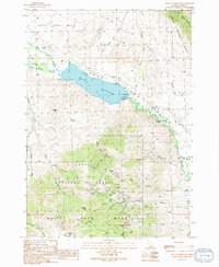
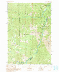 1990 Artillery Dome1991 Print · USGSThe Salmon River wilderness comes into focus in the 1990s as a landscape of remote outposts and river navigation. Trace the paths to Pistol Creek Ranch, Joe Bump Cabin, and the geothermal Sheepeater Hot Springs along the Middle Fork Salmon River.2 unique versions available
 - 1990 Map of Little Soldier Mountain, 1991 Print
 1990 Little Soldier Mountain1991 Print · USGSThe Salmon River backcountry of the early 1990s is captured here, showing the remote intersection of Custer and Valley counties. Trace river routes past Ski Jump Rapid and find wilderness outposts like Middle Fork Lodge or the Thomas Creek Landing Field.
 - 1991 Map of Trail Creek
 1991 Trail Creek1991 Print · USGSThe remote tri-county border of Blaine, Custer, and Butte Counties is captured here in the early nineties. Geologists and local history buffs can trace primitive access routes and high-mountain drainages such as Argosy Creek, Grannys Canyon, and a lonely Mine Shaft.
 - 1991 Map of Big Black Dome
 1991 Big Black Dome1991 Print · USGSCuster and Blaine Counties are shown in the early 1990s as a high-altitude wilderness at the border of two national forests. Researchers can trace remote alpine trails and high-country landmarks like the Copper Basin Cow Camp, Big Black Dome, and the Lake Creek Recreation Site.
 - 1991 Map of Mackay
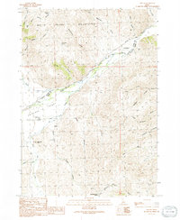
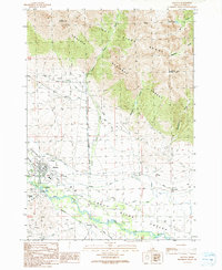 1991 Mackay1991 Print · USGSThe valley of the Big Lost River near Mackay appears here during the early nineties, showing a landscape defined by irrigation and early mining. Genealogists and historians can trace the Old Railroad Grade, locate the Empire Smelter, and identify family sites near Houston and the Mount McCaleb Cem.
 - 1991 Map of Big Blind Canyon
 1991 Big Blind Canyon1991 Print · USGSCuster County’s high country is captured here during the early nineties, centered on the dramatic rise from the Big Lost River Valley into the White Mountains. Genealogists and researchers can locate the Houston Cemetery and trace early land use through named sites like Fallini Spring and Slaughterhouse Springs.
 - 1991 Map of Lehman Butte
 1991 Lehman Butte1991 Print · USGSCuster County's high-mountain country is mapped here during the late twentieth century, showing a mix of mining exploration and public forest land. Researchers can locate the Barton Cemetery, trace water sources like Warm Springs, or follow the Burma Road through the White Knob Mountains.
 - 1991 Map of Star Hope Mine
 1991 Star Hope Mine1991 Print · USGSThe high alpine mining country of Custer and Blaine Counties is documented here in the early nineties, showing where the national forests meet. Miners and hikers can trace the Pack Trail systems leading to the Star Hope Mine, Drummond Mine, and Mandolin Spring.
 - 1991 Map of Porphyry Peak
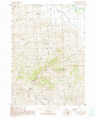
 1991 Porphyry Peak1991 Print · USGSCuster County, Idaho, is shown during the early nineties as a high-mountain wilderness dominated by the White Cloud Mountains. Researchers can trace old 4WD routes past Rosenkrance Ranch and survey landmarks like Porphyry Peak and Castle Rock.
 - 1991 Map of Mackay Reservoir
 1991 Mackay Reservoir1991 Print · USGSCuster County's industrial and water-management history is on full display in the early nineties, focused on the heights above the Big Lost River. Local researchers can trace mining operations at the Empire Mine or locate the Battleground Cem near the shores of Mackay Reservoir.
 - 1991 Map of Miller Peak
 1991 Miller Peak1991 Print · USGSCuster and Butte County high country is shown here in the 1990s as a landscape of forest management and early prospecting. Trace the paths of 4WD tracks through Bear Creek Summit and locate landmarks like the Antelope FS Station or the Prospect near Iron Bog Creek.
 - 1991 Map of Grouse
 1991 Grouse1991 Print · USGSAntelope Valley and the high Idaho desert are captured here in the early nineties, showing a landscape of deep canyons and seasonal waterways. Genealogists and local historians can locate Grouse, trace the Antelope Cem, and explore the rugged White Knob Mountains.
 - 1991 Map of Copper Basin Knob
 1991 Copper Basin Knob1991 Print · USGSCuster County's high-altitude interior is captured here in the early nineties, revealing a landscape defined by resource extraction and forest management. Researchers can trace the legacy of local mining and ranching at the Copper Basin Mine, the Corral Creek Cow Camp, and the Copper Basin F S Station.
 - 1991 Map of Smiley Mountain
 1991 Smiley Mountain1991 Print · USGSThe high backcountry of the Challis and Sawtooth National Forests is captured here in the early nineties, showing a landscape of alpine lakes and mountain drainages. Trace the remote trails and primitive paths near Iron Bog Lake, Smiley Mountain, and the mining prospects along Iron Bog Creek.
 - 1991 Map of Shelly Mountain
 1991 Shelly Mountain1991 Print · USGSThe high peaks of the White Knob Mountains are captured here in the early 1990s during a period of provisional geological mapping. Local historians and mineral hunters can trace the locations of the Champion Mine, the Mammoth site, and various Mine Shafts scattered across Stewart Canyon.
 - 1992 Map of Sun Valley, 1993 Print
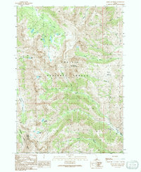
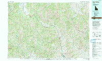 1992 Sun Valley1993 Print · USGSThe Wood River Valley and surrounding high peaks are documented here in the early nineties, showing the region's shift toward a recreation economy. Researchers can trace the legacy of mining and mountain development at the Triumph Mine, Sun Valley, and Alturas Lake.2 unique versions available
End of results
Showing maps 1-19 of 19
Top cities of Custer County
- Challis historical maps
- Mackay historical maps
- Stanley historical maps
- Clayton historical maps
- Tunnel Rock historical maps
Frequently asked questions
- What are the different types of historical maps available for Custer County?
- What is the oldest map of Custer County?
- Where can I purchase historical maps of Custer County for my home or office?
- Where can I download high-res historical maps of Custer County?
- Are there historical topographic maps available for Custer County?
- Is there historical aerial imagery available for Custer County?
- Where are historical maps of Custer County sourced from?