1900s (20th Century) Maps of Challis, Idaho
Explore 11 historic maps of Challis from the 1900s (20th Century). These maps offer a rare glimpse into what life looked like during the 1900s — showing old roads, neighborhoods, homes, and landmarks that have changed or disappeared over time.
Whether you're researching your family's past, planning a metal detecting trip, or studying how Challis's landscape evolved across the 1900s, these high-resolution maps are a powerful tool for exploring the history of this region.
- Focus on a specific era: All maps on this page are from the 1900s, giving you a focused view of this time period.
- See what’s changed: Compare century-old streets, trails, and buildings to today's modern landscape using overlays and satellite layers.
- Research with precision: Use these maps for genealogy, historical research, land use analysis, or educational projects.
- View, download, or print: Maps are fully viewable online in high resolution, and can be downloaded or printed for your own records.
Start exploring Challis's history through authentic maps from the 1900s. This is your window into the past.
Challis, ID maps
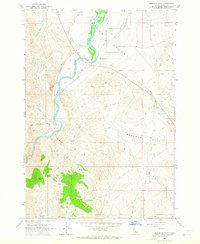
(11)- 1929 Map of Bayhorse, 1961 Print
 1929 Bayhorse1961 Print · USGSCentral Idaho mining and ranching life are detailed in the late 1920s as mountain settlements like Bayhorse and Clayton thrived. Researchers can trace historic extraction sites like the Hecla Mine and Redbird Mine or locate the old East Fork Sch.
 - 1956 Map of Challis, 1960 Print
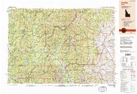
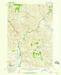 1956 Challis1960 Print · USGSThe Salmon River valley comes into focus during the mid-1950s, showing the settlement of Challis and its vital mountain infrastructure. Researchers can trace local landmarks like Beardsley Hot Springs, the Challis Airfield, and family-named routes such as Burstadt Lane.2 unique versions available
 - 1957 Map of Challis, 1964 Print
 1957 Challis1964 Print · USGSCentral Idaho in the late fifties and early sixties remains a territory of remote mining camps and high-mountain ranger stations. Trace historic mining operations like the Lucky Boy Mine or locate isolated homesteads including Robinson Bar Ranch and Allison Ranch.3 unique versions available
 - 1960 Map of Challis
 1960 Challis1960 Print · USGSCentral Idaho’s high backcountry is detailed here in the early sixties, showing the remote ranching and mining life across five national forests. Genealogists and researchers can trace family holdings at the Silva Ranch or Jones Ranch and find historic sites like Redfish Lake Lodge and Clayton.
 - 1963 Map of Challis
 1963 Challis1963 Print · USGSCentral Idaho's mountain corridors and mining districts appear in detail during the early sixties, highlighting the remote settlements of Challis and Stanley. Researchers can trace the legacy of the gold and silver rushes through labels for Bonanza, the Bayhorse Mine, and the Falconberry ranch.
 - 1963 Map of Lone Pine Peak, 1965 Print
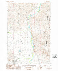
 1963 Lone Pine Peak1965 Print · USGSCuster County ranching and wilderness lands are captured here during the early sixties, as the high-country landscape remained defined by its remote springs and river valleys. Researchers can locate the Petrified Forest, early river crossings near Round Valley, and family-named landmarks like Jenson Cabin Spring.2 unique versions available
 - 1963 Map of Bradbury Flat, 1965 Print
 1963 Bradbury Flat1965 Print · USGSCuster County ranching and river lands are preserved here in the early sixties, showing the vital waterways of the Salmon River. Researchers can trace the layout of early rural life through landmarks like Bishop Spring, Germer Peak, and a maze of historic fence lines.
 - 1982 Map of Challis
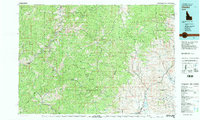 1982 Challis1982 Print · USGSIn the early 1980s, the rugged central Idaho backcountry around Challis remained a stronghold of mining and wilderness. Researchers can trace the legacy of remote industry at the Yellowjacket Mine and locate backcountry outposts like Casto and the Boyle Landing Strip.
 - 1982 Map of White Cloud Peaks
 1982 White Cloud Peaks1982 Print · USGSCuster County in the early eighties is a landscape where high-mountain recreation meets a legacy of hard-rock mining. Genealogists and researchers can trace the roads to Custer, locate isolated sites like the Livingston Mine, or find the waters of Redfish Lake.2 unique versions available
 - 1989 Map of Challis
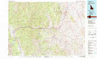
 1989 Challis1989 Print · USGSCentral Idaho in the late eighties remains a vast expanse of protected wilderness and high-mountain drainages. Researchers can trace remote settlements and backcountry outposts like Custer, Stibnite, and Sunbeam along the Salmon River and its many forks.2 unique versions available
 - 1989 Map of Challis
 1989 Challis1989 Print · USGSCuster County life in the late eighties is centered where the mountains meet the Round Valley floor. You can trace the local economy and geography through the Salmon River corridor, from Challis Hot Springs to the town of Challis.
End of results
Showing maps 1-11 of 11
Top cities near Challis
Top neighborhoods of Challis
Frequently asked questions
- What are the different types of historical maps available for Challis?
- What is the oldest map of Challis?
- Where can I purchase historical maps of Challis for my home or office?
- Where can I download high-res historical maps of Challis?
- Are there historical topographic maps available for Challis?
- Is there historical aerial imagery available for Challis?
- Where are historical maps of Challis sourced from?